Lugares de interés (POIs) del Mapa
0: Cloudy sky over field of green shoots
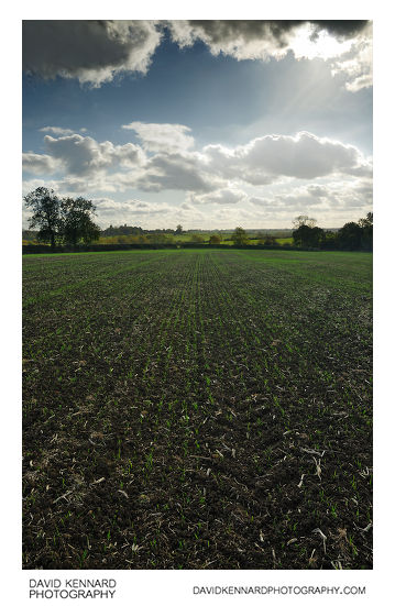
Cloudy sky over field of green shoots from http://www.davidkennardphotography.com
Crops shoot up through the dark soil in a field between the villages of Carlton Curlieu, Burton Overy, and Illston-on-the-Hill, in the county of Leicestershire, UK.
Agriculture accounts for approximately 70% of land use in England.
Date taken: 2008-10-22 14:22:43
Más sobre Cloudy sky over field of green shoots
1: Cloudy sky over field of green shoots
Cloudy sky over field of green shoots from http://www.davidkennardphotography.com
Crops shoot up through the dark soil in a field between the villages of Carlton Curlieu, Burton Overy, and Illston-on-the-Hill, in the county of Leicestershire, UK.
Agriculture accounts for approximately 70% of land use in England.
Date taken: 2008-10-22 14:22:43
Más sobre Cloudy sky over field of green shoots
2: KEEP GAET CLOSED
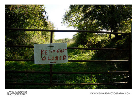
KEEP GAET CLOSED from http://www.davidkennardphotography.com
An unusual spelling of the word 'gate' is featured on a gate near the edge of a wooded area between Scalford and Goadby Marwood, in Leicestershire, UK.
The spelling mistake was not just a slip of the paintbrush as the same message, 'KEEP GAET CLOSED' was painted on the other side of the gate as well.
Date taken: 2010-09-17 10:20:49
Más sobre KEEP GAET CLOSED
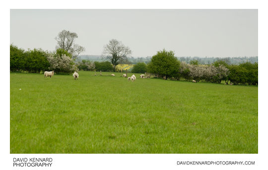
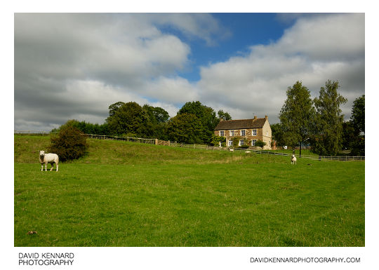
3: Sheep in field near Goadby Marwood
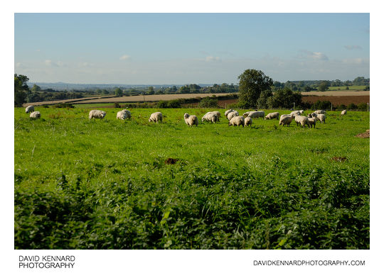
Sheep in field near Goadby Marwood from http://www.davidkennardphotography.com
Looking south over a field of sheep near Goadby Marwood in Leicestershire, UK.
From Wikipedia (http://en.wikipedia.org/wiki/Domestic_sheep):
Sheep are most likely descended from the wild mouflon of Europe and Asia. One of the earliest animals to be domesticated for agricultural purposes, sheep are raised for fleece, meat (lamb, hogget or mutton) and milk. A sheep's wool is the most widely used of any animal, and is usually harvested by shearing. Ovine meat is called lamb when from younger animals and mutton when from older ones. Sheep continue to be important for wool and meat today, and are also occasionally raised for pelts, as dairy animals, or as model organisms for science.
Sheep husbandry is practised throughout the majority of the inhabited world, and has been fundamental to many civilizations. In the modern era, Australia, New Zealand, the southern and central South American nations, and the British Isles are most closely associated with sheep production.
Date taken: 2010-09-17 10:23:08
Más sobre Sheep in field near Goadby Marwood
4: Fungi in grassy field
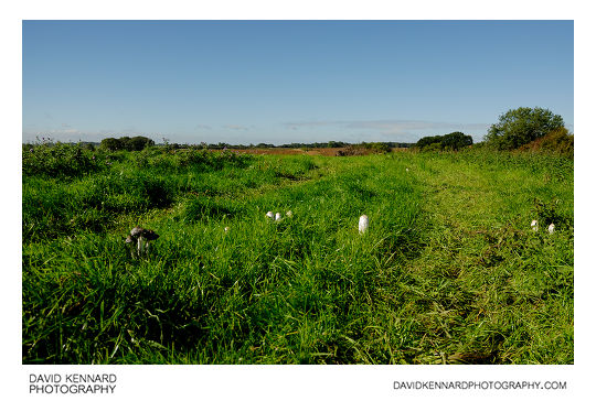
Fungi in grassy field from http://www.davidkennardphotography.com
Fungi grow in a grassy field near Goadby Marwood in Leicestershire, UK.
Date taken: 2010-09-17 10:23:52
Más sobre Fungi in grassy field
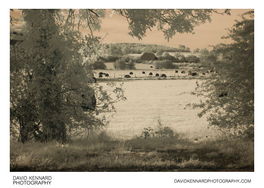
5: Cattle resting, Goadby Marwood
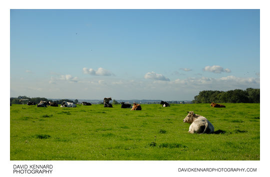
Cattle resting, Goadby Marwood from http://www.davidkennardphotography.com
Cattle enjoy a warm September day in a field near Goadby Marwood, in Leicestershire, UK.
From Wikipedia (http://en.wikipedia.org/wiki/Cattle):
Cattle (colloquially cows) are the most common type of large domesticated ungulates. They are a prominent modern member of the subfamily Bovinae, are the most widespread species of the genus Bos, and are most commonly classified collectively as Bos primigenius. Cattle are raised as livestock for meat (beef and veal), as dairy animals for milk and other dairy products, and as draft animals (pulling carts, plows and the like). Other products include leather and dung for manure or fuel. In some countries, such as India, cattle are sacred. It is estimated that there are 1.3 billion cattle in the world today. In 2009, cattle became the first livestock animal to have its genome mapped.
Date taken: 2010-09-17 10:28:37
Más sobre Cattle resting, Goadby Marwood
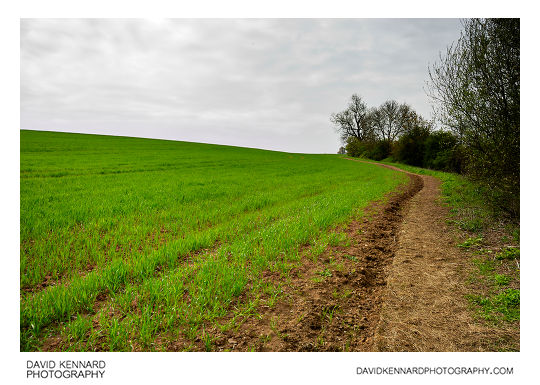
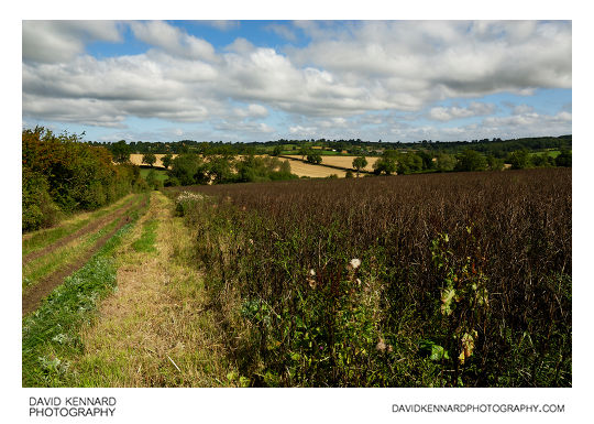
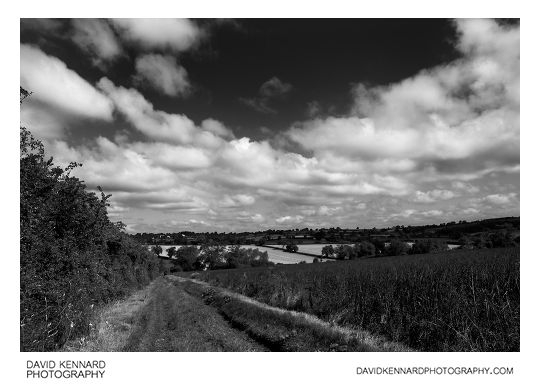
6: Farm track near Goadby Marwood
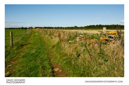
Farm track near Goadby Marwood from http://www.davidkennardphotography.com
Looking west along a track that runs eastwards to link up with Wycomb Lane in Goadby Marwood, Leicestershire, UK. To the right of the track is a mostly fallen down dry-stone wall, probably built from locally mined Ironstone.
Date taken: 2010-09-17 10:29:30
Más sobre Farm track near Goadby Marwood
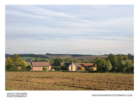
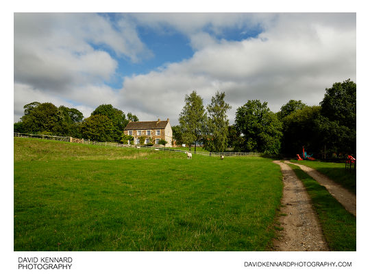
7: Farm house and buildings, Goadby Marwood
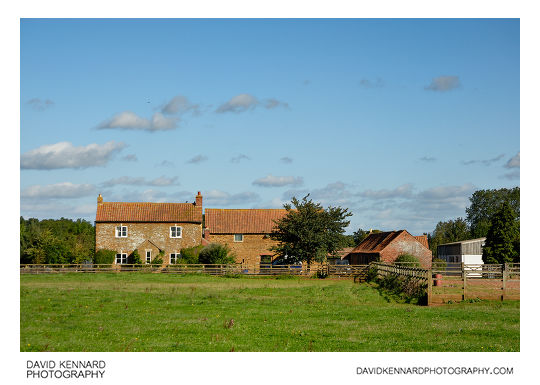
Farm house and buildings, Goadby Marwood from http://www.davidkennardphotography.com
A farm house and buildings to the west of the village of Goadby Marwood, in Leicestershire, UK.
Date taken: 2010-09-17 10:31:46
Más sobre Farm house and buildings, Goadby Marwood
8: Large puddle, track and field
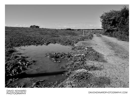
Large puddle, track and field from http://www.davidkennardphotography.com
A large puddle where a farm track meets Wycomb Lane, near Goadby Marwood in Leicestershire, UK.
Date taken: 2010-09-17 10:33:26
Más sobre Large puddle, track and field
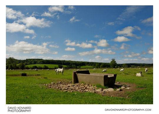
9: Water trough in muddy field
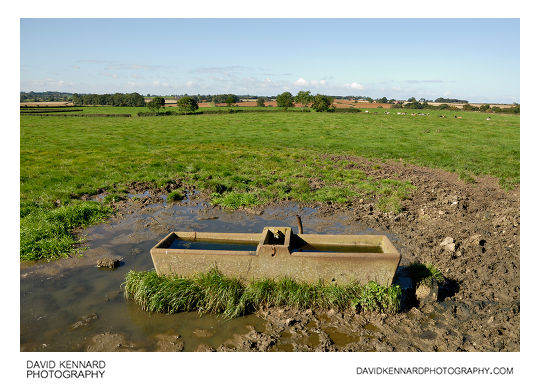
Water trough in muddy field from http://www.davidkennardphotography.com
A water trough is surrounded by mud and puddles in a field between Goadby Marwood and Wycomb, in Leicestershire, UK.
Date taken: 2010-09-17 10:35:17
Más sobre Water trough in muddy field
10: Wycomb Lane, Goadby Marwood
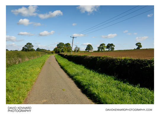
Wycomb Lane, Goadby Marwood from http://www.davidkennardphotography.com
Looking north up Wycomb Lane, between Wycomb and Goadby Marwood in Leicestershire, UK.
Date taken: 2010-09-17 10:40:57
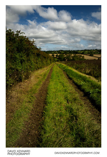
Más sobre Wycomb Lane, Goadby Marwood
11: Wycomb Lane, Goadby Marwood
Wycomb Lane, Goadby Marwood from http://www.davidkennardphotography.com
Looking south down Wycomb Lane, between the villages of Wycomb and Goadby Marwood in Leicestershire, UK.
Date taken: 2010-09-17 10:36:30
Más sobre Wycomb Lane, Goadby Marwood
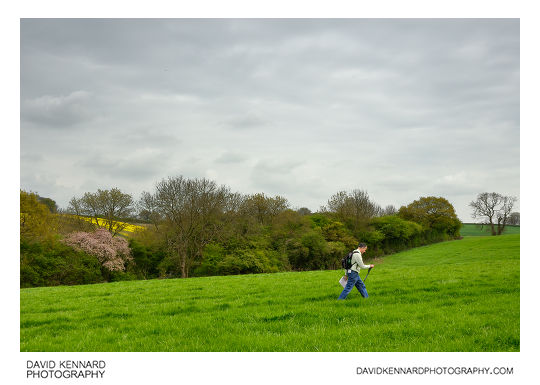
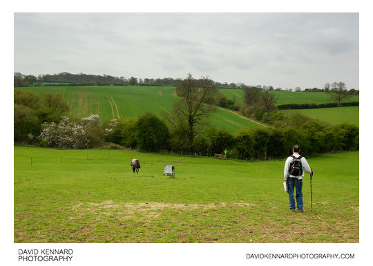
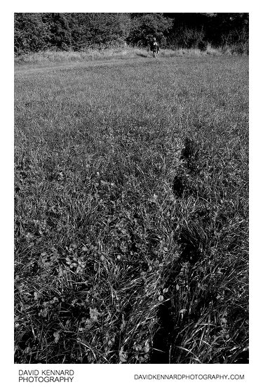
12: Silhouette of family walking through field
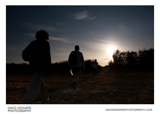
Silhouette of family walking through field from http://www.davidkennardphotography.com
A family takes a late afternoon walk through a field near Great Bowden, Leicestershire, UK.
Recently walking has been promoted by various organisations to help tackle the rising level of Obesity in the United Kingdom.
Date taken: 2009-08-22 19:05:02
Más sobre Silhouette of family walking through field
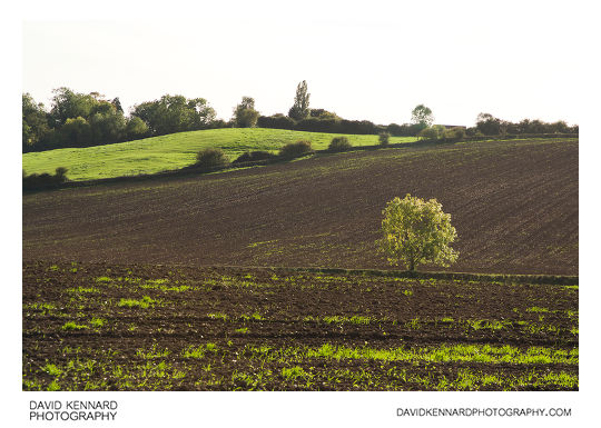
13: Ploughed field near Great Bowden
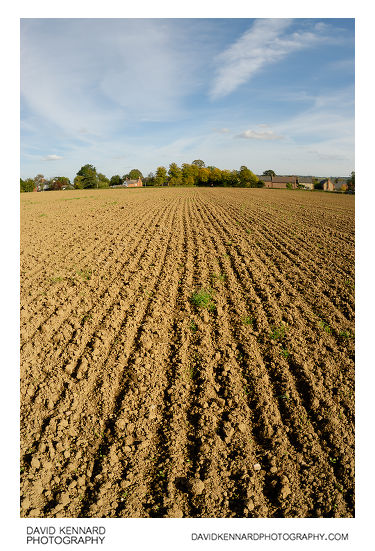
Ploughed field near Great Bowden from http://www.davidkennardphotography.com
Looking east across a ploughed field towards Great Bowden, near Market Harborough in Leicestershire, England.
Date taken: 2010-10-07 15:17:14
Más sobre Ploughed field near Great Bowden
14: Ploughed field and large tree
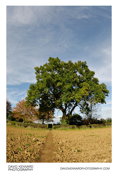
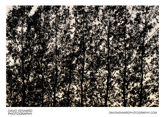
Ploughed field and large tree from http://www.davidkennardphotography.com
A footpath leads through a ploughed field, coming out on Leicester Lane near Great Bowden, in Leicestershire, UK. A large tree grows out of the hedge at the end of the footpath.
Date taken: 2010-10-07 15:21:37
Más sobre Ploughed field and large tree
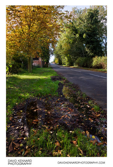
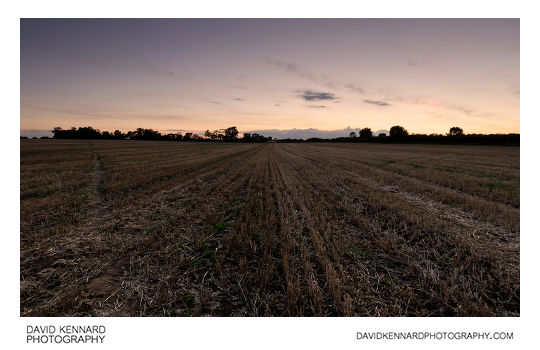
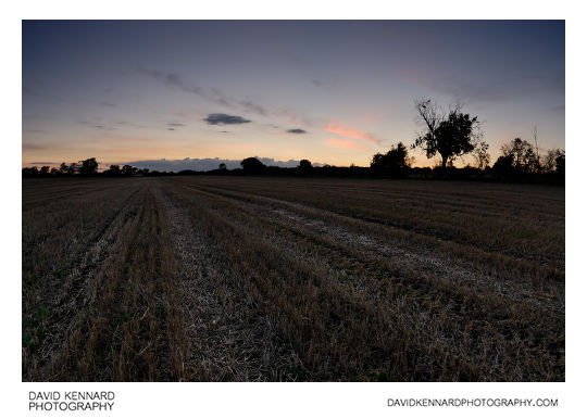
15: Leicester Lane, Great Bowden in Autumn
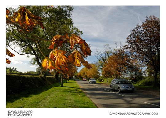
Leicester Lane, Great Bowden in Autumn from http://www.davidkennardphotography.com
The horse chestnut trees in autumn colours along Leicester Lane near Great Bowden, in Leicestershire, England.
Date taken: 2010-10-07 15:23:01
Más sobre Leicester Lane, Great Bowden in Autumn
16: Autumnal trees outside Great Bowden Hall
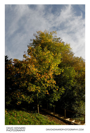
Autumnal trees outside Great Bowden Hall from http://www.davidkennardphotography.com
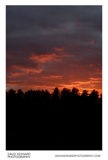
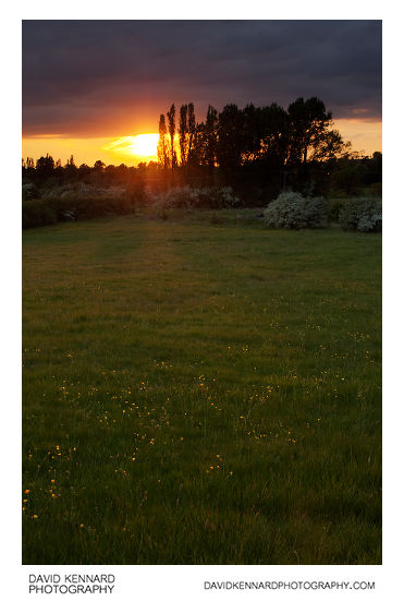
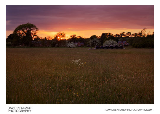
Trees start to change colour as autumn advances, outside Great Bowden Hall near Great Bowden, Lesicestershire, UK.
Date taken: 2010-10-07 16:04:45
Más sobre Autumnal trees outside Great Bowden Hall
17: Ploughed field near Great Bowden in Infrared
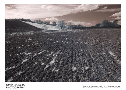
Ploughed field near Great Bowden in Infrared from http://www.davidkennardphotography.com
Looking west across a ploughed field between Great Bowden and Market Harborough. The photograph was taken using infrared, which is invisible to the human eye.
Date taken: 2010-10-07 15:14:06
Más sobre Ploughed field near Great Bowden in Infrared
18: Ploughed field near Great Bowden
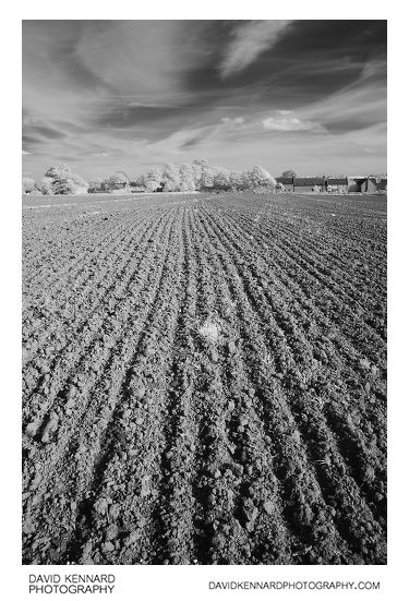
Ploughed field near Great Bowden from http://www.davidkennardphotography.com
Looking east across a ploughed field towards Great Bowden, near Market Harborough in Leicestershire, England. The photo was taken using infrared light in the 720nm - 1000nm range, invisible to the human eye.
Date taken: 2010-10-07 15:15:04
Más sobre Ploughed field near Great Bowden
19: Ploughed field and large tree (Infrared)
.jpg)
Ploughed field and large tree (Infrared) from http://www.davidkennardphotography.com
A footpath leads through a ploughed field, coming out on Leicester Lane near Great Bowden, in Leicestershire, UK. A large tree grows out of the hedge at the end of the footpath.
The photo was taken using infrared light, which is invisible to the human eye.
Date taken: 2010-10-07 15:19:15
Más sobre Ploughed field and large tree (Infrared)
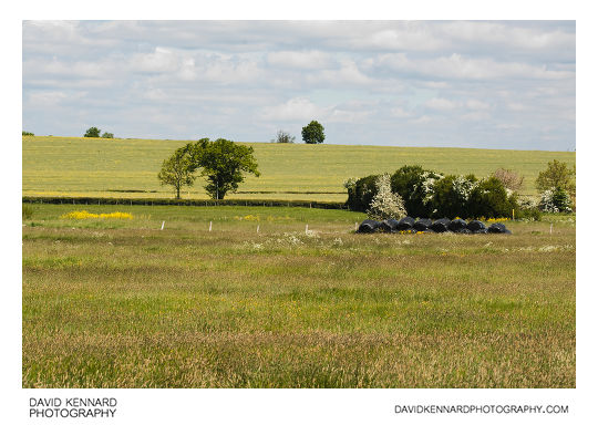
20: Ploughed fields between Harborough and Great Bowden
Ploughed fields between Harborough and Great Bowden from http://www.davidkennardphotography.com
Looking south across ploughed fields from Leicester Lane near Great Bowden in Leicestershire, England.
Date taken: 2010-10-07 15:35:27
Más sobre Ploughed fields between Harborough and Great Bowden
21: Fields and houses, Great Bowden
Fields and houses, Great Bowden from http://www.davidkennardphotography.com
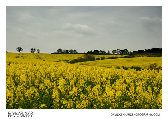
Looking east across a ploughed field towards the village of Great Bowden, near Market Harborough in Leicestershire, UK.
Date taken: 2010-10-07 15:36:33
Más sobre Fields and houses, Great Bowden
22: Leicester Lane in autumn, Great Bowden
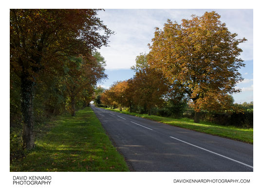
Leicester Lane in autumn, Great Bowden from http://www.davidkennardphotography.com
Looking west along Leicester Lane near Great Bowden, in Leicestershire, England in autumn. The section of Leicester Lane between Great Bowden village and the canal is lined with Horse Chestnut trees on either side of the road.
Date taken: 2010-10-07 15:37:51
Más sobre Leicester Lane in autumn, Great Bowden
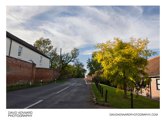
23: Leicester Lane, Great Bowden in autumn
Leicester Lane, Great Bowden in autumn from http://www.davidkennardphotography.com
Looking west along Leicester Lane, just before Great Bowden Hall and the bridge over the canal, near Great Bowden in Leicestershire, England.
Date taken: 2010-10-07 15:47:23
Más sobre Leicester Lane, Great Bowden in autumn
24: Great Bowden Hall on Leicester Lane, Great Bowden
Great Bowden Hall on Leicester Lane, Great Bowden from http://www.davidkennardphotography.com
Looking west along Leicester Lane towards the bridge over the Harborough arm of the Grand Union canal.
On the left can be seen Great Bowden Hall, a Grade II listed building built in 1860. After falling into dis-repair, Great Bowden Hall was rennovated and converted into apartments in 1998.
Date taken: 2010-10-07 15:52:44
Más sobre Great Bowden Hall on Leicester Lane, Great Bowden
25: Pink-white berries
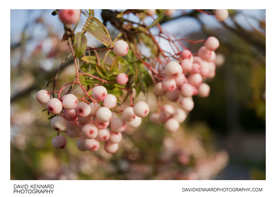
Pink-white berries from http://www.davidkennardphotography.com
Pink-white berries on a tree opposite Great Bowden Hall, on Leicester Lane in Great Bowden, Leicestershire, UK.
Date taken: 2010-10-07 15:54:01
Más sobre Pink-white berries
26: Great Bowden Hall and the Grand Union Canal
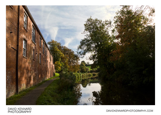
Great Bowden Hall and the Grand Union Canal from http://www.davidkennardphotography.com
Looking south down the Harborough arm of the Grand Union Canal, with Great Bowden Hall to the left.
Great Bowden Hall was originally built in 1860, and is currently a grade II listed building. Great Bowden Hall and the connected red-brick mews buildings, shown here, were rennovated and converted into apartments in 1998.
Date taken: 2010-10-07 15:55:41
Más sobre Great Bowden Hall and the Grand Union Canal
27: Great Bowden Hall and the Grand Union Canal
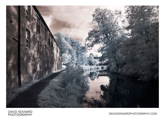
Great Bowden Hall and the Grand Union Canal from http://www.davidkennardphotography.com
Looking south down the Harborough arm of the Grand Union Canal, with Great Bowden Hall to the left.
Great Bowden Hall was originally built in 1860, and is currently a grade II listed building. Great Bowden Hall and the connected red-brick mews buildings, shown here, were rennovated and converted into apartments in 1998.
This photograph was taken using infrared light, which is invisible to the human eye.
Date taken: 2010-10-07 16:01:32
Más sobre Great Bowden Hall and the Grand Union Canal
28: Cattle trough in wheat field
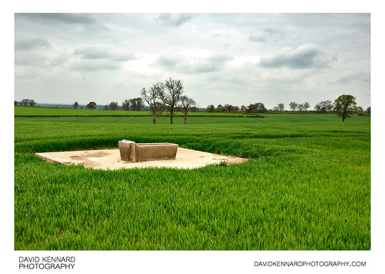
Cattle trough in wheat field from http://www.davidkennardphotography.com
A cattle trough looks out of place in a wheat field near Houghton on the Hill in Leicestershire, UK.
Date taken: 2010-05-05 11:51:32
Más sobre Cattle trough in wheat field
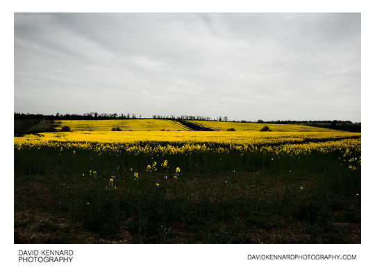
29: Fields of oilseed rape
Fields of oilseed rape from http://www.davidkennardphotography.com
Rapeseed (Brassica napus), also known as rape, oilseed rape, rapa, rappi, rapaseed and (in the case of one particular group of cultivars, canola) is a bright yellow flowering member of the family Brassicaceae (mustard or cabbage family). The name derives from the Latin for turnip, r?pum or r?pa, and is first recorded in English at the end of the 14th century. Older writers usually distinguished the turnip and rape by the adjectives round and long(-rooted) respectively. See also Brassica napobrassica, which may be considered a variety of Brassica napus. Some botanists include the closely related Brassica campestris within B. napus. (See Triangle of U).
In agriculture, canola are certain varieties of rapeseed oil, or the oil produced from those varieties. Canola is a trademark for a hybrid variety of rape initially bred in Canada. Rapeseed oil was produced in the 19th century as a source of a lubricant for steam engines, and the oil has a bitter taste due to high levels of acids. Canola has been bred to reduce the amount of acid, yielding a more palatable oil.
Rapeseed is grown for the production of animal feed, vegetable oil for human consumption, and biodiesel; leading producers include the European Union, Canada, the United States, Australia, China and India. In India, it is grown on 13% of cropped land. According to the United States Department of Agriculture, rapeseed was the third leading source of vegetable oil in the world in 2000, after soybean and oil palm, and also the world's second leading source of protein meal, although only one-fifth of the production of the leading soybean meal.
World production is growing rapidly, with FAO reporting that 36 million tonnes of rapeseed was produced in the 2003-2004 season, and 46 million tonnes in 2004-2005. In Europe, rapeseed is primarily cultivated for animal feed, owing to its very high lipid and medium protein content, and is a leading option for Europeans to avoid importation of genetically modified organism (GMO) products.
Natural rapeseed oil contains 50% erucic acid. Wild type seeds also contain high levels of glucosinolates (mustard oil glucosindes), chemical compounds that significantly lowered the nutritional value of rape seed press cakes for animal feed. Canola, originally a syncopated form of the abbreviation "Can.O., L-A." (Canadian Oilseed, Low-Acid) that was used by the Manitoba government to label the seed during its experimental stages, is now a tradename for "double low" (low erucic acid and low glucosinolate) rapeseed. Sometimes the "Canola-quality" label is affixed to other varieties as well.
The rapeseed is the valuable, harvested component of the crop. The crop is also grown as a winter-cover crop. It provides good coverage of the soil in winter, and limits nitrogen run-off. The plant is ploughed back in the soil or used as bedding. On some ecological or organic operations, livestock such as sheep or cattle are allowed to graze on the plants.
Processing of rapeseed for oil production provides rapeseed animal meal as a by-product. The by-product is a high-protein animal feed, competitive with soya. The feed is mostly employed for cattle feeding, but also for pigs and chickens (though less valuable for these). The meal has a very low content of the glucosinolates responsible for metabolism disruption in cattle and pigs. Rapeseed "oil cake" is also used as a fertilizer in China, and may be used for ornamentals, such as Bonsai, as well.
Rapeseed leaves and stems are also edible, similar to those of the related bok choy or kale. Some varieties of rapeseed (called ??, yóu cài, lit. "oil vegetable" in Chinese; yau choy in Cantonese; c?i d?u in Vietnamese; phak kat kan khao [?????????????] in Thai; and nanohana [???] in Japanese) are sold as greens, primarily in Asian groceries, including those in California where it is known as yao choy or tender greens. They are eaten as sag (spinach) in Indian and Nepalese cuisine, usually stir-fried with salt, garlic and spices.
Rapeseed is a heavy nectar producer, and honeybees produce a light colored, but peppery honey from it. It must be extracted immediately after processing is finished, as it will quickly granulate in the honeycomb and will be impossible to extract. The honey is usually blended with milder honeys, if used for table use, or sold as bakery grade. Rapeseed growers contract with beekeepers for the pollination of the crop.
Description from Wikipedia: http://en.wikipedia.org/wiki/Brassica_napus
Date taken: 2010-05-05 10:30:43
Más sobre Fields of oilseed rape
30: Fields of oilseed rape
Fields of oilseed rape from http://www.davidkennardphotography.com
Rapeseed (Brassica napus), also known as rape, oilseed rape, rapa, rappi, rapaseed and (in the case of one particular group of cultivars, canola) is a bright yellow flowering member of the family Brassicaceae (mustard or cabbage family). The name derives from the Latin for turnip, r?pum or r?pa, and is first recorded in English at the end of the 14th century. Older writers usually distinguished the turnip and rape by the adjectives round and long(-rooted) respectively. See also Brassica napobrassica, which may be considered a variety of Brassica napus. Some botanists include the closely related Brassica campestris within B. napus. (See Triangle of U).
In agriculture, canola are certain varieties of rapeseed oil, or the oil produced from those varieties. Canola is a trademark for a hybrid variety of rape initially bred in Canada. Rapeseed oil was produced in the 19th century as a source of a lubricant for steam engines, and the oil has a bitter taste due to high levels of acids. Canola has been bred to reduce the amount of acid, yielding a more palatable oil.
Rapeseed is grown for the production of animal feed, vegetable oil for human consumption, and biodiesel; leading producers include the European Union, Canada, the United States, Australia, China and India. In India, it is grown on 13% of cropped land. According to the United States Department of Agriculture, rapeseed was the third leading source of vegetable oil in the world in 2000, after soybean and oil palm, and also the world's second leading source of protein meal, although only one-fifth of the production of the leading soybean meal.
World production is growing rapidly, with FAO reporting that 36 million tonnes of rapeseed was produced in the 2003-2004 season, and 46 million tonnes in 2004-2005. In Europe, rapeseed is primarily cultivated for animal feed, owing to its very high lipid and medium protein content, and is a leading option for Europeans to avoid importation of genetically modified organism (GMO) products.
Natural rapeseed oil contains 50% erucic acid. Wild type seeds also contain high levels of glucosinolates (mustard oil glucosindes), chemical compounds that significantly lowered the nutritional value of rape seed press cakes for animal feed. Canola, originally a syncopated form of the abbreviation "Can.O., L-A." (Canadian Oilseed, Low-Acid) that was used by the Manitoba government to label the seed during its experimental stages, is now a tradename for "double low" (low erucic acid and low glucosinolate) rapeseed. Sometimes the "Canola-quality" label is affixed to other varieties as well.
The rapeseed is the valuable, harvested component of the crop. The crop is also grown as a winter-cover crop. It provides good coverage of the soil in winter, and limits nitrogen run-off. The plant is ploughed back in the soil or used as bedding. On some ecological or organic operations, livestock such as sheep or cattle are allowed to graze on the plants.
Processing of rapeseed for oil production provides rapeseed animal meal as a by-product. The by-product is a high-protein animal feed, competitive with soya. The feed is mostly employed for cattle feeding, but also for pigs and chickens (though less valuable for these). The meal has a very low content of the glucosinolates responsible for metabolism disruption in cattle and pigs. Rapeseed "oil cake" is also used as a fertilizer in China, and may be used for ornamentals, such as Bonsai, as well.
Rapeseed leaves and stems are also edible, similar to those of the related bok choy or kale. Some varieties of rapeseed (called ??, yóu cài, lit. "oil vegetable" in Chinese; yau choy in Cantonese; c?i d?u in Vietnamese; phak kat kan khao [?????????????] in Thai; and nanohana [???] in Japanese) are sold as greens, primarily in Asian groceries, including those in California where it is known as yao choy or tender greens. They are eaten as sag (spinach) in Indian and Nepalese cuisine, usually stir-fried with salt, garlic and spices.
Rapeseed is a heavy nectar producer, and honeybees produce a light colored, but peppery honey from it. It must be extracted immediately after processing is finished, as it will quickly granulate in the honeycomb and will be impossible to extract. The honey is usually blended with milder honeys, if used for table use, or sold as bakery grade. Rapeseed growers contract with beekeepers for the pollination of the crop.
Description from Wikipedia: http://en.wikipedia.org/wiki/Brassica_napus
Date taken: 2010-05-05 10:50:45
Más sobre Fields of oilseed rape
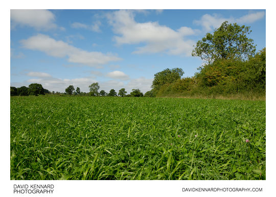
31: Green field and tree
Green field and tree from http://www.davidkennardphotography.com
Looking across a green field towards a large tree near Houghton on the Hill in Leicestershire, UK.
Date taken: 2010-05-05 11:43:06
Más sobre Green field and tree
32: Green fields

Green fields from http://www.davidkennardphotography.com
Looking east across the fields from a footpath partway between Houghton on the Hill and Keyham in Leicestershire, UK.
Date taken: 2010-05-05 10:48:27
Más sobre Green fields
33: Green fields and houses
Green fields and houses from http://www.davidkennardphotography.com
Looking south across some green fields towards a line of houses on Uppingham Road (A47) between Houghton on the Hill and Thurnby.
Date taken: 2010-05-05 11:44:49
Más sobre Green fields and houses
34: Sheep in field
Sheep in field from http://www.davidkennardphotography.com
Sheep in a field near Houghton on the Hill in Leicestershire, UK.
Date taken: 2010-05-05 10:39:59
Más sobre Sheep in field
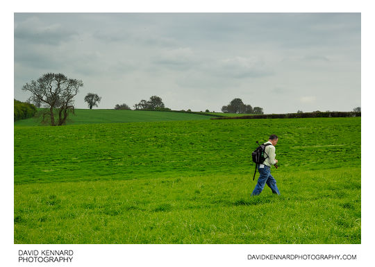
35: Walking across green hay field
Walking across green hay field from http://www.davidkennardphotography.com
Walking across a hay field near Houghton on the Hill in Leicestershire, UK.
From Wikipedia: http://en.wikipedia.org/wiki/Hay
Hay is grass, legumes or other herbaceous plants that have been cut, dried, and stored for use as animal fodder, particularly for grazing livestock such as cattle, horses, goats, and sheep. Hay is also fed to pets such as rabbits and guinea pigs. Pigs may be fed hay, but they do not digest it as efficiently as more fully herbivorous animals.
Hay is fed when or where there is not enough pasture or rangeland on which to graze an animal, when grazing is unavailable due to weather (such as during the winter) or when lush pasture by itself is too rich for the health of the animal. It is also fed during times when an animal is unable to access pasture, such as when animals are kept in a stable or barn.
Date taken: 2010-05-05 11:40:38
Más sobre Walking across green hay field
36: Walking across green hay field
Walking across green hay field from http://www.davidkennardphotography.com
Walking across a hay field near Houghton on the Hill in Leicestershire, UK.
From Wikipedia: http://en.wikipedia.org/wiki/Hay
Hay is grass, legumes or other herbaceous plants that have been cut, dried, and stored for use as animal fodder, particularly for grazing livestock such as cattle, horses, goats, and sheep. Hay is also fed to pets such as rabbits and guinea pigs. Pigs may be fed hay, but they do not digest it as efficiently as more fully herbivorous animals.
Hay is fed when or where there is not enough pasture or rangeland on which to graze an animal, when grazing is unavailable due to weather (such as during the winter) or when lush pasture by itself is too rich for the health of the animal. It is also fed during times when an animal is unable to access pasture, such as when animals are kept in a stable or barn.
Date taken: 2010-05-05 11:41:40
Más sobre Walking across green hay field
37: Young cows in field
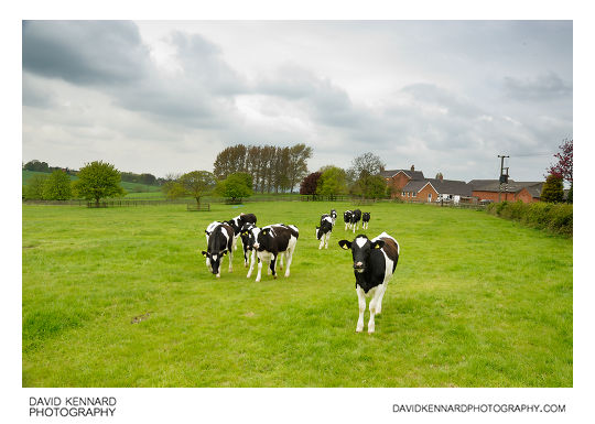
Young cows in field from http://www.davidkennardphotography.com
A group of inquisitive heifers on a farm near Houghton on the Hill in Leicestershire, UK.
Date taken: 2010-05-05 11:48:58
Más sobre Young cows in field
38: Cloudy sky over field of green shoots
Cloudy sky over field of green shoots from http://www.davidkennardphotography.com
Crops shoot up through the dark soil in a field between the villages of Carlton Curlieu, Burton Overy, and Illston-on-the-Hill, in the county of Leicestershire, UK.
Agriculture accounts for approximately 70% of land use in England.
Date taken: 2008-10-22 14:22:43
Más sobre Cloudy sky over field of green shoots
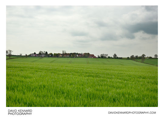
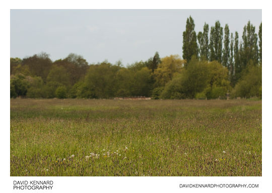
39: Field of young green crops
Field of young green crops from http://www.davidkennardphotography.com
A footpath runs alongside the edge of a field full of young green crops near Keyham in Leicestershire, UK.
Date taken: 2010-05-05 11:11:33
Más sobre Field of young green crops
40: Fields of oilseed rape
Fields of oilseed rape from http://www.davidkennardphotography.com
Rapeseed (Brassica napus), also known as rape, oilseed rape, rapa, rappi, rapaseed and (in the case of one particular group of cultivars, canola) is a bright yellow flowering member of the family Brassicaceae (mustard or cabbage family). The name derives from the Latin for turnip, r?pum or r?pa, and is first recorded in English at the end of the 14th century. Older writers usually distinguished the turnip and rape by the adjectives round and long(-rooted) respectively. See also Brassica napobrassica, which may be considered a variety of Brassica napus. Some botanists include the closely related Brassica campestris within B. napus. (See Triangle of U).
In agriculture, canola are certain varieties of rapeseed oil, or the oil produced from those varieties. Canola is a trademark for a hybrid variety of rape initially bred in Canada. Rapeseed oil was produced in the 19th century as a source of a lubricant for steam engines, and the oil has a bitter taste due to high levels of acids. Canola has been bred to reduce the amount of acid, yielding a more palatable oil.
Rapeseed is grown for the production of animal feed, vegetable oil for human consumption, and biodiesel; leading producers include the European Union, Canada, the United States, Australia, China and India. In India, it is grown on 13% of cropped land. According to the United States Department of Agriculture, rapeseed was the third leading source of vegetable oil in the world in 2000, after soybean and oil palm, and also the world's second leading source of protein meal, although only one-fifth of the production of the leading soybean meal.
World production is growing rapidly, with FAO reporting that 36 million tonnes of rapeseed was produced in the 2003-2004 season, and 46 million tonnes in 2004-2005. In Europe, rapeseed is primarily cultivated for animal feed, owing to its very high lipid and medium protein content, and is a leading option for Europeans to avoid importation of genetically modified organism (GMO) products.
Natural rapeseed oil contains 50% erucic acid. Wild type seeds also contain high levels of glucosinolates (mustard oil glucosindes), chemical compounds that significantly lowered the nutritional value of rape seed press cakes for animal feed. Canola, originally a syncopated form of the abbreviation "Can.O., L-A." (Canadian Oilseed, Low-Acid) that was used by the Manitoba government to label the seed during its experimental stages, is now a tradename for "double low" (low erucic acid and low glucosinolate) rapeseed. Sometimes the "Canola-quality" label is affixed to other varieties as well.
The rapeseed is the valuable, harvested component of the crop. The crop is also grown as a winter-cover crop. It provides good coverage of the soil in winter, and limits nitrogen run-off. The plant is ploughed back in the soil or used as bedding. On some ecological or organic operations, livestock such as sheep or cattle are allowed to graze on the plants.
Processing of rapeseed for oil production provides rapeseed animal meal as a by-product. The by-product is a high-protein animal feed, competitive with soya. The feed is mostly employed for cattle feeding, but also for pigs and chickens (though less valuable for these). The meal has a very low content of the glucosinolates responsible for metabolism disruption in cattle and pigs. Rapeseed "oil cake" is also used as a fertilizer in China, and may be used for ornamentals, such as Bonsai, as well.
Rapeseed leaves and stems are also edible, similar to those of the related bok choy or kale. Some varieties of rapeseed (called ??, yóu cài, lit. "oil vegetable" in Chinese; yau choy in Cantonese; c?i d?u in Vietnamese; phak kat kan khao [?????????????] in Thai; and nanohana [???] in Japanese) are sold as greens, primarily in Asian groceries, including those in California where it is known as yao choy or tender greens. They are eaten as sag (spinach) in Indian and Nepalese cuisine, usually stir-fried with salt, garlic and spices.
Rapeseed is a heavy nectar producer, and honeybees produce a light colored, but peppery honey from it. It must be extracted immediately after processing is finished, as it will quickly granulate in the honeycomb and will be impossible to extract. The honey is usually blended with milder honeys, if used for table use, or sold as bakery grade. Rapeseed growers contract with beekeepers for the pollination of the crop.
Description from Wikipedia: http://en.wikipedia.org/wiki/Brassica_napus
Date taken: 2010-05-05 10:55:14
Más sobre Fields of oilseed rape
41: Horse and houses
Horse and houses from http://www.davidkennardphotography.com
Looking north up a field towards Keyham, as a horse crosses the field. Keyham is a small village in Leicestershire, UK.
Date taken: 2010-05-05 11:08:46
Más sobre Horse and houses
42: Tree awaiting spring
Tree awaiting spring from http://www.davidkennardphotography.com
A man takes photos underneath a tree on top of a hill about half a mile south of Keyham in Leicestershire, UK.
Date taken: 2010-05-05 11:17:49
Más sobre Tree awaiting spring
43: View of Keyham from hill
View of Keyham from hill from http://www.davidkennardphotography.com
Looking northeast across the fields towards the village of Keyham in Leicestershire, UK.
Date taken: 2010-05-05 11:17:07
Más sobre View of Keyham from hill
44: View south from Keyham
View south from Keyham from http://www.davidkennardphotography.com
Looking down a horse's field at the south of Keyham village in Leicestershire, UK.
Date taken: 2010-05-05 11:07:35
Más sobre View south from Keyham
45: Hay field and fluffy clouds
Hay field and fluffy clouds from http://www.davidkennardphotography.com
Looking north across a hay field between Withcote and Knossington in Leicestershire, UK
Date taken: 2010-08-30 10:01:45
Más sobre Hay field and fluffy clouds
46: Walking across a hay field
Walking across a hay field from http://www.davidkennardphotography.com
Walking across a hay field between Knossington and Withcote in Leicestershire, UK.
Date taken: 2010-08-30 10:02:47
Más sobre Walking across a hay field
47: Grassy field
Grassy field from http://www.davidkennardphotography.com
Looking southeast across a hay field between Knossington and Withcote in Leicestershire, UK.
Date taken: 2010-08-30 10:04:53
Más sobre Grassy field
48: Footprints in grass
Footprints in grass from http://www.davidkennardphotography.com
Footprints in the long grass of a hay field between Knossington and Withcote in Leicestershire, UK.
Date taken: 2010-08-30 10:05:50
Más sobre Footprints in grass
49: Lush green field
Lush green field from http://www.davidkennardphotography.com
Looking west across a lush green field of grass and clover between Knossington and Withcote in Leicestershire, UK.
Date taken: 2010-08-30 10:09:39
Más sobre Lush green field
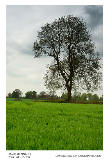
50: Tree in hay field

Tree in hay field from http://www.davidkennardphotography.com
A large tree stands alone in the middle of a hay field between Knossington and Withcote, Leicestershire, UK.
Date taken: 2010-08-30 10:12:37
Más sobre Tree in hay field
51: Tree in hay field
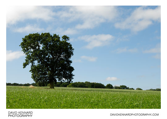
Tree in hay field from http://www.davidkennardphotography.com
A large tree stands alone in the middle of a hay field between Knossington and Withcote, Leicestershire, UK.
Date taken: 2010-08-30 10:12:51
Más sobre Tree in hay field
52: Old shack
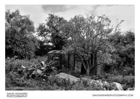
Old shack from http://www.davidkennardphotography.com
An old shack stands at the side of a field to the south of Knossington in Leicestershire, UK.
Date taken: 2010-08-30 10:27:22
Más sobre Old shack
53: Field and Farmhouse, Knossington
Field and Farmhouse, Knossington from http://www.davidkennardphotography.com
Looking northwest across a field just to the south of a farmhouse off Owston Road in Knossington, Leicestershire, UK.
Date taken: 2010-08-30 10:28:16
Más sobre Field and Farmhouse, Knossington
54: Field and Farmhouse, Knossington
Field and Farmhouse, Knossington from http://www.davidkennardphotography.com
Looking northwest across a field just to the south of a farmhouse off Owston Road in Knossington, Leicestershire, UK.
Date taken: 2010-08-30 10:28:26
Más sobre Field and Farmhouse, Knossington
55: Green fields and grey-blue sky
Green fields and grey-blue sky from http://www.davidkennardphotography.com
Looking south across the lush green fields, while sheep feed in the foreground, near Knossington in Leicestershire, UK.
Date taken: 2010-08-30 10:29:42
Más sobre Green fields and grey-blue sky
56: House on Main Street, Knossington
House on Main Street, Knossington from http://www.davidkennardphotography.com
A house on Main Street in Knossington, Leicestershire, UK.
Date taken: 2010-08-30 10:34:23
Más sobre House on Main Street, Knossington
57: Main Street, Knossington
Main Street, Knossington from http://www.davidkennardphotography.com
Looking west along Main Street in Knossington, Leicestershire, UK.
Date taken: 2010-08-30 10:34:35
Más sobre Main Street, Knossington
58: Old Petrol Pump on Braunston Road, Knossington
Old Petrol Pump on Braunston Road, Knossington from http://www.davidkennardphotography.com
An old petrol pump stands by the side of a house on Braunston Road in Knossington, Leicestershire, UK.
Date taken: 2010-08-30 10:35:14
Más sobre Old Petrol Pump on Braunston Road, Knossington
59: Trough in field of sheep
Trough in field of sheep from http://www.davidkennardphotography.com
Looking south across a field of sheep between Knossington and Withcote in Leicestershire, UK.
Date taken: 2010-08-30 10:50:18
Más sobre Trough in field of sheep
60: Field of wheat and cloudy sky
Field of wheat and cloudy sky from http://www.davidkennardphotography.com
Looking northeast across a field of short-stemmed wheat to the south of Knossington in Leicestershire, UK.
Date taken: 2010-08-30 10:22:04
Más sobre Field of wheat and cloudy sky
61: Trough in field of sheep
Trough in field of sheep from http://www.davidkennardphotography.com
Looking south across a field of sheep between Knossington and Withcote in Leicestershire, UK.
Date taken: 2010-08-30 10:50:39
Más sobre Trough in field of sheep
62: Plough in shed
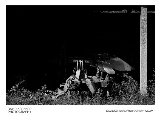
Plough in shed from http://www.davidkennardphotography.com
A piece of farm equipment used for ploughing fields is stored in a shed between Knossington and Withcote in Leicestershire, UK.
Date taken: 2010-08-30 10:57:09
Más sobre Plough in shed
63: Farm track
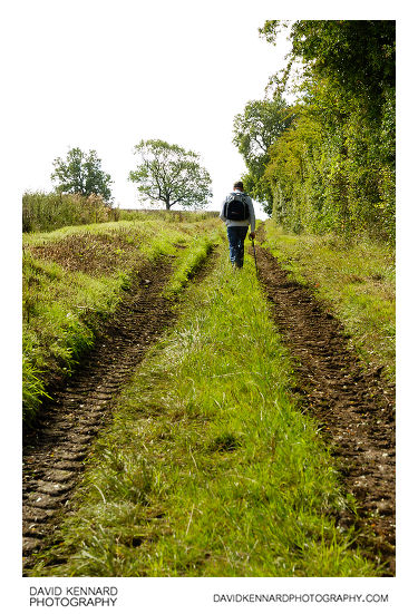
Farm track from http://www.davidkennardphotography.com
Looking south down a farm track that runs alongside a field located about half way between the villages of Knossington and Withcote in Leicestershire, UK.
Date taken: 2010-08-30 10:58:06
Más sobre Farm track
64: Farm track
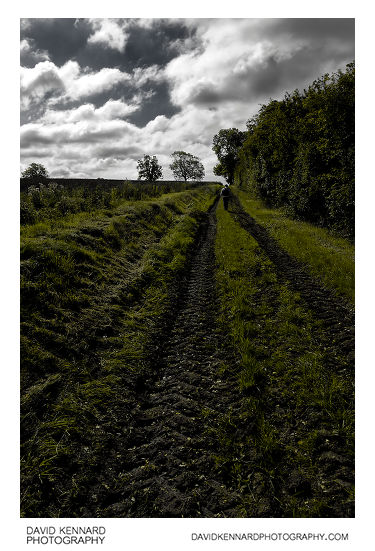
Farm track from http://www.davidkennardphotography.com
Looking south down a farm track that runs alongside a field located about half way between the villages of Knossington and Withcote in Leicestershire, UK.
Date taken: 2010-08-30 10:58:47
Más sobre Farm track
65: Track and Pea field
Track and Pea field from http://www.davidkennardphotography.com
Looking north down a track that runs alongside a field of peas ready for harvesting, between Knossington and Withcote in Leicestershire, UK.
Date taken: 2010-08-30 10:59:54
Más sobre Track and Pea field
66: Track and Pea field
Track and Pea field from http://www.davidkennardphotography.com
Looking north down a track that runs alongside a field of peas ready for harvesting, between Knossington and Withcote in Leicestershire, UK.
Date taken: 2010-08-30 11:00:49
Más sobre Track and Pea field
67: Track and Pea field
Track and Pea field from http://www.davidkennardphotography.com
Looking north down a track that runs alongside a field of peas ready for harvesting, between Knossington and Withcote in Leicestershire, UK.
Date taken: 2010-08-30 11:01:18
Más sobre Track and Pea field
68: Meadow Foxtail - Alopecurus pratensis
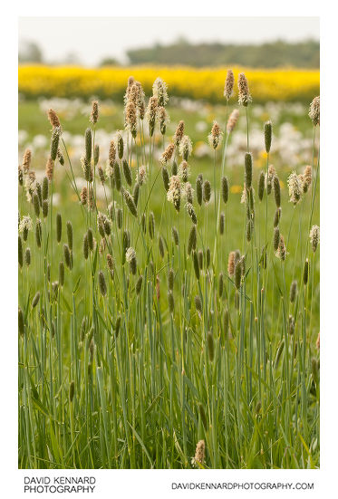
Meadow Foxtail - Alopecurus pratensis from http://www.davidkennardphotography.com
Alopecurus pratensis, known as the Meadow Foxtail or the Field Meadow Foxtail, is a perennial grass, belonging to the grass family (Poaceae). It is native to Europe and Asia.
This common plant is found on grasslands, especially on neutral soils. It can grow to a height of about 110 cm. The stem is erect or geniculate at the base. The leaves are about 5 mm wide. Meadow Foxtail has a cylindrical inflorescence, with glumes about 5-10 mm wide and spikelets about 4-6 mm long. It flowers from late spring to early summer and often again from late summer till autumn.
This species is widely cultivated for pasture and hay, and has become naturalised in many areas outside of its native range, including Australia and North America. The caterpillars of some Lepidoptera use it as a foodplant, e.g. the Essex Skipper (Thymelicus lineola). And male mosquitos can often be found on this flower drinking the nectar.
Description from Wikipedia: http://en.wikipedia.org/wiki/Alopecurus_pratensis
Date taken: 2010-05-19 10:24:51
Más sobre Meadow Foxtail - Alopecurus pratensis
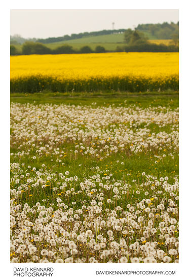
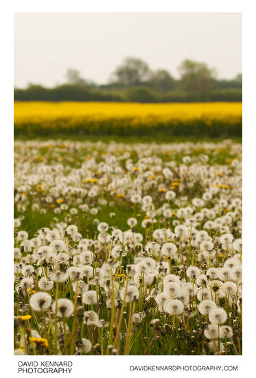
69: Dandelions, Rape, and Trees
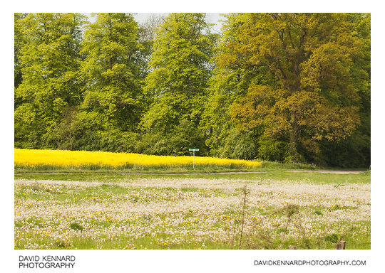
Dandelions, Rape, and Trees from http://www.davidkennardphotography.com
A field full of seeding dandelions meets a field of oilseed rape edged with large trees near the edge of the village Lubenham, in Leicestershire, UK.
Date taken: 2010-05-19 10:01:47
Más sobre Dandelions, Rape, and Trees
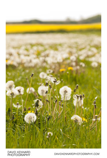
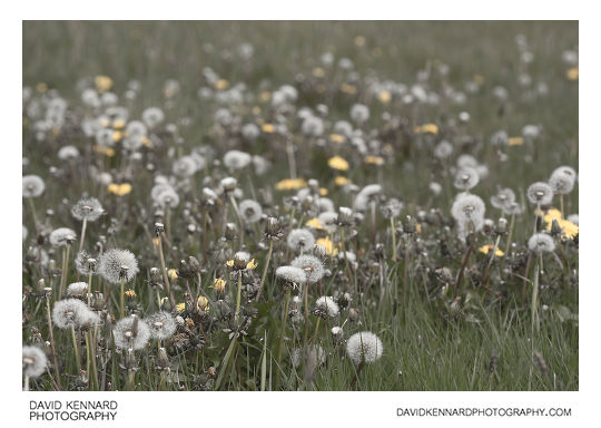
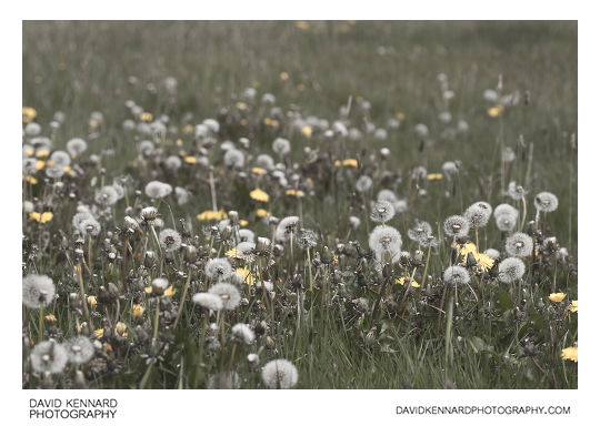
70: Field of seeding dandelions
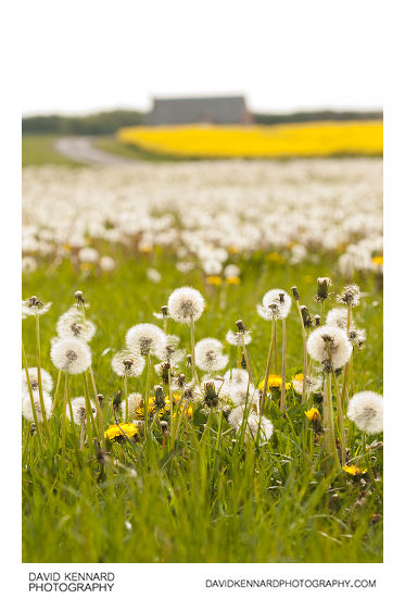
Field of seeding dandelions from http://www.davidkennardphotography.com
A field of seeding dandelions between Market Harborough and Lubenham, in Leicestershire, UK.
From Wikipedia (http://en.wikipedia.org/wiki/Taraxacum_officinale):
Taraxacum officinale, the Common Dandelion (often simply called "dandelion"), is a herbaceous perennial plant of the family Asteraceae (Compositae). It can be found growing in temperate regions of the world, in lawns, on roadsides, on disturbed banks and shores of water ways, and other areas with moist soils. T. officinale is considered a weedy species, especially in lawns and along roadsides, but it is sometimes used as a medical herb and in food preparation. As a nearly cosmopolitan weed, Dandelion is best known for its yellow flower heads, that turn into round balls of silver tufted fruits, that blow away on the wind.
Date taken: 2010-05-19 10:14:52
Más sobre Field of seeding dandelions
71: Field of seeding dandelions
Field of seeding dandelions from http://www.davidkennardphotography.com
A field of seeding dandelions between Market Harborough and Lubenham, in Leicestershire, UK.
From Wikipedia (http://en.wikipedia.org/wiki/Taraxacum_officinale):
Taraxacum officinale, the Common Dandelion (often simply called "dandelion"), is a herbaceous perennial plant of the family Asteraceae (Compositae). It can be found growing in temperate regions of the world, in lawns, on roadsides, on disturbed banks and shores of water ways, and other areas with moist soils. T. officinale is considered a weedy species, especially in lawns and along roadsides, but it is sometimes used as a medical herb and in food preparation. As a nearly cosmopolitan weed, Dandelion is best known for its yellow flower heads, that turn into round balls of silver tufted fruits, that blow away on the wind.
Date taken: 2010-05-19 10:14:59
Más sobre Field of seeding dandelions
72: Field of seeding dandelions
Field of seeding dandelions from http://www.davidkennardphotography.com
A field of seeding dandelions between Market Harborough and Lubenham, in Leicestershire, UK.
From Wikipedia (http://en.wikipedia.org/wiki/Taraxacum_officinale):
Taraxacum officinale, the Common Dandelion (often simply called "dandelion"), is a herbaceous perennial plant of the family Asteraceae (Compositae). It can be found growing in temperate regions of the world, in lawns, on roadsides, on disturbed banks and shores of water ways, and other areas with moist soils. T. officinale is considered a weedy species, especially in lawns and along roadsides, but it is sometimes used as a medical herb and in food preparation. As a nearly cosmopolitan weed, Dandelion is best known for its yellow flower heads, that turn into round balls of silver tufted fruits, that blow away on the wind.
Date taken: 2010-05-19 10:18:05
Más sobre Field of seeding dandelions
73: Field of seeding dandelions
Field of seeding dandelions from http://www.davidkennardphotography.com
A field of seeding dandelions between Market Harborough and Lubenham, in Leicestershire, UK.
From Wikipedia (http://en.wikipedia.org/wiki/Taraxacum_officinale):
Taraxacum officinale, the Common Dandelion (often simply called "dandelion"), is a herbaceous perennial plant of the family Asteraceae (Compositae). It can be found growing in temperate regions of the world, in lawns, on roadsides, on disturbed banks and shores of water ways, and other areas with moist soils. T. officinale is considered a weedy species, especially in lawns and along roadsides, but it is sometimes used as a medical herb and in food preparation. As a nearly cosmopolitan weed, Dandelion is best known for its yellow flower heads, that turn into round balls of silver tufted fruits, that blow away on the wind.
Date taken: 2010-05-19 10:19:15
Más sobre Field of seeding dandelions
74: Dandelions, Rape, and Trees
Dandelions, Rape, and Trees from http://www.davidkennardphotography.com
A field full of seeding dandelions meets a field of oilseed rape edged with large trees near the edge of the village Lubenham, in Leicestershire, UK.
Date taken: 2010-05-19 10:20:44
Más sobre Dandelions, Rape, and Trees
75: Dandelions, Rape, and Trees
Dandelions, Rape, and Trees from http://www.davidkennardphotography.com
A field full of seeding dandelions meets a field of oilseed rape edged with large trees near the edge of the village Lubenham, in Leicestershire, UK.
Date taken: 2010-05-19 10:21:59
Más sobre Dandelions, Rape, and Trees
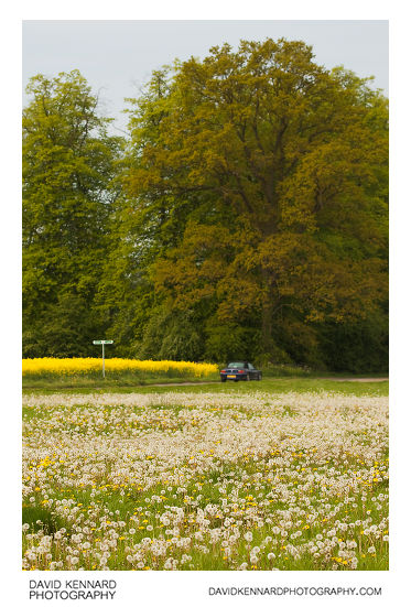
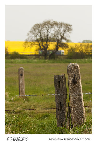
76: Old gate post
Old gate post from http://www.davidkennardphotography.com
Old gate posts on the edge of a hay field between Market Harborough and Lubenham in Leicestershire, UK. In the background can be seen the bright yellow colour of flowering fields of oilseed rape.
Date taken: 2010-05-19 10:29:02
Más sobre Old gate post
77: Old gate post
Old gate post from http://www.davidkennardphotography.com
Old gate posts on the edge of a hay field between Market Harborough and Lubenham in Leicestershire, UK. In the background can be seen the bright yellow colour of flowering fields of oilseed rape.
Date taken: 2010-05-19 10:29:25
Más sobre Old gate post
78: Farndon Road, Lubenham at dusk
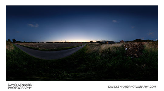
Farndon Road, Lubenham at dusk from http://www.davidkennardphotography.com
360° panorama of Farndon Road in Lubenham, Leicestershire, UK. The narrow road connects the village of Lubenham to East Farndon while bypassing the town of Market Harborough.
Date taken: 2010-08-23 20:40:58
Más sobre Farndon Road, Lubenham at dusk
79: Cattle grazing at twilight
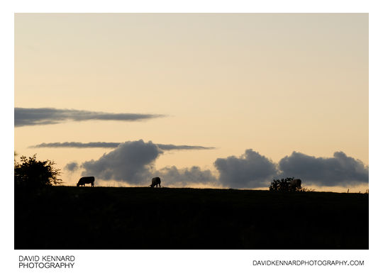
Cattle grazing at twilight from http://www.davidkennardphotography.com
Cattle graze in a field between Lubenham, Market harborough, and East Farndon shortly after sunset.
From Wikipedia (http://en.wikipedia.org/wiki/Cattle):
Cattle (colloquially cows) are the most common type of large domesticated ungulates. They are a prominent modern member of the subfamily Bovinae, are the most widespread species of the genus Bos, and are most commonly classified collectively as Bos primigenius. Cattle are raised as livestock for meat (beef and veal), as dairy animals for milk and other dairy products, and as draft animals (pulling carts, plows and the like). Other products include leather and dung for manure or fuel. In some countries, such as India, cattle are sacred. It is estimated that there are 1.3 billion cattle in the world today. In 2009, cattle became the first livestock animal to have its genome mapped.
Date taken: 2010-08-23 20:18:32
Más sobre Cattle grazing at twilight
80: Bull grazing at twilight
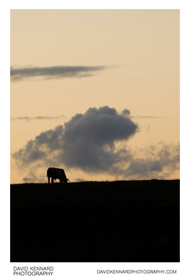
Bull grazing at twilight from http://www.davidkennardphotography.com
A grazing bull is silhouetted against the twilight sky in a field between Lubenham, Market harborough, and East Farndon.
From Wikipedia (http://en.wikipedia.org/wiki/Cattle):
Cattle (colloquially cows) are the most common type of large domesticated ungulates. They are a prominent modern member of the subfamily Bovinae, are the most widespread species of the genus Bos, and are most commonly classified collectively as Bos primigenius. Cattle are raised as livestock for meat (beef and veal), as dairy animals for milk and other dairy products, and as draft animals (pulling carts, plows and the like). Other products include leather and dung for manure or fuel. In some countries, such as India, cattle are sacred. It is estimated that there are 1.3 billion cattle in the world today. In 2009, cattle became the first livestock animal to have its genome mapped.
Date taken: 2010-08-23 20:19:34
Más sobre Bull grazing at twilight
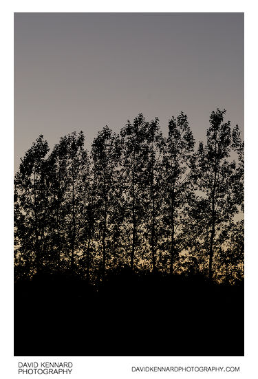
81: Tree silhouttes at twilight
Tree silhouttes at twilight from http://www.davidkennardphotography.com
A row of trees are silhouetted against the twilight sky, between Lubenham, East Farndon, and Market Harborough.
Date taken: 2010-08-23 20:25:16
Más sobre Tree silhouttes at twilight
82: Tree silhouttes at twilight
Tree silhouttes at twilight from http://www.davidkennardphotography.com
A row of trees are silhouetted against the twilight sky, between Lubenham, East Farndon, and Market Harborough.
Date taken: 2010-08-23 20:26:25
Más sobre Tree silhouttes at twilight
83: All Saints Church, Lubenham
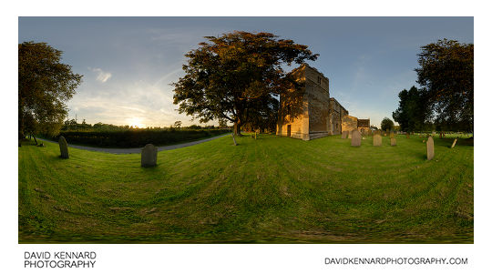
All Saints Church, Lubenham from http://www.davidkennardphotography.com
All Saints Church in Lubenham, Leicestershire, UK, at sunset. Constructed of ironstone dressed with limestone, the Church consists of a chancel, clerestoried nave, north and south aisles, a north chapel, and south porch. The West tower is castellated, and it is thought that it may once have been topped with a spire.
Date taken: 2010-09-03 19:22:34
Más sobre All Saints Church, Lubenham
84: Field near Thorpe Lubenham Hall at sunset
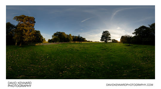
Field near Thorpe Lubenham Hall at sunset from http://www.davidkennardphotography.com
The sun sets over a field / parkland to the north of Thorpe Lubenham Hall in Lubenham, Leicestershire, UK.
Thorpe Lubenham, located to south of the river Welland that marks the southern boundary of Lubenham, was once a civil parish, but has since been absorbed into the parish of Marston Trussell. Thorpe Lubenham Hall was built around 1800, and was visited by Queen Elizabeth II and her family on a regular basis in the 1950s.
Date taken: 2010-09-03 19:13:20
Más sobre Field near Thorpe Lubenham Hall at sunset
85: Harvested field at twilight
Harvested field at twilight from http://www.davidkennardphotography.com
Looking west across a harvested field between Lubenham, Market Harborough, and Gartree, Leicestershire, UK at twilight.
Date taken: 2010-09-08 19:55:12
Más sobre Harvested field at twilight
86: Harvested field at twilight
Harvested field at twilight from http://www.davidkennardphotography.com
Looking west across a harvested field between Lubenham, Market Harborough, and Gartree, Leicestershire, UK at twilight.
Date taken: 2010-09-08 19:53:29
Más sobre Harvested field at twilight
87: Field at twilight
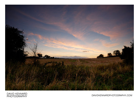
Field at twilight from http://www.davidkennardphotography.com
Looking west across a harvested field between Lubenham, Market Harborough, and Gartree, Leicestershire, UK at twilight.
Date taken: 2010-09-08 19:42:20
Más sobre Field at twilight
88: Path through harvested field, Lubenham
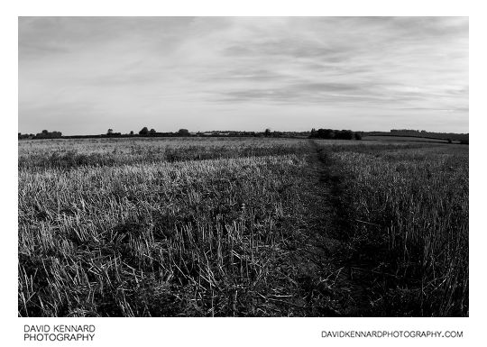
Path through harvested field, Lubenham from http://www.davidkennardphotography.com
Looking northeast along the path through a harvested field, between Lubenham, Market Harborough, and Gartree, in Leicestershire, UK.
Date taken: 2010-10-02 10:29:57
Más sobre Path through harvested field, Lubenham
89: Infrared countryside
Infrared countryside from http://www.davidkennardphotography.com
Looking south from Harborough Road, between Market Harborough and Lubenham.
Through the hole in the hedge can be seen fields filled with black plastic wrapped haybales and a house located on the road between Lubenham and East Farndon.
The photograph was taken using an Infrared filter, capturing light in the 720-1000nm range, which is invisible to the human eye.
Date taken: 2010-10-02 10:08:05
Más sobre Infrared countryside
90: The Old Forge, Lubenham, in Infrared
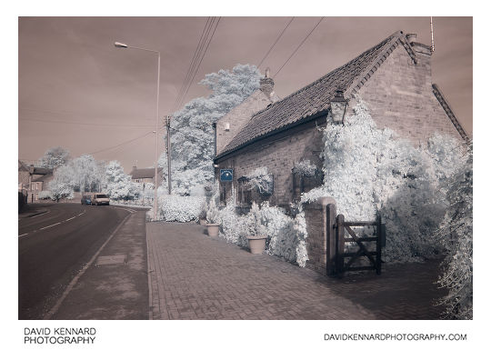
The Old Forge, Lubenham, in Infrared from http://www.davidkennardphotography.com
Infrared photograph of the Old Forge and Harborough Road in Lubenham, Leicestershire, UK.
The photograph was taken using an Infrared filter, capturing light in the 720-1000nm range, which is invisible to the human eye.
Date taken: 2010-10-02 10:19:03
Más sobre The Old Forge, Lubenham, in Infrared
91: Path through harvested field, Lubenham, in infrared
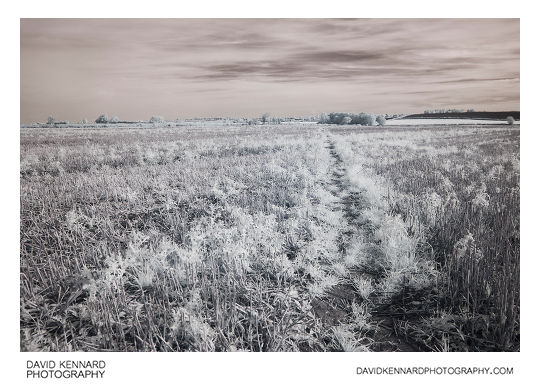
Path through harvested field, Lubenham, in infrared from http://www.davidkennardphotography.com
Looking northeast along the path through a harvested field, between Lubenham, Market Harborough, and Gartree, in Leicestershire, UK.
The photograph was taken using an Infrared filter, capturing light in the 720-1000nm range, which is invisible to the human eye.
Date taken: 2010-10-02 10:27:22
Más sobre Path through harvested field, Lubenham, in infrared
92: Sunset over the trees
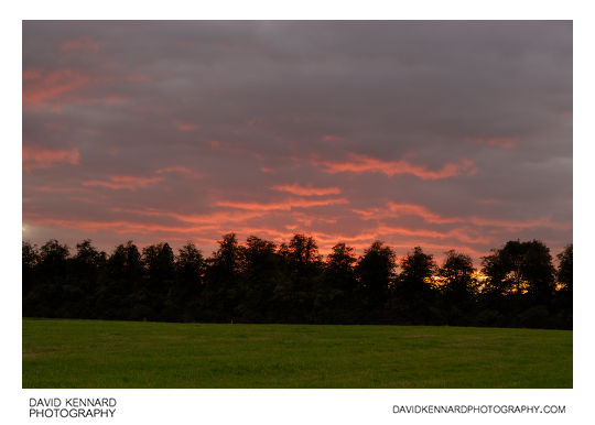
Sunset over the trees from http://www.davidkennardphotography.com
Looking west over a field towards a line of trees as the setting sun lights up the clouds a firey red colour, near Lubenham in Leicestershire, Engalnd.
Date taken: 2010-10-21 18:01:35
Más sobre Sunset over the trees
93: Sunset over the trees
Sunset over the trees from http://www.davidkennardphotography.com
Looking west towards a line of trees as the setting sun lights up the clouds a firey red colour, near Lubenham in Leicestershire, Engalnd.
Date taken: 2010-10-21 17:59:41
Más sobre Sunset over the trees
94: Welland Park Road Bridge
Welland Park Road Bridge from http://www.davidkennardphotography.com
The Bridge over the River Welland on Welland Park Road in Market Harborough, England.
The bridge was originally constructed as part of Welland Park Road in 1931.
Date taken: 2008-05-22 13:42:42
Más sobre Welland Park Road Bridge
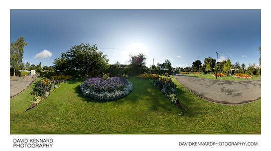
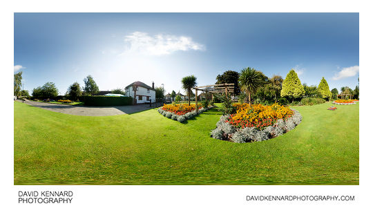
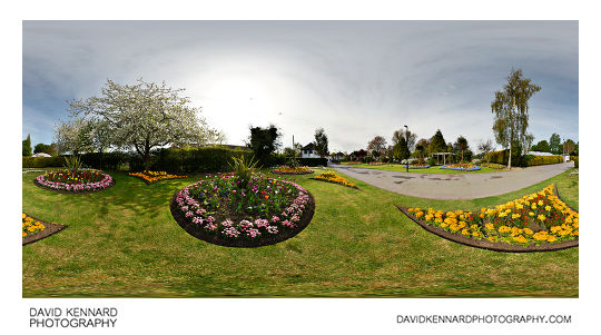
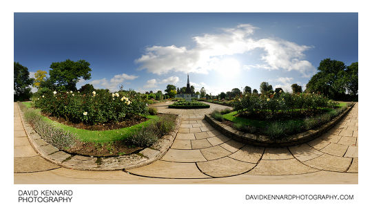
95: Welland Park Rose Garden 360 panorama
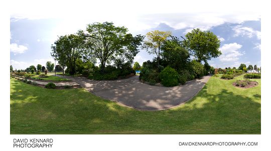
Welland Park Rose Garden 360 panorama from http://www.davidkennardphotography.com
The Rose Garden in Welland Park, Market Harborough, England. At the centre of the Rose Garden is the old Bell Tower from the old Symington Corset Factory (now used as the council offices).
Located near Harborough town centre, Welland Park is the main park in the Harborough District, offering a range of facilities to visitors. The Millennium Mile cyclepath and footpath running alongside the River Welland links the park Harborough's Train Station. The park includes a Rose Garden, Playing field, Tennis Courts, Bowling Green, Mini Golf Course, Cafe, Riverside walk, and many beautifully planted flowerbeds. There is also a small skate park adjoining the main section of the park.
The park was awarded a Green Flag award for its high standards in 2007, and has received the award in 2008 and 2009 as well (at the time of writing the 2010 awards are yet to be announced). The park also plays a large part in Harborough's entry to the East Midlands in Bloom Competition, in which the town consistently does well.
Date taken: 2008-05-22 13:59:40
Más sobre Welland Park Rose Garden 360 panorama
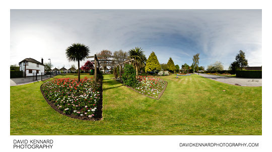
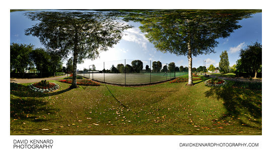
96: Welland Park play park under construction 360 panorama
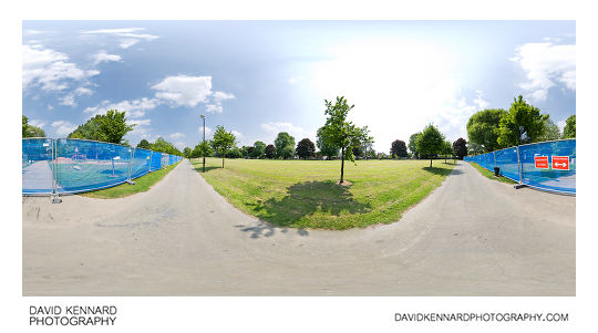
Welland Park play park under construction 360 panorama from http://www.davidkennardphotography.com
Located near Harborough town centre, Welland Park is the main park in the Harborough District, offering a range of facilities to visitors. The Millennium Mile cyclepath and footpath running alongside the River Welland links the park Harborough's Train Station. The park includes a Rose Garden, Playing field, Tennis Courts, Bowling Green, Mini Golf Course, Cafe, Riverside walk, and many beautifully planted flowerbeds. There is also a small skate park adjoining the main section of the park.
New play facilities were installed in Welland Park during 2008, at a cost of £300,000. Opening in August 2008, the play facilities attract a large number of families to the park, especially on sunny days.
Date taken: 2008-05-22 14:02:30
Más sobre Welland Park play park under construction 360 panorama
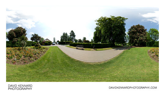
97: Welland Park 360 panorama
Welland Park 360 panorama from http://www.davidkennardphotography.com
Located near Harborough town centre, Welland Park is the main park in the Harborough District, offering a range of facilities to visitors. The Millennium Mile cyclepath and footpath running alongside the River Welland links the park Harborough's Train Station. The park includes a Rose Garden, Playing field, Tennis Courts, Bowling Green, Mini Golf Course, Cafe, Riverside walk, and many beautifully planted flowerbeds. There is also a small skate park adjoining the main section of the park.
The park was awarded a Green Flag award for its high standards in 2007, and has received the award in 2008 and 2009 as well (at the time of writing the 2010 awards are yet to be announced). The park also plays a large part in Harborough's entry to the East Midlands in Bloom Competition, in which the town consistently does well.
New play facilities were installed in Welland Park during 2008, at a cost of £300,000. Opening in August 2008, the play facilities attract a large number of families to the park, especially on sunny days.
Date taken: 2008-09-01 09:51:27
Más sobre Welland Park 360 panorama
98: Welland Park 360 panorama
Welland Park 360 panorama from http://www.davidkennardphotography.com
Located near Harborough town centre, Welland Park is the main park in the Harborough District, offering a range of facilities to visitors. The Millennium Mile cyclepath and footpath running alongside the River Welland links the park Harborough's Train Station. The park includes a Rose Garden, Playing field, Tennis Courts, Bowling Green, Mini Golf Course, Cafe, Riverside walk, and many beautifully planted flowerbeds. There is also a small skate park adjoining the main section of the park.
The park was awarded a Green Flag award for its high standards in 2007, and has received the award in 2008 and 2009 as well (at the time of writing the 2010 awards are yet to be announced). The park also plays a large part in Harborough's entry to the East Midlands in Bloom Competition, in which the town consistently does well.
New play facilities were installed in Welland Park during 2008, at a cost of £300,000. Opening in August 2008, the play facilities attract a large number of families to the park, especially on sunny days.
Date taken: 2008-09-01 09:48:10
Más sobre Welland Park 360 panorama
99: Welland Park 360 panorama
Welland Park 360 panorama from http://www.davidkennardphotography.com
Located near Harborough town centre, Welland Park is the main park in the Harborough District, offering a range of facilities to visitors. The Millennium Mile cyclepath and footpath running alongside the River Welland links the park Harborough's Train Station. The park includes a Rose Garden, Playing field, Tennis Courts, Bowling Green, Mini Golf Course, Cafe, Riverside walk, and many beautifully planted flowerbeds. There is also a small skate park adjoining the main section of the park.
The park was awarded a Green Flag award for its high standards in 2007, and has received the award in 2008 and 2009 as well (at the time of writing the 2010 awards are yet to be announced). The park also plays a large part in Harborough's entry to the East Midlands in Bloom Competition, in which the town consistently does well.
New play facilities were installed in Welland Park during 2008, at a cost of £300,000. Opening in August 2008, the play facilities attract a large number of families to the park, especially on sunny days.
Date taken: 2008-05-22 13:55:15
Más sobre Welland Park 360 panorama
100: Welland Park 360 panorama
Welland Park 360 panorama from http://www.davidkennardphotography.com
Located near Harborough town centre, Welland Park is the main park in the Harborough District, offering a range of facilities to visitors. The Millennium Mile cyclepath and footpath running alongside the River Welland links the park Harborough's Train Station. The park includes a Rose Garden, Playing field, Tennis Courts, Bowling Green, Mini Golf Course, Cafe, Riverside walk, and many beautifully planted flowerbeds. There is also a small skate park adjoining the main section of the park.
The park was awarded a Green Flag award for its high standards in 2007, and has received the award in 2008 and 2009 as well (at the time of writing the 2010 awards are yet to be announced). The park also plays a large part in Harborough's entry to the East Midlands in Bloom Competition, in which the town consistently does well.
Date taken: 2010-04-29 09:46:22
Más sobre Welland Park 360 panorama
101: Welland Park 360 panorama
Welland Park 360 panorama from http://www.davidkennardphotography.com
Located near Harborough town centre, Welland Park is the main park in the Harborough District, offering a range of facilities to visitors. The Millennium Mile cyclepath and footpath running alongside the River Welland links the park Harborough's Train Station. The park includes a Rose Garden, Playing field, Tennis Courts, Bowling Green, Mini Golf Course, Cafe, Riverside walk, and many beautifully planted flowerbeds. There is also a small skate park adjoining the main section of the park.
The park was awarded a Green Flag award for its high standards in 2007, and has received the award in 2008 and 2009 as well (at the time of writing the 2010 awards are yet to be announced). The park also plays a large part in Harborough's entry to the East Midlands in Bloom Competition, in which the town consistently does well.
Date taken: 2010-04-29 09:49:35
Más sobre Welland Park 360 panorama
102: Welland Park - Blossoming Trees
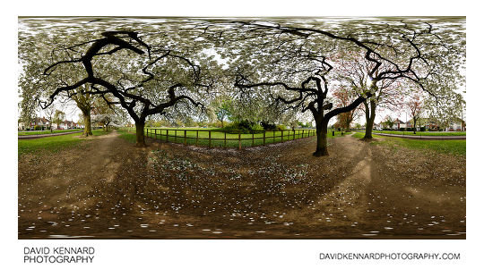
Welland Park - Blossoming Trees from http://www.davidkennardphotography.com
Located near Harborough town centre, Welland Park is the main park in the Harborough District, offering a range of facilities to visitors. The Millennium Mile cyclepath and footpath running alongside the River Welland links the park Harborough's Train Station. The park includes a Rose Garden, Playing field, Tennis Courts, Bowling Green, Mini Golf Course, Cafe, Riverside walk, and many beautifully planted flowerbeds. There is also a small skate park adjoining the main section of the park.
The park was awarded a Green Flag award for its high standards in 2007, and has received the award in 2008 and 2009 as well (at the time of writing the 2010 awards are yet to be announced). The park also plays a large part in Harborough's entry to the East Midlands in Bloom Competition, in which the town consistently does well.
Date taken: 2010-04-29 10:00:11
Más sobre Welland Park - Blossoming Trees
103: Welland Park 360 panorama
Welland Park 360 panorama from http://www.davidkennardphotography.com
Located near Harborough town centre, Welland Park is the main park in the Harborough District, offering a range of facilities to visitors. The Millennium Mile cyclepath and footpath running alongside the River Welland links the park Harborough's Train Station. The park includes a Rose Garden, Playing field, Tennis Courts, Bowling Green, Mini Golf Course, Cafe, Riverside walk, and many beautifully planted flowerbeds. There is also a small skate park adjoining the main section of the park.
The park was awarded a Green Flag award for its high standards in 2007, and has received the award in 2008 and 2009 as well (at the time of writing the 2010 awards are yet to be announced). The park also plays a large part in Harborough's entry to the East Midlands in Bloom Competition, in which the town consistently does well.
Date taken: 2008-09-01 10:00:20
Más sobre Welland Park 360 panorama
104: Welland Park 360 panorama
Welland Park 360 panorama from http://www.davidkennardphotography.com
Located near Harborough town centre, Welland Park is the main park in the Harborough District, offering a range of facilities to visitors. The Millennium Mile cyclepath and footpath running alongside the River Welland links the park Harborough's Train Station. The park includes a Rose Garden, Playing field, Tennis Courts, Bowling Green, Mini Golf Course, Cafe, Riverside walk, and many beautifully planted flowerbeds. There is also a small skate park adjoining the main section of the park.
The park was awarded a Green Flag award for its high standards in 2007, and has received the award in 2008 and 2009 as well (at the time of writing the 2010 awards are yet to be announced). The park also plays a large part in Harborough's entry to the East Midlands in Bloom Competition, in which the town consistently does well.
Date taken: 2008-09-01 10:03:13
Más sobre Welland Park 360 panorama
105: Welland Park Rose Garden

Welland Park Rose Garden from http://www.davidkennardphotography.com
The Rose Garden in Welland Park, Market Harborough, England. At the centre of the Rose Garden is the old Bell Tower from the old Symington Corset Factory (now used as the council offices).
Located near Harborough town centre, Welland Park is the main park in the Harborough District, offering a range of facilities to visitors. The Millennium Mile cyclepath and footpath running alongside the River Welland links the park Harborough's Train Station. The park includes a Rose Garden, Playing field, Tennis Courts, Bowling Green, Mini Golf Course, Cafe, Riverside walk, and many beautifully planted flowerbeds. There is also a small skate park adjoining the main section of the park.
The park was awarded a Green Flag award for its high standards in 2007, and has received the award in 2008 and 2009 as well (at the time of writing the 2010 awards are yet to be announced). The park also plays a large part in Harborough's entry to the East Midlands in Bloom Competition, in which the town consistently does well.
Date taken: 2008-09-01 10:06:44
Más sobre Welland Park Rose Garden
106: Welland Park Rose Garden
Welland Park Rose Garden from http://www.davidkennardphotography.com
The Rose Garden in Welland Park, Market Harborough, England. At the centre of the Rose Garden is the old Bell Tower from the old Symington Corset Factory (now used as the council offices).
Located near Harborough town centre, Welland Park is the main park in the Harborough District, offering a range of facilities to visitors. The Millennium Mile cyclepath and footpath running alongside the River Welland links the park Harborough's Train Station. The park includes a Rose Garden, Playing field, Tennis Courts, Bowling Green, Mini Golf Course, Cafe, Riverside walk, and many beautifully planted flowerbeds. There is also a small skate park adjoining the main section of the park.
The park was awarded a Green Flag award for its high standards in 2007, and has received the award in 2008 and 2009 as well (at the time of writing the 2010 awards are yet to be announced). The park also plays a large part in Harborough's entry to the East Midlands in Bloom Competition, in which the town consistently does well.
Date taken: 2008-09-01 10:11:27
Más sobre Welland Park Rose Garden
107: Hay field
Hay field from http://www.davidkennardphotography.com
A hay field full of seeding grass, between Lubenham and Market Harborough in Leicestershire, UK.
From Wikipedia (http://en.wikipedia.org/wiki/Hay):
Hay is grass, legumes or other herbaceous plants that have been cut, dried, and stored for use as animal fodder, particularly for grazing livestock such as cattle, horses, goats, and sheep. Hay is also fed to pets such as rabbits and guinea pigs. Pigs may be fed hay, but they do not digest it as efficiently as more fully herbivorous animals.
Hay is fed when or where there is not enough pasture or rangeland on which to graze an animal, when grazing is unavailable due to weather (such as during the winter) or when lush pasture by itself is too rich for the health of the animal. It is also fed during times when an animal is unable to access pasture, such as when animals are kept in a stable or barn.
Date taken: 2010-05-19 10:36:19
Más sobre Hay field
108: Seeding dandelions
Seeding dandelions from http://www.davidkennardphotography.com
Seeding dandelions in a hay field between Market Harborough and Lubenham, in Leicestershire, UK.
From Wikipedia (http://en.wikipedia.org/wiki/Taraxacum_officinale):
Taraxacum officinale, the Common Dandelion (often simply called "dandelion"), is a herbaceous perennial plant of the family Asteraceae (Compositae). It can be found growing in temperate regions of the world, in lawns, on roadsides, on disturbed banks and shores of water ways, and other areas with moist soils. T. officinale is considered a weedy species, especially in lawns and along roadsides, but it is sometimes used as a medical herb and in food preparation. As a nearly cosmopolitan weed, Dandelion is best known for its yellow flower heads, that turn into round balls of silver tufted fruits, that blow away on the wind.
Date taken: 2010-05-19 10:33:29
Más sobre Seeding dandelions
109: Seeding dandelions
Seeding dandelions from http://www.davidkennardphotography.com
Seeding dandelions in a hay field between Market Harborough and Lubenham, in Leicestershire, UK.
From Wikipedia (http://en.wikipedia.org/wiki/Taraxacum_officinale):
Taraxacum officinale, the Common Dandelion (often simply called "dandelion"), is a herbaceous perennial plant of the family Asteraceae (Compositae). It can be found growing in temperate regions of the world, in lawns, on roadsides, on disturbed banks and shores of water ways, and other areas with moist soils. T. officinale is considered a weedy species, especially in lawns and along roadsides, but it is sometimes used as a medical herb and in food preparation. As a nearly cosmopolitan weed, Dandelion is best known for its yellow flower heads, that turn into round balls of silver tufted fruits, that blow away on the wind.
Date taken: 2010-05-19 10:38:11
Más sobre Seeding dandelions
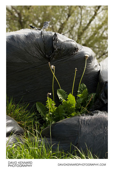
110: Dandelion growing on haybales
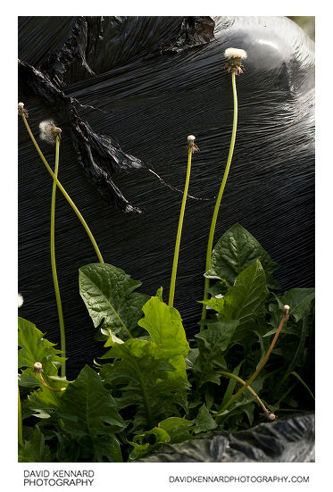
Dandelion growing on haybales from http://www.davidkennardphotography.com
A dandelion grows on black plastic wrapped haybales in a field between Market Harborough and Lubenham, in Leicestershire, UK.
From Wikipedia (http://en.wikipedia.org/wiki/Taraxacum_officinale):
Taraxacum officinale, the Common Dandelion (often simply called "dandelion"), is a herbaceous perennial plant of the family Asteraceae (Compositae). It can be found growing in temperate regions of the world, in lawns, on roadsides, on disturbed banks and shores of water ways, and other areas with moist soils. T. officinale is considered a weedy species, especially in lawns and along roadsides, but it is sometimes used as a medical herb and in food preparation. As a nearly cosmopolitan weed, Dandelion is best known for its yellow flower heads, that turn into round balls of silver tufted fruits, that blow away on the wind.
Date taken: 2010-05-19 10:44:20
Más sobre Dandelion growing on haybales
111: Dandelion growing on haybales
Dandelion growing on haybales from http://www.davidkennardphotography.com
A dandelion grows on black plastic wrapped haybales in a field between Market Harborough and Lubenham, in Leicestershire, UK.
From Wikipedia (http://en.wikipedia.org/wiki/Taraxacum_officinale):
Taraxacum officinale, the Common Dandelion (often simply called "dandelion"), is a herbaceous perennial plant of the family Asteraceae (Compositae). It can be found growing in temperate regions of the world, in lawns, on roadsides, on disturbed banks and shores of water ways, and other areas with moist soils. T. officinale is considered a weedy species, especially in lawns and along roadsides, but it is sometimes used as a medical herb and in food preparation. As a nearly cosmopolitan weed, Dandelion is best known for its yellow flower heads, that turn into round balls of silver tufted fruits, that blow away on the wind.
Date taken: 2010-05-19 10:45:10
Más sobre Dandelion growing on haybales
112: Trees
Trees from http://www.davidkennardphotography.com
Trees near Lubenham Hill Lake and the Welland Lodge pub in Market Harborough, Leicestershire.
Date taken: 2010-05-19 10:49:24
Más sobre Trees
113: Sheep on hill above the Welland
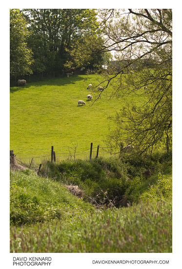
Sheep on hill above the Welland from http://www.davidkennardphotography.com
The river Welland turns to run along the bottom of a field of sheep to the west of Market Harborough in Leicestershire, UK.
From Wikipedia (http://en.wikipedia.org/wiki/River_Welland):
The River Welland is a river in the east of England, 56 km (35 m) long, and it has been a main waterway across the part of The Fens called "South Holland" for thousands of years. It rises in the Hothorpe Hills, (adjoining Welland Rise, Sibbertoft) in Northamptonshire, then flows generally eastwards to Market Harborough, Ketton, Stamford, The Deepings, Crowland, Cowbit and Spalding, then into The Wash at Fosdyke Bridge.
Date taken: 2010-05-19 10:50:23
Más sobre Sheep on hill above the Welland
114: Sunset over a field
Sunset over a field from http://www.davidkennardphotography.com
Sunset over a field between Lubenham and Market Harborough in Leicestershire, UK.
Date taken: 2010-05-28 20:47:21
Más sobre Sunset over a field
115: Hay field
Hay field from http://www.davidkennardphotography.com
A hay field between Lubenham and Market Harborough in Leicestershire, UK. On the hill behind the field can be seen a field of oil seed rape, now nearly finished flowering.
From Wikipedia (http://en.wikipedia.org/wiki/Hay):
Hay is grass, legumes or other herbaceous plants that have been cut, dried, and stored for use as animal fodder, particularly for grazing livestock such as cattle, horses, goats, and sheep. Hay is also fed to pets such as rabbits and guinea pigs. Pigs may be fed hay, but they do not digest it as efficiently as more fully herbivorous animals.
Hay is fed when or where there is not enough pasture or rangeland on which to graze an animal, when grazing is unavailable due to weather (such as during the winter) or when lush pasture by itself is too rich for the health of the animal. It is also fed during times when an animal is unable to access pasture, such as when animals are kept in a stable or barn.
Date taken: 2010-05-28 11:25:11
Más sobre Hay field
116: Old railway line between Lubenham and Harborough
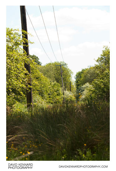
Old railway line between Lubenham and Harborough from http://www.davidkennardphotography.com
Looking east along the old railway line between Market Harborough and Lubenham. The line was originally part of the Rugby and Stamford Railway, connecting Rugby to Market Harborough, and opened in 1850.
Date taken: 2010-05-28 11:47:30
Más sobre Old railway line between Lubenham and Harborough
117: Leafy track
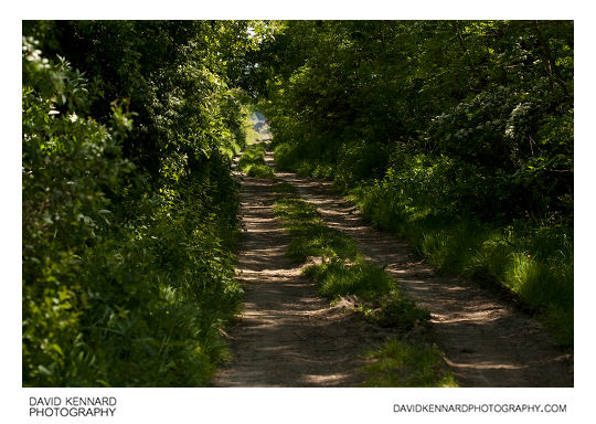
Leafy track from http://www.davidkennardphotography.com
Looking west down the old railway line between Market Harborough and Lubenham. The line was originally part of the Rugby and Stamford Railway, connecting Rugby to Market Harborough, and opened in 1850.
Date taken: 2010-05-28 12:25:01
Más sobre Leafy track
118: Sunset over a field
Sunset over a field from http://www.davidkennardphotography.com
Sunset over a field between Lubenham and Market Harborough in Leicestershire, UK.
Date taken: 2010-05-28 20:56:36
Más sobre Sunset over a field
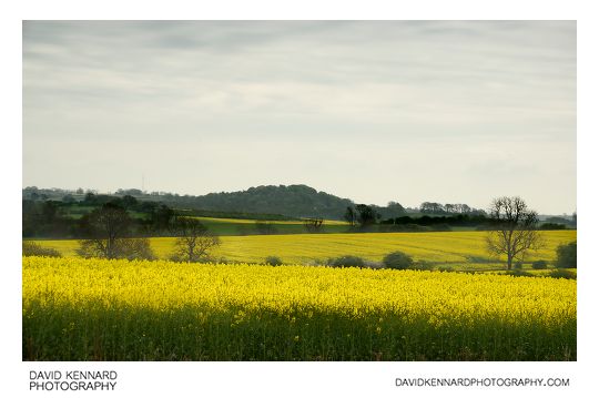
119: Oilseed Rape field

Oilseed Rape field from http://www.davidkennardphotography.com
A field of oilseed rape on the western edge of Market Harborough, Leicestershire, UK.
Oilseed rape is typically grown as a 'break crop', which allows fungal diseases and pests that would normally feed on the cereal crop to die out, thus improving the yield of the next year's cereal crop.
Oilseed rape will not normally be grown in the same field more than once every three years. It is lower yielding than most cereal crops, however does command a better price.
The UK is generally self sufficient in growing enough rape to cope with domestic demand, as of 2008 there was 598 hectares of land being used for rape, with 1,973,000 tonnes being produced.
Date taken: 2010-06-02 19:35:41
Más sobre Oilseed Rape field
120: Farndale View and Rhodes Close
Farndale View and Rhodes Close from http://www.davidkennardphotography.com
Houses on Farndale View and Rhodes Close, in Market Harborough, England.
The estate was built by David Wilson Homes around 1999 on land just to the south of Lubenham Hill road.
Date taken: 2008-05-22 13:33:26
Más sobre Farndale View and Rhodes Close
121: Oilseed Rape field
Oilseed Rape field from http://www.davidkennardphotography.com
A field of oilseed rape on the western edge of Market Harborough, Leicestershire, UK.
Oilseed rape is typically grown as a 'break crop', which allows fungal diseases and pests that would normally feed on the cereal crop to die out, thus improving the yield of the next year's cereal crop.
Oilseed rape will not normally be grown in the same field more than once every three years. It is lower yielding than most cereal crops, however does command a better price.
The UK is generally self sufficient in growing enough rape to cope with domestic demand, as of 2008 there was 598 hectares of land being used for rape, with 1,973,000 tonnes being produced.
Date taken: 2010-06-02 19:41:54
Más sobre Oilseed Rape field
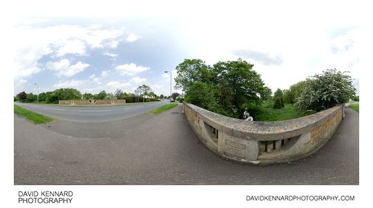
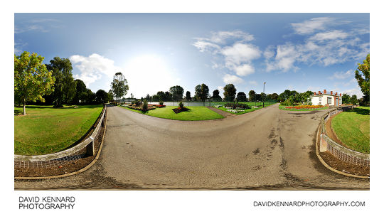
122: Welland Park Road 360 pano
Welland Park Road 360 pano from http://www.davidkennardphotography.com
360° panorama of the path along Welland Park road and the south side of Welland Park in Market Harborough, England.
From Wikipedia (http://en.wikipedia.org/wiki/Market_Harborough#1800-1899):
A major improvement took place from 1930 with the acquisition of land between Northampton Road and Farndon Road. This enabled the construction of Welland Park Road (which enabled east west traffic to bypass the town centre), provision of 100 homes for rent along Welland Park Road and 52 in Walcot Road to rehouse occupants of the old yard houses, plots for private housing, the layout of Welland Park and the construction of Welland Park School.
Date taken: 2008-05-22 13:47:19
Más sobre Welland Park Road 360 pano
123: Footpath through Hay field
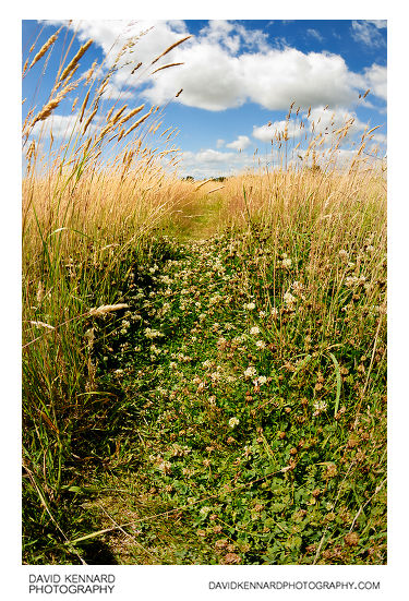
Footpath through Hay field from http://www.davidkennardphotography.com
Looking west down the footpath through a field of hay between Lubenham and Market Harborough, in Leicestershire, UK.
From Wikipedia (http://en.wikipedia.org/wiki/Hay):
Hay is grass, legumes or other herbaceous plants that have been cut, dried, and stored for use as animal fodder, particularly for grazing livestock such as cattle, horses, goats, and sheep. Hay is also fed to pets such as rabbits and guinea pigs. Pigs may be fed hay, but they do not digest it as efficiently as more fully herbivorous animals.
Hay is fed when or where there is not enough pasture or rangeland on which to graze an animal, when grazing is unavailable due to weather (such as during the winter) or when lush pasture by itself is too rich for the health of the animal. It is also fed during times when an animal is unable to access pasture, such as when animals are kept in a stable or barn.
Date taken: 2010-07-16 13:44:00
Más sobre Footpath through Hay field
124: Hay field between Lubenham and Harborough
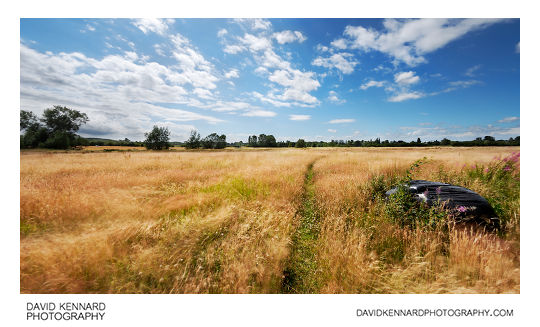
Hay field between Lubenham and Harborough from http://www.davidkennardphotography.com
A field of hay between Lubenham and Market Harborough, in Leicestershire, UK.
From Wikipedia (http://en.wikipedia.org/wiki/Hay):
Hay is grass, legumes or other herbaceous plants that have been cut, dried, and stored for use as animal fodder, particularly for grazing livestock such as cattle, horses, goats, and sheep. Hay is also fed to pets such as rabbits and guinea pigs. Pigs may be fed hay, but they do not digest it as efficiently as more fully herbivorous animals.
Hay is fed when or where there is not enough pasture or rangeland on which to graze an animal, when grazing is unavailable due to weather (such as during the winter) or when lush pasture by itself is too rich for the health of the animal. It is also fed during times when an animal is unable to access pasture, such as when animals are kept in a stable or barn.
Date taken: 2010-07-16 13:47:36
Más sobre Hay field between Lubenham and Harborough
125: Hay field between Lubenham and Harborough (near IR)
.jpg)
Hay field between Lubenham and Harborough (near IR) from http://www.davidkennardphotography.com
A near Infrared photo of a hay field between Lubenham and Market Harborough, in Leicestershire, UK. The photo was taken using mostly red light at end of the visible spectrum, rather than true infrared light.
From Wikipedia: http://en.wikipedia.org/wiki/Hay
Hay is grass, legumes or other herbaceous plants that have been cut, dried, and stored for use as animal fodder, particularly for grazing livestock such as cattle, horses, goats, and sheep. Hay is also fed to pets such as rabbits and guinea pigs. Pigs may be fed hay, but they do not digest it as efficiently as more fully herbivorous animals.
Hay is fed when or where there is not enough pasture or rangeland on which to graze an animal, when grazing is unavailable due to weather (such as during the winter) or when lush pasture by itself is too rich for the health of the animal. It is also fed during times when an animal is unable to access pasture, such as when animals are kept in a stable or barn.
Date taken: 2010-07-16 13:57:03
Más sobre Hay field between Lubenham and Harborough (near IR)
126: Old steel shack in hay field
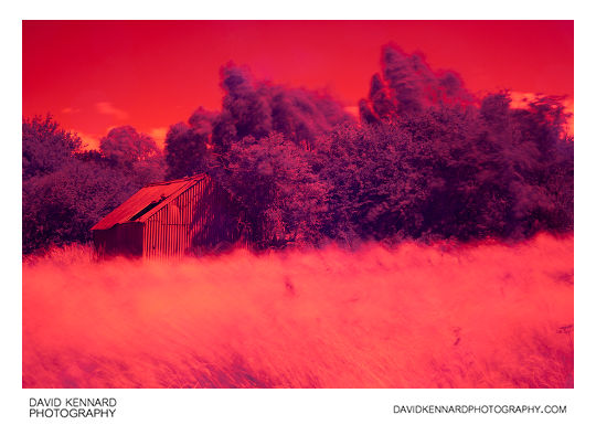
Old steel shack in hay field from http://www.davidkennardphotography.com
An old corrugated steel shack stands by the trees on the edge of a hay field on the western edge of Market Harborough in Leicestershire, UK.
Date taken: 2010-07-16 14:30:27
Más sobre Old steel shack in hay field
127: Old steel shack in hay field
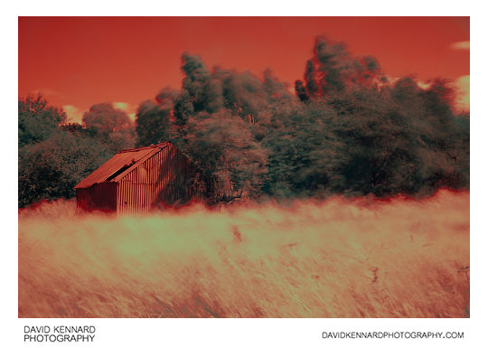
Old steel shack in hay field from http://www.davidkennardphotography.com
An old corrugated steel shack stands by the trees on the edge of a hay field on the western edge of Market Harborough in Leicestershire, UK.
Date taken: 2010-07-16 14:30:54
Más sobre Old steel shack in hay field
128: Old steel shack in hay field
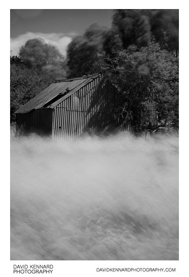
Old steel shack in hay field from http://www.davidkennardphotography.com
An old corrugated steel shack stands by the trees on the edge of a hay field on the western edge of Market Harborough in Leicestershire, UK.
Date taken: 2010-07-16 14:33:13
Más sobre Old steel shack in hay field
129: Old steel shack in hay field
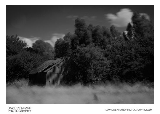
Old steel shack in hay field from http://www.davidkennardphotography.com
An old corrugated steel shack stands by the trees on the edge of a hay field on the western edge of Market Harborough in Leicestershire, UK.
Date taken: 2010-07-16 14:34:01
Más sobre Old steel shack in hay field
130: Hay field between Lubenham and Harborough
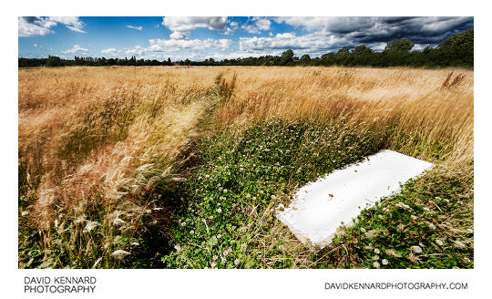
Hay field between Lubenham and Harborough from http://www.davidkennardphotography.com
An old door lies in a field of hay between Lubenham and Market Harborough, in Leicestershire, UK.
From Wikipedia (http://en.wikipedia.org/wiki/Hay):
Hay is grass, legumes or other herbaceous plants that have been cut, dried, and stored for use as animal fodder, particularly for grazing livestock such as cattle, horses, goats, and sheep. Hay is also fed to pets such as rabbits and guinea pigs. Pigs may be fed hay, but they do not digest it as efficiently as more fully herbivorous animals.
Hay is fed when or where there is not enough pasture or rangeland on which to graze an animal, when grazing is unavailable due to weather (such as during the winter) or when lush pasture by itself is too rich for the health of the animal. It is also fed during times when an animal is unable to access pasture, such as when animals are kept in a stable or barn.
Date taken: 2010-07-16 13:40:55
Más sobre Hay field between Lubenham and Harborough
131: Old steel shack in hay field
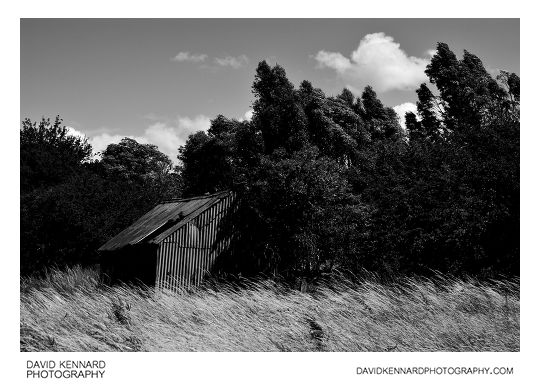
Old steel shack in hay field from http://www.davidkennardphotography.com
An old corrugated steel shack stands by the trees on the edge of a hay field on the western edge of Market Harborough in Leicestershire, UK.
Date taken: 2010-07-16 14:34:17
Más sobre Old steel shack in hay field
132: Old steel shack in hay field
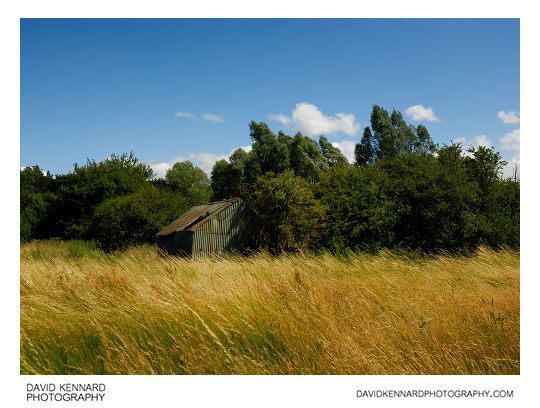
Old steel shack in hay field from http://www.davidkennardphotography.com
An old corrugated steel shack stands by the trees on the edge of a hay field on the western edge of Market Harborough in Leicestershire, UK.
Date taken: 2010-07-16 14:34:33
Más sobre Old steel shack in hay field
133: Old steel shack in hay field
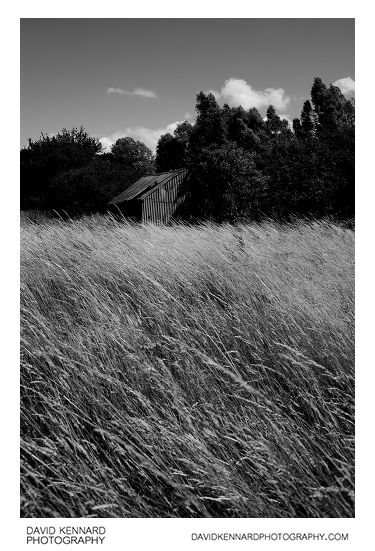
Old steel shack in hay field from http://www.davidkennardphotography.com
An old corrugated steel shack stands by the trees on the edge of a hay field on the western edge of Market Harborough in Leicestershire, UK.
Date taken: 2010-07-16 14:34:41
Más sobre Old steel shack in hay field
134: Old steel shack in hay field
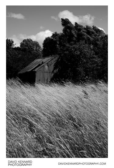
Old steel shack in hay field from http://www.davidkennardphotography.com
An old corrugated steel shack stands by the trees on the edge of a hay field on the western edge of Market Harborough in Leicestershire, UK.
Date taken: 2010-07-16 14:35:06
Más sobre Old steel shack in hay field
135: Field of oilseed rape on Lubenham Hill
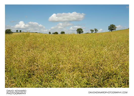
Field of oilseed rape on Lubenham Hill from http://www.davidkennardphotography.com
Looking north over a field of oilseed rape on Lubenham Hill in Market Harborough, Leicestershire, England.
From Wikipedia (http://en.wikipedia.org/wiki/Oilseed_rape):
Rapeseed (Brassica napus), also known as rape, oilseed rape, rapa, rappi, rapaseed and (in the case of one particular group of cultivars, canola) is a bright yellow flowering member of the family Brassicaceae (mustard or cabbage family). The name derives from the Latin for turnip, r?pum or r?pa, and is first recorded in English at the end of the 14th century. Older writers usually distinguished the turnip and rape by the adjectives round and long(-rooted) respectively.
In agriculture, canola are certain varieties of rapeseed oil, or the oil produced from those varieties. Canola is a trademark for a hybrid variety of rape initially bred in Canada. Rapeseed oil was produced in the 19th century as a source of a lubricant for steam engines, and the oil has a bitter taste due to high levels of acids. Canola has been bred to reduce the amount of acid, yielding a more palatable oil.
Rapeseed is grown for the production of animal feed, vegetable oil for human consumption, and biodiesel; leading producers include the European Union, Canada, the United States, Australia, China and India. In India, it is grown on 13% of cropped land. According to the United States Department of Agriculture, rapeseed was the third leading source of vegetable oil in the world in 2000, after soybean and oil palm, and also the world's second leading source of protein meal, although only one-fifth of the production of the leading soybean meal.
Date taken: 2010-07-16 14:40:34
Más sobre Field of oilseed rape on Lubenham Hill
136: Path through oilseed rape field on Lubenham Hill
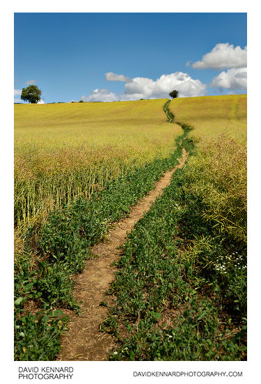
Path through oilseed rape field on Lubenham Hill from http://www.davidkennardphotography.com
Looking east up a path through a field of oilseed rape on Lubenham Hill in Market harborough, Leicestershire, UK.
From Wikipedia (http://en.wikipedia.org/wiki/Oilseed_rape):
Rapeseed (Brassica napus), also known as rape, oilseed rape, rapa, rappi, rapaseed and (in the case of one particular group of cultivars, canola) is a bright yellow flowering member of the family Brassicaceae (mustard or cabbage family). The name derives from the Latin for turnip, r?pum or r?pa, and is first recorded in English at the end of the 14th century. Older writers usually distinguished the turnip and rape by the adjectives round and long(-rooted) respectively.
In agriculture, canola are certain varieties of rapeseed oil, or the oil produced from those varieties. Canola is a trademark for a hybrid variety of rape initially bred in Canada. Rapeseed oil was produced in the 19th century as a source of a lubricant for steam engines, and the oil has a bitter taste due to high levels of acids. Canola has been bred to reduce the amount of acid, yielding a more palatable oil.
Rapeseed is grown for the production of animal feed, vegetable oil for human consumption, and biodiesel; leading producers include the European Union, Canada, the United States, Australia, China and India. In India, it is grown on 13% of cropped land. According to the United States Department of Agriculture, rapeseed was the third leading source of vegetable oil in the world in 2000, after soybean and oil palm, and also the world's second leading source of protein meal, although only one-fifth of the production of the leading soybean meal.
Date taken: 2010-07-16 14:41:16
Más sobre Path through oilseed rape field on Lubenham Hill
137: Path through oilseed rape field on Lubenham Hill
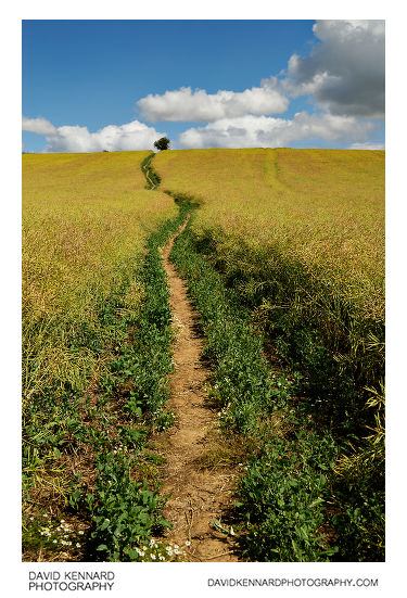
Path through oilseed rape field on Lubenham Hill from http://www.davidkennardphotography.com
Looking east up a path through a field of oilseed rape on Lubenham Hill in Market harborough, Leicestershire, UK.
From Wikipedia (http://en.wikipedia.org/wiki/Oilseed_rape):
Rapeseed (Brassica napus), also known as rape, oilseed rape, rapa, rappi, rapaseed and (in the case of one particular group of cultivars, canola) is a bright yellow flowering member of the family Brassicaceae (mustard or cabbage family). The name derives from the Latin for turnip, r?pum or r?pa, and is first recorded in English at the end of the 14th century. Older writers usually distinguished the turnip and rape by the adjectives round and long(-rooted) respectively.
In agriculture, canola are certain varieties of rapeseed oil, or the oil produced from those varieties. Canola is a trademark for a hybrid variety of rape initially bred in Canada. Rapeseed oil was produced in the 19th century as a source of a lubricant for steam engines, and the oil has a bitter taste due to high levels of acids. Canola has been bred to reduce the amount of acid, yielding a more palatable oil.
Rapeseed is grown for the production of animal feed, vegetable oil for human consumption, and biodiesel; leading producers include the European Union, Canada, the United States, Australia, China and India. In India, it is grown on 13% of cropped land. According to the United States Department of Agriculture, rapeseed was the third leading source of vegetable oil in the world in 2000, after soybean and oil palm, and also the world's second leading source of protein meal, although only one-fifth of the production of the leading soybean meal.
Date taken: 2010-07-16 14:42:10
Más sobre Path through oilseed rape field on Lubenham Hill
138: Path through oilseed rape field on Lubenham Hill
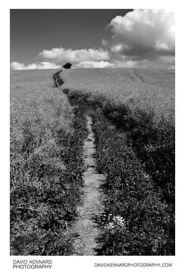
Path through oilseed rape field on Lubenham Hill from http://www.davidkennardphotography.com
Looking east up a path through a field of oilseed rape on Lubenham Hill in Market harborough, Leicestershire, UK.
From Wikipedia (http://en.wikipedia.org/wiki/Oilseed_rape):
Rapeseed (Brassica napus), also known as rape, oilseed rape, rapa, rappi, rapaseed and (in the case of one particular group of cultivars, canola) is a bright yellow flowering member of the family Brassicaceae (mustard or cabbage family). The name derives from the Latin for turnip, r?pum or r?pa, and is first recorded in English at the end of the 14th century. Older writers usually distinguished the turnip and rape by the adjectives round and long(-rooted) respectively.
In agriculture, canola are certain varieties of rapeseed oil, or the oil produced from those varieties. Canola is a trademark for a hybrid variety of rape initially bred in Canada. Rapeseed oil was produced in the 19th century as a source of a lubricant for steam engines, and the oil has a bitter taste due to high levels of acids. Canola has been bred to reduce the amount of acid, yielding a more palatable oil.
Rapeseed is grown for the production of animal feed, vegetable oil for human consumption, and biodiesel; leading producers include the European Union, Canada, the United States, Australia, China and India. In India, it is grown on 13% of cropped land. According to the United States Department of Agriculture, rapeseed was the third leading source of vegetable oil in the world in 2000, after soybean and oil palm, and also the world's second leading source of protein meal, although only one-fifth of the production of the leading soybean meal.
Date taken: 2010-07-16 14:42:47
Más sobre Path through oilseed rape field on Lubenham Hill
139: Field of oilseed rape on Lubenham Hill
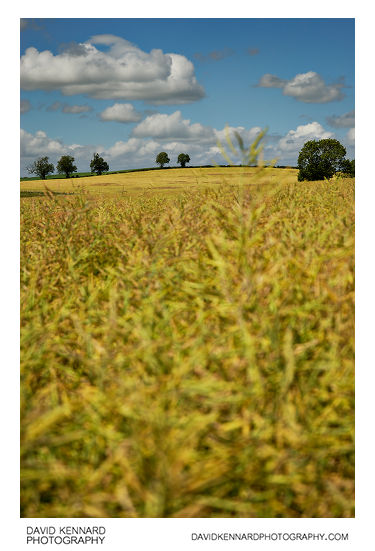
Field of oilseed rape on Lubenham Hill from http://www.davidkennardphotography.com
Looking north over a field of oilseed rape on Lubenham Hill in Market Harborough, Leicestershire, England.
From Wikipedia (http://en.wikipedia.org/wiki/Oilseed_rape):
Rapeseed (Brassica napus), also known as rape, oilseed rape, rapa, rappi, rapaseed and (in the case of one particular group of cultivars, canola) is a bright yellow flowering member of the family Brassicaceae (mustard or cabbage family). The name derives from the Latin for turnip, r?pum or r?pa, and is first recorded in English at the end of the 14th century. Older writers usually distinguished the turnip and rape by the adjectives round and long(-rooted) respectively.
In agriculture, canola are certain varieties of rapeseed oil, or the oil produced from those varieties. Canola is a trademark for a hybrid variety of rape initially bred in Canada. Rapeseed oil was produced in the 19th century as a source of a lubricant for steam engines, and the oil has a bitter taste due to high levels of acids. Canola has been bred to reduce the amount of acid, yielding a more palatable oil.
Rapeseed is grown for the production of animal feed, vegetable oil for human consumption, and biodiesel; leading producers include the European Union, Canada, the United States, Australia, China and India. In India, it is grown on 13% of cropped land. According to the United States Department of Agriculture, rapeseed was the third leading source of vegetable oil in the world in 2000, after soybean and oil palm, and also the world's second leading source of protein meal, although only one-fifth of the production of the leading soybean meal.
Date taken: 2010-07-16 14:43:43
Más sobre Field of oilseed rape on Lubenham Hill
140: Hay field between Lubenham and Harborough
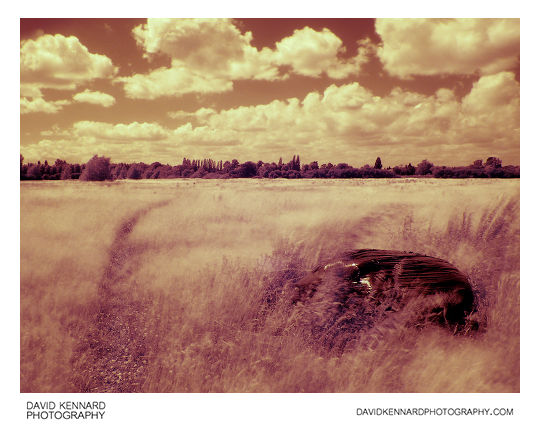
Hay field between Lubenham and Harborough from http://www.davidkennardphotography.com
A near Infrared photo of a hay field between Lubenham and Market Harborough, in Leicestershire, UK. The photo was taken using mostly red light at end of the visible spectrum, rather than true infrared light.
From Wikipedia: http://en.wikipedia.org/wiki/Hay
Hay is grass, legumes or other herbaceous plants that have been cut, dried, and stored for use as animal fodder, particularly for grazing livestock such as cattle, horses, goats, and sheep. Hay is also fed to pets such as rabbits and guinea pigs. Pigs may be fed hay, but they do not digest it as efficiently as more fully herbivorous animals.
Hay is fed when or where there is not enough pasture or rangeland on which to graze an animal, when grazing is unavailable due to weather (such as during the winter) or when lush pasture by itself is too rich for the health of the animal. It is also fed during times when an animal is unable to access pasture, such as when animals are kept in a stable or barn.
Date taken: 2010-07-16 14:13:19
Más sobre Hay field between Lubenham and Harborough
141: Field of oilseed rape on Lubenham Hill
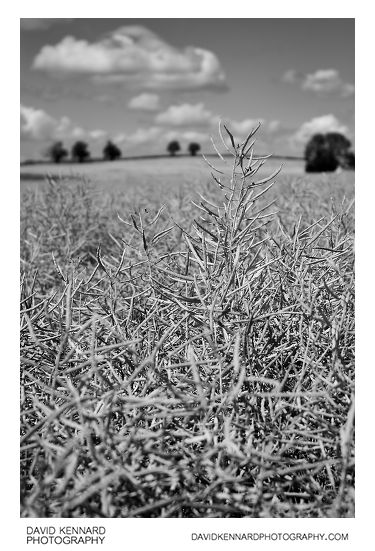
Field of oilseed rape on Lubenham Hill from http://www.davidkennardphotography.com
Looking north over a field of oilseed rape on Lubenham Hill in Market Harborough, Leicestershire, England.
From Wikipedia (http://en.wikipedia.org/wiki/Oilseed_rape):
Rapeseed (Brassica napus), also known as rape, oilseed rape, rapa, rappi, rapaseed and (in the case of one particular group of cultivars, canola) is a bright yellow flowering member of the family Brassicaceae (mustard or cabbage family). The name derives from the Latin for turnip, r?pum or r?pa, and is first recorded in English at the end of the 14th century. Older writers usually distinguished the turnip and rape by the adjectives round and long(-rooted) respectively.
In agriculture, canola are certain varieties of rapeseed oil, or the oil produced from those varieties. Canola is a trademark for a hybrid variety of rape initially bred in Canada. Rapeseed oil was produced in the 19th century as a source of a lubricant for steam engines, and the oil has a bitter taste due to high levels of acids. Canola has been bred to reduce the amount of acid, yielding a more palatable oil.
Rapeseed is grown for the production of animal feed, vegetable oil for human consumption, and biodiesel; leading producers include the European Union, Canada, the United States, Australia, China and India. In India, it is grown on 13% of cropped land. According to the United States Department of Agriculture, rapeseed was the third leading source of vegetable oil in the world in 2000, after soybean and oil palm, and also the world's second leading source of protein meal, although only one-fifth of the production of the leading soybean meal.
Date taken: 2010-07-16 14:44:02
Más sobre Field of oilseed rape on Lubenham Hill
142: Path through oilseed rape field on Lubenham Hill
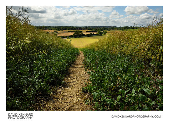
Path through oilseed rape field on Lubenham Hill from http://www.davidkennardphotography.com
Looking west down the footpath through a field of oilseed rape on Lubenham Hill in Market Harborough, Leicestershire, UK.
From Wikipedia (http://en.wikipedia.org/wiki/Oilseed_rape):
Rapeseed (Brassica napus), also known as rape, oilseed rape, rapa, rappi, rapaseed and (in the case of one particular group of cultivars, canola) is a bright yellow flowering member of the family Brassicaceae (mustard or cabbage family). The name derives from the Latin for turnip, r?pum or r?pa, and is first recorded in English at the end of the 14th century. Older writers usually distinguished the turnip and rape by the adjectives round and long(-rooted) respectively.
In agriculture, canola are certain varieties of rapeseed oil, or the oil produced from those varieties. Canola is a trademark for a hybrid variety of rape initially bred in Canada. Rapeseed oil was produced in the 19th century as a source of a lubricant for steam engines, and the oil has a bitter taste due to high levels of acids. Canola has been bred to reduce the amount of acid, yielding a more palatable oil.
Rapeseed is grown for the production of animal feed, vegetable oil for human consumption, and biodiesel; leading producers include the European Union, Canada, the United States, Australia, China and India. In India, it is grown on 13% of cropped land. According to the United States Department of Agriculture, rapeseed was the third leading source of vegetable oil in the world in 2000, after soybean and oil palm, and also the world's second leading source of protein meal, although only one-fifth of the production of the leading soybean meal.
Date taken: 2010-07-16 14:46:53
Más sobre Path through oilseed rape field on Lubenham Hill
143: Path through oilseed rape field on Lubenham Hill
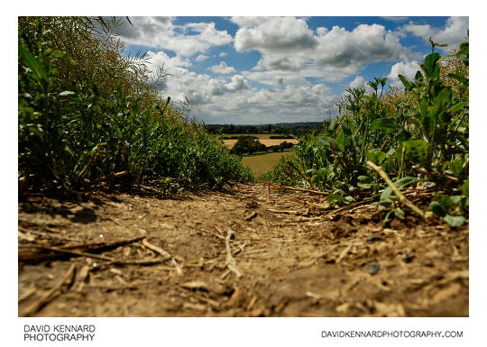
Path through oilseed rape field on Lubenham Hill from http://www.davidkennardphotography.com
Looking west down the footpath through a field of oilseed rape on Lubenham Hill in Market Harborough, Leicestershire, UK.
Date taken: 2010-07-16 14:47:13
Más sobre Path through oilseed rape field on Lubenham Hill
144: Path through oilseed rape field on Lubenham Hill
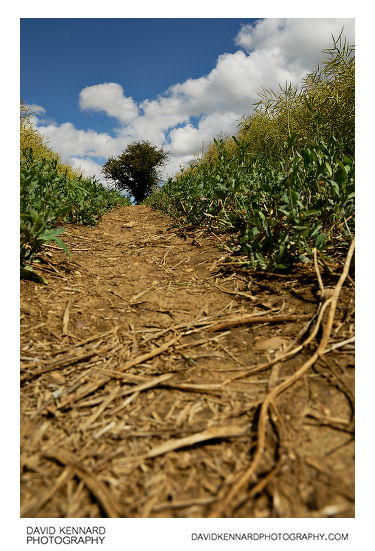
Path through oilseed rape field on Lubenham Hill from http://www.davidkennardphotography.com
Looking east up a path through a field of oilseed rape on Lubenham Hill in Market harborough, Leicestershire, UK.
Date taken: 2010-07-16 14:47:45
Más sobre Path through oilseed rape field on Lubenham Hill
145: Path through oilseed rape field on Lubenham Hill
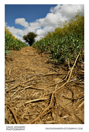
Path through oilseed rape field on Lubenham Hill from http://www.davidkennardphotography.com
Looking east up a path through a field of oilseed rape on Lubenham Hill in Market harborough, Leicestershire, UK.
Date taken: 2010-07-16 14:47:55
Más sobre Path through oilseed rape field on Lubenham Hill
146: Path through oilseed rape field on Lubenham Hill
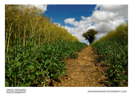
Path through oilseed rape field on Lubenham Hill from http://www.davidkennardphotography.com
Looking east up a path through a field of oilseed rape on Lubenham Hill in Market harborough, Leicestershire, UK.
From Wikipedia (http://en.wikipedia.org/wiki/Oilseed_rape):
Rapeseed (Brassica napus), also known as rape, oilseed rape, rapa, rappi, rapaseed and (in the case of one particular group of cultivars, canola) is a bright yellow flowering member of the family Brassicaceae (mustard or cabbage family). The name derives from the Latin for turnip, r?pum or r?pa, and is first recorded in English at the end of the 14th century. Older writers usually distinguished the turnip and rape by the adjectives round and long(-rooted) respectively.
In agriculture, canola are certain varieties of rapeseed oil, or the oil produced from those varieties. Canola is a trademark for a hybrid variety of rape initially bred in Canada. Rapeseed oil was produced in the 19th century as a source of a lubricant for steam engines, and the oil has a bitter taste due to high levels of acids. Canola has been bred to reduce the amount of acid, yielding a more palatable oil.
Rapeseed is grown for the production of animal feed, vegetable oil for human consumption, and biodiesel; leading producers include the European Union, Canada, the United States, Australia, China and India. In India, it is grown on 13% of cropped land. According to the United States Department of Agriculture, rapeseed was the third leading source of vegetable oil in the world in 2000, after soybean and oil palm, and also the world's second leading source of protein meal, although only one-fifth of the production of the leading soybean meal.
Date taken: 2010-07-16 14:48:31
Más sobre Path through oilseed rape field on Lubenham Hill
147: Hay field between Lubenham and Harborough
Hay field between Lubenham and Harborough from http://www.davidkennardphotography.com
A near Infrared photo of a hay field between Lubenham and Market Harborough, in Leicestershire, UK. The photo was taken using mostly red light at end of the visible spectrum, rather than true infrared light.
From Wikipedia: http://en.wikipedia.org/wiki/Hay
Hay is grass, legumes or other herbaceous plants that have been cut, dried, and stored for use as animal fodder, particularly for grazing livestock such as cattle, horses, goats, and sheep. Hay is also fed to pets such as rabbits and guinea pigs. Pigs may be fed hay, but they do not digest it as efficiently as more fully herbivorous animals.
Hay is fed when or where there is not enough pasture or rangeland on which to graze an animal, when grazing is unavailable due to weather (such as during the winter) or when lush pasture by itself is too rich for the health of the animal. It is also fed during times when an animal is unable to access pasture, such as when animals are kept in a stable or barn.
Date taken: 2010-07-16 14:06:43
Más sobre Hay field between Lubenham and Harborough
148: Hay field between Lubenham and Harborough
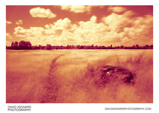
Hay field between Lubenham and Harborough from http://www.davidkennardphotography.com
A near Infrared photo of a hay field between Lubenham and Market Harborough, in Leicestershire, UK. The photo was taken using mostly red light at end of the visible spectrum, rather than true infrared light.
From Wikipedia: http://en.wikipedia.org/wiki/Hay
Hay is grass, legumes or other herbaceous plants that have been cut, dried, and stored for use as animal fodder, particularly for grazing livestock such as cattle, horses, goats, and sheep. Hay is also fed to pets such as rabbits and guinea pigs. Pigs may be fed hay, but they do not digest it as efficiently as more fully herbivorous animals.
Hay is fed when or where there is not enough pasture or rangeland on which to graze an animal, when grazing is unavailable due to weather (such as during the winter) or when lush pasture by itself is too rich for the health of the animal. It is also fed during times when an animal is unable to access pasture, such as when animals are kept in a stable or barn.
Date taken: 2010-07-16 14:09:13
Más sobre Hay field between Lubenham and Harborough
149: Sunset over ridge and furrow field
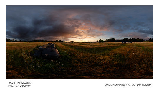
Sunset over ridge and furrow field from http://www.davidkennardphotography.com
Grass grown for Hay grows in an old ridge and furrow field between Market Harborough and Lubenham. Leicestershire features some of the best-preserved ridge and furrow in England.
From Wikipedia (http://en.wikipedia.org/wiki/Ridge_and_furrow):
Ridge and furrow is an archaeological pattern of ridges and troughs created by a system of ploughing used in Europe during the Middle Ages. The earliest examples date to the immediate post-Roman period and the system was used until the 17th century in some areas. Ridge and furrow topography is found in Great Britain, Ireland and elsewhere in Europe. The surviving ridges are parallel, ranging from 3 to 22 yards (3 to 20 m) apart and up to 24 in (0.61 m) tall – they were much taller when in use. Older examples are often curved.
Ridge and furrow topography was a result of ploughing with non-reversible ploughs on the same strip of land each year. It is visible on land that was ploughed in the Middle Ages, but which has not been ploughed since then. No actively ploughed ridge and furrow survives.
Traditional ploughs turn the soil over in one direction, to the right (see Single-sided ploughing). This means that the plough cannot return along the same furrow. Instead, ploughing is done in a clockwise direction around a long rectangular strip (a land). After ploughing one of the long sides of the strip, the plough is removed from the ground, moved across the unploughed headland (the short end of the strip), then put back in the ground to work back down the other long side of the strip. The width of the ploughed strip is fairly narrow, to avoid having to drag the plough too far across the headland.
This process has the effect of moving the soil in each half of the strip one furrow's-width towards the centre line.
In the Middle Ages each strip was managed by one small family, within large common fields (see strip cultivation), and the location of the ploughing was the same each year. The movement of soil year after year gradually built the centre of the strip up into a ridge, leaving a dip, or "furrow" between each ridge (note that this use of "furrow" is different from that for the furrow left by each pass of the plough). The building up of a ridge was called filling or gathering, and was sometimes done before ploughing began. It is thought that the raised ridges offered better drainage (on some well-drained soils the fields were left flat). The dip often marked the boundary between plots. Although they varied, strips would traditionally be a furlong (a "furrow-long") in length, (220 yards, about 200 metres), and from about 5 yards (4.6 m) up to a chain wide (22 yards, about 20 metres), giving an area of from 0.25 to 1 acre (0.1 to 0.4 ha).
In places where ploughing continued over the centuries, later methods removed the ridge and furrow pattern. However, in some cases the land became grassland, and where this has not been ploughed since, the pattern has often been preserved. Surviving ridge and furrow may have a height difference of 18 to 24 in (0.5 to 0.6 m) in places, and gives a strongly rippled effect to the landscape. When in active use, the height difference was even more, over 6 feet (1.8 m) in places.
Date taken: 2010-08-07 20:36:19
Más sobre Sunset over ridge and furrow field
150: Harborough Hay field at sunset
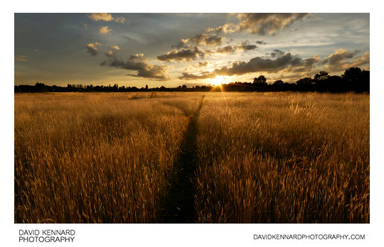
Harborough Hay field at sunset from http://www.davidkennardphotography.com
Looking west across a hay field between Lubenham and Market Harborough as the sun sets in the distance.
Date taken: 2010-07-27 20:36:57
Más sobre Harborough Hay field at sunset
151: Harborough Hay field at twilight
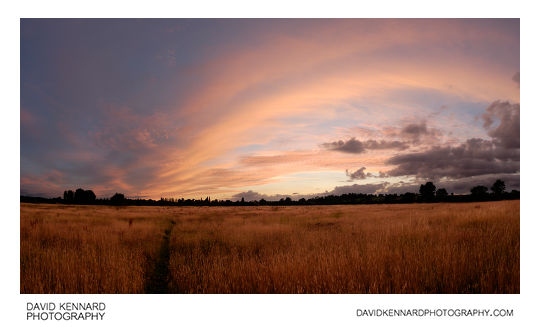
Harborough Hay field at twilight from http://www.davidkennardphotography.com
Looking west across a hay field between Lubenham and Market Harborough at twilight.
Date taken: 2010-07-27 21:15:36
Más sobre Harborough Hay field at twilight
152: Harborough Hay field at twilight
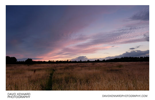
Harborough Hay field at twilight from http://www.davidkennardphotography.com
Looking west across a hay field between Lubenham and Market Harborough at twilight.
Date taken: 2010-07-27 21:23:35
Más sobre Harborough Hay field at twilight
153: Sunset over Harborough hay field
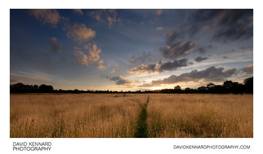
Sunset over Harborough hay field from http://www.davidkennardphotography.com
Looking west across a hay field between Lubenham and Market Harborough as the sun sets in the distance.
Date taken: 2010-07-27 20:41:32
Más sobre Sunset over Harborough hay field
154: Harborough Hay field at twilight
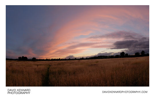
Harborough Hay field at twilight from http://www.davidkennardphotography.com
Looking west across a hay field between Lubenham and Market Harborough at twilight.
Date taken: 2010-07-27 21:19:48
Más sobre Harborough Hay field at twilight
155: Harborough Hay field at twilight
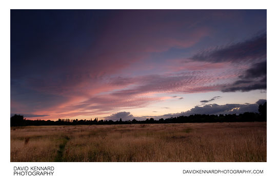
Harborough Hay field at twilight from http://www.davidkennardphotography.com
Looking west across a hay field between Lubenham and Market Harborough at twilight.
Date taken: 2010-07-27 21:22:24
Más sobre Harborough Hay field at twilight
156: Harborough Hay field at twilight
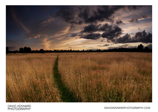
Harborough Hay field at twilight from http://www.davidkennardphotography.com
Looking west across a hay field between Lubenham and Market Harborough at twilight.
Date taken: 2010-07-27 20:58:34
Más sobre Harborough Hay field at twilight
157: Harborough Hay field at twilight
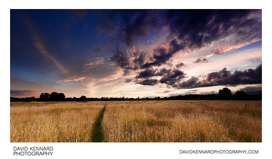
Harborough Hay field at twilight from http://www.davidkennardphotography.com
Looking west across a hay field between Lubenham and Market Harborough at twilight.
Date taken: 2010-07-27 20:57:43
Más sobre Harborough Hay field at twilight
158: Path over Lubenham hill near sunset
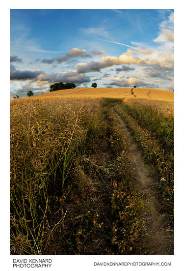
Path over Lubenham hill near sunset from http://www.davidkennardphotography.com
Looking east along the path through a field of oilseed rape on Lubenham Hill, Market Harborough, UK.
Date taken: 2010-07-27 20:31:17
Más sobre Path over Lubenham hill near sunset
159: Path over Lubenham hill
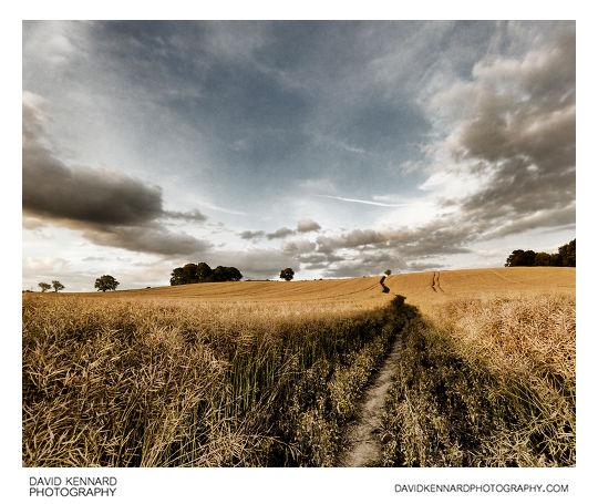
Path over Lubenham hill from http://www.davidkennardphotography.com
Looking east along the path through a field of oilseed rape on Lubenham Hill, Market Harborough, UK.
Date taken: 2010-07-27 20:33:22
Más sobre Path over Lubenham hill
160: Sunset over Harborough hay field
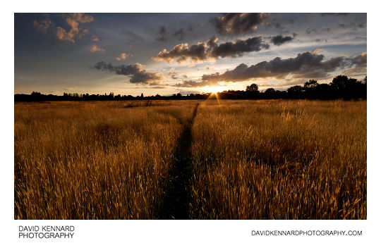
Sunset over Harborough hay field from http://www.davidkennardphotography.com
Looking west across a hay field between Lubenham and Market Harborough as the sun sets in the distance.
Date taken: 2010-07-27 20:40:24
Más sobre Sunset over Harborough hay field
161: Harborough Hay field at sunset
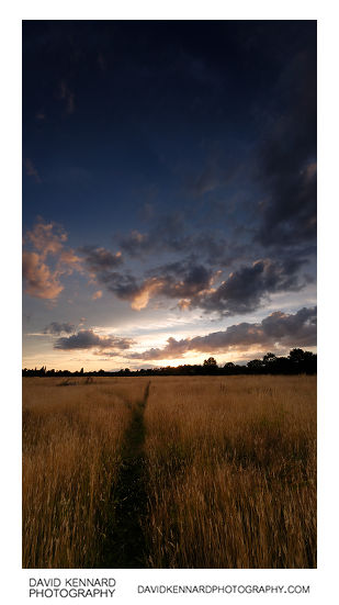
Harborough Hay field at sunset from http://www.davidkennardphotography.com
Looking west across a hay field between Lubenham and Market Harborough at sunset.
Date taken: 2010-07-27 20:44:55
Más sobre Harborough Hay field at sunset
162: Harborough Hay field at twilight
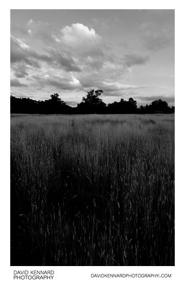
Harborough Hay field at twilight from http://www.davidkennardphotography.com
Looking east across a hay field between Lubenham and Market Harborough at twilight.
Date taken: 2010-07-27 20:51:06
Más sobre Harborough Hay field at twilight
163: Harborough Hay field at twilight
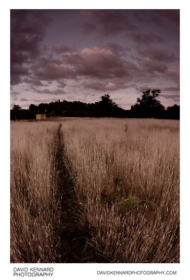
Harborough Hay field at twilight from http://www.davidkennardphotography.com
Looking east across a hay field between Lubenham and Market Harborough at twilight.
Date taken: 2010-07-27 20:53:11
Más sobre Harborough Hay field at twilight
164: Harborough Hay field at twilight
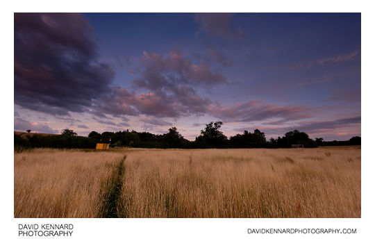
Harborough Hay field at twilight from http://www.davidkennardphotography.com
Looking west across a hay field between Lubenham and Market Harborough at twilight.
Date taken: 2010-07-27 20:55:01
Más sobre Harborough Hay field at twilight
165: Harborough Hay field at twilight
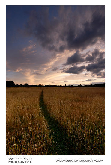
Harborough Hay field at twilight from http://www.davidkennardphotography.com
Looking west across a hay field between Lubenham and Market Harborough at twilight.
Date taken: 2010-07-27 20:59:52
Más sobre Harborough Hay field at twilight
166: Harborough Hay field at twilight
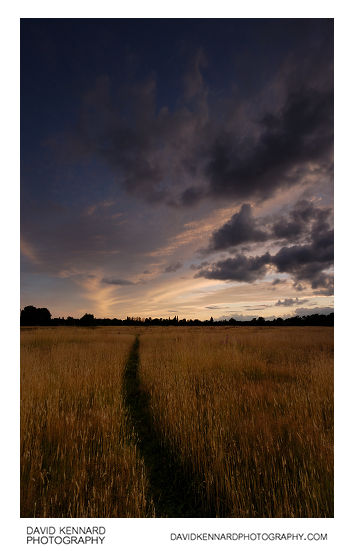
Harborough Hay field at twilight from http://www.davidkennardphotography.com
Looking west across a hay field between Lubenham and Market Harborough at twilight.
Date taken: 2010-07-27 21:00:51
Más sobre Harborough Hay field at twilight
167: Harborough Hay field at twilight
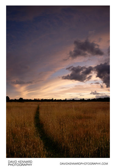
Harborough Hay field at twilight from http://www.davidkennardphotography.com
Looking west across a hay field between Lubenham and Market Harborough at twilight.
Date taken: 2010-07-27 21:03:55
Más sobre Harborough Hay field at twilight
168: Harborough Hay field at twilight
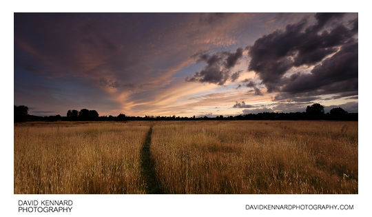
Harborough Hay field at twilight from http://www.davidkennardphotography.com
Looking west across a hay field between Lubenham and Market Harborough at twilight.
Date taken: 2010-07-27 21:05:21
Más sobre Harborough Hay field at twilight
169: Harborough Hay field at twilight
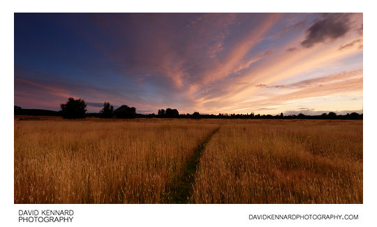
Harborough Hay field at twilight from http://www.davidkennardphotography.com
Looking west across a hay field between Lubenham and Market Harborough at twilight.
Date taken: 2010-07-27 21:07:49
Más sobre Harborough Hay field at twilight
170: Harborough Hay field at twilight
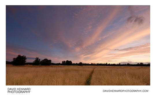
Harborough Hay field at twilight from http://www.davidkennardphotography.com
Looking west across a hay field between Lubenham and Market Harborough at twilight.
Date taken: 2010-07-27 21:09:08
Más sobre Harborough Hay field at twilight
171: Harborough Hay field at twilight
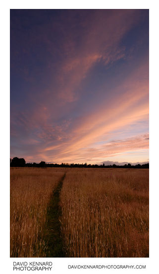
Harborough Hay field at twilight from http://www.davidkennardphotography.com
Looking west across a hay field between Lubenham and Market Harborough at twilight.
Date taken: 2010-07-27 21:12:31
Más sobre Harborough Hay field at twilight
172: Harborough Hay field at twilight
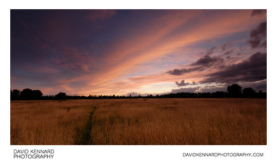
Harborough Hay field at twilight from http://www.davidkennardphotography.com
Looking west across a hay field between Lubenham and Market Harborough at twilight.
Date taken: 2010-07-27 21:14:06
Más sobre Harborough Hay field at twilight
173: Sunset over Hay field
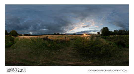
Sunset over Hay field from http://www.davidkennardphotography.com
The sun sets over a hay field between Market Harborough and Lubenham in Leicestershire, UK. The river Welland can be seen running along the nearest edge of the field, and the field is a popular spot with dog walkers.
Date taken: 2010-08-09 20:28:05
Más sobre Sunset over Hay field
174: Partially harvested field of oilseed rape
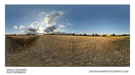
Partially harvested field of oilseed rape from http://www.davidkennardphotography.com
A half-harvested field of oilseed rape on the western edge of Market Harborough, Leicestershire, UK.
Oilseed rape is typically grown as a 'break crop', which allows fungal diseases and pests that would normally feed on the cereal crop to die out, thus improving the yield of the next year's cereal crop.
Oilseed rape will not normally be grown in the same field more than once every three years. It is lower yielding than most cereal crops, however does command a better price.
The UK is generally self sufficient in growing enough rape to cope with domestic demand, as of 2008 there was 598 hectares of land being used for rape, with 1,973,000 tonnes being produced.
Date taken: 2010-08-10 19:22:31
Más sobre Partially harvested field of oilseed rape
175: Hay field between Lubenham and Harborough
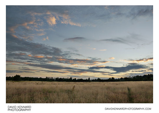
Hay field between Lubenham and Harborough from http://www.davidkennardphotography.com
Looking west down the footpath through a hay field between Lubenham and Market Harborough, in Leicestershire, UK.
From Wikipedia (http://en.wikipedia.org/wiki/Hay):
Hay is grass, legumes or other herbaceous plants that have been cut, dried, and stored for use as animal fodder, particularly for grazing livestock such as cattle, horses, goats, and sheep. Hay is also fed to pets such as rabbits and guinea pigs. Pigs may be fed hay, but they do not digest it as efficiently as more fully herbivorous animals.
Hay is fed when or where there is not enough pasture or rangeland on which to graze an animal, when grazing is unavailable due to weather (such as during the winter) or when lush pasture by itself is too rich for the health of the animal. It is also fed during times when an animal is unable to access pasture, such as when animals are kept in a stable or barn.
Date taken: 2010-07-17 21:16:39
Más sobre Hay field between Lubenham and Harborough
176: Lubenham hill road at night

Lubenham hill road at night from http://www.davidkennardphotography.com
Car headlights are recorded as streaks of light at the top of Lubenham Hill in Market Harborough, Leicestershire.
Date taken: 2010-07-17 21:52:26
Más sobre Lubenham hill road at night
177: Hay field between Lubenham and Harborough
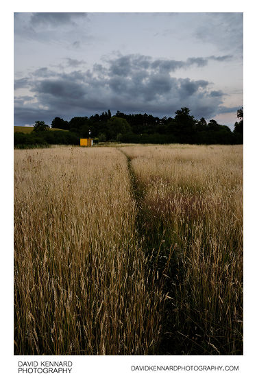
Hay field between Lubenham and Harborough from http://www.davidkennardphotography.com
Looking east down the footpath through a hay field between Lubenham and Market Harborough, in Leicestershire, UK.
From Wikipedia (http://en.wikipedia.org/wiki/Hay):
Hay is grass, legumes or other herbaceous plants that have been cut, dried, and stored for use as animal fodder, particularly for grazing livestock such as cattle, horses, goats, and sheep. Hay is also fed to pets such as rabbits and guinea pigs. Pigs may be fed hay, but they do not digest it as efficiently as more fully herbivorous animals.
Hay is fed when or where there is not enough pasture or rangeland on which to graze an animal, when grazing is unavailable due to weather (such as during the winter) or when lush pasture by itself is too rich for the health of the animal. It is also fed during times when an animal is unable to access pasture, such as when animals are kept in a stable or barn.
Date taken: 2010-07-17 21:19:59
Más sobre Hay field between Lubenham and Harborough
178: Sunset over fallow field, Market Harborough
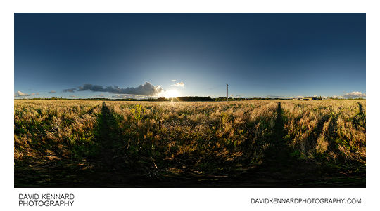
Sunset over fallow field, Market Harborough from http://www.davidkennardphotography.com
360° panorama of the sunset over a fallow field between Market Harborough and East Farndon in Leicestershire, UK. The field has been subject to various development proposals over the years, and is currently (as of 2010) for sale as residential development land by its owner, CJC Devlopments Co. Ltd.
Date taken: 2010-08-23 19:31:13
Más sobre Sunset over fallow field, Market Harborough
179: Sunset over fallow field, Market Harborough
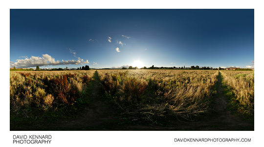
Sunset over fallow field, Market Harborough from http://www.davidkennardphotography.com
The sun sets over a field between Market Harborough and East Farndon in Leicestershire, UK. The field has been left fallow and is filled with various grasses, dock, and willowherb, amongst other plants.
Date taken: 2010-08-23 19:17:51
Más sobre Sunset over fallow field, Market Harborough
180: Pots near farm buildings, Farndon Fields Farm
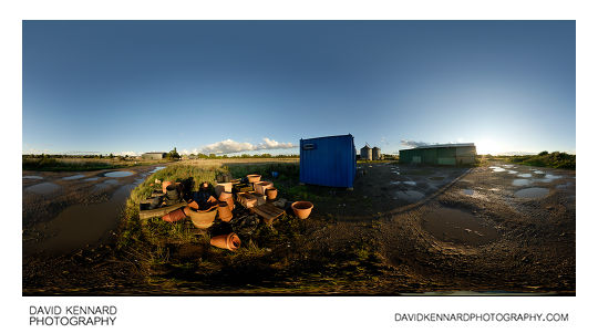
Pots near farm buildings, Farndon Fields Farm from http://www.davidkennardphotography.com
Old pots and terracotta containers sit near a farm building behind Farndon Fields Farm shop, off Farndon road in Market Harborough, Leicestershire, UK.
Farndon Fields Farm is a 250 acre farm to the southwest of Market Harborough. They operate a popular farm shop on Farndon Road, selling their farm produce, other local produce, and also a large selection of plants, terracotta pots and compost.
Date taken: 2010-08-23 19:25:03
Más sobre Pots near farm buildings, Farndon Fields Farm
181: Sunset over wheat field
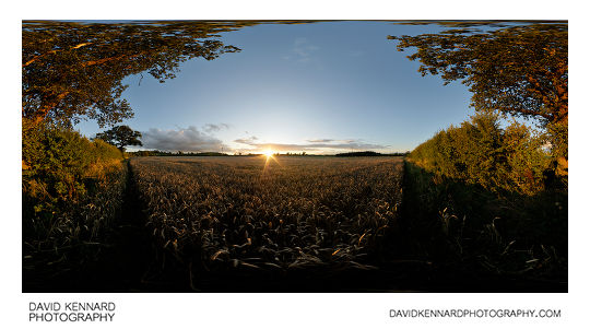
Sunset over wheat field from http://www.davidkennardphotography.com
360° panorama of the sunset over a field of wheat between Market Harborough and East Farndon, Leicestershire, UK.
In the UK around 15 million tonnes of wheat is harvested annually, at a rate of approximately 8 tonnes per hectare.
From Wikipedia (http://en.wikipedia.org/wiki/Wheat):
Wheat (Triticum spp.) is a grass, originally from the Fertile Crescent region of the Near East, but now cultivated worldwide. In 2007 world production of wheat was 607 million tons, making it the third most-produced cereal after maize (784 million tons) and rice (651 million tons). Globally, wheat is the leading source of vegetable protein in human food, having a higher protein content than either maize (corn) or rice, the other major cereals. In terms of total production tonnages used for food, it is currently second to rice as the main human food crop, and ahead of maize, after allowing for maize's more extensive use in animal feeds.
Date taken: 2010-08-23 19:54:52
Más sobre Sunset over wheat field
182: Sunset over wheat field
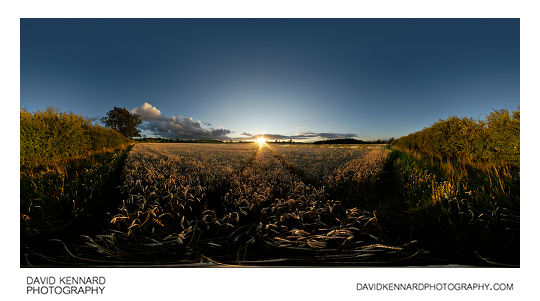
Sunset over wheat field from http://www.davidkennardphotography.com
360° panorama of the sunset over a field of wheat between Market Harborough and East Farndon, Leicestershire, UK.
In the UK around 15 million tonnes of wheat is harvested annually, at a rate of approximately 8 tonnes per hectare.
From Wikipedia (http://en.wikipedia.org/wiki/Wheat):
Wheat (Triticum spp.) is a grass, originally from the Fertile Crescent region of the Near East, but now cultivated worldwide. In 2007 world production of wheat was 607 million tons, making it the third most-produced cereal after maize (784 million tons) and rice (651 million tons). Globally, wheat is the leading source of vegetable protein in human food, having a higher protein content than either maize (corn) or rice, the other major cereals. In terms of total production tonnages used for food, it is currently second to rice as the main human food crop, and ahead of maize, after allowing for maize's more extensive use in animal feeds.
Date taken: 2010-08-23 19:50:39
Más sobre Sunset over wheat field
183: Cattle grazing at twilight
Cattle grazing at twilight from http://www.davidkennardphotography.com
Cattle graze in a field between Lubenham, Market harborough, and East Farndon shortly after sunset.
From Wikipedia (http://en.wikipedia.org/wiki/Cattle):
Cattle (colloquially cows) are the most common type of large domesticated ungulates. They are a prominent modern member of the subfamily Bovinae, are the most widespread species of the genus Bos, and are most commonly classified collectively as Bos primigenius. Cattle are raised as livestock for meat (beef and veal), as dairy animals for milk and other dairy products, and as draft animals (pulling carts, plows and the like). Other products include leather and dung for manure or fuel. In some countries, such as India, cattle are sacred. It is estimated that there are 1.3 billion cattle in the world today. In 2009, cattle became the first livestock animal to have its genome mapped.
Date taken: 2010-08-23 20:18:32
Más sobre Cattle grazing at twilight
184: Bull grazing at twilight
Bull grazing at twilight from http://www.davidkennardphotography.com
A grazing bull is silhouetted against the twilight sky in a field between Lubenham, Market harborough, and East Farndon.
From Wikipedia (http://en.wikipedia.org/wiki/Cattle):
Cattle (colloquially cows) are the most common type of large domesticated ungulates. They are a prominent modern member of the subfamily Bovinae, are the most widespread species of the genus Bos, and are most commonly classified collectively as Bos primigenius. Cattle are raised as livestock for meat (beef and veal), as dairy animals for milk and other dairy products, and as draft animals (pulling carts, plows and the like). Other products include leather and dung for manure or fuel. In some countries, such as India, cattle are sacred. It is estimated that there are 1.3 billion cattle in the world today. In 2009, cattle became the first livestock animal to have its genome mapped.
Date taken: 2010-08-23 20:19:34
Más sobre Bull grazing at twilight
185: Tree silhouttes at twilight
Tree silhouttes at twilight from http://www.davidkennardphotography.com
A row of trees are silhouetted against the twilight sky, between Lubenham, East Farndon, and Market Harborough.
Date taken: 2010-08-23 20:25:16
Más sobre Tree silhouttes at twilight
186: Tree silhouttes at twilight
Tree silhouttes at twilight from http://www.davidkennardphotography.com
A row of trees are silhouetted against the twilight sky, between Lubenham, East Farndon, and Market Harborough.
Date taken: 2010-08-23 20:26:25
Más sobre Tree silhouttes at twilight
187: Field between Lubenham and Harborough at twilight
Field between Lubenham and Harborough at twilight from http://www.davidkennardphotography.com
Looking west across a hay field between Lubenham and Market Harborough in Leicestershire, UK at twilight. A pile of black plastic wrapped haybales is stacked next to the fence that runs along the field's edge.
Date taken: 2010-09-03 19:51:28
Más sobre Field between Lubenham and Harborough at twilight
188: Field between Lubenham and Harborough at twilight
Field between Lubenham and Harborough at twilight from http://www.davidkennardphotography.com
Looking west across a hay field between Lubenham and Market Harborough in Leicestershire, UK at twilight. A pile of black plastic wrapped haybales is stacked next to the fence that runs along the field's edge.
Date taken: 2010-09-03 19:54:33
Más sobre Field between Lubenham and Harborough at twilight
189: Field between Lubenham and Harborough at twilight
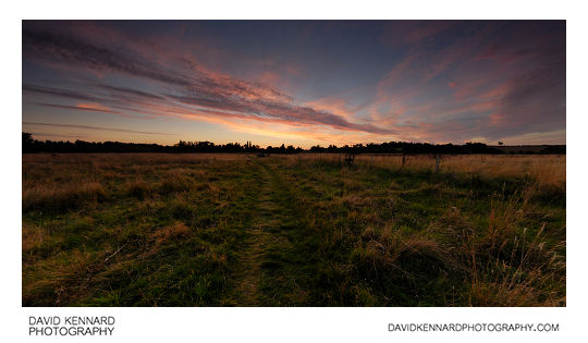
Field between Lubenham and Harborough at twilight from http://www.davidkennardphotography.com
Looking west across a hay field between Lubenham and Market Harborough in Leicestershire, UK at twilight.
Date taken: 2010-09-03 19:58:33
Más sobre Field between Lubenham and Harborough at twilight
190: Field between Lubenham and Harborough at twilight
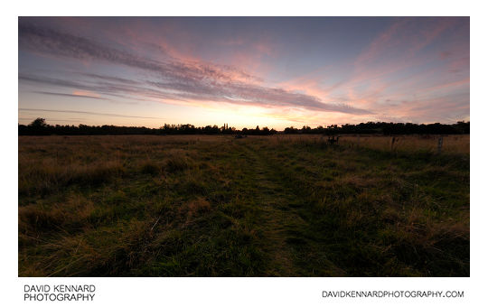
Field between Lubenham and Harborough at twilight from http://www.davidkennardphotography.com
Looking west across a hay field between Lubenham and Market Harborough in Leicestershire, UK at twilight.
Date taken: 2010-09-03 19:59:54
Más sobre Field between Lubenham and Harborough at twilight
191: Field between Lubenham and Harborough at twilight
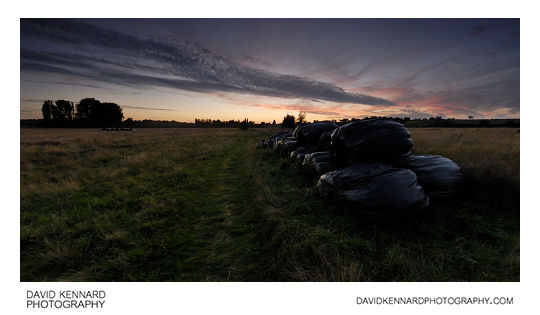
Field between Lubenham and Harborough at twilight from http://www.davidkennardphotography.com
Looking west across a hay field between Lubenham and Market Harborough in Leicestershire, UK at twilight. A pile of black plastic wrapped haybales is stacked between the footpath and the fence that runs along the field's edge.
Date taken: 2010-09-03 20:04:14
Más sobre Field between Lubenham and Harborough at twilight
192: Old railway line between Lubenham and Harborough
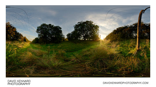
Old railway line between Lubenham and Harborough from http://www.davidkennardphotography.com
360° panorama of the old railway line between Lubenham and Market Harborough, Leicestershire, UK.
The line, opened in 1850, ran from Rugby to Market Harborough, but was closed under the Beeching cuts of the 1960s. Today it is mainly used by dog walkers, but it can get quite waterlogged after rain.
Date taken: 2010-09-08 19:03:22
Más sobre Old railway line between Lubenham and Harborough
193: Harvested field at twilight
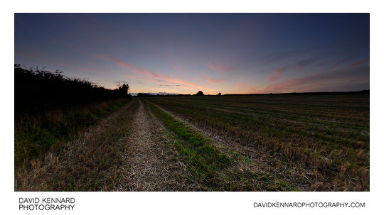
Harvested field at twilight from http://www.davidkennardphotography.com
Looking west across a harvested field between Lubenham, Market Harborough, and Gartree, Leicestershire, UK at twilight.
Date taken: 2010-09-08 19:49:58
Más sobre Harvested field at twilight
194: Harvested field at twilight
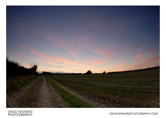
Harvested field at twilight from http://www.davidkennardphotography.com
Looking west across a harvested field between Lubenham, Market Harborough, and Gartree, Leicestershire, UK at twilight.
Date taken: 2010-09-08 19:49:02
Más sobre Harvested field at twilight
195: Ridge and furrow field at sunset
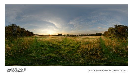
Ridge and furrow field at sunset from http://www.davidkennardphotography.com
360° panorama of a ridge and furrow field between Market Harborough and Lubenham at sunset.
From Wikipedia (http://en.wikipedia.org/wiki/Ridge_and_furrow):
Ridge and furrow is an archaeological pattern of ridges and troughs created by a system of ploughing used in Europe during the Middle Ages. The earliest examples date to the immediate post-Roman period and the system was used until the 17th century in some areas. Ridge and furrow topography is found in Great Britain, Ireland and elsewhere in Europe. The surviving ridges are parallel, ranging from 3 to 22 yards (3 to 20 m) apart and up to 24 in (0.61 m) tall – they were much taller when in use. Older examples are often curved.
Ridge and furrow topography was a result of ploughing with non-reversible ploughs on the same strip of land each year. It is visible on land that was ploughed in the Middle Ages, but which has not been ploughed since then. No actively ploughed ridge and furrow survives.
Date taken: 2010-09-08 19:13:19
Más sobre Ridge and furrow field at sunset
196: Trees, Grass, and Clouds in Infrared
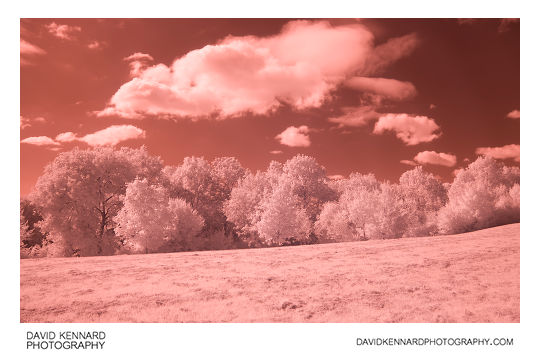
Trees, Grass, and Clouds in Infrared from http://www.davidkennardphotography.com
Looking south across a patch of grass just off Farndale Road, towards a patch of trees that run along the old railway line between Market Harborough and Lubenham. Viewed in Infrared light between the 720nm - 1000nm range, the grass and foliage of the trees takes on a much brighter tone than it does when viewed in visible light.
Date taken: 2010-09-25 11:54:28
Más sobre Trees, Grass, and Clouds in Infrared
197: The old railway line in Infrared
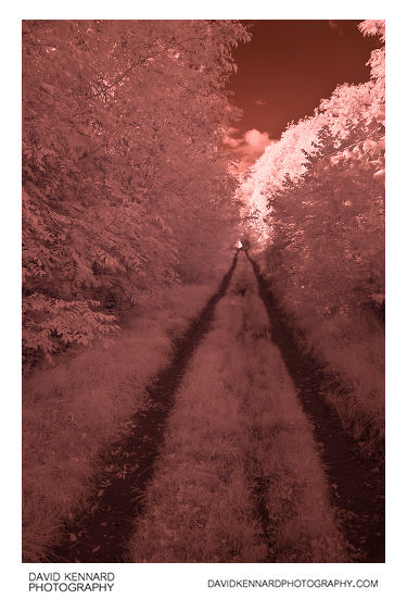
The old railway line in Infrared from http://www.davidkennardphotography.com
Looking west along the old railway line between Market Harborough and Lubenham, in Leicestershire, England. When viewed in infrared light, the grass and foliage of the trees takes on a much lighter tone than it does when viewed in visible light.
Date taken: 2010-09-25 11:56:49
Más sobre The old railway line in Infrared
198: Tree by the old railway line in IR
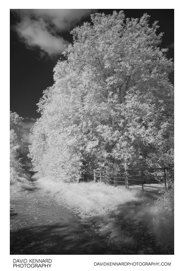
Tree by the old railway line in IR from http://www.davidkennardphotography.com
A large tree growing by the entrance to a field along the old railway line between Market Harborough and Lubenham, in Leicestershire, England. This photograph was taken using infrared light between the 720nm - 1000nm range, which is not visible to humans.
Date taken: 2010-09-25 12:00:20
Más sobre Tree by the old railway line in IR
199: Path by ploughed field in Infrared
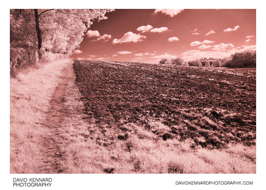
Path by ploughed field in Infrared from http://www.davidkennardphotography.com
Looking east along the edge of a field in Market Harborough, Leicestershire, UK. When viewed in infrared light, the grass and trees' leaves taken on a much brighter tone than they do under normal visible light.
Date taken: 2010-09-25 12:02:14
Más sobre Path by ploughed field in Infrared
200: Ploughed field in Infrared B&W
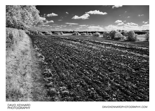
Ploughed field in Infrared B&W from http://www.davidkennardphotography.com
Looking south-east across a ploughed field on the western edge of Market Harborough, in Leicestershire, UK. When viewed in infrared light, the grass and trees take on a much brighter tone than they do under normal visible light.
Date taken: 2010-09-25 12:03:49
Más sobre Ploughed field in Infrared B&W
201: Ploughed field in Infrared
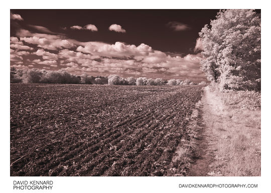
Ploughed field in Infrared from http://www.davidkennardphotography.com
Looking west across a ploughed field on the western edge of Market Harborough, in Leicestershire, UK. The photograph is taken using an Infrared filter, which cuts out light below a wavelength of 720nm.
Date taken: 2010-09-25 12:06:47
Más sobre Ploughed field in Infrared
202: Trees by Farndale Road in IR
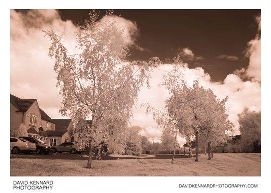
Trees by Farndale Road in IR from http://www.davidkennardphotography.com
Trees growing by the edge of Farndale View in Market Harborough, Leicestershire, UK. The photograph is taken using Infrared light between 720 - 1000nm, which is invisible to the human eye.
Date taken: 2010-09-25 12:10:00
Más sobre Trees by Farndale Road in IR
203: Harborough Road
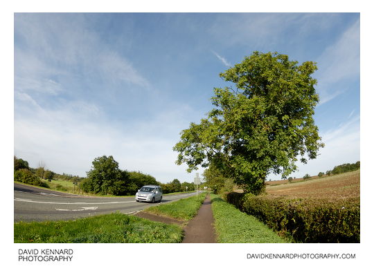
Harborough Road from http://www.davidkennardphotography.com
Looking west along Harborough Road between Lubenham and Market Harborough, Leicestershire, UK.
Date taken: 2010-10-02 10:01:17
Más sobre Harborough Road
204: Farm track and fields, Harborough
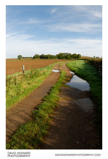
Farm track and fields, Harborough from http://www.davidkennardphotography.com
Looking north up a track that runs alongside a recently ploughed field, just off Harborough Road between Market Harborough and Lubenham.
Date taken: 2010-10-02 10:06:42
Más sobre Farm track and fields, Harborough
205: Farm track and fields, Harborough
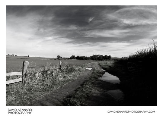
Farm track and fields, Harborough from http://www.davidkennardphotography.com
Looking north up a track that runs alongside a recently ploughed field, just off Harborough Road between Market Harborough and Lubenham.
Date taken: 2010-10-02 10:07:03
Más sobre Farm track and fields, Harborough
206: Ploughed field near Harborough
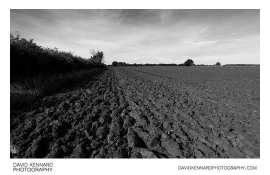
Ploughed field near Harborough from http://www.davidkennardphotography.com
Looking east across a recently ploughed field between Market Harborough, Lubenham, and Gartree, in Leicestershire, UK.
Date taken: 2010-10-02 10:39:10
Más sobre Ploughed field near Harborough
207: Ploughed field near Harborough
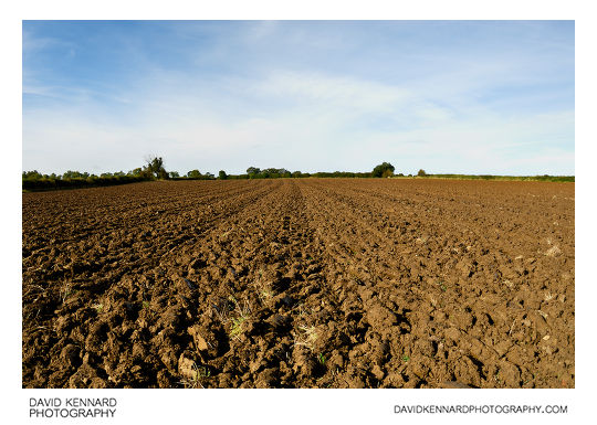
Ploughed field near Harborough from http://www.davidkennardphotography.com
Looking east across a recently ploughed field between Market Harborough, Gartree, and Lubenham, in Leicestershire, UK.
Date taken: 2010-10-02 10:46:39
Más sobre Ploughed field near Harborough
208: Path across harvested field, Harborough
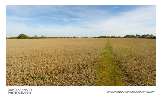
Path across harvested field, Harborough from http://www.davidkennardphotography.com
Looking north-east along the path across a harvested field between Gartree, Lubenham, and Market Harborough, in Leicestershire, UK.
Date taken: 2010-10-02 10:58:52
Más sobre Path across harvested field, Harborough
209: Harvested field, Harborough
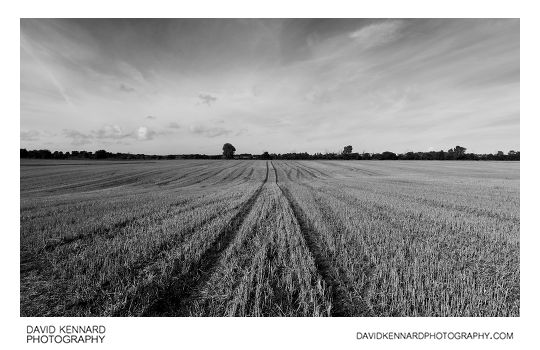
Harvested field, Harborough from http://www.davidkennardphotography.com
Looking west across a harvested field between Gartree and Market Harborough, in Leicestershire, UK
Date taken: 2010-10-02 11:02:59
Más sobre Harvested field, Harborough
210: Path across harvested field near Harborough
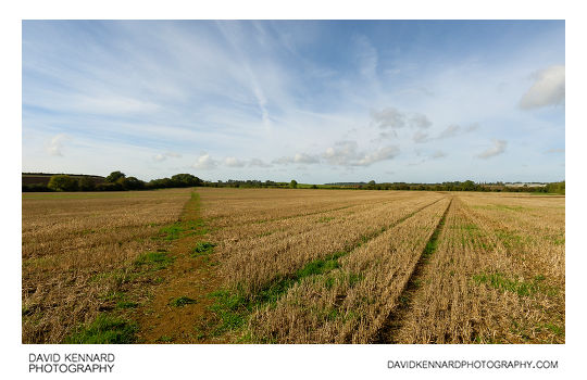
Path across harvested field near Harborough from http://www.davidkennardphotography.com
Looking south-west across a harvested field between Market Harborough and Gartree, in Leicestershire, UK.
Date taken: 2010-10-02 11:08:00
Más sobre Path across harvested field near Harborough
211: Old tyre in field
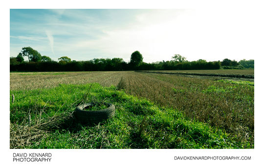
Old tyre in field from http://www.davidkennardphotography.com
An old tyre rests on a patch of grass in a harvested field near Green Acres traveller's site in Market Harborough, Leicestershire, UK.
Date taken: 2010-10-02 11:11:25
Más sobre Old tyre in field
212: Grand Union Canal, Market Harborough
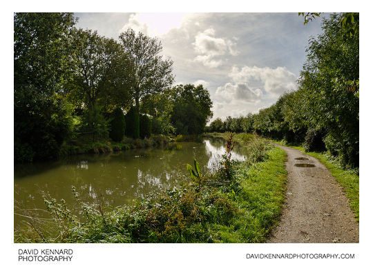
Grand Union Canal, Market Harborough from http://www.davidkennardphotography.com
Looking south along the Grand Union Canal in Market Harborough, Leicestershire, UK.
Date taken: 2010-10-02 11:46:12
Más sobre Grand Union Canal, Market Harborough
213: Overgrown rubbish
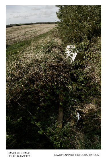
Overgrown rubbish from http://www.davidkennardphotography.com
Rubbish dumped in a ditch is slowly covered up by the surrounding plants, near Green Acres travellers site in Market Harborough, Leicestershire, UK.
Date taken: 2010-10-02 11:19:13
Más sobre Overgrown rubbish
214: Shadow on field, Harborough
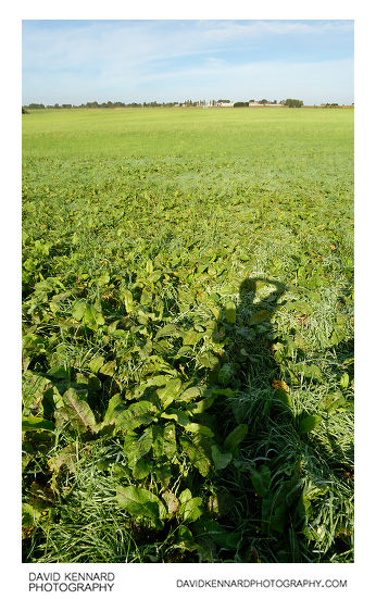
Shadow on field, Harborough from http://www.davidkennardphotography.com
Looking north-west across a hay field between Lubenham, Market Harborough, and Gartree. Gartree prison can be seen in the distance.
Date taken: 2010-10-02 10:54:23
Más sobre Shadow on field, Harborough
215: Grand Union Canal Harborough arm
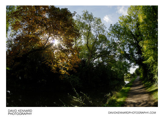
Grand Union Canal Harborough arm from http://www.davidkennardphotography.com
The sun shines through a Horse Chestnut tree in autumn colours, alongside the Grand Union Canal in Market Harborough, Leicestershire, UK.
Date taken: 2010-10-02 11:41:43
Más sobre Grand Union Canal Harborough arm
216: Grassy field, Harborough
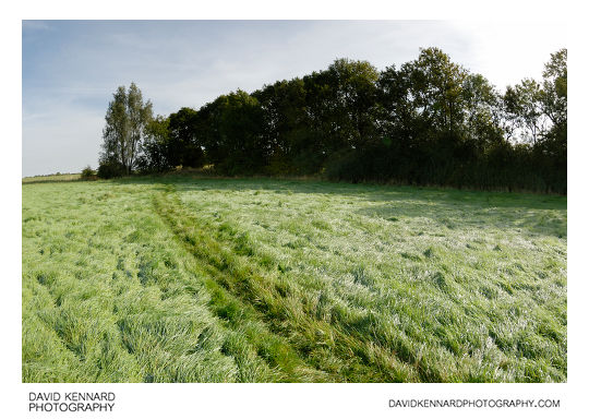
Grassy field, Harborough from http://www.davidkennardphotography.com
Looking east across a small hay field in the countryside between Lubenham, Gartree, and Market Harborough, in Leicestershire, UK.
Date taken: 2010-10-02 10:49:10
Más sobre Grassy field, Harborough
217: Old tyre in field
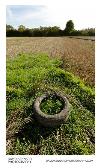
Old tyre in field from http://www.davidkennardphotography.com
An old tyre rests on a patch of grass in a harvested field near Green Acres traveller's site in Market Harborough, Leicestershire, UK.
Date taken: 2010-10-02 11:12:09
Más sobre Old tyre in field
218: Grand Union Canal, Market Harborough
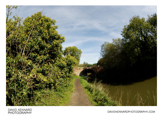
Grand Union Canal, Market Harborough from http://www.davidkennardphotography.com
Looking north up the Grand Union Canal towards the bridge near Green Acres travellers' park and Forest Gate Ford, in Market Harborough, Leicestershire, UK.
On the left of the towpath can be seen a large amount of ivy, which is currently flowering.
Date taken: 2010-10-02 11:28:26
Más sobre Grand Union Canal, Market Harborough
219: Jolly Roger narrowboat, Market Harborough
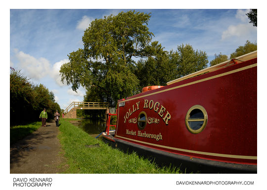
Jolly Roger narrowboat, Market Harborough from http://www.davidkennardphotography.com
Looking north-west up the Grand Union canal in Market Harborough, Leicestershire, UK. Up ahead can be seen bridge #14, a narrow footbridge across the canal. Moored to the right can be seen the Jolly Roger narrowboat.
Date taken: 2010-10-02 11:35:56
Más sobre Jolly Roger narrowboat, Market Harborough
220: Lubenham Hill, Market Harborough
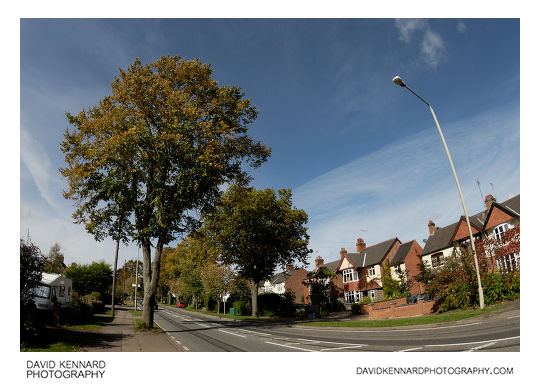
Lubenham Hill, Market Harborough from http://www.davidkennardphotography.com
Looking north-west along Lubenham Hill in Market Harborough, Leicestershire, UK. Taken in early October, the trees are starting to show a bit of autumn colour.
Date taken: 2010-10-02 12:15:33
Más sobre Lubenham Hill, Market Harborough
221: Lubenham Hill in IR
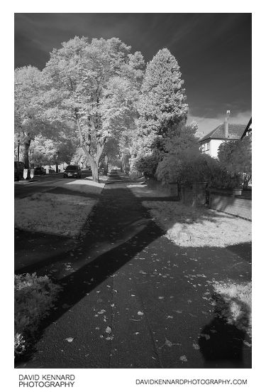
Lubenham Hill in IR from http://www.davidkennardphotography.com
Looking north up the footpath on Lubenham Hill in Market Harborough, Leicestershire, UK. This photograph was taken using infrared light, invisible to the human eye.
Date taken: 2010-10-02 09:51:00
Más sobre Lubenham Hill in IR
222: Harborough Road in Infrared
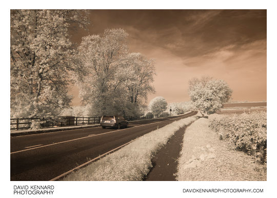
Harborough Road in Infrared from http://www.davidkennardphotography.com
Looking west along Harborough Road between Lubenham and Market Harborough, Leicestershire, UK.
The photograph was taken using an Infrared filter, capturing light in the 720-1000nm range, which is invisible to the human eye.
Date taken: 2010-10-02 09:57:27
Más sobre Harborough Road in Infrared
223: Harborough Road in IR
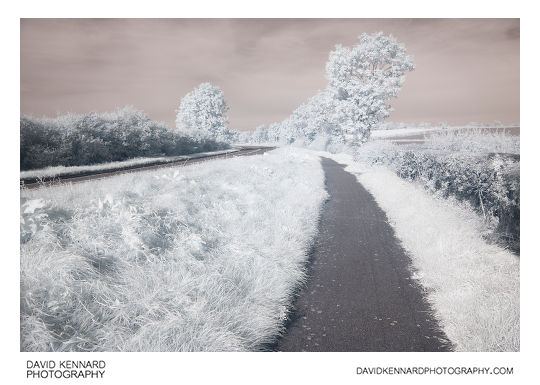
Harborough Road in IR from http://www.davidkennardphotography.com
Looking west along Harborough Road between Lubenham and Market Harborough, Leicestershire, UK.
The photograph was taken using an Infrared filter, capturing light in the 720-1000nm range, which is invisible to the human eye.
Date taken: 2010-10-02 10:02:43
Más sobre Harborough Road in IR
224: Farm track off Harborough Road in IR
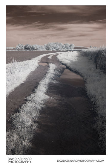
Farm track off Harborough Road in IR from http://www.davidkennardphotography.com
Looking north up a track that runs alongside a recently ploughed field, just off Harborough Road between Market Harborough and Lubenham.
The photograph was taken using an Infrared filter, capturing light in the 720-1000nm range, which is invisible to the human eye.
Date taken: 2010-10-02 10:04:10
Más sobre Farm track off Harborough Road in IR
225: Farm track off Harborough Road in IR
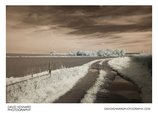
Farm track off Harborough Road in IR from http://www.davidkennardphotography.com
Looking north up a track that runs alongside a recently ploughed field, just off Harborough Road between Market Harborough and Lubenham.
The photograph was taken using an Infrared filter, capturing light in the 720-1000nm range, which is invisible to the human eye.
Date taken: 2010-10-02 10:06:00
Más sobre Farm track off Harborough Road in IR
226: Ploughed field near Harborough in infrared
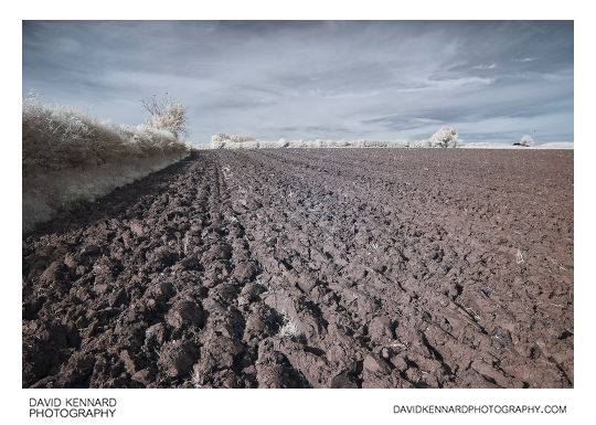
Ploughed field near Harborough in infrared from http://www.davidkennardphotography.com
Looking east across a recently ploughed field between Market Harborough, Lubenham, and Gartree, in Leicestershire, UK.
The photograph was taken using an Infrared filter, capturing light in the 720-1000nm range, which is invisible to the human eye.
Date taken: 2010-10-02 10:36:07
Más sobre Ploughed field near Harborough in infrared
227: Ploughed field near Harborough (visible IR)
.jpg)
Ploughed field near Harborough (visible IR) from http://www.davidkennardphotography.com
Looking east across a recently ploughed field between Market Harborough, Lubenham, and Gartree, in Leicestershire, UK.
The photograph was taken using a camera sensitive to both visible and infrared light.
Date taken: 2010-10-02 10:38:28
Más sobre Ploughed field near Harborough (visible IR)
228: Ploughed field near Harborough in infrared
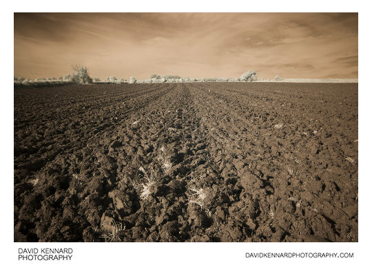
Ploughed field near Harborough in infrared from http://www.davidkennardphotography.com
Looking east across a recently ploughed field between Market Harborough, Gartree, and Lubenham, in Leicestershire, UK.
The photograph was taken using an Infrared filter, capturing light in the 720-1000nm range, which is invisible to the human eye.
Date taken: 2010-10-02 10:45:18
Más sobre Ploughed field near Harborough in infrared
229: Grassy field, Harborough, in infrared
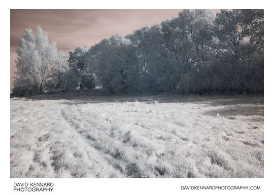
Grassy field, Harborough, in infrared from http://www.davidkennardphotography.com
Looking east across a small hay field in the countryside between Lubenham, Gartree, and Market Harborough, in Leicestershire, UK.
The photograph was taken using an Infrared filter, capturing light in the 720-1000nm range, which is invisible to the human eye.
Date taken: 2010-10-02 10:48:04
Más sobre Grassy field, Harborough, in infrared
230: Path across harvested field in infrared
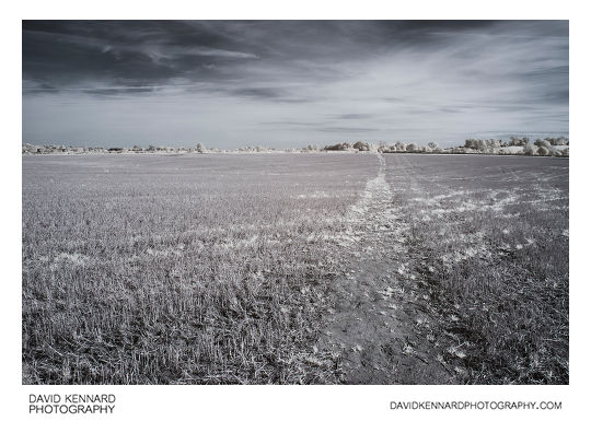
Path across harvested field in infrared from http://www.davidkennardphotography.com
Looking north-east along the path across a harvested field between Gartree, Lubenham, and Market Harborough, in Leicestershire, UK.
The photograph was taken using an Infrared filter, capturing light in the 720-1000nm range, which is invisible to the human eye.
Date taken: 2010-10-02 10:57:54
Más sobre Path across harvested field in infrared
231: Path across harvested field in infrared
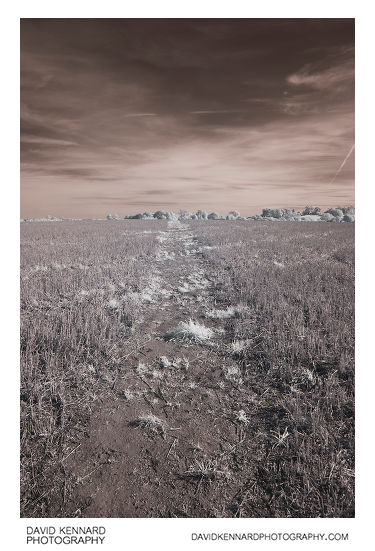
Path across harvested field in infrared from http://www.davidkennardphotography.com
Looking north-east along the path across a harvested field between Gartree, Lubenham, and Market Harborough, in Leicestershire, UK.
The photograph was taken using an Infrared filter, capturing light in the 720-1000nm range, which is invisible to the human eye.
Date taken: 2010-10-02 10:59:48
Más sobre Path across harvested field in infrared
232: Harvested field, Harborough, in infrared
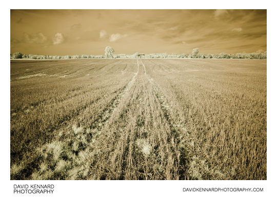
Harvested field, Harborough, in infrared from http://www.davidkennardphotography.com
Looking west across a harvested field between Gartree and Market Harborough, in Leicestershire, UK.
The photograph was taken using an Infrared filter, capturing light in the 720-1000nm range, which is invisible to the human eye.
Date taken: 2010-10-02 11:02:32
Más sobre Harvested field, Harborough, in infrared
233: Old tyre in field in infrared
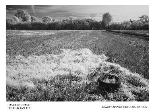
Old tyre in field in infrared from http://www.davidkennardphotography.com
An old tyre rests on a patch of grass in a harvested field near Green Acres traveller's site in Market Harborough, Leicestershire, UK.
The photograph was taken using an Infrared filter, capturing light in the 720-1000nm range, which is invisible to the human eye.
Date taken: 2010-10-02 11:12:00
Más sobre Old tyre in field in infrared
234: Dumped appliance in infrared
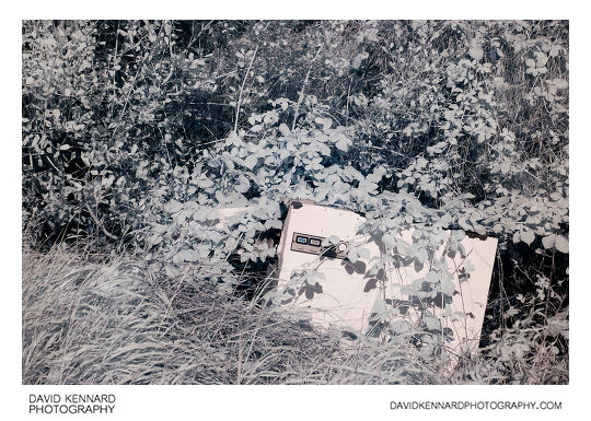
Dumped appliance in infrared from http://www.davidkennardphotography.com
An old appliance is dumped in a ditch under a hedge at the edge of a field near Market Harborough in Leicestershire, England.
The photograph was taken using an Infrared filter, capturing light in the 720-1000nm range, which is invisible to the human eye.
Date taken: 2010-10-02 11:14:06
Más sobre Dumped appliance in infrared
235: Grand Union Canal Harborough arm in infrared
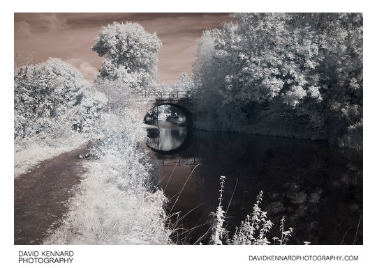
Grand Union Canal Harborough arm in infrared from http://www.davidkennardphotography.com
Looking north up the Grand Union Canal towards the bridge near Green Acres travellers' park and Forest Gate Ford, in Market Harborough, Leicestershire, UK.
The photograph was taken using an Infrared filter, capturing light in the 720-1000nm range, which is invisible to the human eye.
Date taken: 2010-10-02 11:28:00
Más sobre Grand Union Canal Harborough arm in infrared
236: Narrowboats in infrared
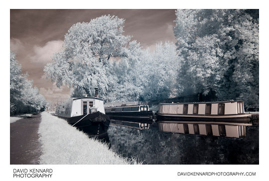
Narrowboats in infrared from http://www.davidkennardphotography.com
House boats are moored along the sides of the Grand Union Canal in Market Harborough, Leicestershire, UK.
The photograph was taken using an Infrared filter, capturing light in the 720-1000nm range, which is invisible to the human eye.
Date taken: 2010-10-02 11:36:21
Más sobre Narrowboats in infrared
237: Grand Union Canal, Market Harborough (infrared)
.jpg)
Grand Union Canal, Market Harborough (infrared) from http://www.davidkennardphotography.com
Looking south along the Grand Union Canal in Market Harborough, Leicestershire, UK.
The photograph was taken using an Infrared filter, capturing light in the 720-1000nm range, which is invisible to the human eye.
Date taken: 2010-10-02 11:46:39
Más sobre Grand Union Canal, Market Harborough (infrared)
238: Grand Union Canal, Market Harborough (IR visible)
.jpg)
Grand Union Canal, Market Harborough (IR visible) from http://www.davidkennardphotography.com
Looking south along the Grand Union Canal in Market Harborough, Leicestershire, UK.
The photograph was taken using a camera sensitive to both visible and infrared light.
Date taken: 2010-10-02 11:48:10
Más sobre Grand Union Canal, Market Harborough (IR visible)
239: Knoll Street, Market Harborough in infrared
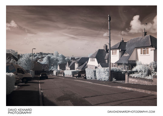
Knoll Street, Market Harborough in infrared from http://www.davidkennardphotography.com
Looking south-west along Knoll Street in Market Harborough, Leicestershire, UK.
The photograph was taken using an Infrared filter, capturing light in the 720-1000nm range, which is invisible to the human eye.
Date taken: 2010-10-02 12:02:10
Más sobre Knoll Street, Market Harborough in infrared
240: Knoll Street, Market Harborough in infrared
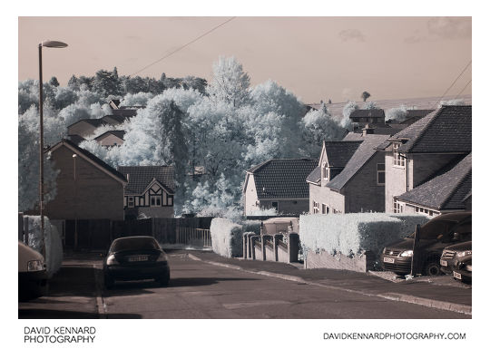
Knoll Street, Market Harborough in infrared from http://www.davidkennardphotography.com
Looking south-west along Knoll Street in Market Harborough, Leicestershire, UK.
The photograph was taken using an Infrared filter, capturing light in the 720-1000nm range, which is invisible to the human eye.
Date taken: 2010-10-02 12:02:49
Más sobre Knoll Street, Market Harborough in infrared
241: Path across ploughed field near Great Bowden
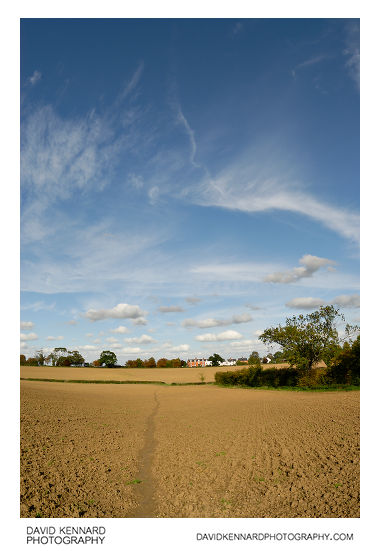
Path across ploughed field near Great Bowden from http://www.davidkennardphotography.com
Looking north along a path through a ploughed field between Market Harborough and Great Bowden in Leicestershire, UK.
Date taken: 2010-10-07 15:03:20
Más sobre Path across ploughed field near Great Bowden
242: Path across ploughed field near Great Bowden
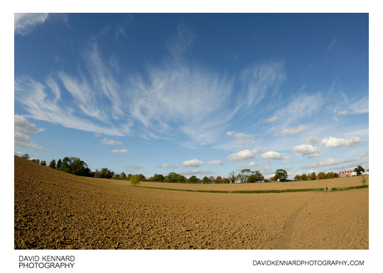
Path across ploughed field near Great Bowden from http://www.davidkennardphotography.com
Looking north over a ploughed field between Market Harborough and Great Bowden in Leicestershire, UK.
Date taken: 2010-10-07 15:10:23
Más sobre Path across ploughed field near Great Bowden
243: Autumnal trees, Grand Union Canal
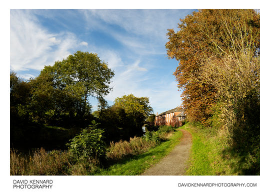
Autumnal trees, Grand Union Canal from http://www.davidkennardphotography.com
Looking north up the canal towpath alongside the Harborough arm of the Grand Union Canal, in Leicestershire, England. Further up the path can be seen the Mews buildings of Great Bowden Hall, now converted to apartments.
Date taken: 2010-10-07 16:07:36
Más sobre Autumnal trees, Grand Union Canal
244: Grand Union Canal Harborough Arm
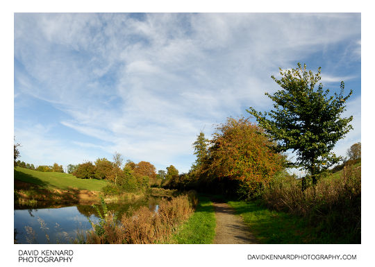
Grand Union Canal Harborough Arm from http://www.davidkennardphotography.com
Looking east along the Harborough arm of the Grand Union Canal, between Market Harborough and Great Bowden, in Leicestershire, England.
Date taken: 2010-10-07 16:11:24
Más sobre Grand Union Canal Harborough Arm
245: Grand Union Canal Harborough arm in autumn, near Market Harborough in Leicestershire, England.
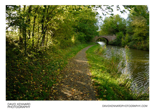
Grand Union Canal Harborough arm in autumn, near Market Harborough in Leicestershire, England. from http://www.davidkennardphotography.com
Looking west along the Harborough arm of the Grand Union Canal in autumn.
Date taken: 2010-10-07 16:13:22
Más sobre Grand Union Canal Harborough arm in autumn, near Market Harborough in Leicestershire, England.
246: Trees
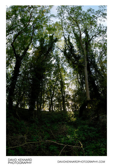
Trees from http://www.davidkennardphotography.com
Looking up at a patch of trees growing on a bank alongside the Grand Union Canal, near Market Harborough in Leicestershire, England.
Date taken: 2010-10-07 16:17:16
Más sobre Trees
247: Overgrown mooring, Grand Union Canal
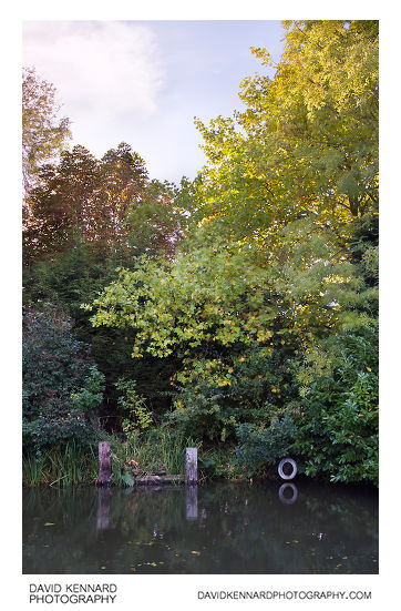
Overgrown mooring, Grand Union Canal from http://www.davidkennardphotography.com
An overgrown mooring area on the Grand Union Canal in Market Harborough, Leicestershire, UK. The trees growing nearby are starting to change colour as autumn advances.
Date taken: 2010-10-07 17:15:35
Más sobre Overgrown mooring, Grand Union Canal
248: Ploughed field between Harborough and Great Bowden
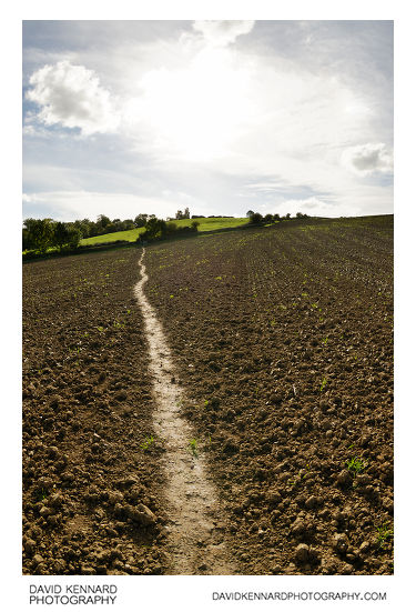
Ploughed field between Harborough and Great Bowden from http://www.davidkennardphotography.com
Looking south along a path over a ploughed field between Market Harborough and Great Bowden in Leicestershire, England.
Date taken: 2010-10-07 15:11:13
Más sobre Ploughed field between Harborough and Great Bowden
249: Grand Union Canal, Market Harborough
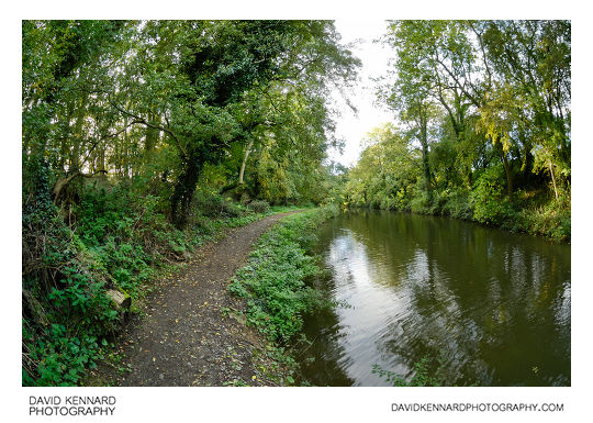
Grand Union Canal, Market Harborough from http://www.davidkennardphotography.com
Looking west along a wooded patch of the Grand Union canal, near Market Harborough, Leicestershire, UK.
Date taken: 2010-10-07 16:16:02
Más sobre Grand Union Canal, Market Harborough
250: Ploughed field between Harborough and Great Bowden
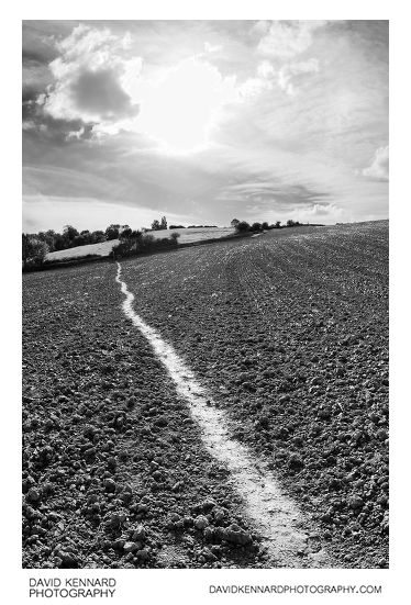
Ploughed field between Harborough and Great Bowden from http://www.davidkennardphotography.com
Looking south along a path over a ploughed field between Market Harborough and Great Bowden in Leicestershire, England.
Date taken: 2010-10-07 15:12:29
Más sobre Ploughed field between Harborough and Great Bowden
251: Old Golden Wonder Building under redevelopment
Old Golden Wonder Building under redevelopment from http://www.davidkennardphotography.com
Edinburgh House, the old Golden Wonder Headquarters on Abbey Road in Market Harborough, Leicestershire, UK. The building is currently (October 2010) under redevelopment, being converted into offices, shops, restaurants and a Travelodge hotel.
Date taken: 2010-10-07 14:15:00
Más sobre Old Golden Wonder Building under redevelopment
252: North end of the High Street, Market Harborough
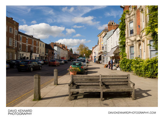
North end of the High Street, Market Harborough from http://www.davidkennardphotography.com
Looking northwest up the High Street in Market Harborough, Leicestershire, UK.
Date taken: 2010-10-07 14:16:21
Más sobre North end of the High Street, Market Harborough
253: Old telephone cabinet
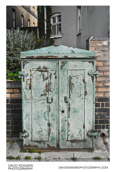
Old telephone cabinet from http://www.davidkennardphotography.com
An old telephone cabinet with peeling green paint, located near the Congregational Church on the High Street, Market Harborough.
Date taken: 2010-10-07 14:17:50
Más sobre Old telephone cabinet
254: Congregational Church side door, Market Harborough
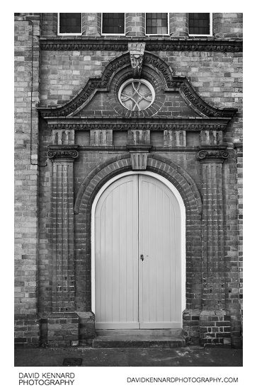
Congregational Church side door, Market Harborough from http://www.davidkennardphotography.com
A side entrance to the Congregational Church building on Bowden Lane in Market Harborough, Leicestershire.
The Independent chapel was built at the north end of High Street / west end of Bowden Lane in 1844, and a large hall was built behind the chapel in 1875.
Date taken: 2010-10-07 14:19:20
Más sobre Congregational Church side door, Market Harborough
255: White van outside house
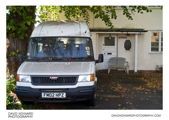
White van outside house from http://www.davidkennardphotography.com
A white LDV van outside a house on Burnmill Road in Market Harborough, Leicestershire, UK. An old plastic seat has been placed in front of the front door of the house, and a sign next to the door reads "WRIGHT'S".
Date taken: 2010-10-07 14:22:35
Más sobre White van outside house
256: Countryside between Harborough and Great Bowden
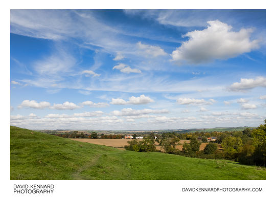
Countryside between Harborough and Great Bowden from http://www.davidkennardphotography.com
Looking north across fields between Market Harborough and Great Bowden in Leicestershire, England.
Date taken: 2010-10-07 14:34:18
Más sobre Countryside between Harborough and Great Bowden
257: Countryside between Harborough and Great Bowden
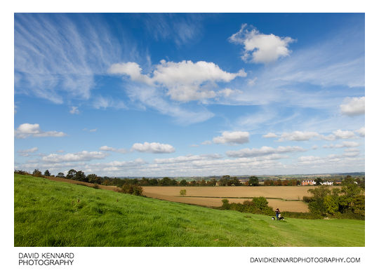
Countryside between Harborough and Great Bowden from http://www.davidkennardphotography.com
Looking north across fields between Market Harborough and Great Bowden in Leicestershire, England.
Date taken: 2010-10-07 14:42:03
Más sobre Countryside between Harborough and Great Bowden
258: Countryside between Harborough and Great Bowden
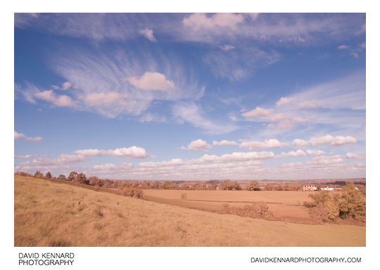
Countryside between Harborough and Great Bowden from http://www.davidkennardphotography.com
Looking north across fields between Market Harborough and Great Bowden in Leicestershire, England.
The photograph was taken using visible light, ultraviolet and infrared light.
Date taken: 2010-10-07 14:45:51
Más sobre Countryside between Harborough and Great Bowden
259: Countryside between Harborough and Great Bowden
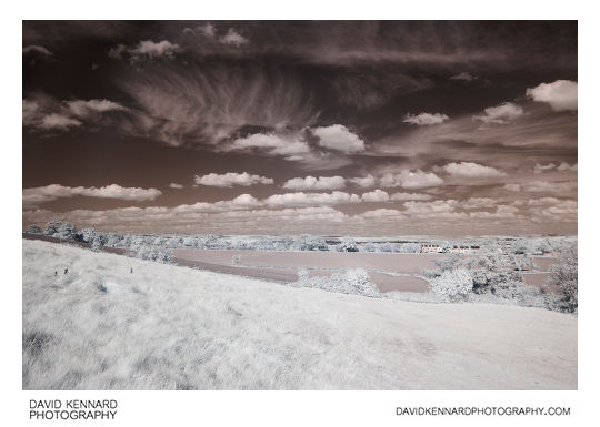
Countryside between Harborough and Great Bowden from http://www.davidkennardphotography.com
Looking north across fields between Market Harborough and Great Bowden in Leicestershire, England.
The photograph was taken using infrared light, invisible to the naked eye.
Date taken: 2010-10-07 14:49:07
Más sobre Countryside between Harborough and Great Bowden
260: Grassy field B&W infrared
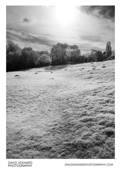
Grassy field B&W infrared from http://www.davidkennardphotography.com
Looking southeast across a field between Market Harborough and Great Bowden in Leicestershire, UK. The photograph was taken using infrared light, which is invisible to the human eye.
Date taken: 2010-10-07 14:57:09
Más sobre Grassy field B&W infrared
261: Fields between Harborough and Great Bowden in IR
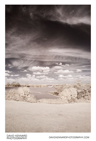
Fields between Harborough and Great Bowden in IR from http://www.davidkennardphotography.com
Looking across the fields towards Great Bowden from the north of Market harborough, in Leicestershire, England. The photograph was taken using infrared light.
Date taken: 2010-10-07 14:58:53
Más sobre Fields between Harborough and Great Bowden in IR
262: Ploughed field and cloudy sky in IR
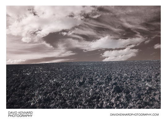
Ploughed field and cloudy sky in IR from http://www.davidkennardphotography.com
Looking west across a ploughed field between Market Harborough and Great Bowden in Leicestershire, England.
The photo was taken using infrared light with a wavelength in the 720nm - 1000nm range.
Date taken: 2010-10-07 15:02:40
Más sobre Ploughed field and cloudy sky in IR
263: Ploughed field and cloudy sky in IR
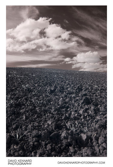
Ploughed field and cloudy sky in IR from http://www.davidkennardphotography.com
Looking west across a ploughed field between Market Harborough and Great Bowden in Leicestershire, England.
The photo was taken using infrared light with a wavelength in the 720nm - 1000nm range.
Date taken: 2010-10-07 15:05:41
Más sobre Ploughed field and cloudy sky in IR
264: Cirrus clouds and ploughed field in IR
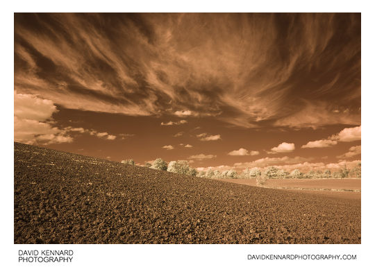
Cirrus clouds and ploughed field in IR from http://www.davidkennardphotography.com
Looking north over a ploughed field between Market Harborough and Great Bowden in Leicestershire, UK.
The photo was taken using infrared light with a wavelength between 720nm and 1000nm, invisible to the human eye.
Date taken: 2010-10-07 15:06:27
Más sobre Cirrus clouds and ploughed field in IR
265: Countryside in cherry coke
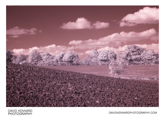
Countryside in cherry coke from http://www.davidkennardphotography.com
Looking north over a ploughed field between Market Harborough and Great Bowden in Leicestershire, UK.
The photograph was taken using infrared light, wich is invisible to the human eye.
Date taken: 2010-10-07 15:07:06
Más sobre Countryside in cherry coke
266: Grand Union Canal Harborough Arm in Infrared
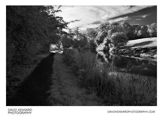
Grand Union Canal Harborough Arm in Infrared from http://www.davidkennardphotography.com
Looking southwest along the canal towpath of the Grand Union Canal, Market Harborough, in Leicestershire, England.
Date taken: 2010-10-07 16:07:41
Más sobre Grand Union Canal Harborough Arm in Infrared
267: Light in the woods
Light in the woods from http://www.davidkennardphotography.com
A shaft of sunlight lights up nettles and cobwebs, in a patch of woodland just off the Harborough arm of the Grand Union Canal, Market Harborough, Leicestershire, UK.
Date taken: 2010-10-07 16:27:03
Más sobre Light in the woods
268: Grand Union Canal Harborough Arm
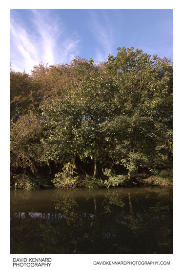
Grand Union Canal Harborough Arm from http://www.davidkennardphotography.com
Trees grow alongside the Harborough arm of the Grand Union Canal, near Market Harborough, in Leicestershire, England.
Date taken: 2010-10-07 16:31:59
Más sobre Grand Union Canal Harborough Arm
269: Grand Union Canal Harborough Arm
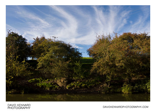
Grand Union Canal Harborough Arm from http://www.davidkennardphotography.com
Trees growing alongside the Grand Union Canal, near Market Harborough in Leicestershire, UK.
Date taken: 2010-10-07 16:34:21
Más sobre Grand Union Canal Harborough Arm
270: Grand Union Canal Harborough Arm
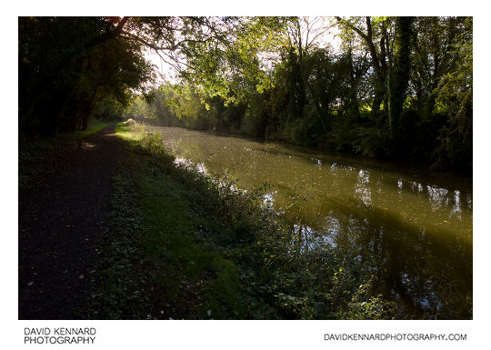
Grand Union Canal Harborough Arm from http://www.davidkennardphotography.com
Looking southwest along the Harborough arm of the Grand Union Canal, near Market Harborough in Leicestershire, UK.
Date taken: 2010-10-07 16:36:51
Más sobre Grand Union Canal Harborough Arm
271: Concrete bridge, Grand Union Canal
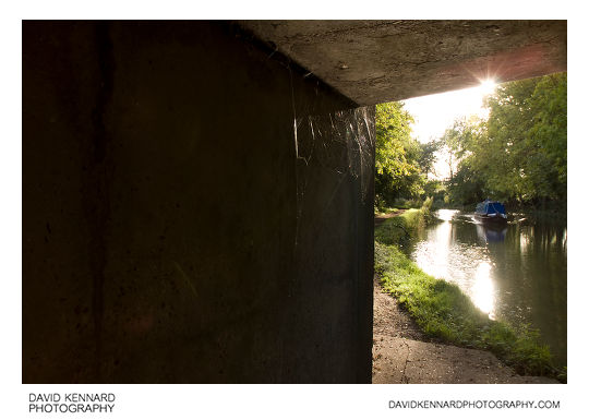
Concrete bridge, Grand Union Canal from http://www.davidkennardphotography.com
Spiders webs underneath a bridge shine in the sunlight, on the Grand Union Canal, neat Market Harborough, Leicestershire, UK
Date taken: 2010-10-07 16:40:20
Más sobre Concrete bridge, Grand Union Canal
272: Corrugated sheet building by the Grand Union Canal
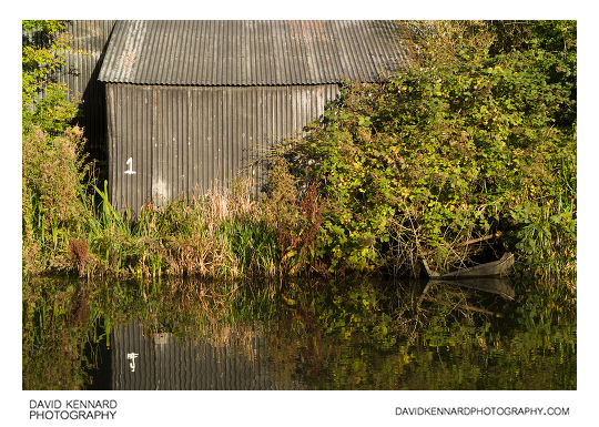
Corrugated sheet building by the Grand Union Canal from http://www.davidkennardphotography.com
The back of a corrugated sheet building behind Kirby Agricultural on Leicester Road in Market Harborough. The building juts out against the edge of the Grand Union Canal Harborough Arm.
Date taken: 2010-10-07 16:45:26
Más sobre Corrugated sheet building by the Grand Union Canal
273: Corrugated sheet building by the Grand Union Canal
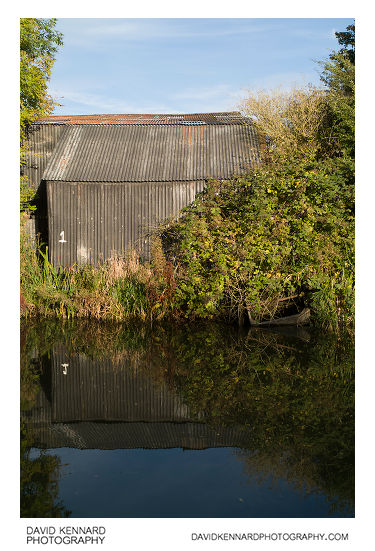
Corrugated sheet building by the Grand Union Canal from http://www.davidkennardphotography.com
The back of a corrugated sheet building located behind the Kirby Agricultural premises on Leicester Road in Market Harborough. The building extends up to the edge of the Harborough Arm of the Grand Union Canal.
Date taken: 2010-10-07 16:46:24
Más sobre Corrugated sheet building by the Grand Union Canal
274: Grand Union Canal Harborough Arm
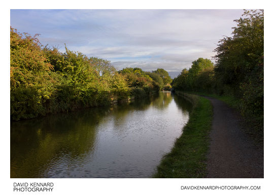
Grand Union Canal Harborough Arm from http://www.davidkennardphotography.com
Looking southeast down the Harborough arm of the Grand Union Canal, near Market Harborough, Leicestershire, England.
Date taken: 2010-10-07 16:48:00
Más sobre Grand Union Canal Harborough Arm
275: Clouds and trees
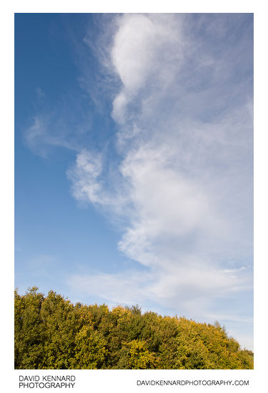
Clouds and trees from http://www.davidkennardphotography.com
Clouds float in the blue sky above trees in autumn colours below, just off the Grand Union Canal in Market Harborough, Leicestershire.
Date taken: 2010-10-07 16:49:20
Más sobre Clouds and trees
276: Field by the Grand Union Canal, Harborough
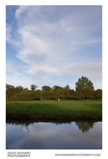
Field by the Grand Union Canal, Harborough from http://www.davidkennardphotography.com
A shire horse stands in a field next to the Grand Union Canal, near Market Harborough, Leicestershire, England.
Date taken: 2010-10-07 16:51:37
Más sobre Field by the Grand Union Canal, Harborough
277: Field by the Grand Union Canal, Harborough
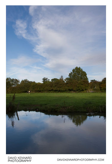
Field by the Grand Union Canal, Harborough from http://www.davidkennardphotography.com
A shire horse stands in a field next to the Grand Union Canal, near Market Harborough, Leicestershire, England.
Date taken: 2010-10-07 16:52:09
Más sobre Field by the Grand Union Canal, Harborough
278: Shire horse in field
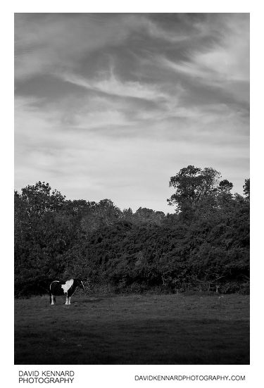
Shire horse in field from http://www.davidkennardphotography.com
A shire horse stands in a field next to the Harborough arm of the Grand Union Canal in Leicestershire, England.
Date taken: 2010-10-07 16:52:18
Más sobre Shire horse in field
279: Grand Union Canal, Market Harborough
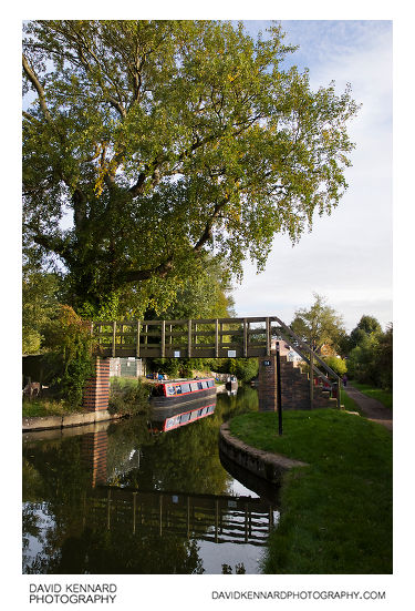
Grand Union Canal, Market Harborough from http://www.davidkennardphotography.com
The narrow footbridge, bridge #14 over the Grand Union Canal near Market Harborough, in Leicestershire, England. Narrowboats are moored in the area near the bridge.
Date taken: 2010-10-07 16:53:21
Más sobre Grand Union Canal, Market Harborough
280: House and Narrowboat, Grand Union Canal
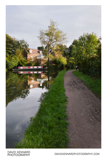
House and Narrowboat, Grand Union Canal from http://www.davidkennardphotography.com
A narrowboat is moored outside a house on the Grand Union Canal in Market Harborough, Leicestershire, UK.
Date taken: 2010-10-07 16:54:32
Más sobre House and Narrowboat, Grand Union Canal
281: House and Narrowboat, Harborough
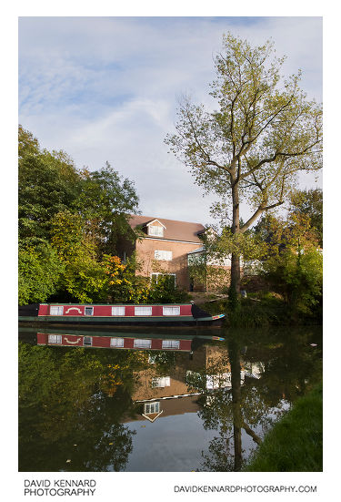
House and Narrowboat, Harborough from http://www.davidkennardphotography.com
A narrowboat is moored outside a house on the Harborough arm of the Grand Union Canal in Market Harborough, Leicestershire, UK.
Date taken: 2010-10-07 16:55:12
Más sobre House and Narrowboat, Harborough
282: Boat and reflection, Grand Union Canal
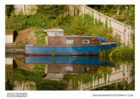
Boat and reflection, Grand Union Canal from http://www.davidkennardphotography.com
A small boat moored on the Grand Union Canal is reflected in the canal's water, near Market Harborough in Leicestershire, UK.
Date taken: 2010-10-07 16:55:43
Más sobre Boat and reflection, Grand Union Canal
283: Garden steps
Garden steps from http://www.davidkennardphotography.com
Steps up from the canal edge in a garden of a house along the edge of the Grand Union Canal, Market Harborough arm.
Date taken: 2010-10-07 16:57:55
Más sobre Garden steps
284: Thin clouds above house
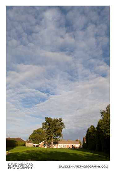
Thin clouds above house from http://www.davidkennardphotography.com
Looking across the Grand Union Canal towards the back garden of a house in the Woodlands, Market Harborough. The blue sky above the house is permeated with thin white clouds.
Date taken: 2010-10-07 17:05:47
Más sobre Thin clouds above house
285: Boat moored on the Grand Union Canal
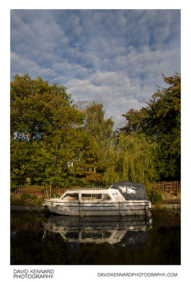
Boat moored on the Grand Union Canal from http://www.davidkennardphotography.com
A boat is moored on the Grand Union Canal, next to the back garden of a house in The Woodlands, Market Harborough.
Date taken: 2010-10-07 17:07:52
Más sobre Boat moored on the Grand Union Canal
286: Grand Union Canal, Market Harborough
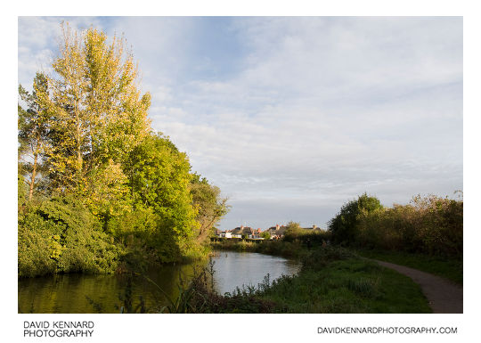
Grand Union Canal, Market Harborough from http://www.davidkennardphotography.com
Looking southeast along the Grand Union Canal in Market Harborough, Leicestershire, England.
Date taken: 2010-10-07 17:09:51
Más sobre Grand Union Canal, Market Harborough
287: Hedge and Autumnal tree
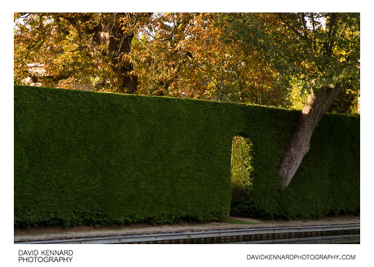
Hedge and Autumnal tree from http://www.davidkennardphotography.com
A doorway is cut into the hedge of a garden that backs onto the Grand Union Canal in Market Harborough, Leicestershire. To the right of the doorway a tree grows out of the hedge, while other trees in the garden are in autumn colours.
Date taken: 2010-10-07 17:16:37
Más sobre Hedge and Autumnal tree
288: Doorway and tree trunk in hedge
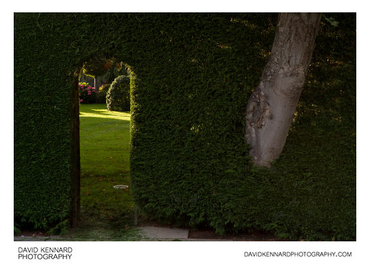
Doorway and tree trunk in hedge from http://www.davidkennardphotography.com
Looking through the doorway carved into a hedge into the back garden of a house in The Woodlands, Market Harborough. The back gardens of most houses in The Woodlands back onto the Harborough arm of the Grand Union Canal.
Date taken: 2010-10-07 17:18:16
Más sobre Doorway and tree trunk in hedge
289: Autumnal tree
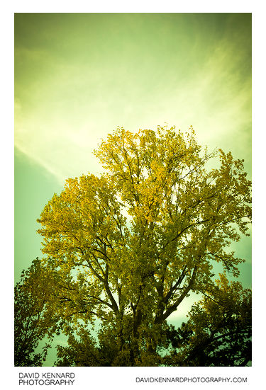
Autumnal tree from http://www.davidkennardphotography.com
A tree in autumn yellow colour growing alongside the Grand Union Canal in Market Harborough, England.
Date taken: 2010-10-07 17:19:53
Más sobre Autumnal tree
290: Frosty ploughed field at sunrise
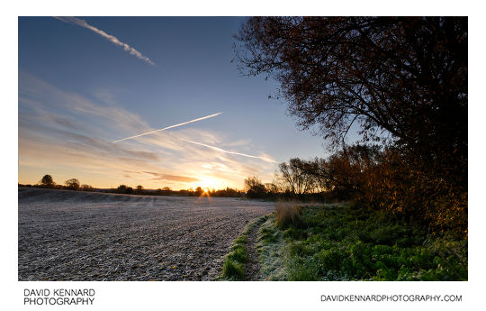
Frosty ploughed field at sunrise from http://www.davidkennardphotography.com
Looking east across a ploughed field as the sun rises on a frosty October morning, near Market Harborough in Leicestershire, UK.
Date taken: 2010-10-21 07:50:04
Más sobre Frosty ploughed field at sunrise
291: Sunrise over ploughed field, Market Harborough
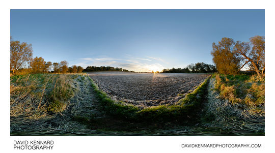
Sunrise over ploughed field, Market Harborough from http://www.davidkennardphotography.com
The sun rises over a frosty ploughed field on a cold October morning in Market Harborough, Leicestershire, UK.
Date taken: 2010-10-21 07:59:38
Más sobre Sunrise over ploughed field, Market Harborough
292: Sunrise over Harborough from Lubenham Hill
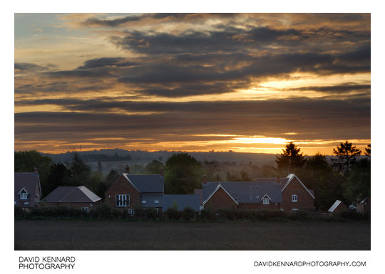
Sunrise over Harborough from Lubenham Hill from http://www.davidkennardphotography.com
Looking east towards Market Harborough from Lubenham Hill at sunrise, in Leicestershire, England. The houses at the bottom of the field are part of the recently built (December 2009) Copper Trees development.
Date taken: 2010-10-22 07:56:54
Más sobre Sunrise over Harborough from Lubenham Hill
293: Sunset and black plastic wrapped haybale
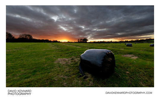
Sunset and black plastic wrapped haybale from http://www.davidkennardphotography.com
The sun sets over a hay field with a black plastic wrapped haybale in the foreground, near Market Harborough in Leicestershire, England.
Date taken: 2010-10-21 17:51:29
Más sobre Sunset and black plastic wrapped haybale
294: Sunset over ridge and furrow field
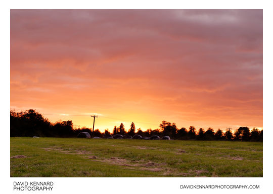
Sunset over ridge and furrow field from http://www.davidkennardphotography.com
The sun sets over a medieval ridge and furrow field between Market Harborough and Lubenham, in Leicestershire, UK. Today the field is used for growing hay, a stack of black plastic wrapped haybales can be seen further up the field.
Date taken: 2010-10-21 17:53:35
Más sobre Sunset over ridge and furrow field
295: Storage tanks at JELD-WEN, Melton Mowbray
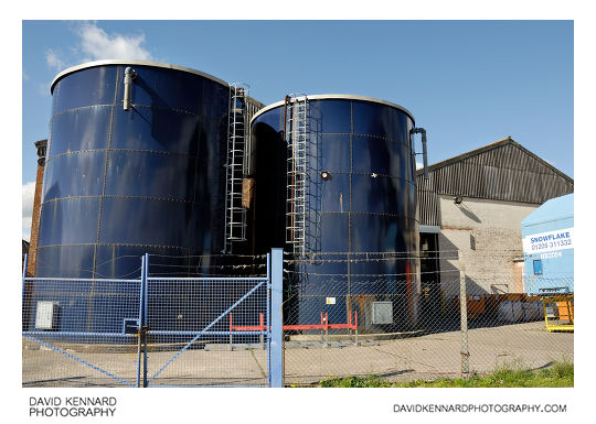
Storage tanks at JELD-WEN, Melton Mowbray from http://www.davidkennardphotography.com
Storage tanks outside a JELD-WEN building used for making stair components in Melton Mowbray, Leicestershire, England.
Date taken: 2010-09-17 11:34:54
Más sobre Storage tanks at JELD-WEN, Melton Mowbray
296: Bentley Street, Melton Mowbray
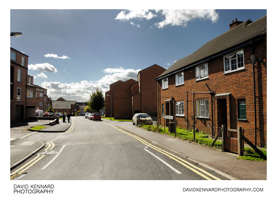
Bentley Street, Melton Mowbray from http://www.davidkennardphotography.com
The view south down Bentley Street in Melton Mowbray, Leicestershire, UK.
Date taken: 2010-09-17 11:37:09
Más sobre Bentley Street, Melton Mowbray
297: Sherrard Street, Melton Mowbray
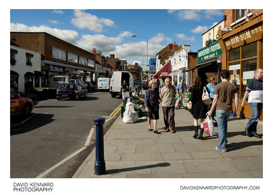
Sherrard Street, Melton Mowbray from http://www.davidkennardphotography.com
Looking west along Sherrard Street in Melton Mowbray as people do their shopping. To the right can be seen the Dim-sum Chinese takeaway, Brewsters Fruitiers, an RSPCA Charity shop, and Family Butchers.
Date taken: 2010-09-17 11:40:00
Más sobre Sherrard Street, Melton Mowbray
298: Sherrard Street, Melton Mowbray
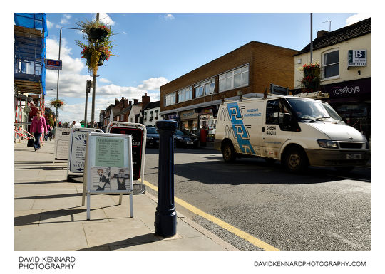
Sherrard Street, Melton Mowbray from http://www.davidkennardphotography.com
Looking east along Sherrard Street in Melton Mowbray, Leicestershire, England. Various shops in Bowley Court, a shopping area off from Sherrard Street, have signs put out on the pavement to advertise themselves.
Date taken: 2010-09-17 11:43:10
Más sobre Sherrard Street, Melton Mowbray
299: Brooksby Melton College King Street Building, Melton Mowbray
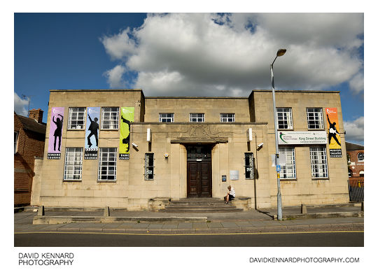
Brooksby Melton College King Street Building, Melton Mowbray from http://www.davidkennardphotography.com
Brooksby Melton College King Street Building on King Street in Melton Mowbray, Leicestershire, UK.
The college offers a range of performing arts courses, covering singing, acting, dancing, and musical theatre.
Date taken: 2010-09-17 11:54:11
Más sobre Brooksby Melton College King Street Building, Melton Mowbray
300: Derek Jones Butchers, Melton Mowbray
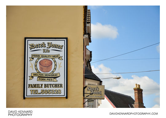
Derek Jones Butchers, Melton Mowbray from http://www.davidkennardphotography.com
Derek Jones Family Butcher shop on King Street in Melton Mowbray, Leicestershire, England. Melton Mowbray is famous for its Pork Pies, and promotes itself as the "Rural Capital of Food".
Date taken: 2010-09-17 11:54:51
Más sobre Derek Jones Butchers, Melton Mowbray
301: Regal Cinema, Melton Mowbray
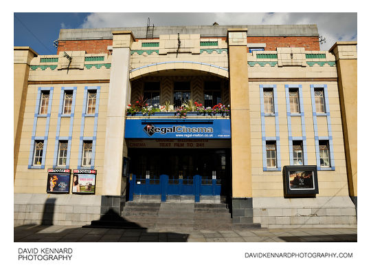
Regal Cinema, Melton Mowbray from http://www.davidkennardphotography.com
The Regal Cinema on King Street in Melton Mowbray, Leicestershire, England. The cinema, featuring an art-deco frontage, was built in 1937, and is still actively used as a cinema today.
Date taken: 2010-09-17 11:55:27
Más sobre Regal Cinema, Melton Mowbray
302: The Bell Shopping Centre, Melton Mowbray
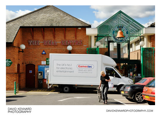
The Bell Shopping Centre, Melton Mowbray from http://www.davidkennardphotography.com
The Bell Shopping Centre is a covered shopping area in Melton Mowbray, Leicestershire, UK.
One end of the shopping centre backs onto a car park off St Mary's Road (shown here), while the other end comes out on Nottingham Street in the town centre.
Date taken: 2010-09-17 11:56:53
Más sobre The Bell Shopping Centre, Melton Mowbray
303: Inside the Bell Centre, Melton Mowbray
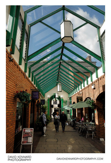
Inside the Bell Centre, Melton Mowbray from http://www.davidkennardphotography.com
Looking west along the Bell Shopping Centre in Melton Mowbray, Leicestershire, UK. The covered shopping centre comes out on Nottingham Street, one of the main shopping streets in Melton Mowbray.
Date taken: 2010-09-17 11:58:57
Más sobre Inside the Bell Centre, Melton Mowbray
304: Inside the Bell Centre, Melton Mowbray
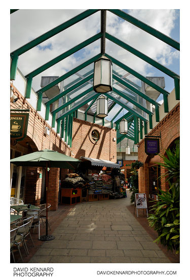
Inside the Bell Centre, Melton Mowbray from http://www.davidkennardphotography.com
Looking east along the Bell shopping centre in Melton Mowbray, Leicestershire, UK.
Date taken: 2010-09-17 11:59:18
Más sobre Inside the Bell Centre, Melton Mowbray
305: Market Place, Melton Mowbray
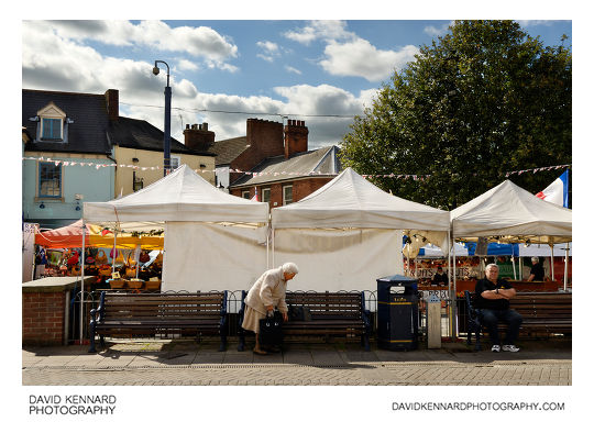
Market Place, Melton Mowbray from http://www.davidkennardphotography.com
Benches behind market stalls in Market Place, Melton Mowbray, Leicestershire, UK.
Melton Mowbray was listed as Leicestershire's only town with a market in the 1086 Domesday book. It has been a market town for over 1000 years, and has the third oldest market in England.
Date taken: 2010-09-17 12:02:25
Más sobre Market Place, Melton Mowbray
306: The Black Swan, Melton Mowbray
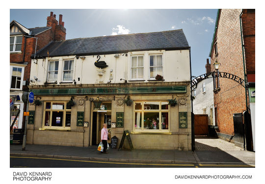
The Black Swan, Melton Mowbray from http://www.davidkennardphotography.com
The Black Swan pub on Sherrard Street in Melton Mowbray, Leicestershire, England.
Date taken: 2010-09-17 11:48:54
Más sobre The Black Swan, Melton Mowbray
307: King Street Art, Melton Mowbray
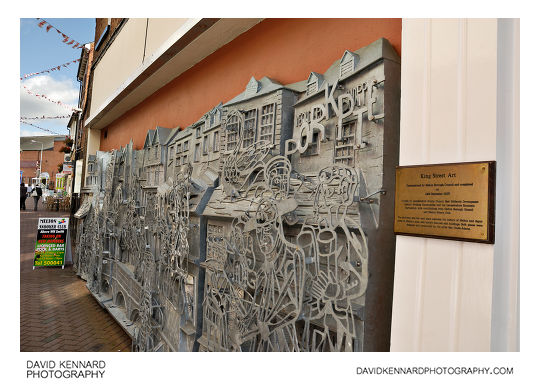
King Street Art, Melton Mowbray from http://www.davidkennardphotography.com
This wall piece depicts Melton's most well known buildings and features, celebrating the history of Melton Mowbray.
The King Street Art wall piece was commissioned by Melton Borough Council, and designed and constructed by Ben Coode-Adams. It was completed on 24th September 2007.
Date taken: 2010-09-17 12:02:45
Más sobre King Street Art, Melton Mowbray
308: Dickinson & Morris Pork Pie and Sausage shops, Melton Mowbray
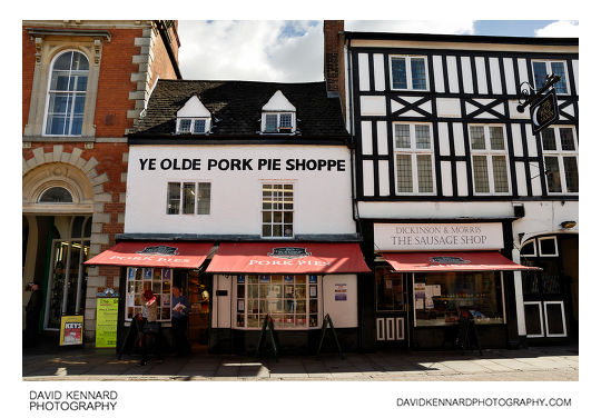
Dickinson & Morris Pork Pie and Sausage shops, Melton Mowbray from http://www.davidkennardphotography.com
The Dickinson & Morris Ye Olde Pork Pie Shoppe on Nottingham Street in Melton Mowbray, Leicestershire, England. To the right of the Pork Pie shop is the Dickinson & Morris Sausage Shop and the Half Moon pub.
Date taken: 2010-09-17 12:00:20
Más sobre Dickinson & Morris Pork Pie and Sausage shops, Melton Mowbray
309: Windsor Street, Melton Mowbray
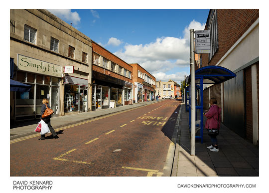
Windsor Street, Melton Mowbray from http://www.davidkennardphotography.com
Looking north up Windsor Street in Melton Mowbray, Leicestershire, England. The eastern side of Windsor Street features a line of bus-stops, while the western side has a range of shops including Kate's Book shop, County Crafts, Loros Hospice charity shop, and Simply Hair.
Date taken: 2010-09-17 11:42:09
Más sobre Windsor Street, Melton Mowbray
310: Ye Olde Pork Pie Shoppe, Melton Mowbray
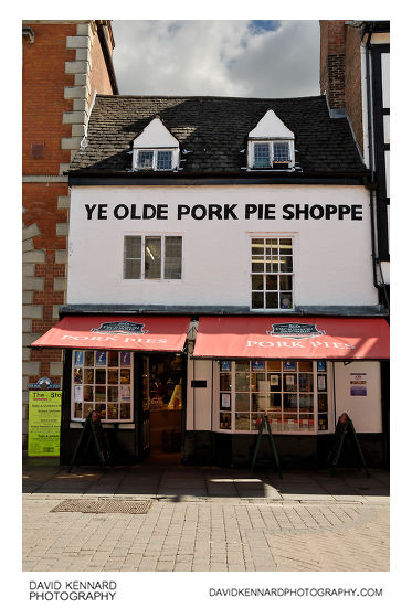
Ye Olde Pork Pie Shoppe, Melton Mowbray from http://www.davidkennardphotography.com
The Dickinson and Morris Pork Pie shop on Nottingham Street in Melton Mowbray, Leicestershire, UK.
Dickinson & Morris is both the oldest pork pie bakery and the last remaining producer of Melton Mowbray pork pies based in the town centre, having been baking pork pies at Ye Olde Pork Pie Shoppe since 1851.
Date taken: 2010-09-17 12:00:39
Más sobre Ye Olde Pork Pie Shoppe, Melton Mowbray
311: Nottingham Street, Melton Mowbray
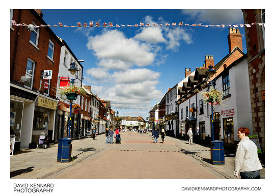
Nottingham Street, Melton Mowbray from http://www.davidkennardphotography.com
Looking north along Nottingham Street in Melton Mowbray, Leicestershire, UK. Nottingham Street is one of the main shopping streets in Melton Mowbray.
Date taken: 2010-09-17 11:59:45
Más sobre Nottingham Street, Melton Mowbray
312: Partially constructed building, Melton Mowbray
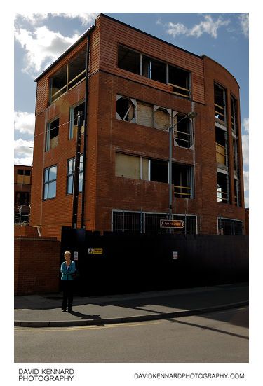
Partially constructed building, Melton Mowbray from http://www.davidkennardphotography.com
A partially constructed building at the corner of King Street and Windsor Street in Melton Mowbray, Leicestershire, England.
A brown tourist sign attached to the lamp-post outside the building points the way to the 'Pork Pie Shoppe', Melton Mowbray is famous for its Pork Pies.
Date taken: 2010-09-17 12:05:31
Más sobre Partially constructed building, Melton Mowbray
313: JELD-WEN stair workshop, Melton Mowbray
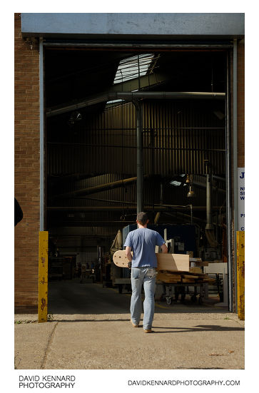
JELD-WEN stair workshop, Melton Mowbray from http://www.davidkennardphotography.com
A man takes a piece of joinery into the stair workshop at the JELD-WEN premises in Melton Mowbray, UK.
Date taken: 2010-09-17 12:10:48
Más sobre JELD-WEN stair workshop, Melton Mowbray
314: Woodland in Melton Country Park
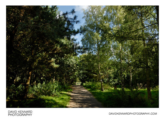
Woodland in Melton Country Park from http://www.davidkennardphotography.com
Looking northeast through a patch of woodland in Melton Country Park in Melton Mowbray, Leicestershire, England.
The 137 acre Melton Country Park is just 10 minutes walk from the centre of Melton Mowbray, and features sports facilities, play areas, and a series of lakes.
Date taken: 2010-09-17 12:57:58
Más sobre Woodland in Melton Country Park
315: Seeding thistles, Melton Country Park
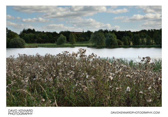
Seeding thistles, Melton Country Park from http://www.davidkennardphotography.com
Seeding thistles growing by the edge of the central lake at Melton Country Park in Melton Mowbray, Leicestershire, England.
The 137 acre Melton Country Park is just 10 minutes walk from the centre of Melton Mowbray, and features a series of lakes, sports facilities, and play areas.
Date taken: 2010-09-17 12:42:03
Más sobre Seeding thistles, Melton Country Park
316: Melton Country Park, Melton Mowbray
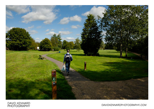
Melton Country Park, Melton Mowbray from http://www.davidkennardphotography.com
Looking north from the southern tip of Melton Country Park in Melton Mowbray, Leicestershire, England. The 137 acre park is just 10 minutes walk from the centre of Melton Mowbray, and features sports facilities, play areas, and a series of lakes.
Date taken: 2010-09-17 12:14:01
Más sobre Melton Country Park, Melton Mowbray
317: Melton Country Park Central Lake
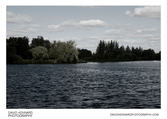
Melton Country Park Central Lake from http://www.davidkennardphotography.com
Looking north over the main lake in Melton Country Park in Melton Mowbray, Leicestershire, UK.
Just 10 minutes walk from the centre of Melton Mowbray, the 137 acre park features a series of lakes, sports facilities, and play areas.
Date taken: 2010-09-17 12:45:00
Más sobre Melton Country Park Central Lake
318: Central Lake, Melton Country Park
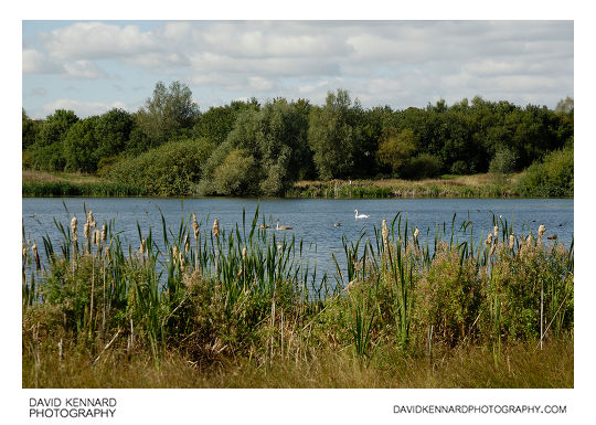
Central Lake, Melton Country Park from http://www.davidkennardphotography.com
Looking west across the central lake of Melton Country Park in Melton Mowbray, Leicestershire, England.
The 137 acre Melton Country Park is just 10 minutes walk from the centre of Melton Mowbray, and features a series of lakes, sports facilities, and play areas.
Date taken: 2010-09-17 12:47:18
Más sobre Central Lake, Melton Country Park
319: Mute Swan, Melton Country Park
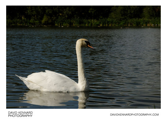
Mute Swan, Melton Country Park from http://www.davidkennardphotography.com
A mute swan at Melton Country Park in Melton Mowbray, Leicestershire, England.
Description adapted from Wikipedia (http://en.wikipedia.org/wiki/Mute_Swan):
The Mute Swan (Cygnus olor) is a species of swan, native to much of Europe and Asia. It is also an introduced species in North America, Australasia and southern Africa. The name 'mute' derives from it being less vocal than other swan species.
The Mute Swan is wholly white in plumage with an orange bill bordered with black, and can be recognised by its pronounced knob atop the bill.
Adults of this large swan range from 125 to 170 centimetres (49 to 67 in) long with a 200 to 240 centimetres (79 to 94 in) wingspan. They may stand over 120 centimetres (47 in) tall on land. Males are larger than females and have a larger knob on their bill.
The Mute Swan is one of the heaviest flying birds, with males (known as cobs) averaging about 12 kilograms (26 lb) and the slightly smaller females (known as pens) weighing about 9 kilograms (20 lb). An unusually big Polish cob weighed almost 23 kilograms (51 lb), surpassing the longer-bodied Trumpeter Swan to make it the heaviest waterfowl ever recorded.
Date taken: 2010-09-17 12:49:33
Más sobre Mute Swan, Melton Country Park
320: Old railway bridge, Melton Country Park
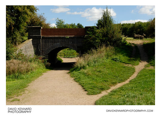
Old railway bridge, Melton Country Park from http://www.davidkennardphotography.com
An old railway bridge in Melton Country Park, Melton Mowbray, UK.
The old railway line between Melton and Scalford, closed in 1953, runs through the centre of the park, and is now used as a footpath.
Date taken: 2010-09-17 12:54:05
Más sobre Old railway bridge, Melton Country Park
321: Preparing grass for baling, Melton Country Park
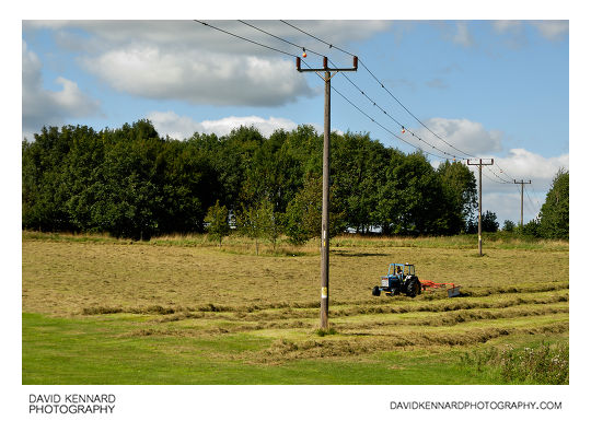
Preparing grass for baling, Melton Country Park from http://www.davidkennardphotography.com
A tractor moves cut grass into rows, ready for baling, in Melton Country Park, Melton Mowbray, UK.
Coloured balls are attached to the power lines running over the field to try and make them more visible and so prevent birds flying into them.
Date taken: 2010-09-17 12:55:21
Más sobre Preparing grass for baling, Melton Country Park
322: Resting cattle
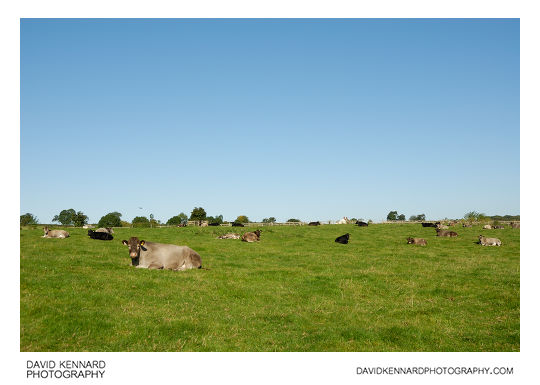
Resting cattle from http://www.davidkennardphotography.com
Cows and calves rest in a field near the village of Scalford in Leicestershire, UK.
From Wikipedia (http://en.wikipedia.org/wiki/Cattle):
Cattle (colloquially cows) are the most common type of large domesticated ungulates. They are a prominent modern member of the subfamily Bovinae, are the most widespread species of the genus Bos, and are most commonly classified collectively as Bos primigenius. Cattle are raised as livestock for meat (beef and veal), as dairy animals for milk and other dairy products, and as draft animals (pulling carts, plows and the like). Other products include leather and dung for manure or fuel. In some countries, such as India, cattle are sacred. It is estimated that there are 1.3 billion cattle in the world today. In 2009, cattle became the first livestock animal to have its genome mapped.
Date taken: 2010-09-17 09:35:03
Más sobre Resting cattle
323: Resting cattle, Scalford
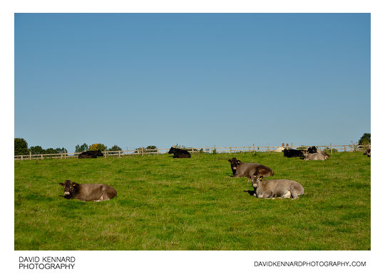
Resting cattle, Scalford from http://www.davidkennardphotography.com
Cows and calves rest in a field near the village of Scalford in Leicestershire, UK.
From Wikipedia (http://en.wikipedia.org/wiki/Cattle):
Cattle (colloquially cows) are the most common type of large domesticated ungulates. They are a prominent modern member of the subfamily Bovinae, are the most widespread species of the genus Bos, and are most commonly classified collectively as Bos primigenius. Cattle are raised as livestock for meat (beef and veal), as dairy animals for milk and other dairy products, and as draft animals (pulling carts, plows and the like). Other products include leather and dung for manure or fuel. In some countries, such as India, cattle are sacred. It is estimated that there are 1.3 billion cattle in the world today. In 2009, cattle became the first livestock animal to have its genome mapped.
Date taken: 2010-09-17 09:35:27
Más sobre Resting cattle, Scalford
324: Track through ploughed field, Scalford
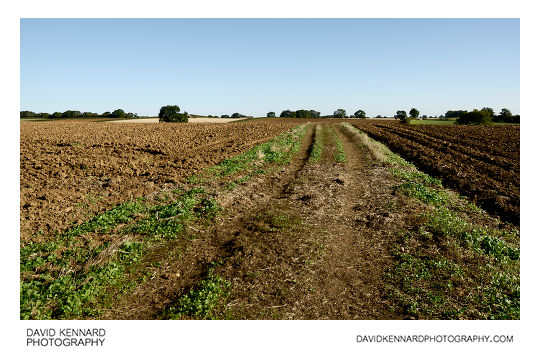
Track through ploughed field, Scalford from http://www.davidkennardphotography.com
A track runs through a ploughed field near Scalford in Leicestershire, UK. After the harvest in August, ploughed fields are a common site in September, ready for the planting of next years crop.
Date taken: 2010-09-17 09:37:13
Más sobre Track through ploughed field, Scalford
325: Ploughed field near Scalford
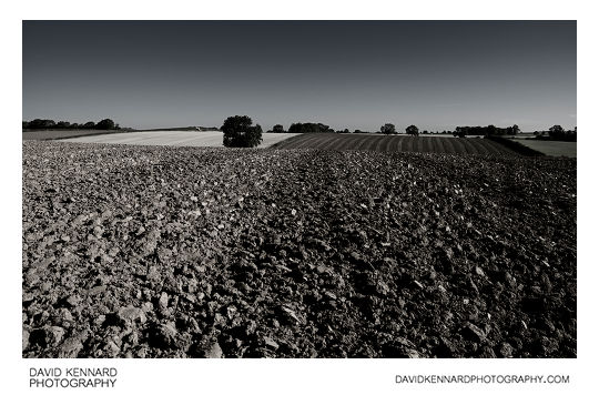
Ploughed field near Scalford from http://www.davidkennardphotography.com
Looking north-east across a ploughed field near Scalford in Leicestershire, UK. Ploughed fields are a common sight across the UK in September, as fields harvested in August are prepared for the planting of next years crop.
Date taken: 2010-09-17 09:40:09
Más sobre Ploughed field near Scalford
326: Walking across a ploughed field
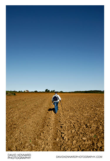
Walking across a ploughed field from http://www.davidkennardphotography.com
Walking across a ploughed field near Scalford, Leicestershire, UK.
In September many farmers are ploughing their fields in preparation for planting next year's crop. Unfortunately any traces of a footpath across the field are removed as a result, and traversing the field across lumps of sod is not as easy as a flat footpath.
Date taken: 2010-09-17 09:40:42
Más sobre Walking across a ploughed field
327: Green fields near Scalford
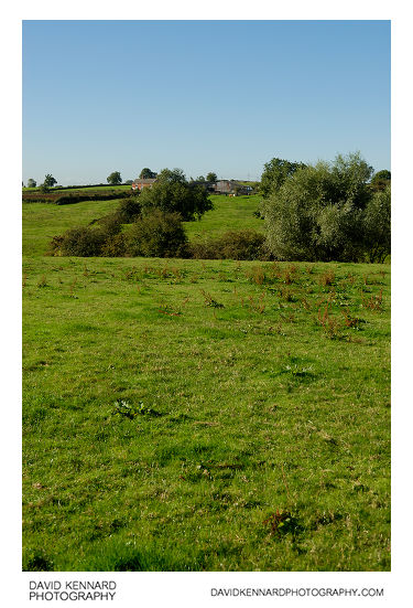
Green fields near Scalford from http://www.davidkennardphotography.com
Looking south-west across green fields towards farm buildings and houses from a field near Scalford in Leicestershire, UK.
Date taken: 2010-09-17 09:54:32
Más sobre Green fields near Scalford
328: Footpath across harvested field, Scalford
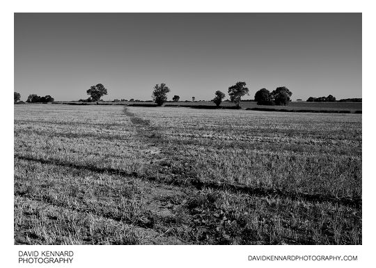
Footpath across harvested field, Scalford from http://www.davidkennardphotography.com
A footpath runs across a harvested field near Scalford, in Leicestershire, UK.
Date taken: 2010-09-17 09:57:09
Más sobre Footpath across harvested field, Scalford
329: Harvested field and tree, Scalford
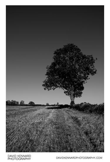
Harvested field and tree, Scalford from http://www.davidkennardphotography.com
A tree stands as part of a hedge separating two fields near Scalford, Leicestershire, UK. The harvested field will likely be ploughed soon (being mid September) to make way for next year's crop.
Date taken: 2010-09-17 10:00:37
Más sobre Harvested field and tree, Scalford
330: Ploughed field and tree, Scalford
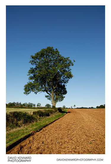
Ploughed field and tree, Scalford from http://www.davidkennardphotography.com
The edge of a ploughed field between Scalford and Goadby Marwood in Leicestershire, UK. In September the majority of fields are ploughed in preparation for planting next year's crop.
Date taken: 2010-09-17 10:01:02
Más sobre Ploughed field and tree, Scalford
331: Walking across a ploughed field near Scalford
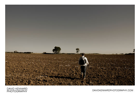
Walking across a ploughed field near Scalford from http://www.davidkennardphotography.com
Walking across a ploughed field between Scalford and Goadby Marwood, in Leicestershire, UK.
Many fields are ploughed in September as farmers prepare for planting next year's crop. Unfortunately a ploughed field is much more difficult to walk across than a footpath, and it can be hard to see where a footpath leads when it has been ploughed up with the rest of the field.
Date taken: 2010-09-17 10:02:04
Más sobre Walking across a ploughed field near Scalford
332: Harvested field, Scalford
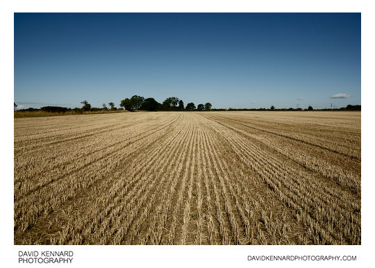
Harvested field, Scalford from http://www.davidkennardphotography.com
A harvested field between Scalford and Goadby Marwood in Leicestershire, UK.
Date taken: 2010-09-17 10:05:28
Más sobre Harvested field, Scalford
333: Farm track off Eastwell Road, Scalford
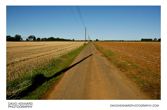
Farm track off Eastwell Road, Scalford from http://www.davidkennardphotography.com
Looking north-west up a track towards Eastwell Road, Scalford, Leicestershire, UK. The track leads to a small farm, and despite its narrow width, is used by HGVs that visit the farm.
Date taken: 2010-09-17 10:08:05
Más sobre Farm track off Eastwell Road, Scalford
334: Farm track off Eastwell Road, Scalford
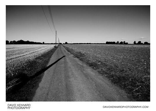
Farm track off Eastwell Road, Scalford from http://www.davidkennardphotography.com
Looking north-west up a track that connects a small farm to Eastwell Road, between Goadby Marwood and Scalford, Leicestershire, UK. Despite its narrow width, the track is used by HGVs that visit the farm.
Date taken: 2010-09-17 10:08:35
Más sobre Farm track off Eastwell Road, Scalford
335: Ploughed field, Scalford
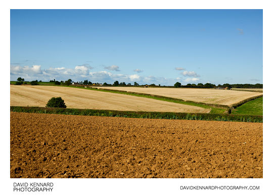
Ploughed field, Scalford from http://www.davidkennardphotography.com
Looking west across a ploughed field between Scalford and Wycomb, in Leicestershire, UK. In the distance can be seen harvested fields, likely soon to be ploughed over too.
Date taken: 2010-09-17 10:54:32
Más sobre Ploughed field, Scalford
336: Cumulus clouds and countryside
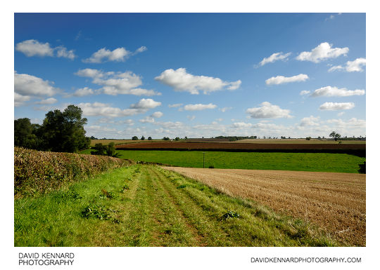
Cumulus clouds and countryside from http://www.davidkennardphotography.com
Fluffy cumulus clouds float over the fields between Wycomb and Scalford, in Leicestershire, UK on a warm September day.
Date taken: 2010-09-17 11:00:28
Más sobre Cumulus clouds and countryside
337: Old railway bridge near Scalford
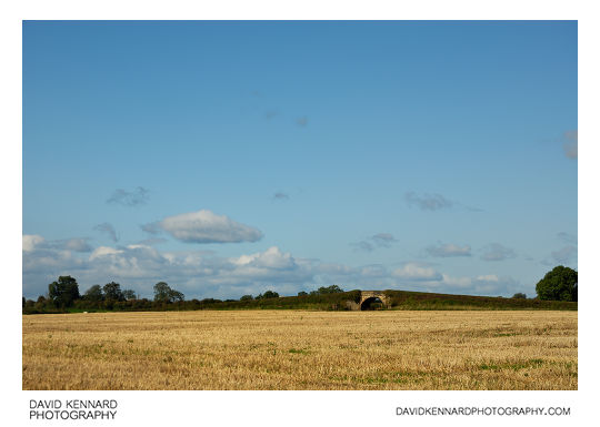
Old railway bridge near Scalford from http://www.davidkennardphotography.com
Looking north-west across a harvested field towards an old railway bridge, near Scalford in Leicestershire, UK. The Midland Railway line to Holwell used to run under the bridge, until it was closed in the 1960s.
Date taken: 2010-09-17 11:01:40
Más sobre Old railway bridge near Scalford
338: Harvested field and old railway bridge, Scalford
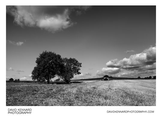
Harvested field and old railway bridge, Scalford from http://www.davidkennardphotography.com
Looking northwest across a harvested field near Scalford in Leicestershire, UK. In the distance can be seen an old railway bridge that ran over the Midland Railway line to Holwell.
Date taken: 2010-09-17 11:04:52
Más sobre Harvested field and old railway bridge, Scalford
339: Ploughed fields, Scalford
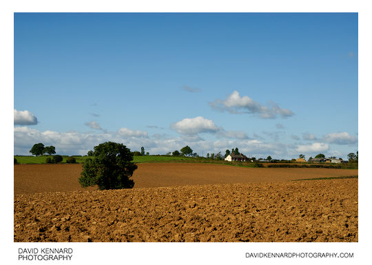
Ploughed fields, Scalford from http://www.davidkennardphotography.com
Looking north-west over ploughed fields near Scalford in Leicestershire, UK. In September ploughed fields are a common sight across the UK as farmers prepare their fields for planting next year's crops.
Date taken: 2010-09-17 11:07:16
Más sobre Ploughed fields, Scalford
340: Ploughed fields near Scalford
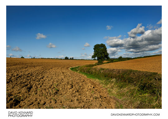
Ploughed fields near Scalford from http://www.davidkennardphotography.com
Ploughed fields near Scalford, in Leicestershire, UK. In the Autumn many farmers are ploughing their fields and preparing them for planting next year's crops.
Date taken: 2010-09-17 11:09:06
Más sobre Ploughed fields near Scalford
341: Track through ploughed field, Scalford
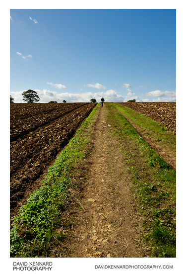
Track through ploughed field, Scalford from http://www.davidkennardphotography.com
Walking south-west along a track through a ploughed field near Scalford in Leicestershire, UK.
Date taken: 2010-09-17 11:10:16
Más sobre Track through ploughed field, Scalford
342: Track through ploughed field, Scalford
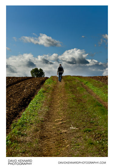
Track through ploughed field, Scalford from http://www.davidkennardphotography.com
Walking south-west along a track through a ploughed field near Scalford in Leicestershire, UK.
Date taken: 2010-09-17 11:10:23
Más sobre Track through ploughed field, Scalford
343: Track through ploughed field, Scalford
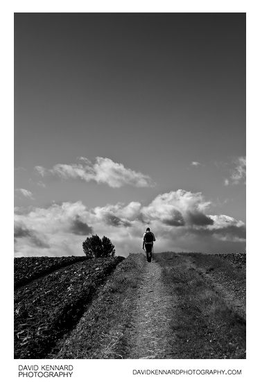
Track through ploughed field, Scalford from http://www.davidkennardphotography.com
Walking south-west along a track through a ploughed field near Scalford in Leicestershire, UK.
Date taken: 2010-09-17 11:10:28
Más sobre Track through ploughed field, Scalford
344: Blue sky and ploughed field, Scalford
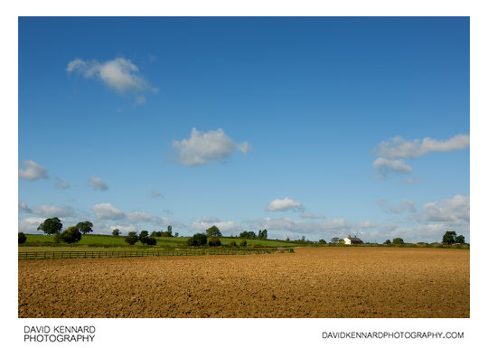
Blue sky and ploughed field, Scalford from http://www.davidkennardphotography.com
Looking north-west across a ploughed field near Scalford, in Leicestershire, UK. In the Autumn many fields are ploughed as farmers prepare for planting next year's crops.
Date taken: 2010-09-17 11:11:38
Más sobre Blue sky and ploughed field, Scalford
345: Cow and calf, Scalford
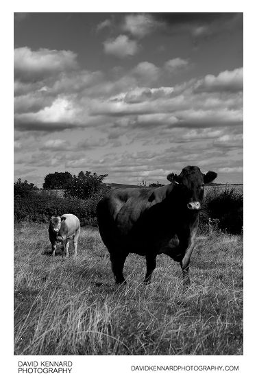
Cow and calf, Scalford from http://www.davidkennardphotography.com
A cow and calf pose in a field near Scalford, Leicestershire, UK.
From Wikipedia (http://en.wikipedia.org/wiki/Cattle):
Cattle (colloquially cows) are the most common type of large domesticated ungulates. They are a prominent modern member of the subfamily Bovinae, are the most widespread species of the genus Bos, and are most commonly classified collectively as Bos primigenius.
Cattle are raised as livestock for meat (beef and veal), as dairy animals for milk and other dairy products, and as draft animals (pulling carts, plows and the like). Other products include leather and dung for manure or fuel. In some countries, such as India, cattle are sacred. It is estimated that there are 1.3 billion cattle in the world today.
Date taken: 2010-09-17 11:13:31
Más sobre Cow and calf, Scalford
346: Cow and calf, Scalford
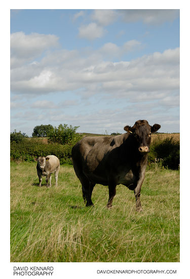
Cow and calf, Scalford from http://www.davidkennardphotography.com
A cow and calf pose in a field near Scalford, Leicestershire, UK.
From Wikipedia (http://en.wikipedia.org/wiki/Cattle):
Cattle (colloquially cows) are the most common type of large domesticated ungulates. They are a prominent modern member of the subfamily Bovinae, are the most widespread species of the genus Bos, and are most commonly classified collectively as Bos primigenius.
Cattle are raised as livestock for meat (beef and veal), as dairy animals for milk and other dairy products, and as draft animals (pulling carts, plows and the like). Other products include leather and dung for manure or fuel. In some countries, such as India, cattle are sacred. It is estimated that there are 1.3 billion cattle in the world today.
Date taken: 2010-09-17 11:13:34
Más sobre Cow and calf, Scalford
347: Crows over harvested field, Scalford
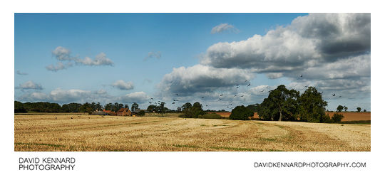
Crows over harvested field, Scalford from http://www.davidkennardphotography.com
Crows take flight over a harvested field between Scalford, Wycomb, and Goadby Marwood, in Leicestershire, UK.
Date taken: 2010-09-17 11:01:19
Más sobre Crows over harvested field, Scalford
348: Fields and farm, Scalford
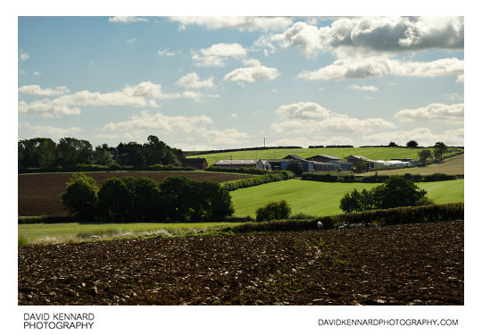
Fields and farm, Scalford from http://www.davidkennardphotography.com
Looking southeast towards across a ploughed field towards a farm between the villages of Wycomb and Scalford, in Leicestershire, UK.
Sheep, presumably escaped from a nearby field, rest around the edges of the ploughed field.
Date taken: 2010-09-17 11:09:46
Más sobre Fields and farm, Scalford
349: Green and beige fields, Scalford
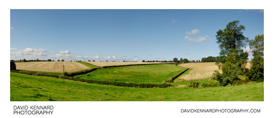
Green and beige fields, Scalford from http://www.davidkennardphotography.com
Looking west across grass fields and yellow harvested fields, near the villages of Wycomb and Scalford in Leicestershire, England.
Date taken: 2010-09-17 10:56:20
Más sobre Green and beige fields, Scalford
350: Old railway bridge and harvested field, Scalford
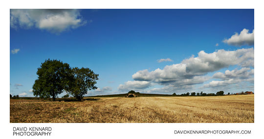
Old railway bridge and harvested field, Scalford from http://www.davidkennardphotography.com
The view north-west across a harvested field between Scalford and Goadby Marwood in Leicestershire, UK. In the distance can be seen an old railway bridge.
Midland Railway used to run a line towards Holwell that ran under the bridge, but the line closed in the 1960s when the Ironstone mine at Holwell closed.
Date taken: 2010-09-17 11:04:56
Más sobre Old railway bridge and harvested field, Scalford
351: Ploughed field near Scalford
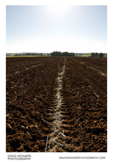
Ploughed field near Scalford from http://www.davidkennardphotography.com
Tractor tracks run across a ploughed field between Scalford and Goadby Marwood, Leicestershire, England.
Date taken: 2010-09-17 10:03:40
Más sobre Ploughed field near Scalford
352: Sun and field, Scalford
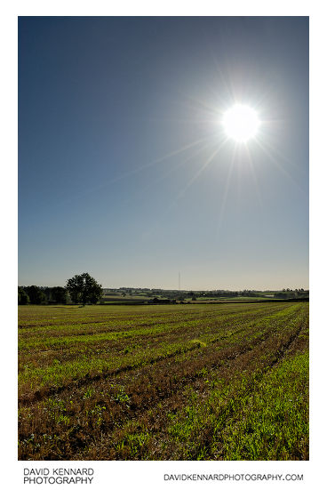
Sun and field, Scalford from http://www.davidkennardphotography.com
Looking west across a field with the sun in the sky above, between Scalford and Goadby Marwood, Leicestershire, UK. In the distance can be seen the 309 metre tall Waltham Transmitter mast.
Date taken: 2010-09-17 09:57:35
Más sobre Sun and field, Scalford
353: Sun over ploughed field near Scalford
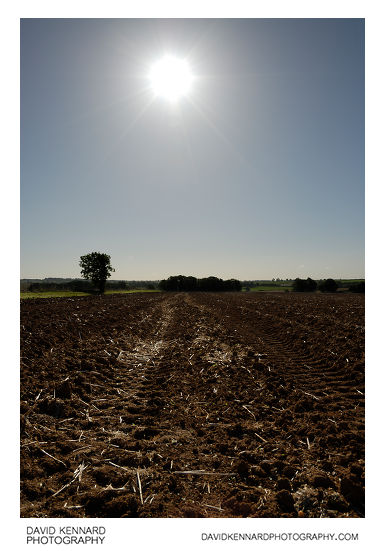
Sun over ploughed field near Scalford from http://www.davidkennardphotography.com
The shines brightly in the sky above a ploughed field between Scalford and Goadby Marwood in Leicestershire, UK. During Autumn many fields are ploughed as farmers prepare the fields for planting next year's crops.
Date taken: 2010-09-17 10:04:27
Más sobre Sun over ploughed field near Scalford
354: Sun and ploughed field, Scalford
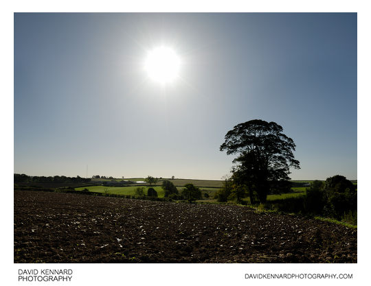
Sun and ploughed field, Scalford from http://www.davidkennardphotography.com
The sun shines down on a ploughed field below, near Scalford in Leicestershire, England.
Date taken: 2010-09-17 09:38:40
Más sobre Sun and ploughed field, Scalford
355: Track across grass field, Scalford
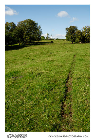
Track across grass field, Scalford from http://www.davidkennardphotography.com
Looking west along a small track running across a grass field at the north of the village of Scalford in Leicestershire, England.
Date taken: 2010-09-17 11:15:56
Más sobre Track across grass field, Scalford
356: Field of oilseed rape
Field of oilseed rape from http://www.davidkennardphotography.com
Rapeseed (Brassica napus), also known as rape, oilseed rape, rapa, rappi, rapaseed and (in the case of one particular group of cultivars, canola) is a bright yellow flowering member of the family Brassicaceae (mustard or cabbage family). The name derives from the Latin for turnip, r?pum or r?pa, and is first recorded in English at the end of the 14th century. Older writers usually distinguished the turnip and rape by the adjectives round and long(-rooted) respectively. See also Brassica napobrassica, which may be considered a variety of Brassica napus. Some botanists include the closely related Brassica campestris within B. napus. (See Triangle of U).
In agriculture, canola are certain varieties of rapeseed oil, or the oil produced from those varieties. Canola is a trademark for a hybrid variety of rape initially bred in Canada. Rapeseed oil was produced in the 19th century as a source of a lubricant for steam engines, and the oil has a bitter taste due to high levels of acids. Canola has been bred to reduce the amount of acid, yielding a more palatable oil.
Rapeseed is grown for the production of animal feed, vegetable oil for human consumption, and biodiesel; leading producers include the European Union, Canada, the United States, Australia, China and India. In India, it is grown on 13% of cropped land. According to the United States Department of Agriculture, rapeseed was the third leading source of vegetable oil in the world in 2000, after soybean and oil palm, and also the world's second leading source of protein meal, although only one-fifth of the production of the leading soybean meal.
World production is growing rapidly, with FAO reporting that 36 million tonnes of rapeseed was produced in the 2003-2004 season, and 46 million tonnes in 2004-2005. In Europe, rapeseed is primarily cultivated for animal feed, owing to its very high lipid and medium protein content, and is a leading option for Europeans to avoid importation of genetically modified organism (GMO) products.
Natural rapeseed oil contains 50% erucic acid. Wild type seeds also contain high levels of glucosinolates (mustard oil glucosindes), chemical compounds that significantly lowered the nutritional value of rape seed press cakes for animal feed. Canola, originally a syncopated form of the abbreviation "Can.O., L-A." (Canadian Oilseed, Low-Acid) that was used by the Manitoba government to label the seed during its experimental stages, is now a tradename for "double low" (low erucic acid and low glucosinolate) rapeseed. Sometimes the "Canola-quality" label is affixed to other varieties as well.
The rapeseed is the valuable, harvested component of the crop. The crop is also grown as a winter-cover crop. It provides good coverage of the soil in winter, and limits nitrogen run-off. The plant is ploughed back in the soil or used as bedding. On some ecological or organic operations, livestock such as sheep or cattle are allowed to graze on the plants.
Processing of rapeseed for oil production provides rapeseed animal meal as a by-product. The by-product is a high-protein animal feed, competitive with soya. The feed is mostly employed for cattle feeding, but also for pigs and chickens (though less valuable for these). The meal has a very low content of the glucosinolates responsible for metabolism disruption in cattle and pigs. Rapeseed "oil cake" is also used as a fertilizer in China, and may be used for ornamentals, such as Bonsai, as well.
Rapeseed leaves and stems are also edible, similar to those of the related bok choy or kale. Some varieties of rapeseed (called ??, yóu cài, lit. "oil vegetable" in Chinese; yau choy in Cantonese; c?i d?u in Vietnamese; phak kat kan khao [?????????????] in Thai; and nanohana [???] in Japanese) are sold as greens, primarily in Asian groceries, including those in California where it is known as yao choy or tender greens. They are eaten as sag (spinach) in Indian and Nepalese cuisine, usually stir-fried with salt, garlic and spices.
Rapeseed is a heavy nectar producer, and honeybees produce a light colored, but peppery honey from it. It must be extracted immediately after processing is finished, as it will quickly granulate in the honeycomb and will be impossible to extract. The honey is usually blended with milder honeys, if used for table use, or sold as bakery grade. Rapeseed growers contract with beekeepers for the pollination of the crop.
Description from Wikipedia: http://en.wikipedia.org/wiki/Brassica_napus
Date taken: 2010-05-05 11:32:36
Más sobre Field of oilseed rape
357: Footpath through woodland
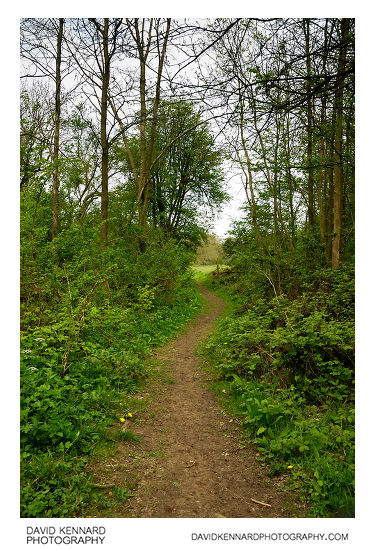
Footpath through woodland from http://www.davidkennardphotography.com
Looking northwest down a footpath through a small patch of woodland between the villages of Scraptoft, Keyham, and Houghton on the Hill in Leicestershire, UK.
Date taken: 2010-05-05 11:28:54
Más sobre Footpath through woodland
358: Green fields
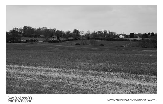
Green fields from http://www.davidkennardphotography.com
Looking west across fields towards the Sports Ground on Covert Lane, Scraptoft in Leicestershire, UK.
Date taken: 2010-05-05 11:19:10
Más sobre Green fields
359: Old railway line near Scraptoft
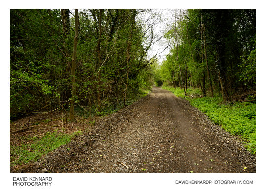
Old railway line near Scraptoft from http://www.davidkennardphotography.com
Looking southwest down the old Leicester branch line of the Great Northern Railway near Scraptoft in Leceistershire, UK.
Date taken: 2010-05-05 11:38:12
Más sobre Old railway line near Scraptoft
360: Way out of the woods
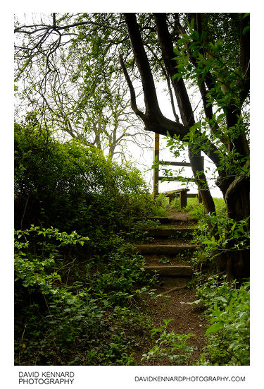
Way out of the woods from http://www.davidkennardphotography.com
Steps lead up a bank to a field from the old railway line near Scraptoft in Leicestershire, UK.
Date taken: 2010-05-05 11:39:10
Más sobre Way out of the woods
361: Horse in field
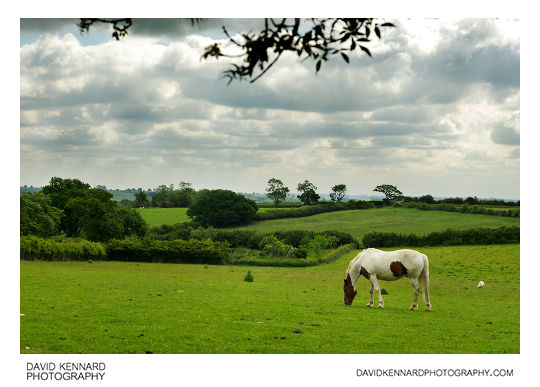
Horse in field from http://www.davidkennardphotography.com
A horse browses a grassy field near Withcote in Leicestershire, England.
Date taken: 2010-06-12 09:49:30
Más sobre Horse in field
362: Horses in field near Withcote
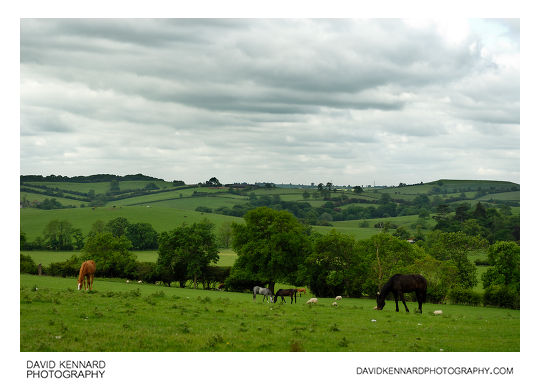
Horses in field near Withcote from http://www.davidkennardphotography.com
Horses and sheep browse the grass on a hill near the small town of Withcote in Leicestershire, UK.
Date taken: 2010-06-12 09:48:57
Más sobre Horses in field near Withcote
363: Track through field of sheep
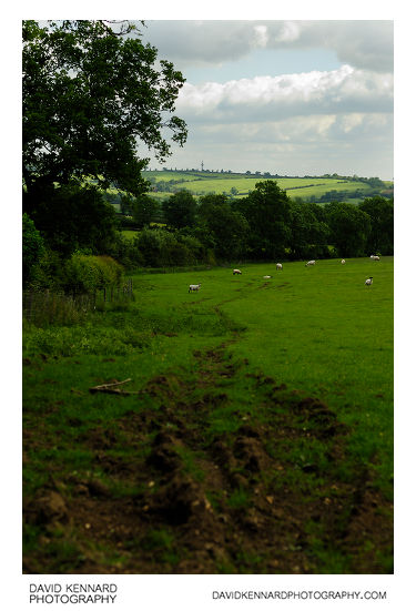
Track through field of sheep from http://www.davidkennardphotography.com
A muddy track leads northeast along the edge of a field of sheep near the hamlet of Withcote in Leicestershire, UK.
Date taken: 2010-06-12 09:53:06
Más sobre Track through field of sheep
364: Sheep in green field
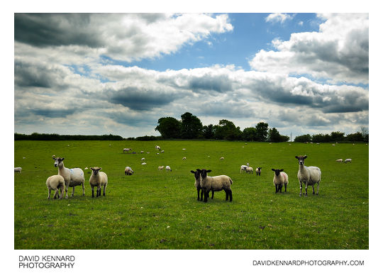
Sheep in green field from http://www.davidkennardphotography.com
Sheep stand in a field between the hamlet of Withcote and village of Braunston-in-Rutland, around the border between Rutland and Leicestershire, UK.
From Wikipedia (http://en.wikipedia.org/wiki/Domestic_sheep):
Sheep are most likely descended from the wild mouflon of Europe and Asia. One of the earliest animals to be domesticated for agricultural purposes, sheep are raised for fleece, meat (lamb, hogget or mutton) and milk. A sheep's wool is the most widely used of any animal, and is usually harvested by shearing. Ovine meat is called lamb when from younger animals and mutton when from older ones. Sheep continue to be important for wool and meat today, and are also occasionally raised for pelts, as dairy animals, or as model organisms for science.
Sheep husbandry is practised throughout the majority of the inhabited world, and has been fundamental to many civilizations. In the modern era, Australia, New Zealand, the southern and central South American nations, and the British Isles are most closely associated with sheep production.
Sheep-raising has a large lexicon of unique terms which vary considerably by region and dialect. Use of the word sheep began in Middle English as a derivation of the Old English word sc?ap; it is both the singular and plural name for the animal. A group of sheep is called a flock, herd or mob. Adult female sheep are referred to as ewes, intact males as rams or occasionally tups, castrated males as wethers, and younger sheep as lambs. Many other specific terms for the various life stages of sheep exist, generally related to lambing, shearing, and age.
Being a key animal in the history of farming, sheep have a deeply entrenched place in human culture, and find representation in much modern language and symbology. As livestock, sheep are most-often associated with pastoral, Arcadian imagery. Sheep figure in many mythologies - such as the Golden Fleece—and major religions, especially the Abrahamic traditions. In both ancient and modern religious ritual, sheep are used as sacrificial animals.
Date taken: 2010-06-12 12:12:23
Más sobre Sheep in green field
365: Sheep in green field
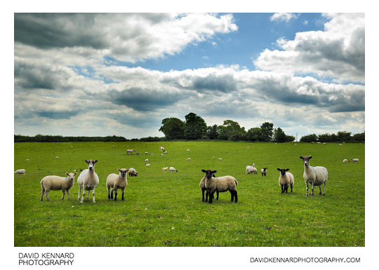
Sheep in green field from http://www.davidkennardphotography.com
Sheep stand in a field between the hamlet of Withcote and village of Braunston-in-Rutland, around the border between Rutland and Leicestershire, UK.
From Wikipedia (http://en.wikipedia.org/wiki/Domestic_sheep):
Sheep are most likely descended from the wild mouflon of Europe and Asia. One of the earliest animals to be domesticated for agricultural purposes, sheep are raised for fleece, meat (lamb, hogget or mutton) and milk. A sheep's wool is the most widely used of any animal, and is usually harvested by shearing. Ovine meat is called lamb when from younger animals and mutton when from older ones. Sheep continue to be important for wool and meat today, and are also occasionally raised for pelts, as dairy animals, or as model organisms for science.
Sheep husbandry is practised throughout the majority of the inhabited world, and has been fundamental to many civilizations. In the modern era, Australia, New Zealand, the southern and central South American nations, and the British Isles are most closely associated with sheep production.
Sheep-raising has a large lexicon of unique terms which vary considerably by region and dialect. Use of the word sheep began in Middle English as a derivation of the Old English word sc?ap; it is both the singular and plural name for the animal. A group of sheep is called a flock, herd or mob. Adult female sheep are referred to as ewes, intact males as rams or occasionally tups, castrated males as wethers, and younger sheep as lambs. Many other specific terms for the various life stages of sheep exist, generally related to lambing, shearing, and age.
Being a key animal in the history of farming, sheep have a deeply entrenched place in human culture, and find representation in much modern language and symbology. As livestock, sheep are most-often associated with pastoral, Arcadian imagery. Sheep figure in many mythologies - such as the Golden Fleece—and major religions, especially the Abrahamic traditions. In both ancient and modern religious ritual, sheep are used as sacrificial animals.
Date taken: 2010-06-12 12:12:27
Más sobre Sheep in green field
366: Sheep in green field
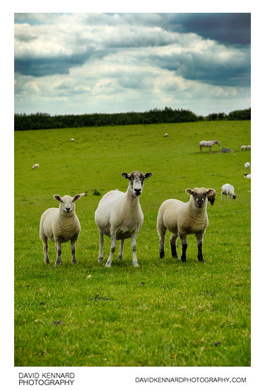
Sheep in green field from http://www.davidkennardphotography.com
Sheep stand in a field between the hamlet of Withcote and village of Braunston-in-Rutland, around the border between Rutland and Leicestershire, UK.
From Wikipedia (http://en.wikipedia.org/wiki/Domestic_sheep):
Sheep are most likely descended from the wild mouflon of Europe and Asia. One of the earliest animals to be domesticated for agricultural purposes, sheep are raised for fleece, meat (lamb, hogget or mutton) and milk. A sheep's wool is the most widely used of any animal, and is usually harvested by shearing. Ovine meat is called lamb when from younger animals and mutton when from older ones. Sheep continue to be important for wool and meat today, and are also occasionally raised for pelts, as dairy animals, or as model organisms for science.
Sheep husbandry is practised throughout the majority of the inhabited world, and has been fundamental to many civilizations. In the modern era, Australia, New Zealand, the southern and central South American nations, and the British Isles are most closely associated with sheep production.
Sheep-raising has a large lexicon of unique terms which vary considerably by region and dialect. Use of the word sheep began in Middle English as a derivation of the Old English word sc?ap; it is both the singular and plural name for the animal. A group of sheep is called a flock, herd or mob. Adult female sheep are referred to as ewes, intact males as rams or occasionally tups, castrated males as wethers, and younger sheep as lambs. Many other specific terms for the various life stages of sheep exist, generally related to lambing, shearing, and age.
Being a key animal in the history of farming, sheep have a deeply entrenched place in human culture, and find representation in much modern language and symbology. As livestock, sheep are most-often associated with pastoral, Arcadian imagery. Sheep figure in many mythologies - such as the Golden Fleece—and major religions, especially the Abrahamic traditions. In both ancient and modern religious ritual, sheep are used as sacrificial animals.
Date taken: 2010-06-12 12:12:47
Más sobre Sheep in green field
367: Horses in field, Withcote Hall Stud
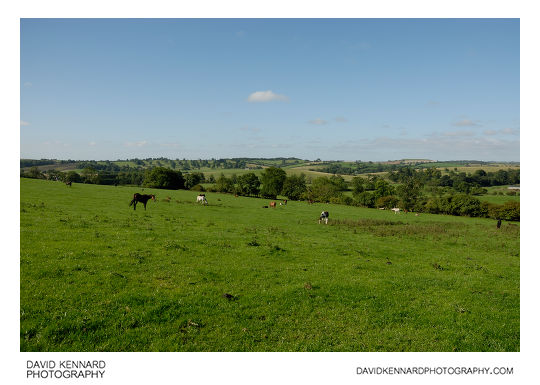
Horses in field, Withcote Hall Stud from http://www.davidkennardphotography.com
Horses rest in a field making up part of Withcote Hall Stud in Leicestershire, UK.
Date taken: 2010-08-30 09:39:04
Más sobre Horses in field, Withcote Hall Stud
368: Horses in field, Withcote Hall Stud
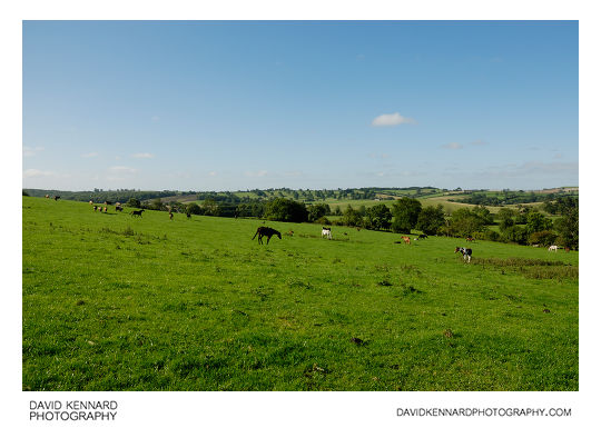
Horses in field, Withcote Hall Stud from http://www.davidkennardphotography.com
Horses rest in a field making up part of Withcote Hall Stud in Leicestershire, UK.
Date taken: 2010-08-30 09:39:10
Más sobre Horses in field, Withcote Hall Stud
369: Horses in field, Withcote Hall Stud
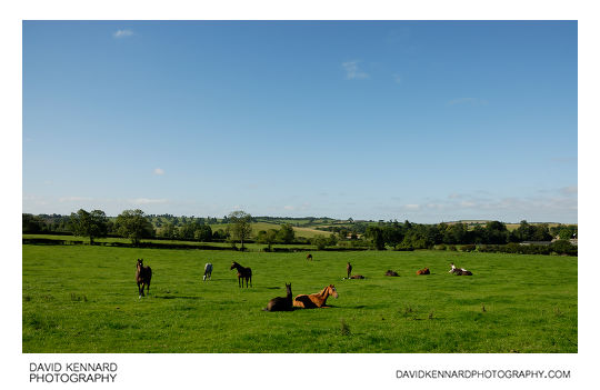
Horses in field, Withcote Hall Stud from http://www.davidkennardphotography.com
Horses rest in a field making up part of Withcote Hall Stud in Leicestershire, UK.
Date taken: 2010-08-30 09:42:47
Más sobre Horses in field, Withcote Hall Stud
370: Grassy field, Withcote
Grassy field, Withcote from http://www.davidkennardphotography.com
Looking southwest across a grassy field towards the farm at Withcote, Leicestershire, UK.
Date taken: 2010-08-30 09:45:38
Más sobre Grassy field, Withcote
371: Grassy field, Withcote
Grassy field, Withcote from http://www.davidkennardphotography.com
Looking south across a grassy field towards the farm at Withcote in Leicestershire, UK.
Date taken: 2010-08-30 09:51:19
Más sobre Grassy field, Withcote
372: Hay field and fluffy clouds
Hay field and fluffy clouds from http://www.davidkennardphotography.com
Looking north across a hay field between Withcote and Knossington in Leicestershire, UK
Date taken: 2010-08-30 10:01:45
Más sobre Hay field and fluffy clouds
373: Walking across a hay field
Walking across a hay field from http://www.davidkennardphotography.com
Walking across a hay field between Knossington and Withcote in Leicestershire, UK.
Date taken: 2010-08-30 10:02:47
Más sobre Walking across a hay field
374: Grassy field
Grassy field from http://www.davidkennardphotography.com
Looking southeast across a hay field between Knossington and Withcote in Leicestershire, UK.
Date taken: 2010-08-30 10:04:53
Más sobre Grassy field
375: Footprints in grass
Footprints in grass from http://www.davidkennardphotography.com
Footprints in the long grass of a hay field between Knossington and Withcote in Leicestershire, UK.
Date taken: 2010-08-30 10:05:50
Más sobre Footprints in grass
376: Lush green field
Lush green field from http://www.davidkennardphotography.com
Looking west across a lush green field of grass and clover between Knossington and Withcote in Leicestershire, UK.
Date taken: 2010-08-30 10:09:39
Más sobre Lush green field
377: Tree in hay field
Tree in hay field from http://www.davidkennardphotography.com
A large tree stands alone in the middle of a hay field between Knossington and Withcote, Leicestershire, UK.
Date taken: 2010-08-30 10:12:37
Más sobre Tree in hay field
378: Tree in hay field
Tree in hay field from http://www.davidkennardphotography.com
A large tree stands alone in the middle of a hay field between Knossington and Withcote, Leicestershire, UK.
Date taken: 2010-08-30 10:12:51
Más sobre Tree in hay field
379: Trough in field of sheep
Trough in field of sheep from http://www.davidkennardphotography.com
Looking south across a field of sheep between Knossington and Withcote in Leicestershire, UK.
Date taken: 2010-08-30 10:50:18
Más sobre Trough in field of sheep
380: Bulls in field, Withcote Hall Stud
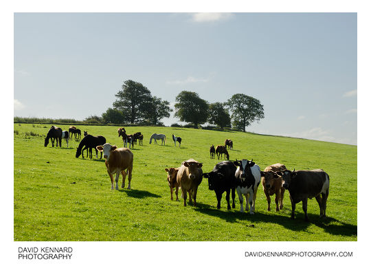
Bulls in field, Withcote Hall Stud from http://www.davidkennardphotography.com
Bulls and horses mix in a field making up part of Withcote Hall Stud in Leicestershire, UK.
Date taken: 2010-08-30 09:41:12
Más sobre Bulls in field, Withcote Hall Stud
381: Trough in field of sheep
Trough in field of sheep from http://www.davidkennardphotography.com
Looking south across a field of sheep between Knossington and Withcote in Leicestershire, UK.
Date taken: 2010-08-30 10:50:39
Más sobre Trough in field of sheep
382: Plough in shed
Plough in shed from http://www.davidkennardphotography.com
A piece of farm equipment used for ploughing fields is stored in a shed between Knossington and Withcote in Leicestershire, UK.
Date taken: 2010-08-30 10:57:09
Más sobre Plough in shed
383: Farm track
Farm track from http://www.davidkennardphotography.com
Looking south down a farm track that runs alongside a field located about half way between the villages of Knossington and Withcote in Leicestershire, UK.
Date taken: 2010-08-30 10:58:06
Más sobre Farm track
384: Farm track
Farm track from http://www.davidkennardphotography.com
Looking south down a farm track that runs alongside a field located about half way between the villages of Knossington and Withcote in Leicestershire, UK.
Date taken: 2010-08-30 10:58:47
Más sobre Farm track
385: Track and Pea field
Track and Pea field from http://www.davidkennardphotography.com
Looking north down a track that runs alongside a field of peas ready for harvesting, between Knossington and Withcote in Leicestershire, UK.
Date taken: 2010-08-30 10:59:54
Más sobre Track and Pea field
386: Track and Pea field
Track and Pea field from http://www.davidkennardphotography.com
Looking north down a track that runs alongside a field of peas ready for harvesting, between Knossington and Withcote in Leicestershire, UK.
Date taken: 2010-08-30 11:00:49
Más sobre Track and Pea field
387: Track and Pea field
Track and Pea field from http://www.davidkennardphotography.com
Looking north down a track that runs alongside a field of peas ready for harvesting, between Knossington and Withcote in Leicestershire, UK.
Date taken: 2010-08-30 11:01:18
Más sobre Track and Pea field
388: Horse-jump log
Horse-jump log from http://www.davidkennardphotography.com
A log sits at the top of a field used for Horse jumping practice near Withcote, Leicestershire, UK.
Date taken: 2010-08-30 11:14:52
Más sobre Horse-jump log
389: Field of maize entrance, Wycomb
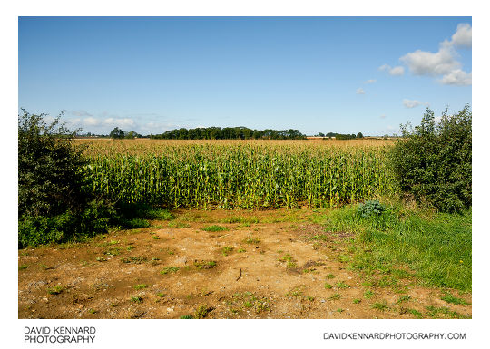
Field of maize entrance, Wycomb from http://www.davidkennardphotography.com
Looking west across a field of maize from Wycomb Lane, near Wycomb, Leicestershire, UK.
From Wikipedia (http://en.wikipedia.org/wiki/Maize):
Maize (Zea mays L. ssp. mays, which is known in many English-speaking countries as corn) is a grass domesticated by indigenous peoples in Mesoamerica in prehistoric times. The Aztecs and Mayans cultivated it in numerous varieties throughout central and southern Mexico, to cook or grind in a process called nixtamalization. Later the crop spread through much of the Americas. Between 1250 A.D. and 1700 A.D. nearly the whole continent had gained access to the crop. Any significant or dense populations in the region developed a great trade network based on surplus and varieties of maize crops. After European contact with the Americas in the late 15th and early 16th centuries, explorers and traders carried maize back to Europe and introduced it to other countries through trade. Its ability to grow in distinct climates, and its use were highly valued, thus spreading to the rest of the world.
Date taken: 2010-09-17 10:41:57
Más sobre Field of maize entrance, Wycomb
390: Field of maize, Wycomb
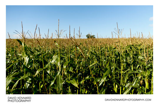
Field of maize, Wycomb from http://www.davidkennardphotography.com
Looking west across a field of maize from Wycomb Lane, near Wycomb, Leicestershire, UK.
From Wikipedia (http://en.wikipedia.org/wiki/Maize):
Maize (Zea mays L. ssp. mays, which is known in many English-speaking countries as corn) is a grass domesticated by indigenous peoples in Mesoamerica in prehistoric times. The Aztecs and Mayans cultivated it in numerous varieties throughout central and southern Mexico, to cook or grind in a process called nixtamalization. Later the crop spread through much of the Americas. Between 1250 A.D. and 1700 A.D. nearly the whole continent had gained access to the crop. Any significant or dense populations in the region developed a great trade network based on surplus and varieties of maize crops. After European contact with the Americas in the late 15th and early 16th centuries, explorers and traders carried maize back to Europe and introduced it to other countries through trade. Its ability to grow in distinct climates, and its use were highly valued, thus spreading to the rest of the world.
The apex of the stem ends in the tassel, an inflorescence of male flowers. When the tassel is mature and conditions are suitably warm and dry, anthers on the tassel dehisce and release pollen. Maize pollen is anemophilous (dispersed by wind) and because of its large settling velocity most pollen falls within a few meters of the tassel. Each silk may become pollinated to produce one kernel of maize. Young ears can be consumed raw, with the cob and silk, but as the plant matures (usually during the summer months) the cob becomes tougher and the silk dries to inedibility. By the end of the growing season, the kernels dry out and become difficult to chew without cooking them tender first in boiling water. Modern farming techniques in developed countries usually rely on dense planting, which produces one large ear per stalk.
Date taken: 2010-09-17 10:44:40
Más sobre Field of maize, Wycomb
391: Maize field and blue sky
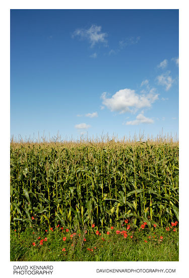
Maize field and blue sky from http://www.davidkennardphotography.com
Red field poppies grow at the edge of a field of maize near Wycomb, in Leicestershire, UK. The bright blue colour of the autumn sky contrasts with the green of the maize plants below.
From Wikipedia (http://en.wikipedia.org/wiki/Maize):
Maize (Zea mays L. ssp. mays, which is known in many English-speaking countries as corn) is a grass domesticated by indigenous peoples in Mesoamerica in prehistoric times. The Aztecs and Mayans cultivated it in numerous varieties throughout central and southern Mexico, to cook or grind in a process called nixtamalization. Later the crop spread through much of the Americas. Between 1250 A.D. and 1700 A.D. nearly the whole continent had gained access to the crop. Any significant or dense populations in the region developed a great trade network based on surplus and varieties of maize crops. After European contact with the Americas in the late 15th and early 16th centuries, explorers and traders carried maize back to Europe and introduced it to other countries through trade. Its ability to grow in distinct climates, and its use were highly valued, thus spreading to the rest of the world.
The apex of the stem ends in the tassel, an inflorescence of male flowers. When the tassel is mature and conditions are suitably warm and dry, anthers on the tassel dehisce and release pollen. Maize pollen is anemophilous (dispersed by wind) and because of its large settling velocity most pollen falls within a few meters of the tassel. Each silk may become pollinated to produce one kernel of maize. Young ears can be consumed raw, with the cob and silk, but as the plant matures (usually during the summer months) the cob becomes tougher and the silk dries to inedibility. By the end of the growing season, the kernels dry out and become difficult to chew without cooking them tender first in boiling water. Modern farming techniques in developed countries usually rely on dense planting, which produces one large ear per stalk.
Date taken: 2010-09-17 10:46:15
Más sobre Maize field and blue sky
392: Manure piles, Wycomb
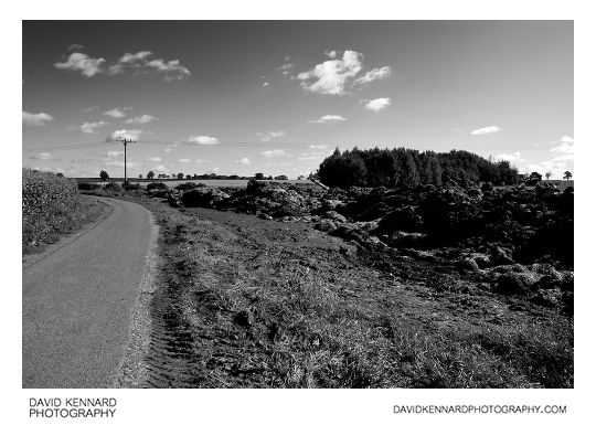
Manure piles, Wycomb from http://www.davidkennardphotography.com
Large piles of manure are stacked in an area on the edge of Wycomb Lane, near Wycomb, Leicestershire, UK.
Date taken: 2010-09-17 10:46:53
Más sobre Manure piles, Wycomb
393: Footpath through maize field, Wycomb
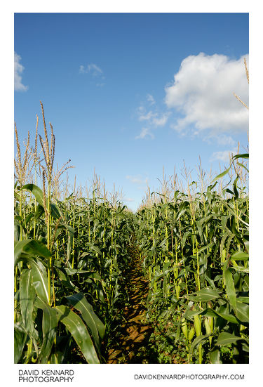
Footpath through maize field, Wycomb from http://www.davidkennardphotography.com
Looking north-west along the footpath across a field of maize, near Wycomb, Leicestershire, UK.
From Wikipedia (http://en.wikipedia.org/wiki/Maize):
Maize (Zea mays L. ssp. mays, which is known in many English-speaking countries as corn) is a grass domesticated by indigenous peoples in Mesoamerica in prehistoric times. The Aztecs and Mayans cultivated it in numerous varieties throughout central and southern Mexico, to cook or grind in a process called nixtamalization. Later the crop spread through much of the Americas. Between 1250 A.D. and 1700 A.D. nearly the whole continent had gained access to the crop. Any significant or dense populations in the region developed a great trade network based on surplus and varieties of maize crops. After European contact with the Americas in the late 15th and early 16th centuries, explorers and traders carried maize back to Europe and introduced it to other countries through trade. Its ability to grow in distinct climates, and its use were highly valued, thus spreading to the rest of the world.
The apex of the stem ends in the tassel, an inflorescence of male flowers. When the tassel is mature and conditions are suitably warm and dry, anthers on the tassel dehisce and release pollen. Maize pollen is anemophilous (dispersed by wind) and because of its large settling velocity most pollen falls within a few meters of the tassel. Each silk may become pollinated to produce one kernel of maize. Young ears can be consumed raw, with the cob and silk, but as the plant matures (usually during the summer months) the cob becomes tougher and the silk dries to inedibility. By the end of the growing season, the kernels dry out and become difficult to chew without cooking them tender first in boiling water. Modern farming techniques in developed countries usually rely on dense planting, which produces one large ear per stalk.
Date taken: 2010-09-17 10:49:44
Más sobre Footpath through maize field, Wycomb
394: Footpath across maize field, Wycomb
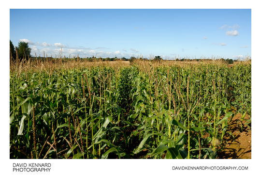
Footpath across maize field, Wycomb from http://www.davidkennardphotography.com
Looking north-west along the footpath through a field of maize, near Wycomb, Leicestershire, UK.
From Wikipedia (http://en.wikipedia.org/wiki/Maize):
Maize (Zea mays L. ssp. mays, which is known in many English-speaking countries as corn) is a grass domesticated by indigenous peoples in Mesoamerica in prehistoric times. The Aztecs and Mayans cultivated it in numerous varieties throughout central and southern Mexico, to cook or grind in a process called nixtamalization. Later the crop spread through much of the Americas. Between 1250 A.D. and 1700 A.D. nearly the whole continent had gained access to the crop. Any significant or dense populations in the region developed a great trade network based on surplus and varieties of maize crops. After European contact with the Americas in the late 15th and early 16th centuries, explorers and traders carried maize back to Europe and introduced it to other countries through trade. Its ability to grow in distinct climates, and its use were highly valued, thus spreading to the rest of the world.
The apex of the stem ends in the tassel, an inflorescence of male flowers. When the tassel is mature and conditions are suitably warm and dry, anthers on the tassel dehisce and release pollen. Maize pollen is anemophilous (dispersed by wind) and because of its large settling velocity most pollen falls within a few meters of the tassel. Each silk may become pollinated to produce one kernel of maize. Young ears can be consumed raw, with the cob and silk, but as the plant matures (usually during the summer months) the cob becomes tougher and the silk dries to inedibility. By the end of the growing season, the kernels dry out and become difficult to chew without cooking them tender first in boiling water. Modern farming techniques in developed countries usually rely on dense planting, which produces one large ear per stalk.
Date taken: 2010-09-17 10:50:45
Más sobre Footpath across maize field, Wycomb
395: Footpath through maize field, Wycomb
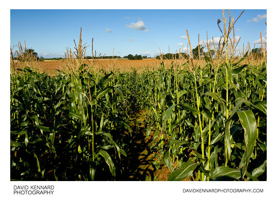
Footpath through maize field, Wycomb from http://www.davidkennardphotography.com
Looking north-west down the footpath through a field of maize, near Wycomb, Leicestershire, UK.
From Wikipedia (http://en.wikipedia.org/wiki/Maize):
Maize (Zea mays L. ssp. mays, which is known in many English-speaking countries as corn) is a grass domesticated by indigenous peoples in Mesoamerica in prehistoric times. The Aztecs and Mayans cultivated it in numerous varieties throughout central and southern Mexico, to cook or grind in a process called nixtamalization. Later the crop spread through much of the Americas. Between 1250 A.D. and 1700 A.D. nearly the whole continent had gained access to the crop. Any significant or dense populations in the region developed a great trade network based on surplus and varieties of maize crops. After European contact with the Americas in the late 15th and early 16th centuries, explorers and traders carried maize back to Europe and introduced it to other countries through trade. Its ability to grow in distinct climates, and its use were highly valued, thus spreading to the rest of the world.
The apex of the stem ends in the tassel, an inflorescence of male flowers. When the tassel is mature and conditions are suitably warm and dry, anthers on the tassel dehisce and release pollen. Maize pollen is anemophilous (dispersed by wind) and because of its large settling velocity most pollen falls within a few meters of the tassel. Each silk may become pollinated to produce one kernel of maize. Young ears can be consumed raw, with the cob and silk, but as the plant matures (usually during the summer months) the cob becomes tougher and the silk dries to inedibility. By the end of the growing season, the kernels dry out and become difficult to chew without cooking them tender first in boiling water. Modern farming techniques in developed countries usually rely on dense planting, which produces one large ear per stalk.
Date taken: 2010-09-17 10:51:51
Más sobre Footpath through maize field, Wycomb
396: Fishing in Infrared, Corby Boating Lake
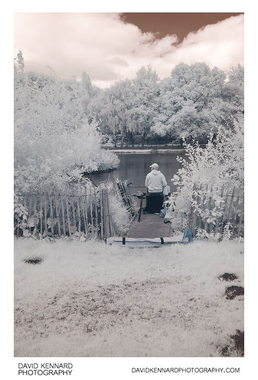
Fishing in Infrared, Corby Boating Lake from http://www.davidkennardphotography.com
An infrared photo of a man fishing at Corby Boating Lake, located in a large park in central Corby, Northamptonshire, UK. The lake is a popular spot with fishers, with many fishing spots located around the lake edge.
Corby Boating Lake is also a popular spot with families who come to feed and admire the ducks and geese. There are also gulls, herons, kingfishers and various other garden and woodland birds that visit the lake and surrounding area.
Date taken: 2010-09-25 12:54:37
Más sobre Fishing in Infrared, Corby Boating Lake
397: Fishing at Corby Boating Lake in Infrared
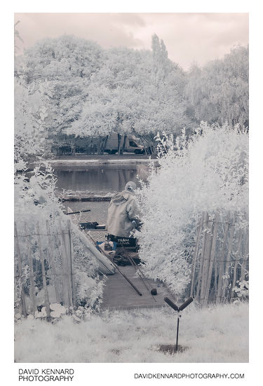
Fishing at Corby Boating Lake in Infrared from http://www.davidkennardphotography.com
An infrared photo of a man fishing at Corby Boating Lake, in central Corby, Northamptonshire, UK. The lake has many fishing spots located around the edge, making it a popular spot with fishers.
Date taken: 2010-09-25 12:55:00
Más sobre Fishing at Corby Boating Lake in Infrared
398: Greylag geese on Corby Boating Lake in Infrared
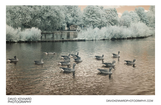
Greylag geese on Corby Boating Lake in Infrared from http://www.davidkennardphotography.com
An infrared photo of Greylag geese (Anser anser) on Corby Boating Lake in central Corby, Northamptonshire, UK.
Corby Boating Lake is a popular spot with families who come to feed and admire the ducks and geese. There are also gulls, herons, kingfishers and various other garden and woodland birds that visit the lake and surrounding area.
Date taken: 2010-09-25 12:56:04
Más sobre Greylag geese on Corby Boating Lake in Infrared
399: Corby Boating Lake in Infrared
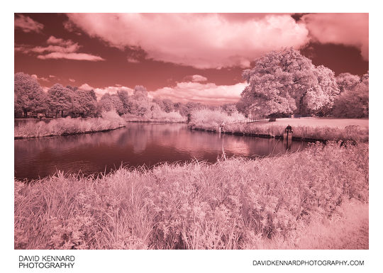
Corby Boating Lake in Infrared from http://www.davidkennardphotography.com
Looking north across Corby Boating Lake in central Corby, Northamptonshire, UK. The Lake, constructed in the early 1970's, is a boating lake only by name, but is a popular spot with both fishers and families who come to feed and admire the ducks and geese.
This photograph was taken using an Infrared filter, capturing light in the 720-1000nm range.
Date taken: 2010-09-25 13:03:46
Más sobre Corby Boating Lake in Infrared
400: Corby Boating Lake in Infrared
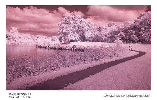
Corby Boating Lake in Infrared from http://www.davidkennardphotography.com
Looking north across Corby Boating Lake in central Corby, Northamptonshire, UK. Constructed in the early 1970's, Corby Boating Lake is a boating lake only by name, but is a popular spot for fishing and also families who come to feed and admire the ducks and geese.
This photograph was taken using an Infrared filter, capturing light in the 720-1000nm range.
Date taken: 2010-09-25 13:18:39
Más sobre Corby Boating Lake in Infrared
401: Trees in Infrared at Corby Boating Lake
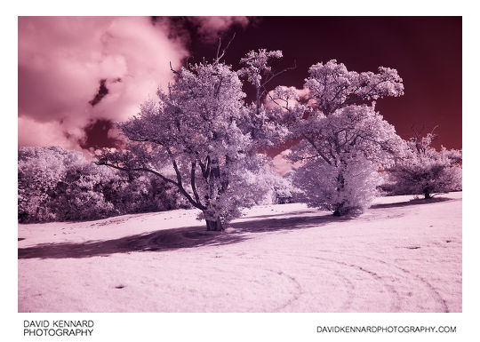
Trees in Infrared at Corby Boating Lake from http://www.davidkennardphotography.com
An infrared photo of trees near Corby Boating Lake in central Corby, Northamptonshire, UK. The photograph was taken using an Infrared filter, capturing light in the 720-1000nm range.
Corby Boating Lake is a popular spot for both fishing and families who come to feed and admire the ducks and geese. The lake was constructed in the 1970's, but is no longer used as a boating lake today, other than by the Corby Model Boat Club, who meet there once a week.
Date taken: 2010-09-25 13:19:29
Más sobre Trees in Infrared at Corby Boating Lake
402: Corby Boating Lake in Infrared
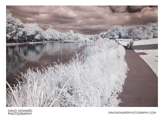
Corby Boating Lake in Infrared from http://www.davidkennardphotography.com
Looking northeast across Corby Boating Lake in central Corby, Northamptonshire, UK. The photograph was taken using an Infrared filter, capturing light in the 720-1000nm range.
Corby Boating Lake is a popular spot for both fishing and families who come to feed and admire the ducks and geese. The lake was constructed in the 1970's, but is no longer used as a boating lake today, other than by the Corby Model Boat Club, who meet there once a week.
Date taken: 2010-09-25 13:20:42
Más sobre Corby Boating Lake in Infrared
403: Greylag Geese at Corby Boating Lake in Infrared
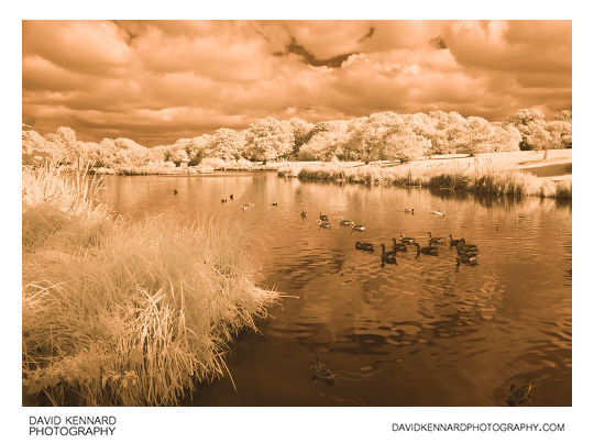
Greylag Geese at Corby Boating Lake in Infrared from http://www.davidkennardphotography.com
Looking northeast across Corby Boating Lake, Greylag geese (Anser anser) and other waterfowl enjoy the lake. The lake, located in central Corby, Northamptonshire, UK, is a popular spot for both fishing, and with families who come to feed and admire the ducks and geese.
This photograph was taken using an Infrared filter, capturing light in the 720-1000nm range, which is invisible to the human eye.
Date taken: 2010-09-25 13:22:19
Más sobre Greylag Geese at Corby Boating Lake in Infrared
404: Western side of Corby Boating Lake in Infrared
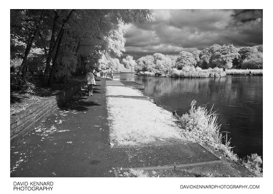
Western side of Corby Boating Lake in Infrared from http://www.davidkennardphotography.com
Looking northeast up the path on the western side of Corby Boating Lake, in central Corby, Northamptonshire, UK. The photograph was taken using an Infrared filter, capturing light in the 720-1000nm range, which is invisible to the human eye.
Corby Boating Lake is a popular spot for fishing, and also with families who come to feed and admire the ducks and geese. The lake was constructed in the 1970's, but is no longer used as a boating lake, other than by the Corby Model Boat Club, who meet there once a week.
Date taken: 2010-09-25 13:24:07
Más sobre Western side of Corby Boating Lake in Infrared
405: Corby Boating Lake in Infrared
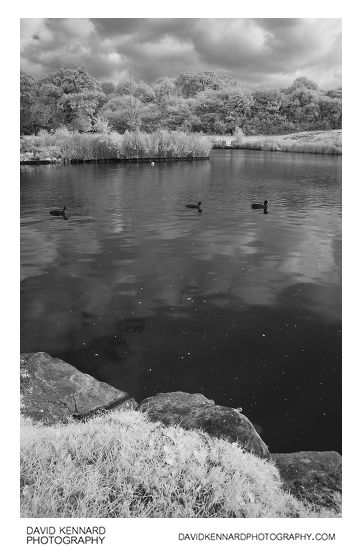
Corby Boating Lake in Infrared from http://www.davidkennardphotography.com
Looking east over Corby Boating Lake, in central Corby, Northamptonshire, UK. The photograph was taken using an Infrared filter, capturing light in the 720-1000nm range, which is invisible to the human eye.
Corby Boating Lake is a popular spot with families who come to feed and admire the waterfowl and other wildlife. The lake is also very popular for recreational fishing, with a number of points around the lake specially built for fishing from.
Date taken: 2010-09-25 13:25:01
Más sobre Corby Boating Lake in Infrared
406: Juvenile Swans at Corby Boating Lake in IR
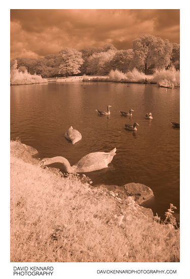
Juvenile Swans at Corby Boating Lake in IR from http://www.davidkennardphotography.com
Juvenile Mute swans (Cygnus olor) and Greylag geese (Anser anser) enjoy Corby Boating Lake in central Corby, Northamptonshire, UK. The photograph was taken using Infrared light in the 720-1000nm range, which is invisible to the human eye.
Corby Boating Lake is a popular spot with families who come to feed and admire the waterfowl and other wildlife. The lake was constructed in the 1970's, but is no longer used as a boating lake, other than by the Corby Model Boat Club, who meet there once a week.
Date taken: 2010-09-25 13:26:29
Más sobre Juvenile Swans at Corby Boating Lake in IR
407: Juvenile Swans at Corby Boating Lake in IR
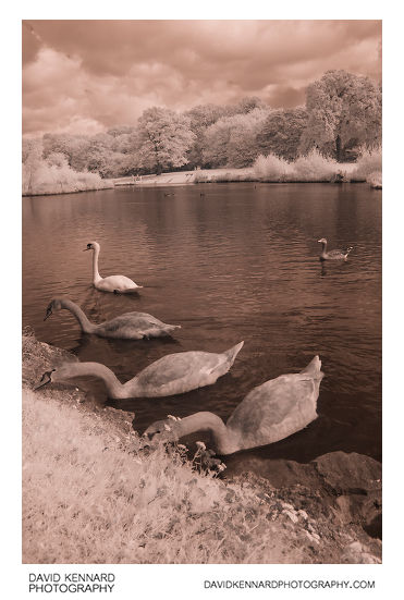
Juvenile Swans at Corby Boating Lake in IR from http://www.davidkennardphotography.com
Juvenile Swans eat plants from the edge of Corby Boating Lake in central Corby, Northamptonshire, UK. The photograph was taken using Infrared light in the 720-1000nm range, invisible to the human eye.
Corby Boating Lake is a popular spot with families who come to feed and admire the waterfowl and other wildlife. The lake is also very popular for recreational fishing, with a number of points around the lake specially built for fishing from.
Date taken: 2010-09-25 13:26:54
Más sobre Juvenile Swans at Corby Boating Lake in IR
408: Juvenile Swans at Corby Boating Lake in IR
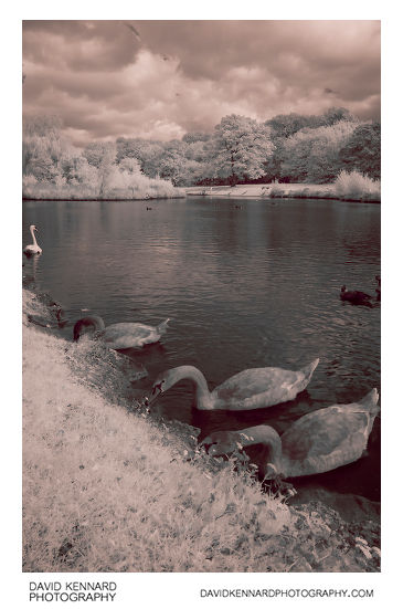
Juvenile Swans at Corby Boating Lake in IR from http://www.davidkennardphotography.com
Juvenile Swans eat plants from the edge of Corby Boating Lake in central Corby, Northamptonshire, UK. The photograph was taken using Infrared light in the 720-1000nm range, invisible to the human eye.
Corby Boating Lake is a popular spot with families who come to feed and admire the waterfowl and other wildlife. The lake is also very popular for recreational fishing, with a number of points around the lake specially built for fishing from.
Date taken: 2010-09-25 13:27:09
Más sobre Juvenile Swans at Corby Boating Lake in IR
409: Corby Boating Lake
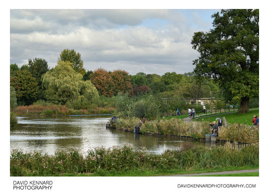
Corby Boating Lake from http://www.davidkennardphotography.com
Looking northeast across Corby Boating Lake in central Corby, Northamptonshire, UK.
Corby Boating Lake is a popular spot for both fishing and families who come to feed and admire the ducks and geese. The lake was constructed in the 1970's, but is no longer used as a boating lake today, other than by the Corby Model Boat Club, who meet there once a week.
Date taken: 2010-09-25 13:17:48
Más sobre Corby Boating Lake
410: Large cloud at sunset
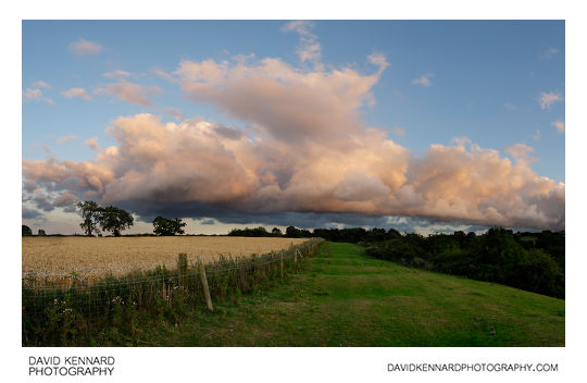
Large cloud at sunset from http://www.davidkennardphotography.com
A large nimbus cloud floats above a hill near East Farndon in Northamptonshire, UK. The cloud is lit up a slightly pinkish colour by the setting sun, which was below the horizon.
Date taken: 2010-08-10 20:24:18
Más sobre Large cloud at sunset
411: Fields to the east of East Farndon
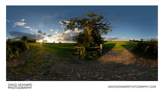
Fields to the east of East Farndon from http://www.davidkennardphotography.com
360 panorama looking through the gateway between two fields to the east of East Farndon, Northamptonshire, UK as the sun sets in the distance.
Date taken: 2010-08-10 19:53:11
Más sobre Fields to the east of East Farndon
412: View from hill at Sunset
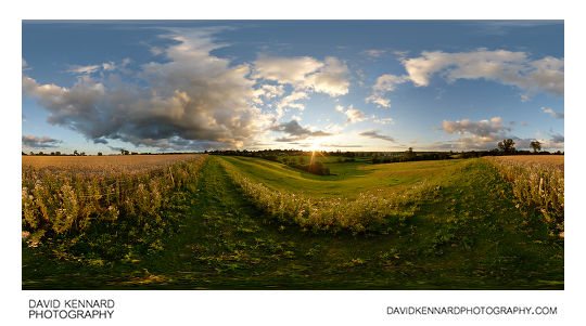
View from hill at Sunset from http://www.davidkennardphotography.com
Looking across a small valley to the east of East Farndon, Nothamptonshire, UK, at sunset. Ridges can clearly be seen on the valley slope below, a remnant of the medieval ridge and furrow ploughing technique.
Date taken: 2010-08-10 20:07:54
Más sobre View from hill at Sunset
413: Sunset from the top of small valley near East Farndon
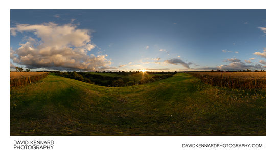
Sunset from the top of small valley near East Farndon from http://www.davidkennardphotography.com
A modern wheat field occupies an old ridge and furrow field at the top of a small valley to the east of East Farndon in Northamptonshire, England. The remains of the medieval ridge and furrow ploughing pattern can be seen in the grass humps outside the wheat field.
Date taken: 2010-08-10 20:16:27
Más sobre Sunset from the top of small valley near East Farndon
414: Lubenham Road, East Farndon at twilight
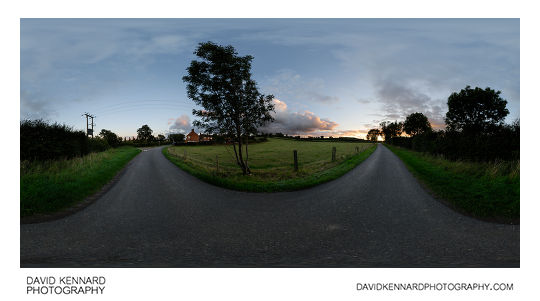
Lubenham Road, East Farndon at twilight from http://www.davidkennardphotography.com
360° panorama of Lubenham Road in East Farndon, Northamptonshire, UK. The narrow road connects the village of East Farndon to Lubenham while bypassing the town of Market Harborough.
Date taken: 2010-08-23 20:06:18
Más sobre Lubenham Road, East Farndon at twilight
415: Lubenham Road, East Farndon at twilight
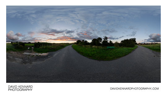
Lubenham Road, East Farndon at twilight from http://www.davidkennardphotography.com
360° panorama of Lubenham Road in East Farndon, Northamptonshire, UK. The narrow road connects the village of East Farndon to Lubenham while bypassing the town of Market Harborough.
Date taken: 2010-08-23 20:11:16
Más sobre Lubenham Road, East Farndon at twilight
416: Cattle grazing at twilight
Cattle grazing at twilight from http://www.davidkennardphotography.com
Cattle graze in a field between Lubenham, Market harborough, and East Farndon shortly after sunset.
From Wikipedia (http://en.wikipedia.org/wiki/Cattle):
Cattle (colloquially cows) are the most common type of large domesticated ungulates. They are a prominent modern member of the subfamily Bovinae, are the most widespread species of the genus Bos, and are most commonly classified collectively as Bos primigenius. Cattle are raised as livestock for meat (beef and veal), as dairy animals for milk and other dairy products, and as draft animals (pulling carts, plows and the like). Other products include leather and dung for manure or fuel. In some countries, such as India, cattle are sacred. It is estimated that there are 1.3 billion cattle in the world today. In 2009, cattle became the first livestock animal to have its genome mapped.
Date taken: 2010-08-23 20:18:32
Más sobre Cattle grazing at twilight
417: Bull grazing at twilight
Bull grazing at twilight from http://www.davidkennardphotography.com
A grazing bull is silhouetted against the twilight sky in a field between Lubenham, Market harborough, and East Farndon.
From Wikipedia (http://en.wikipedia.org/wiki/Cattle):
Cattle (colloquially cows) are the most common type of large domesticated ungulates. They are a prominent modern member of the subfamily Bovinae, are the most widespread species of the genus Bos, and are most commonly classified collectively as Bos primigenius. Cattle are raised as livestock for meat (beef and veal), as dairy animals for milk and other dairy products, and as draft animals (pulling carts, plows and the like). Other products include leather and dung for manure or fuel. In some countries, such as India, cattle are sacred. It is estimated that there are 1.3 billion cattle in the world today. In 2009, cattle became the first livestock animal to have its genome mapped.
Date taken: 2010-08-23 20:19:34
Más sobre Bull grazing at twilight
418: Tree silhouttes at twilight
Tree silhouttes at twilight from http://www.davidkennardphotography.com
A row of trees are silhouetted against the twilight sky, between Lubenham, East Farndon, and Market Harborough.
Date taken: 2010-08-23 20:25:16
Más sobre Tree silhouttes at twilight
419: Tree silhouttes at twilight
Tree silhouttes at twilight from http://www.davidkennardphotography.com
A row of trees are silhouetted against the twilight sky, between Lubenham, East Farndon, and Market Harborough.
Date taken: 2010-08-23 20:26:25
Más sobre Tree silhouttes at twilight
420: Old building at Welford Reservoir
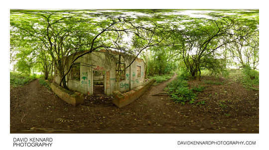
Old building at Welford Reservoir from http://www.davidkennardphotography.com
An old building in a wooded area on the northeast corner of Welford reservoir. The building has been out of use for quite some time, now being overgrown with trees and daubed with graffiti. Inside the building can be seen some large tanks.
Welford Reservoir is located near the town of Welford, and provides water to the Welford arm of the Grand Union Canal.
Date taken: 2010-09-04 12:19:16
Más sobre Old building at Welford Reservoir
421: Gentleman's Cottage Garden, Barnsdale Gardens

Gentleman's Cottage Garden, Barnsdale Gardens from http://www.davidkennardphotography.com
The Gentleman's Cottage Garden in Barnsdale Gardens, Rutland, UK. The garden was built for the BBC TV series "Geoff Hamilton's Cottage Gardens", and was created as an example of how to deal with a garden that is wider than it is long. In 1995 the Gentleman's Cottage Garden was recreated as the main feature garden at the Gardeners' World Live Exhibition.
From Wikipedia (http://en.wikipedia.org/wiki/Barnsdale_Gardens):
Barnsdale Gardens in Rutland, England were made famous by Geoff Hamilton through the BBC television series Gardeners' World which he presented from 1979 until his death in 1996. They are situated on The Avenue in the parish of Exton, a short distance north of Rutland Water.
Geoff Hamilton began developing the garden in 1983 from what was then a ploughed field. It now covers 8 acres (3.2 ha), comprising 37 individual gardens and features.
Date taken: 2010-07-29 10:36:55
Más sobre Gentleman's Cottage Garden, Barnsdale Gardens
422: Artisan's Cottage Garden, Barnsdale Gardens
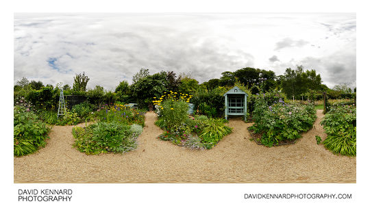
Artisan's Cottage Garden, Barnsdale Gardens from http://www.davidkennardphotography.com
The Artisan's Cottage Garden in Barnsdale Gardens, Rutland, UK. The garden was built for the BBC TV series "Geoff Hamilton's Cottage Gardens", and was created on a minimal budget. The Artisan's Cottage Garden is designed with the features being easy to build yourself and the plants selected to be easy to grow and propagate.
From Wikipedia (http://en.wikipedia.org/wiki/Barnsdale_Gardens):
Barnsdale Gardens in Rutland, England were made famous by Geoff Hamilton through the BBC television series Gardeners' World which he presented from 1979 until his death in 1996. They are situated on The Avenue in the parish of Exton, a short distance north of Rutland Water.
Geoff Hamilton began developing the garden in 1983 from what was then a ploughed field. It now covers 8 acres (3.2 ha), comprising 37 individual gardens and features.
Date taken: 2010-07-29 10:29:56
Más sobre Artisan's Cottage Garden, Barnsdale Gardens
423: Flowers in the centre of the Gentleman's Cottage Garden
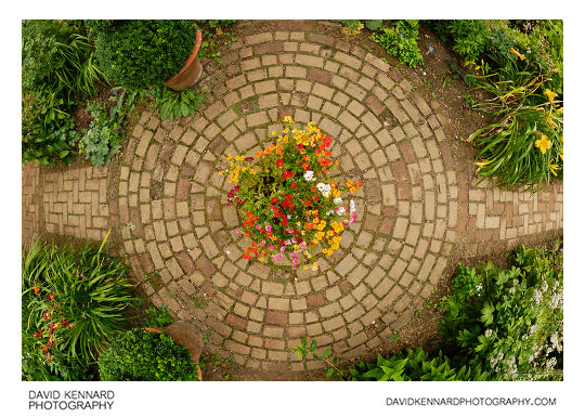
Flowers in the centre of the Gentleman's Cottage Garden from http://www.davidkennardphotography.com
The Gentleman's Cottage Garden in Barnsdale Gardens, Rutland, UK. The garden was built for the BBC TV series "Geoff Hamilton's Cottage Gardens", and was created as an example of how to deal with a garden that is wider than it is long. In 1995 the Gentleman's Cottage Garden was recreated as the main feature garden at the Gardeners' World Live Exhibition.
From Wikipedia (http://en.wikipedia.org/wiki/Barnsdale_Gardens):
Barnsdale Gardens in Rutland, England were made famous by Geoff Hamilton through the BBC television series Gardeners' World which he presented from 1979 until his death in 1996. They are situated on The Avenue in the parish of Exton, a short distance north of Rutland Water.
Geoff Hamilton began developing the garden in 1983 from what was then a ploughed field. It now covers 8 acres (3.2 ha), comprising 37 individual gardens and features.
Date taken: 2010-07-29 10:36:55
Más sobre Flowers in the centre of the Gentleman's Cottage Garden
424: Hosta and Penstemon Beds, Barnsdale Gardens
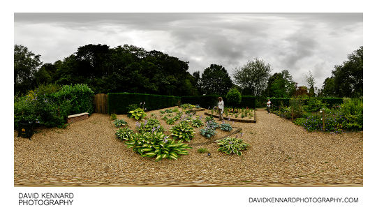
Hosta and Penstemon Beds, Barnsdale Gardens from http://www.davidkennardphotography.com
The Hosta and Penstemon beds in Barnsdale Gardens, Rutland, UK. The Penstemons are planted in a raised bed to allow good drainage, something that the natural heavy clay soil of Barnsdale Gardens does not provide. As well as the Penstemons, a large variety of Hosta species / cultivars are planted in the larger bed of this garden.
From Wikipedia (http://en.wikipedia.org/wiki/Barnsdale_Gardens):
Barnsdale Gardens in Rutland, England were made famous by Geoff Hamilton through the BBC television series Gardeners' World which he presented from 1979 until his death in 1996. They are situated on The Avenue in the parish of Exton, a short distance north of Rutland Water.
Geoff Hamilton began developing the garden in 1983 from what was then a ploughed field. It now covers 8 acres (3.2 ha), comprising 37 individual gardens and features.
Date taken: 2010-07-29 10:49:32
Más sobre Hosta and Penstemon Beds, Barnsdale Gardens
425: Formal Pond and Knot Garden, Barnsdale Gardens
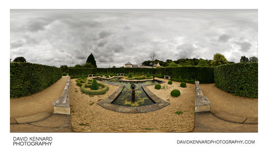
Formal Pond and Knot Garden, Barnsdale Gardens from http://www.davidkennardphotography.com
The Formal Pond and Knot Garden in Barnsdale Gardens, Rutland, UK. The garden is designed around a large pond, which features four bronze statue fountains by British artist Lily Sawtell. The small box hedging in the garden has been 'knotted', and along with the pond design and seating, gives the garden an Italian feel.
From Wikipedia (http://en.wikipedia.org/wiki/Barnsdale_Gardens):
Barnsdale Gardens in Rutland, England were made famous by Geoff Hamilton through the BBC television series Gardeners' World which he presented from 1979 until his death in 1996. They are situated on The Avenue in the parish of Exton, a short distance north of Rutland Water.
Geoff Hamilton began developing the garden in 1983 from what was then a ploughed field. It now covers 8 acres (3.2 ha), comprising 37 individual gardens and features.
Date taken: 2010-07-29 11:09:45
Más sobre Formal Pond and Knot Garden, Barnsdale Gardens
426: Ornamental Kitchen Garden, Barnsdale Gardens
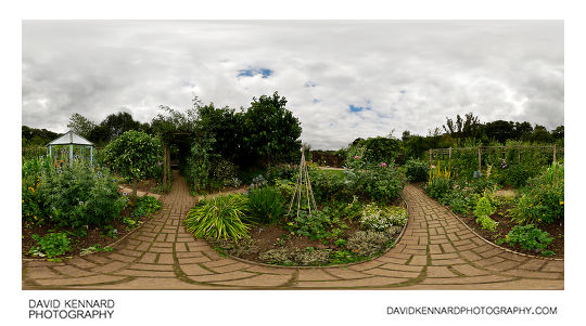
Ornamental Kitchen Garden, Barnsdale Gardens from http://www.davidkennardphotography.com
The Ornamental Kitchen Garden in Barnsdale Gardens, Rutland, UK. Originally built for the television series 'Ornamental Kitchen Garden', this garden features both vegetables and flowers growing side by side. The television series was first shown in 1990, and was made to promote the idea that fruit and vegetables have ornamental value, as well as being edible.
The plants in the Ornamental Kitchen Garden are cropped regularly, and so a well thought out planting schedule is very important. People often find it difficult to separate the ornamental and edible plants in the garden, which is testament to the design of the garden and the choice of plants made.
From Wikipedia (http://en.wikipedia.org/wiki/Barnsdale_Gardens):
Barnsdale Gardens in Rutland, England were made famous by Geoff Hamilton through the BBC television series Gardeners' World which he presented from 1979 until his death in 1996. They are situated on The Avenue in the parish of Exton, a short distance north of Rutland Water.
Geoff Hamilton began developing the garden in 1983 from what was then a ploughed field. It now covers 8 acres (3.2 ha), comprising 37 individual gardens and features.
Date taken: 2010-07-29 11:25:43
Más sobre Ornamental Kitchen Garden, Barnsdale Gardens
427: Elizabethan Vegetable Garden, Barnsdale Gardens
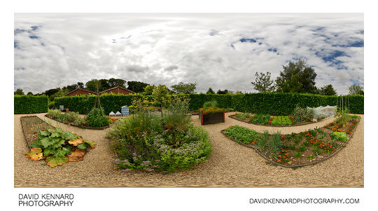
Elizabethan Vegetable Garden, Barnsdale Gardens from http://www.davidkennardphotography.com
The Elizabethan Vegetable Garden in Barnsdale Gardens, Rutland, UK. The plants in the Elizabethan Vegetable Garden are planted close together to maximise the available soil usage. Flowers are also grown alongside the vegetables, making the garden look less strictly utilitarian. All the gardening can be done from the pathways, removing the need for standing or kneeling on the soil when tending the plants.
From Wikipedia (http://en.wikipedia.org/wiki/Barnsdale_Gardens):
Barnsdale Gardens in Rutland, England were made famous by Geoff Hamilton through the BBC television series Gardeners' World which he presented from 1979 until his death in 1996. They are situated on The Avenue in the parish of Exton, a short distance north of Rutland Water.
Geoff Hamilton began developing the garden in 1983 from what was then a ploughed field. It now covers 8 acres (3.2 ha), comprising 37 individual gardens and features.
Date taken: 2010-07-29 11:53:46
Más sobre Elizabethan Vegetable Garden, Barnsdale Gardens
428: Courtyard Gardens, Barnsdale Gardens
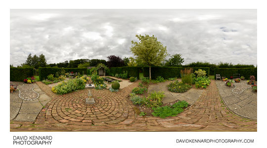
Courtyard Gardens, Barnsdale Gardens from http://www.davidkennardphotography.com
The Courtyard Gardens in Barnsdale Gardens, Rutland, UK. The Courtyard Gardens consists of 4 individual garden designs, suitable for those who only have a small back garden. Each garden features a different design, showing that don't you don't need a large space to create a beautiful garden.
From Wikipedia (http://en.wikipedia.org/wiki/Barnsdale_Gardens):
Barnsdale Gardens in Rutland, England were made famous by Geoff Hamilton through the BBC television series Gardeners' World which he presented from 1979 until his death in 1996. They are situated on The Avenue in the parish of Exton, a short distance north of Rutland Water.
Geoff Hamilton began developing the garden in 1983 from what was then a ploughed field. It now covers 8 acres (3.2 ha), comprising 37 individual gardens and features.
Date taken: 2010-07-29 11:39:29
Más sobre Courtyard Gardens, Barnsdale Gardens
429: Rock Feature, Barnsdale Gardens
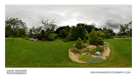
Rock Feature, Barnsdale Gardens from http://www.davidkennardphotography.com
A rock feature in Barnsdale Gardens, Rutland, UK. The rock feature was originally built for photographing alpine plants for the Gardeners' World Practical Gardening Course book. Coarse grit was mixed with the soil to create a growing environment suitable for the alpine plants.
From Wikipedia (http://en.wikipedia.org/wiki/Barnsdale_Gardens):
Barnsdale Gardens in Rutland, England were made famous by Geoff Hamilton through the BBC television series Gardeners' World which he presented from 1979 until his death in 1996. They are situated on The Avenue in the parish of Exton, a short distance north of Rutland Water.
Geoff Hamilton began developing the garden in 1983 from what was then a ploughed field. It now covers 8 acres (3.2 ha), comprising 37 individual gardens and features.
Date taken: 2010-07-29 10:18:18
Más sobre Rock Feature, Barnsdale Gardens
430: Apple Arch, Barnsdale Gardens
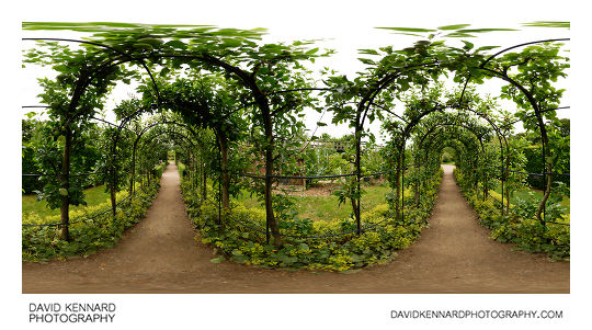
Apple Arch, Barnsdale Gardens from http://www.davidkennardphotography.com
The Apple Arch at Barnsdale Gardens in Rutland, UK. The pergola is comprised of nearly 30 varieties of apple with a few pears. The plants were planted as year old whips, and then trained over the metal arch framework.
From Wikipedia (http://en.wikipedia.org/wiki/Barnsdale_Gardens):
Barnsdale Gardens in Rutland, England were made famous by Geoff Hamilton through the BBC television series Gardeners' World which he presented from 1979 until his death in 1996. They are situated on The Avenue in the parish of Exton, a short distance north of Rutland Water.
Geoff Hamilton began developing the garden in 1983 from what was then a ploughed field. It now covers 8 acres (3.2 ha), comprising 37 individual gardens and features.
Date taken: 2010-07-29 10:25:32
Más sobre Apple Arch, Barnsdale Gardens
431: Spine acanthus (Acanthus spinosus)
.jpg)
Spine acanthus (Acanthus spinosus) from http://www.davidkennardphotography.com
Bears Breeches or the Spine acanthus (Acanthus spinosus) is a popular garden plant with large stiff flower spikes of purple hooded white flowers. It flowers between May and July, with the flowers lasting for several weeks.
Acanthus spinosus is decidous, producing large jagged dark green glossy leaves in early spring. The leaves can grow anywhere up to 90cm long. It is known for being an architectural plant, having a specific shape and form. Acanthus spinosus will grow best in partial shade with well drained fertile soil, but isn't particularly fussy.
Date taken: 2010-07-29 10:07:17
Más sobre Spine acanthus (Acanthus spinosus)
432: Spine acanthus (Acanthus spinosus)
.jpg)
Spine acanthus (Acanthus spinosus) from http://www.davidkennardphotography.com
Bears Breeches or the Spine acanthus (Acanthus spinosus) is a popular garden plant with large stiff flower spikes of purple hooded white flowers. It flowers between May and July, with the flowers lasting for several weeks.
Acanthus spinosus is decidous, producing large jagged dark green glossy leaves in early spring. The leaves can grow anywhere up to 90cm long. It is known for being an architectural plant, having a specific shape and form. Acanthus spinosus will grow best in partial shade with well drained fertile soil, but isn't particularly fussy.
Date taken: 2010-07-29 10:07:32
Más sobre Spine acanthus (Acanthus spinosus)
433: Veronicastrum virginicum 'Fascination'
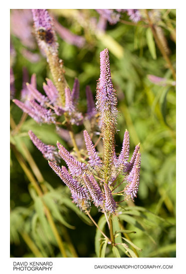
Veronicastrum virginicum 'Fascination' from http://www.davidkennardphotography.com
Veronicastrum virginicum 'Fascination' is a deciduous plant that features large spires of blue-mauve flowers from July to August. The green serrated leaves are arranged in whorls of 3-7 around the stem, with the plant growing up to 1.8m tall. Veronicastrum virginicum 'Fascination' is self-supporting (i.e. it does not need to be staked / supported), and well suited to the back of a border. It will grow best situated in fertile, moist soil, with full or partial sun, and is a popular flower with bumble bees.
Date taken: 2010-07-29 10:10:14
Más sobre Veronicastrum virginicum 'Fascination'
434: Southern Globe Thistle (Echinops ritro)
.jpg)
Southern Globe Thistle (Echinops ritro) from http://www.davidkennardphotography.com
The Southern Globe Thistle (Echinops ritro) is an architectural plant with spherical deep blue bristly flowers. The large leaves are deeply divided and provide interest until the plant flowers in late summer. Echinops ritro is ideally suited to the back of a flower border, though requiring full sun. The flowers are attractive to many insects, and the seeds attract finches and other seed-eating birds.
Date taken: 2010-07-29 10:31:29
Más sobre Southern Globe Thistle (Echinops ritro)
435: Hosta flowers
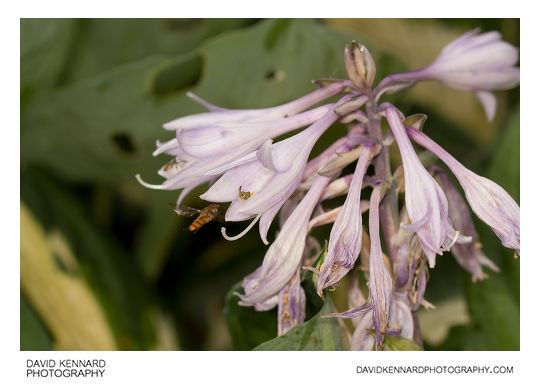
Hosta flowers from http://www.davidkennardphotography.com
Hosta is a genus of about 23–45 species of lily-like plants native to northeast Asia. They were once classified in the Liliaceae but are now included in the Agavaceae by the Angiosperm Phylogeny Group, although some taxonomists place the Hostas in their own family: Hostaceae. The scientific name is also used as the common name; in the past they were also sometimes called the Corfu Lily, the Day Lily, or the Plantain lily, but these terms are now obsolete. The name Hosta is in honor of the Austrian botanist Nicholas Thomas Host. The Japanese name Giboshi is also used in English to a small extent. The rejected generic name Funkia, also used as a common name, can be found in some older literature.
Hostas are herbaceous perennial plants, growing from rhizomes or stolons, with broad lanceolate or ovate leaves varying widely in size by species from 1–15 in (3–40 cm) long and 0.75–12 in (2–30 cm) broad. Variation among the numerous cultivars is even greater, with clumps ranging from less than 4 in (10 cm) across to more than 2.5 ft (76 cm) across. Leaf color in wild species is typically green, although some species (e.g., H. sieboldiana) are known for a glaucous waxy leaf coating that gives a blue appearance to the leaf. Some species have a glaucous white coating covering the underside of the leaves. Natural mutations of native species are known with yellow-green ("gold") colored leaves or with leaf variegation (either white/cream or yellowish edges or centers). Variegated plants very often give rise to "sports" that are the result of the reshuffling of cell layers during bud formation, producing foliage with mixed pigment sections. In seedlings variegation is generally maternally derived by chloroplast transfer and is not a genetically inheritable trait. The flowers are produced on erect scapes up to 31 in (80 cm) tall that end in terminal racemes. The individual flowers are usually pendulous, 0.75–2 in (2–5 cm) long, with six tepals, white, lavender, or violet in color and usually scentless.
Description taken from Wikipedia: http://en.wikipedia.org/wiki/Hosta
Date taken: 2010-07-29 10:45:02
Más sobre Hosta flowers
436: Hosta flowers
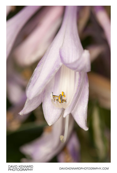
Hosta flowers from http://www.davidkennardphotography.com
Hosta is a genus of about 23–45 species of lily-like plants native to northeast Asia. They were once classified in the Liliaceae but are now included in the Agavaceae by the Angiosperm Phylogeny Group, although some taxonomists place the Hostas in their own family: Hostaceae. The scientific name is also used as the common name; in the past they were also sometimes called the Corfu Lily, the Day Lily, or the Plantain lily, but these terms are now obsolete. The name Hosta is in honor of the Austrian botanist Nicholas Thomas Host. The Japanese name Giboshi is also used in English to a small extent. The rejected generic name Funkia, also used as a common name, can be found in some older literature.
Hostas are herbaceous perennial plants, growing from rhizomes or stolons, with broad lanceolate or ovate leaves varying widely in size by species from 1–15 in (3–40 cm) long and 0.75–12 in (2–30 cm) broad. Variation among the numerous cultivars is even greater, with clumps ranging from less than 4 in (10 cm) across to more than 2.5 ft (76 cm) across. Leaf color in wild species is typically green, although some species (e.g., H. sieboldiana) are known for a glaucous waxy leaf coating that gives a blue appearance to the leaf. Some species have a glaucous white coating covering the underside of the leaves. Natural mutations of native species are known with yellow-green ("gold") colored leaves or with leaf variegation (either white/cream or yellowish edges or centers). Variegated plants very often give rise to "sports" that are the result of the reshuffling of cell layers during bud formation, producing foliage with mixed pigment sections. In seedlings variegation is generally maternally derived by chloroplast transfer and is not a genetically inheritable trait. The flowers are produced on erect scapes up to 31 in (80 cm) tall that end in terminal racemes. The individual flowers are usually pendulous, 0.75–2 in (2–5 cm) long, with six tepals, white, lavender, or violet in color and usually scentless.
Description taken from Wikipedia: http://en.wikipedia.org/wiki/Hosta
Date taken: 2010-07-29 10:45:34
Más sobre Hosta flowers
437: Penstemon 'Castle Forbes'
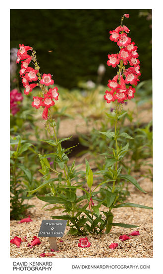
Penstemon 'Castle Forbes' from http://www.davidkennardphotography.com
Penstemon 'Castle Forbes' is a Penstemon cultivar with large white throated red flowers. It flowers from June to October and grows up to 75cm tall.
Date taken: 2010-07-29 10:53:10
Más sobre Penstemon 'Castle Forbes'
438: Penstemon 'Castle Forbes'
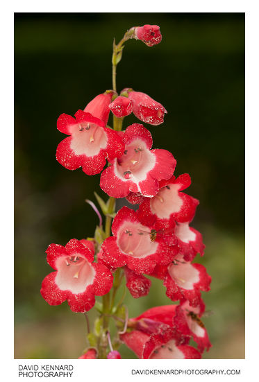
Penstemon 'Castle Forbes' from http://www.davidkennardphotography.com
Penstemon 'Castle Forbes' is a Penstemon cultivar with large white throated red flowers. It flowers from June to October and grows up to 75cm tall.
Date taken: 2010-07-29 10:53:44
Más sobre Penstemon 'Castle Forbes'
439: Penstemon 'Castle Forbes'
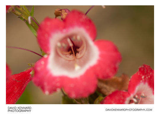
Penstemon 'Castle Forbes' from http://www.davidkennardphotography.com
Penstemon 'Castle Forbes' is a Penstemon cultivar with large white throated red flowers. It flowers from June to October and grows up to 75cm tall.
Date taken: 2010-07-29 10:54:17
Más sobre Penstemon 'Castle Forbes'
440: Penstemon 'Castle Forbes'
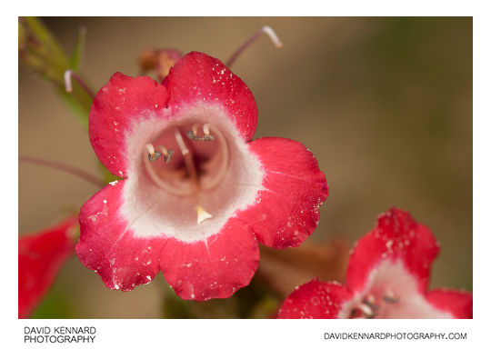
Penstemon 'Castle Forbes' from http://www.davidkennardphotography.com
Penstemon 'Castle Forbes' is a Penstemon cultivar with large white throated red flowers. It flowers from June to October and grows up to 75cm tall.
Date taken: 2010-07-29 10:54:22
Más sobre Penstemon 'Castle Forbes'
441: Pink Hydrangea flower
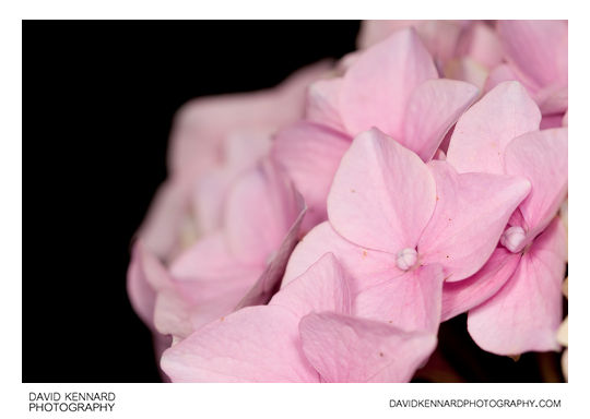
Pink Hydrangea flower from http://www.davidkennardphotography.com
Hydrangea (common names Hydrangea and Hortensia) is a genus of about 70–75 species of flowering plants native to southern and eastern Asia (China, Japan, Korea, the Himalayas, and Indonesia) and North and South America. By far the greatest species diversity is in eastern Asia, notably China, Japan, and Korea. Most are shrubs 1–3 m tall, but some are small trees, and others lianas reaching up to 30 m by climbing up trees. They can be either deciduous or evergreen, though the widely cultivated temperate species are all deciduous.
There are two flower arrangements in hydrangeas. Mophead flowers are large round flowerheads resembling pom-poms or, as the name implies, the head of a mop. In contrast, lacecap flowers bear round, flat flowerheads with a center core of subdued, fertile flowers surrounded by outer rings of showy, sterile flowers.
In most species the flowers are white, but in some species (notably H. macrophylla), can be blue, red, pink, light purple, or dark purple. In these species the exact colour often mirrors the pH of the soil; acidic soils produce blue flowers, neutral soils produce very pale cream petals, and alkaline soils results in pink or purple. This is caused by a color change of the flower pigments in the presence of aluminium ions which can be taken up into hyperaccumulating plants.
Description taken from Wikipedia: http://en.wikipedia.org/wiki/Hydrangea
Date taken: 2010-07-29 10:58:14
Más sobre Pink Hydrangea flower
442: Echinacea purpurea 'Sunset'
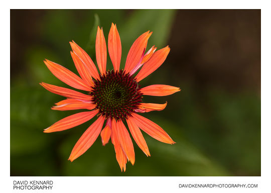
Echinacea purpurea 'Sunset' from http://www.davidkennardphotography.com
Echinacea purpurea 'Sunset' is a coneflower cultivar with bright orange-red sunset coloured flowers. It grows to around 70 - 80cm tall, and features wide green foliage and dark flower stems.
Date taken: 2010-07-29 11:33:21
Más sobre Echinacea purpurea 'Sunset'
443: Hemerocallis 'Cynthia Mary'
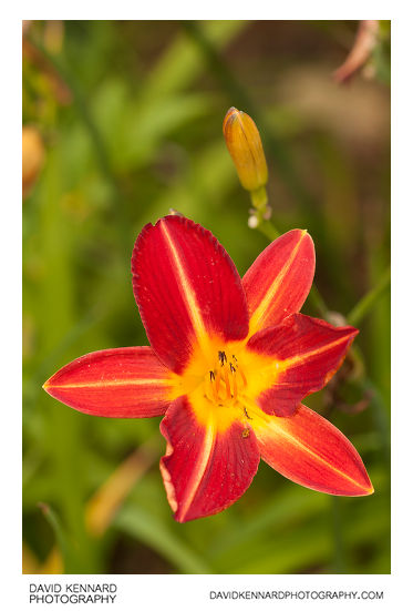
Hemerocallis 'Cynthia Mary' from http://www.davidkennardphotography.com
Hemerocallis 'Cynthia Mary' is a late flowering Daylily cultivar produced by Lady Carew-Pole, who held a National Collection of Hemerocallis at Anthony House in Cornwall. The flower is a deep cherry red with a large amber coloured throat. Like most other daylilies, Hemerocallis 'Cynthia Mary' produces many flowers, with the flowers being held on long stems well above the leaves, growing to around 60cm tall.
Date taken: 2010-07-29 11:43:22
Más sobre Hemerocallis 'Cynthia Mary'
444: Red Hemerocallis flower
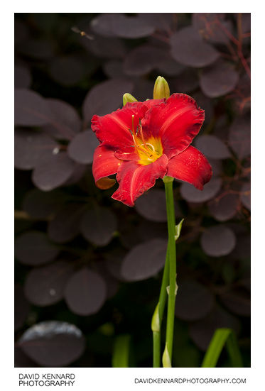
Red Hemerocallis flower from http://www.davidkennardphotography.com
Daylily is the common name of the species, hybrids and cultivars of the genus Hemerocallis. The flowers of these plants are highly diverse in colour and form, often resulting from hybridization by gardening enthusiasts. Thousands of registered cultivars are appreciated and studied by international Hemerocallis societies. Once considered part of the Liliaceae family, such as Lilium (true lilies), the genus name was given to the family Hemerocallidaceae in later circumscriptions.
Daylilies are perennial plants. The name Hemerocallis comes from the Greek words ????? (h?mera) "day" and ????? (kalos) "beautiful". The flowers of most species open at sunrise and wither at sunset, possibly replaced by another one on the same stem the next day. Some species are night-blooming. Daylilies are not commonly used as cut flowers for formal flower arranging, yet they make good cut flowers otherwise as new flowers continue to open on cut stems over several days.
Originally native from Europe to China, Korea, and Japan, their large showy flowers have made them popular worldwide. There are over 60,000 registered cultivars. Only a few cultivars are scented, scented cultivars are appearing more frequently in northern hybridization however. Some cultivars rebloom later in the season, particularly if their developing seedpods are removed.
Hemerocallis is one of the most hybridized of all garden plants, with registrations of new hybrids being made in the thousands each year in the search for new traits. Hybridizers have extended the plant's color range from the yellow, orange, and pale pink of the species, to vibrant reds, purples, lavenders, greenish tones, near-black, near-white, and more. However, a blue daylily is a milestone yet to be reached.
Description taken from Wikipedia: http://en.wikipedia.org/wiki/Hemerocallis
Date taken: 2010-07-29 11:02:24
Más sobre Red Hemerocallis flower
445: Pink Rose flower at Barnsdale Gardens
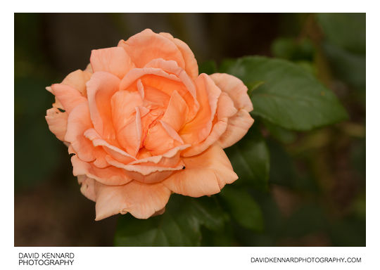
Pink Rose flower at Barnsdale Gardens from http://www.davidkennardphotography.com
A rose is a perennial flower shrub or vine of the genus Rosa, within the family Rosaceae, that contains over 100 species and comes in a variety of colours. The species form a group of erect shrubs, and climbing or trailing plants, with stems that are often armed with sharp prickles. Most are native to Asia, with smaller numbers of species native to Europe, North America, and northwest Africa. Natives, cultivars and hybrids are all widely grown for their beauty and fragrance.
In horticulture roses are propagated by grafting or rooting cuttings. Cultivars are selected for their flowers, growth habit, cold and/or disease resistance, and many other factors. They may be grafted onto a rootstock that provides sturdiness, or (especially with Old Garden Roses) allowed to develop their own roots. Roses require 5 hours of direct sunlight a day during the growing season. Following blooming and exposure to frost roses enter a dormant stage in winter.
Many thousands of rose hybrids and cultivars have been bred and selected for garden use; most are double-flowered with many or all of the stamens having mutated into additional petals. In the early 19th century the Empress Josephine of France patronized the development of rose breeding at her gardens at Malmaison. As long ago as 1840 a collection numbering over one thousand different cultivars, varieties and species was possible when a rosarium was planted by Loddiges nursery for Abney Park Cemetery, an early Victorian garden cemetery and arboretum in England.
Twentieth-century rose breeders generally emphasized size and colour, producing large, attractive blooms with little or no scent. Many wild and "old-fashioned" roses, by contrast, have a strong sweet scent.
Description taken from Wikipedia: http://en.wikipedia.org/wiki/Rose
Date taken: 2010-07-29 11:07:14
Más sobre Pink Rose flower at Barnsdale Gardens
446: Orange Calendula flower
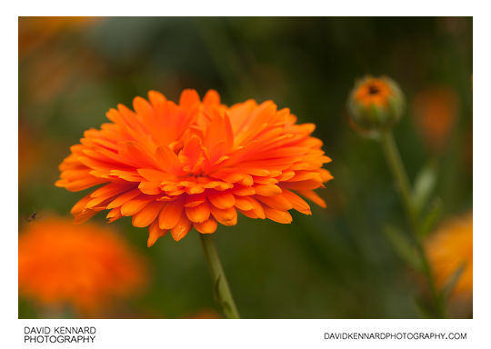
Orange Calendula flower from http://www.davidkennardphotography.com
Calendula, or pot marigold, is a genus of about 12-20 species of annual or perennial herbaceous plants in the daisy family Asteraceae, native to the area from Macaronesia east through the Mediterranean region to Iran. Calendula should not be confused with other plants that are also known as marigolds, such as plants of the genus Tagetes, corn marigolds or marsh marigolds.
The name Calendula stems from the Latin kalendae, meaning first day of the month, presumably because pot marigolds are in bloom at the start of most months of the year. The common name marigold probably refers to the Virgin Mary, or its old Saxon name 'ymbglidegold', which means 'it turns with the sun'. Pot Marigolds typically bloom quickly (in under two months) in bright yellows, reds, and oranges throughout the summer and well into the fall.
Pot Marigolds are considered by many gardening experts as one of the most versatile flowers to grow in a garden, especially since it is easy to grow. Seeds sown in the spring, in most soils, will germinate freely in sunny or half-sunny locations. They do best, however, if planted in sunny locations with rich, well-drained soil. The leaves are spirally arranged, 5–18 cm long, simple, and slightly hairy. The flower heads range from pastel yellow to deep orange, and are 3–7 cm across, with both ray florets and disc florets. They have a spicy aroma and are produced from spring to autumn in temperate climates. It is recommended to deadhead (removal of dying flower heads) the plants regularly to maintain even blossom production.
Pot Marigolds are used as food plants by the larvae of some Lepidoptera species including Cabbage Moth, The Gothic, Large Yellow Underwing and Setaceous Hebrew Character. Be advised not to plant in vegetable gardens.
Pot Marigold petals are considered edible. They are often used to add color to salads, and calendula extract is commonly added to chicken feed to produce darker egg yolks. Their aroma, however, is not sweet, and resembles the smell of hops in beer. The oil from its seed contains calendic acid, an essential component in soap products.
Description taken from Wikipedia: http://en.wikipedia.org/wiki/Calendula
Date taken: 2010-07-29 11:15:51
Más sobre Orange Calendula flower
447: Orange Calendula flower
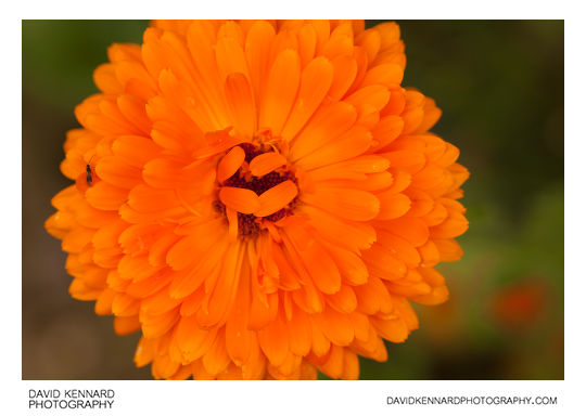
Orange Calendula flower from http://www.davidkennardphotography.com
Calendula, or pot marigold, is a genus of about 12-20 species of annual or perennial herbaceous plants in the daisy family Asteraceae, native to the area from Macaronesia east through the Mediterranean region to Iran. Calendula should not be confused with other plants that are also known as marigolds, such as plants of the genus Tagetes, corn marigolds or marsh marigolds.
The name Calendula stems from the Latin kalendae, meaning first day of the month, presumably because pot marigolds are in bloom at the start of most months of the year. The common name marigold probably refers to the Virgin Mary, or its old Saxon name 'ymbglidegold', which means 'it turns with the sun'. Pot Marigolds typically bloom quickly (in under two months) in bright yellows, reds, and oranges throughout the summer and well into the fall.
Pot Marigolds are considered by many gardening experts as one of the most versatile flowers to grow in a garden, especially since it is easy to grow. Seeds sown in the spring, in most soils, will germinate freely in sunny or half-sunny locations. They do best, however, if planted in sunny locations with rich, well-drained soil. The leaves are spirally arranged, 5–18 cm long, simple, and slightly hairy. The flower heads range from pastel yellow to deep orange, and are 3–7 cm across, with both ray florets and disc florets. They have a spicy aroma and are produced from spring to autumn in temperate climates. It is recommended to deadhead (removal of dying flower heads) the plants regularly to maintain even blossom production.
Pot Marigolds are used as food plants by the larvae of some Lepidoptera species including Cabbage Moth, The Gothic, Large Yellow Underwing and Setaceous Hebrew Character. Be advised not to plant in vegetable gardens.
Pot Marigold petals are considered edible. They are often used to add color to salads, and calendula extract is commonly added to chicken feed to produce darker egg yolks. Their aroma, however, is not sweet, and resembles the smell of hops in beer. The oil from its seed contains calendic acid, an essential component in soap products.
Description taken from Wikipedia: http://en.wikipedia.org/wiki/Calendula
Date taken: 2010-07-29 11:16:39
Más sobre Orange Calendula flower
448: Hemerocallis plant with yellow flowers
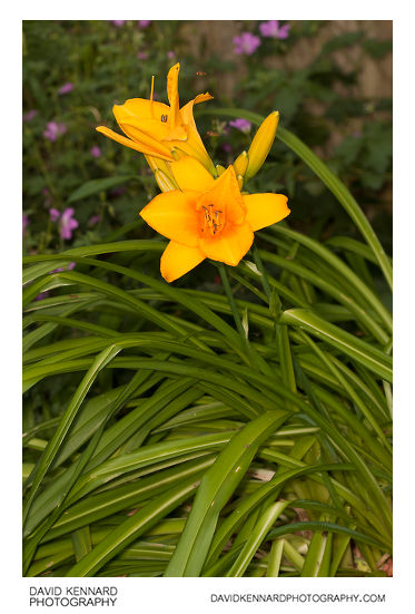
Hemerocallis plant with yellow flowers from http://www.davidkennardphotography.com
Daylily is the common name of the species, hybrids and cultivars of the genus Hemerocallis. The flowers of these plants are highly diverse in colour and form, often resulting from hybridization by gardening enthusiasts. Thousands of registered cultivars are appreciated and studied by international Hemerocallis societies. Once considered part of the Liliaceae family, such as Lilium (true lilies), the genus name was given to the family Hemerocallidaceae in later circumscriptions.
Daylilies are perennial plants. The name Hemerocallis comes from the Greek words ????? (h?mera) "day" and ????? (kalos) "beautiful". The flowers of most species open at sunrise and wither at sunset, possibly replaced by another one on the same stem the next day. Some species are night-blooming. Daylilies are not commonly used as cut flowers for formal flower arranging, yet they make good cut flowers otherwise as new flowers continue to open on cut stems over several days.
Originally native from Europe to China, Korea, and Japan, their large showy flowers have made them popular worldwide. There are over 60,000 registered cultivars. Only a few cultivars are scented, scented cultivars are appearing more frequently in northern hybridization however. Some cultivars rebloom later in the season, particularly if their developing seedpods are removed.
Hemerocallis is one of the most hybridized of all garden plants, with registrations of new hybrids being made in the thousands each year in the search for new traits. Hybridizers have extended the plant's color range from the yellow, orange, and pale pink of the species, to vibrant reds, purples, lavenders, greenish tones, near-black, near-white, and more. However, a blue daylily is a milestone yet to be reached.
Description taken from Wikipedia: http://en.wikipedia.org/wiki/Hemerocallis
Date taken: 2010-07-29 10:12:12
Más sobre Hemerocallis plant with yellow flowers
449: Bronze bust of Geoff Hamilton in Barnsdale Gardens
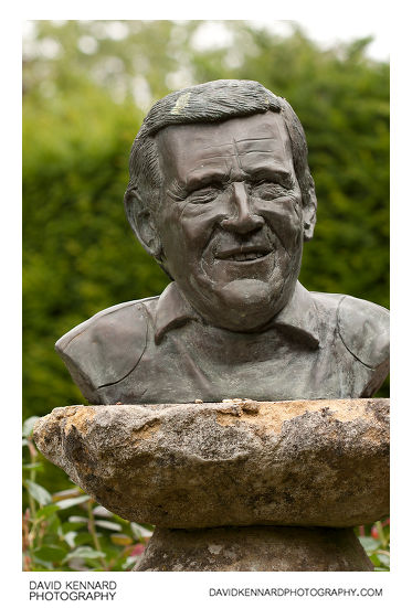
Bronze bust of Geoff Hamilton in Barnsdale Gardens from http://www.davidkennardphotography.com
A bronze bust of Geoff Hamilton, created by his son, Chris, stands in the centre of the Memorial Garden in Barnsdale Gardens, Rutland, UK.
From Wikipedia (http://en.wikipedia.org/wiki/Barnsdale_Gardens):
Barnsdale Gardens in Rutland, England were made famous by Geoff Hamilton through the BBC television series Gardeners' World which he presented from 1979 until his death in 1996. They are situated on The Avenue in the parish of Exton, a short distance north of Rutland Water.
Geoff Hamilton began developing the garden in 1983 from what was then a ploughed field. It now covers 8 acres (3.2 ha), comprising 37 individual gardens and features.
Date taken: 2010-07-29 10:42:41
Más sobre Bronze bust of Geoff Hamilton in Barnsdale Gardens
450: Armenian crane's-bill (Geranium psilostemon)
.jpg)
Armenian crane's-bill (Geranium psilostemon) from http://www.davidkennardphotography.com
A purple flowered Geranium at Barnsdale Gardens in Rutland, UK. The plant is likely a hybrid or cultivar of Geranium psilostemon.
From Wikipedia (http://en.wikipedia.org/wiki/Geranium_psilostemon):
Geranium psilostemon, commonly called Armenian crane's-bill, is a herbaceous plant species in the Geraniaceae family. It is native from Turkey, Armenia, Azerbaijan, and the Russian Federation, and is cultivated as a garden subject, and a number of different cultivars exist. It has glowing reddish purple coloured flowers.
Date taken: 2010-07-29 10:09:26
Más sobre Armenian crane's-bill (Geranium psilostemon)
451: All Saints' Church, Braunston-in-Rutland
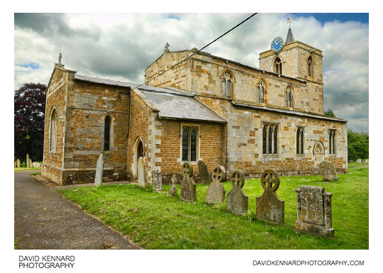
All Saints' Church, Braunston-in-Rutland from http://www.davidkennardphotography.com
All Saints' Church in Braunston-in-Rutland, Rutland, UK. The earliest part of the church dates from around 1150, but parts have been added and rebuilt various times since then.
The south aisle was added and the chancel rebuilt in the first half of the 13th century, while the north aisle was added at the beginning of the 14th century. Around the end of the 14th century and extending into the beginning of the 15th century, new windows were inserted in the chancel and south aisle, with the east end of the aisle refaced or rebuilt, and the porch added.
The tower was erected around the beginning of the 15th century, with the clerestory being added shortly after. The tower was then taken down to its foundations and rebuilt in 1728–9. The vestry was added to the church about 1860. In 1887–8 restoration work was carried out on the chancel, with the south wall of the chancel being rebuilt. The nave was restored in 1890.
Date taken: 2010-06-12 11:10:23
Más sobre All Saints' Church, Braunston-in-Rutland
452: Field of grass
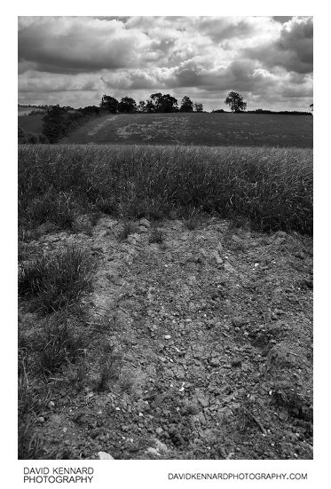
Field of grass from http://www.davidkennardphotography.com
Looking east across a field of flowering grass between the villages of Knossington, Braunston-in-Rutland, and Withcote, in England.
Date taken: 2010-06-12 10:08:26
Más sobre Field of grass
453: Field of grass
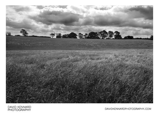
Field of grass from http://www.davidkennardphotography.com
Looking east across a field of flowering grass between the villages of Knossington, Braunston-in-Rutland, and Withcote, in England.
Date taken: 2010-06-12 10:08:41
Más sobre Field of grass
454: Field of Green Wheat
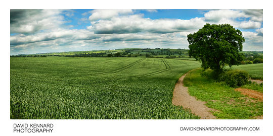
Field of Green Wheat from http://www.davidkennardphotography.com
A field of winter wheat grows to the southwest of Braunston-in-Rutland, in Rutland, UK.
From Wikipedia (http://en.wikipedia.org/wiki/Winter_wheat):
Winter wheat is a type of cereal that is planted from September to December in the Northern Hemisphere. Winter wheat sprouts before freezing occurs, then becomes dormant until the soil warms in the spring. Winter wheat needs a few weeks of cold before being able to flower, however persistent snow cover might be disadvantageous. It is ready to be harvested by early July.
Hard winter wheats have a higher gluten protein content than other wheats. They are used to make flour for yeast breads, or are blended with soft spring wheats to make the all-purpose flour used in a wide variety of baked products. Soft wheat is used for specialty or cake flour. Durum, the hardest wheat, is primarily used for making pasta. Almost all durum wheat grown in North America is spring-planted.
Winter wheat is grown throughout Europe, North America, and in northern Asia.
Date taken: 2010-06-12 11:31:23
Más sobre Field of Green Wheat
455: Fields and cloudy sky
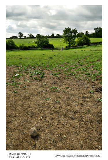
Fields and cloudy sky from http://www.davidkennardphotography.com
Looking south across fields between Knossington, Withcote, and Braunston-in-Rutland, around the border between the counties of Rutland and Leicestershire, UK.
Date taken: 2010-06-12 09:57:05
Más sobre Fields and cloudy sky
456: Grassy path
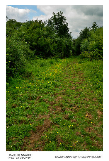
Grassy path from http://www.davidkennardphotography.com
Looking southwest down a path, leading down through the fields towards the road between Knossington and Braunston-in-Rutland, around the border between Rutland and Leicestershire, UK.
Date taken: 2010-06-12 10:34:33
Más sobre Grassy path
457: Hedged path to Braunston
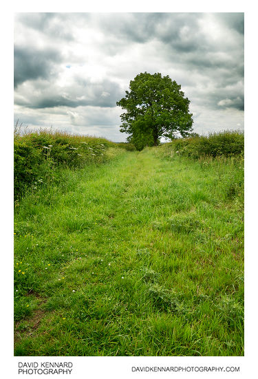
Hedged path to Braunston from http://www.davidkennardphotography.com
Looking down a path with hedges on either side, leading south towards the village of Braunston-in-Rutland, in Rutland, UK.
Date taken: 2010-06-12 10:50:27
Más sobre Hedged path to Braunston
458: Path between trees
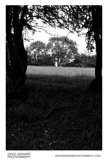
Path between trees from http://www.davidkennardphotography.com
Looking west through a gap in the trees running alongside a track, in the fields between the villages of Knossington (in Leicestershire) and Braunston-in-Rutland.
Date taken: 2010-06-12 10:38:40
Más sobre Path between trees
459: Clump of Trees
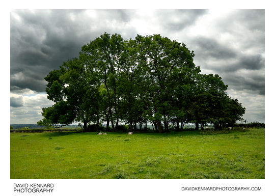
Clump of Trees from http://www.davidkennardphotography.com
Sheep rest beneath a clump of trees to northwest of Braunston-in-Rutland, UK.
Date taken: 2010-06-12 10:46:00
Más sobre Clump of Trees
460: Rubble track
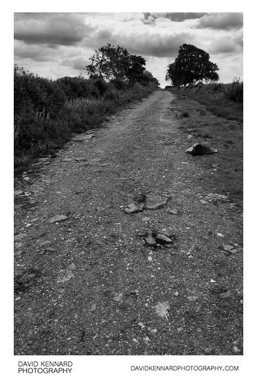
Rubble track from http://www.davidkennardphotography.com
A track made from crushed rubble, running alongside fields between Withcote, Leighfield, and Braunston-in-Rutland, around the border between Rutland Leicestershire, UK.
Date taken: 2010-06-12 11:56:43
Más sobre Rubble track
461: High Street, Braunston-in-Rutland
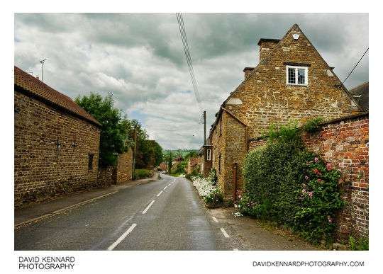
High Street, Braunston-in-Rutland from http://www.davidkennardphotography.com
Looking southwest down High Street in the village of Braunston-in-Rutland, Rutland, UK.
Date taken: 2010-06-12 11:04:54
Más sobre High Street, Braunston-in-Rutland
462: Walking through field of grass
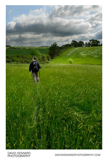
Walking through field of grass from http://www.davidkennardphotography.com
Looking east across a field of flowering grass between the villages of Knossington, Braunston-in-Rutland, and Withcote, in England.
Date taken: 2010-06-12 10:09:12
Más sobre Walking through field of grass
463: Polo Goal Posts
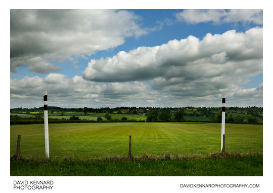
Polo Goal Posts from http://www.davidkennardphotography.com
A pair of goal posts used for polo games in a field between the villages of Withcote, Knossington, and Braunston-in-Rutland. Here looking northwest, Knossington can be seen on the hill in the distance.
Date taken: 2010-06-12 10:04:13
Más sobre Polo Goal Posts
464: Green fields
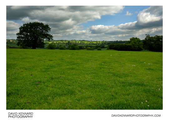
Green fields from http://www.davidkennardphotography.com
Looking north over a green field of grass between the villages of Knossington, Braunston-in-Rutland, and Withcote, around the border between Rutland and Leicestershire, UK.
Date taken: 2010-06-12 10:06:07
Más sobre Green fields
465: Green fields
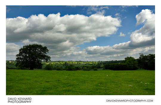
Green fields from http://www.davidkennardphotography.com
Looking north over a green field of grass between the villages of Knossington, Braunston-in-Rutland, and Withcote, around the border between Rutland and Leicestershire, UK.
Date taken: 2010-06-12 10:06:12
Más sobre Green fields
466: Field of flowering grass
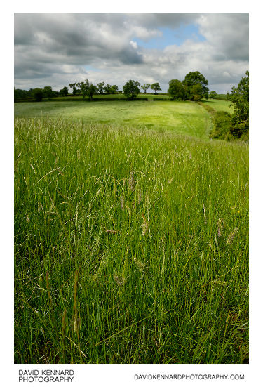
Field of flowering grass from http://www.davidkennardphotography.com
Looking west across a field of flowering grass between the villages of Knossington, Braunston-in-Rutland, and Withcote, in England.
Date taken: 2010-06-12 10:11:12
Más sobre Field of flowering grass
467: Field of buttecups
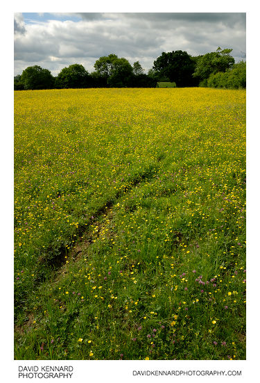
Field of buttecups from http://www.davidkennardphotography.com
Looking south across a field of buttercups between the villages of Withcote, Knossington, and Braunston-in-Rutland, around the border between Rutland and Leicestershire, England.
From Wikipedia (http://en.wikipedia.org/wiki/Ranunculus_acris):
Ranunculus acris is one of the more common buttercups across Europe and temperate Eurasia. Common names include meadow buttercup and tall buttercup. The plant is also known as an introduced species across much of the rest of the world, including Australia. It is a naturalized species and often a weed in parts of North America, but it is probably native in Alaska and Greenland.
This species is variable in appearance across the world. It is a somewhat hairy plant that has ascending flowing stems bearing glossy yellow flowers about 25 mm across. There are five overlapping petals borne above 5 green sepals that soon turn yellow as the flower matures. It has numerous stamens inserted below the ovary. As for other members of the genus, the numerous seeds are borne as achenes.
This and other buttercups contain ranunculin, which breaks down to the toxin protoanemonin, a chemical that can cause dermatitis and vomiting.
Date taken: 2010-06-12 10:12:56
Más sobre Field of buttecups
468: Field of buttecups
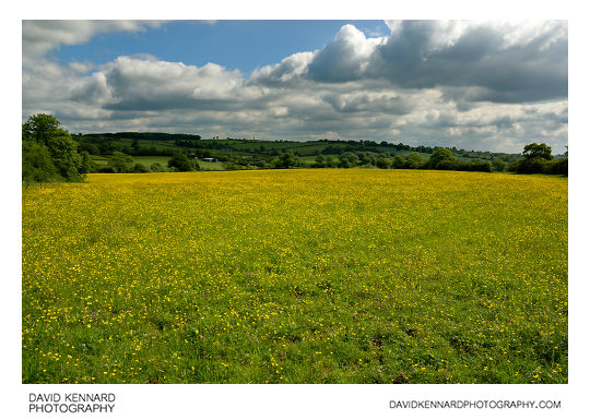
Field of buttecups from http://www.davidkennardphotography.com
Looking northwest across a field of buttercups between the villages of Withcote, Knossington, and Braunston-in-Rutland, around the border between Rutland and Leicestershire, England.
From Wikipedia (http://en.wikipedia.org/wiki/Ranunculus_acris):
Ranunculus acris is one of the more common buttercups across Europe and temperate Eurasia. Common names include meadow buttercup and tall buttercup. The plant is also known as an introduced species across much of the rest of the world, including Australia. It is a naturalized species and often a weed in parts of North America, but it is probably native in Alaska and Greenland.
This species is variable in appearance across the world. It is a somewhat hairy plant that has ascending flowing stems bearing glossy yellow flowers about 25 mm across. There are five overlapping petals borne above 5 green sepals that soon turn yellow as the flower matures. It has numerous stamens inserted below the ovary. As for other members of the genus, the numerous seeds are borne as achenes.
This and other buttercups contain ranunculin, which breaks down to the toxin protoanemonin, a chemical that can cause dermatitis and vomiting.
Date taken: 2010-06-12 10:13:47
Más sobre Field of buttecups
469: Field of buttecups
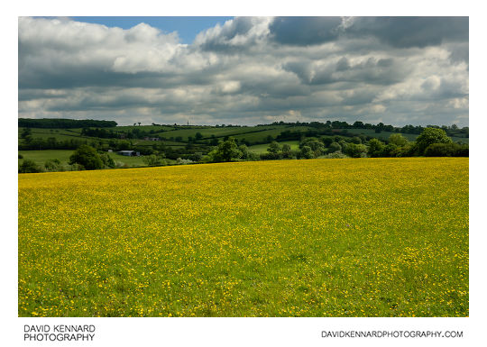
Field of buttecups from http://www.davidkennardphotography.com
Looking northwest across a field of buttercups between the villages of Withcote, Knossington, and Braunston-in-Rutland, around the border between Rutland and Leicestershire, England.
From Wikipedia (http://en.wikipedia.org/wiki/Ranunculus_acris):
Ranunculus acris is one of the more common buttercups across Europe and temperate Eurasia. Common names include meadow buttercup and tall buttercup. The plant is also known as an introduced species across much of the rest of the world, including Australia. It is a naturalized species and often a weed in parts of North America, but it is probably native in Alaska and Greenland.
This species is variable in appearance across the world. It is a somewhat hairy plant that has ascending flowing stems bearing glossy yellow flowers about 25 mm across. There are five overlapping petals borne above 5 green sepals that soon turn yellow as the flower matures. It has numerous stamens inserted below the ovary. As for other members of the genus, the numerous seeds are borne as achenes.
This and other buttercups contain ranunculin, which breaks down to the toxin protoanemonin, a chemical that can cause dermatitis and vomiting.
Date taken: 2010-06-12 10:14:15
Más sobre Field of buttecups
470: Field of buttecups
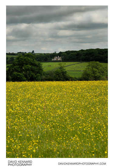
Field of buttecups from http://www.davidkennardphotography.com
Looking north across a field of buttercups towards a house on the road between the villages of Knossington and Braunston-in-Rutland, around the border between Rutland and Leicestershire, England.
From Wikipedia (http://en.wikipedia.org/wiki/Ranunculus_acris):
Ranunculus acris is one of the more common buttercups across Europe and temperate Eurasia. Common names include meadow buttercup and tall buttercup. The plant is also known as an introduced species across much of the rest of the world, including Australia. It is a naturalized species and often a weed in parts of North America, but it is probably native in Alaska and Greenland.
This species is variable in appearance across the world. It is a somewhat hairy plant that has ascending flowing stems bearing glossy yellow flowers about 25 mm across. There are five overlapping petals borne above 5 green sepals that soon turn yellow as the flower matures. It has numerous stamens inserted below the ovary. As for other members of the genus, the numerous seeds are borne as achenes.
This and other buttercups contain ranunculin, which breaks down to the toxin protoanemonin, a chemical that can cause dermatitis and vomiting.
Date taken: 2010-06-12 10:15:35
Más sobre Field of buttecups
471: Field of buttecups
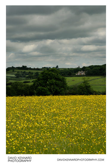
Field of buttecups from http://www.davidkennardphotography.com
Looking north across a field of buttercups towards a house on the road between the villages of Knossington and Braunston-in-Rutland, around the border between Rutland and Leicestershire, England.
From Wikipedia (http://en.wikipedia.org/wiki/Ranunculus_acris):
Ranunculus acris is one of the more common buttercups across Europe and temperate Eurasia. Common names include meadow buttercup and tall buttercup. The plant is also known as an introduced species across much of the rest of the world, including Australia. It is a naturalized species and often a weed in parts of North America, but it is probably native in Alaska and Greenland.
This species is variable in appearance across the world. It is a somewhat hairy plant that has ascending flowing stems bearing glossy yellow flowers about 25 mm across. There are five overlapping petals borne above 5 green sepals that soon turn yellow as the flower matures. It has numerous stamens inserted below the ovary. As for other members of the genus, the numerous seeds are borne as achenes.
This and other buttercups contain ranunculin, which breaks down to the toxin protoanemonin, a chemical that can cause dermatitis and vomiting.
Date taken: 2010-06-12 10:15:41
Más sobre Field of buttecups
472: Sheep in field
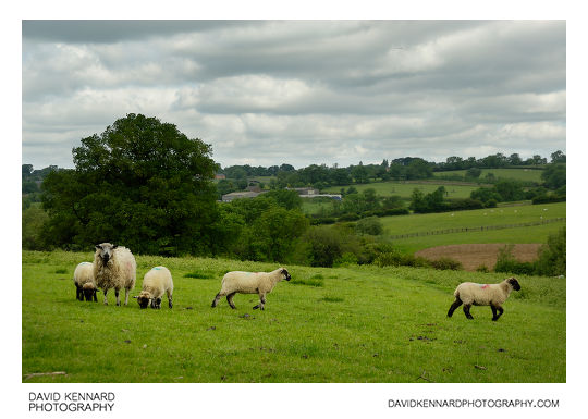
Sheep in field from http://www.davidkennardphotography.com
Sheep in a field between the villages of Withcote, Knossington, and Braunston-in-Rutland, around the border between Rutland and Leicestershire, England.
From Wikipedia (http://en.wikipedia.org/wiki/Domestic_sheep):
Sheep are most likely descended from the wild mouflon of Europe and Asia. One of the earliest animals to be domesticated for agricultural purposes, sheep are raised for fleece, meat (lamb, hogget or mutton) and milk. A sheep's wool is the most widely used of any animal, and is usually harvested by shearing. Ovine meat is called lamb when from younger animals and mutton when from older ones. Sheep continue to be important for wool and meat today, and are also occasionally raised for pelts, as dairy animals, or as model organisms for science.
Sheep husbandry is practised throughout the majority of the inhabited world, and has been fundamental to many civilizations. In the modern era, Australia, New Zealand, the southern and central South American nations, and the British Isles are most closely associated with sheep production.
Sheep-raising has a large lexicon of unique terms which vary considerably by region and dialect. Use of the word sheep began in Middle English as a derivation of the Old English word sc?ap; it is both the singular and plural name for the animal. A group of sheep is called a flock, herd or mob. Adult female sheep are referred to as ewes, intact males as rams or occasionally tups, castrated males as wethers, and younger sheep as lambs. Many other specific terms for the various life stages of sheep exist, generally related to lambing, shearing, and age.
Being a key animal in the history of farming, sheep have a deeply entrenched place in human culture, and find representation in much modern language and symbology. As livestock, sheep are most-often associated with pastoral, Arcadian imagery. Sheep figure in many mythologies - such as the Golden Fleece—and major religions, especially the Abrahamic traditions. In both ancient and modern religious ritual, sheep are used as sacrificial animals.
Date taken: 2010-06-12 10:19:28
Más sobre Sheep in field
473: Sheep in field of thistles
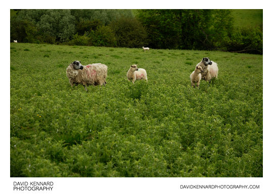
Sheep in field of thistles from http://www.davidkennardphotography.com
Sheep stand in a field of thistles between the villages of Withcote, Knossington, and Braunston-in-Rutland, around the border between Rutland and Leicestershire, England.
From Wikipedia (http://en.wikipedia.org/wiki/Domestic_sheep):
Sheep are most likely descended from the wild mouflon of Europe and Asia. One of the earliest animals to be domesticated for agricultural purposes, sheep are raised for fleece, meat (lamb, hogget or mutton) and milk. A sheep's wool is the most widely used of any animal, and is usually harvested by shearing. Ovine meat is called lamb when from younger animals and mutton when from older ones. Sheep continue to be important for wool and meat today, and are also occasionally raised for pelts, as dairy animals, or as model organisms for science.
Sheep husbandry is practised throughout the majority of the inhabited world, and has been fundamental to many civilizations. In the modern era, Australia, New Zealand, the southern and central South American nations, and the British Isles are most closely associated with sheep production.
Sheep-raising has a large lexicon of unique terms which vary considerably by region and dialect. Use of the word sheep began in Middle English as a derivation of the Old English word sc?ap; it is both the singular and plural name for the animal. A group of sheep is called a flock, herd or mob. Adult female sheep are referred to as ewes, intact males as rams or occasionally tups, castrated males as wethers, and younger sheep as lambs. Many other specific terms for the various life stages of sheep exist, generally related to lambing, shearing, and age.
Being a key animal in the history of farming, sheep have a deeply entrenched place in human culture, and find representation in much modern language and symbology. As livestock, sheep are most-often associated with pastoral, Arcadian imagery. Sheep figure in many mythologies - such as the Golden Fleece—and major religions, especially the Abrahamic traditions. In both ancient and modern religious ritual, sheep are used as sacrificial animals.
Date taken: 2010-06-12 10:20:14
Más sobre Sheep in field of thistles
474: Sheep in field of thistles
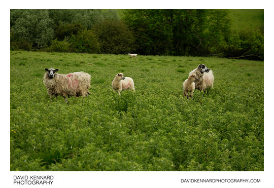
Sheep in field of thistles from http://www.davidkennardphotography.com
Sheep stand in a field of thistles between the villages of Withcote, Knossington, and Braunston-in-Rutland, around the border between Rutland and Leicestershire, England.
From Wikipedia (http://en.wikipedia.org/wiki/Domestic_sheep):
Sheep are most likely descended from the wild mouflon of Europe and Asia. One of the earliest animals to be domesticated for agricultural purposes, sheep are raised for fleece, meat (lamb, hogget or mutton) and milk. A sheep's wool is the most widely used of any animal, and is usually harvested by shearing. Ovine meat is called lamb when from younger animals and mutton when from older ones. Sheep continue to be important for wool and meat today, and are also occasionally raised for pelts, as dairy animals, or as model organisms for science.
Sheep husbandry is practised throughout the majority of the inhabited world, and has been fundamental to many civilizations. In the modern era, Australia, New Zealand, the southern and central South American nations, and the British Isles are most closely associated with sheep production.
Sheep-raising has a large lexicon of unique terms which vary considerably by region and dialect. Use of the word sheep began in Middle English as a derivation of the Old English word sc?ap; it is both the singular and plural name for the animal. A group of sheep is called a flock, herd or mob. Adult female sheep are referred to as ewes, intact males as rams or occasionally tups, castrated males as wethers, and younger sheep as lambs. Many other specific terms for the various life stages of sheep exist, generally related to lambing, shearing, and age.
Being a key animal in the history of farming, sheep have a deeply entrenched place in human culture, and find representation in much modern language and symbology. As livestock, sheep are most-often associated with pastoral, Arcadian imagery. Sheep figure in many mythologies - such as the Golden Fleece—and major religions, especially the Abrahamic traditions. In both ancient and modern religious ritual, sheep are used as sacrificial animals.
Date taken: 2010-06-12 10:20:17
Más sobre Sheep in field of thistles
475: Sheep in field of thistles
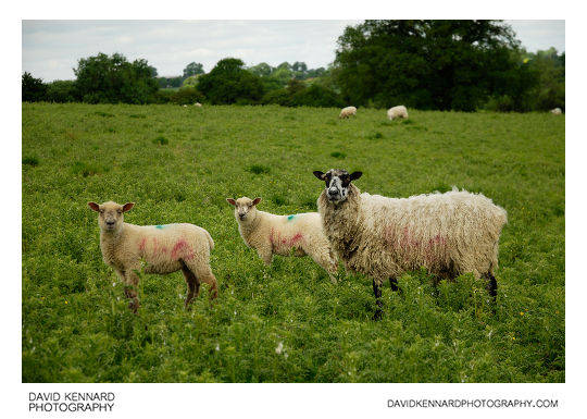
Sheep in field of thistles from http://www.davidkennardphotography.com
Sheep stand in a field of thistles between the villages of Withcote, Knossington, and Braunston-in-Rutland, around the border between Rutland and Leicestershire, England.
From Wikipedia (http://en.wikipedia.org/wiki/Domestic_sheep):
Sheep are most likely descended from the wild mouflon of Europe and Asia. One of the earliest animals to be domesticated for agricultural purposes, sheep are raised for fleece, meat (lamb, hogget or mutton) and milk. A sheep's wool is the most widely used of any animal, and is usually harvested by shearing. Ovine meat is called lamb when from younger animals and mutton when from older ones. Sheep continue to be important for wool and meat today, and are also occasionally raised for pelts, as dairy animals, or as model organisms for science.
Sheep husbandry is practised throughout the majority of the inhabited world, and has been fundamental to many civilizations. In the modern era, Australia, New Zealand, the southern and central South American nations, and the British Isles are most closely associated with sheep production.
Sheep-raising has a large lexicon of unique terms which vary considerably by region and dialect. Use of the word sheep began in Middle English as a derivation of the Old English word sc?ap; it is both the singular and plural name for the animal. A group of sheep is called a flock, herd or mob. Adult female sheep are referred to as ewes, intact males as rams or occasionally tups, castrated males as wethers, and younger sheep as lambs. Many other specific terms for the various life stages of sheep exist, generally related to lambing, shearing, and age.
Being a key animal in the history of farming, sheep have a deeply entrenched place in human culture, and find representation in much modern language and symbology. As livestock, sheep are most-often associated with pastoral, Arcadian imagery. Sheep figure in many mythologies - such as the Golden Fleece—and major religions, especially the Abrahamic traditions. In both ancient and modern religious ritual, sheep are used as sacrificial animals.
Date taken: 2010-06-12 10:20:41
Más sobre Sheep in field of thistles
476: Tree and sheep on top of hill
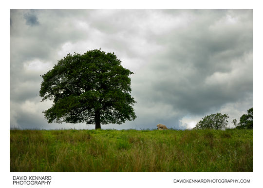
Tree and sheep on top of hill from http://www.davidkennardphotography.com
A sheep browses on top of a hill between the villages of Withcote, Knossington, and Braunston-in-Rutland, around the border between Rutland and Leicestershire, England.
Date taken: 2010-06-12 10:22:36
Más sobre Tree and sheep on top of hill
477: Green fields
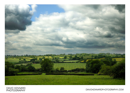
Green fields from http://www.davidkennardphotography.com
Looking southwest over the fields between the villages of Withcote, Knossington, and Braunston-in-Rutland, around the border between Rutland and Leicestershire, England.
Date taken: 2010-06-12 10:33:16
Más sobre Green fields
478: Sheep in field
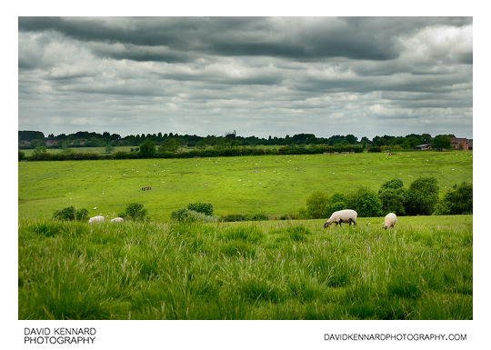
Sheep in field from http://www.davidkennardphotography.com
Sheep browse on a hill between the villages of Withcote, Knossington, and Braunston-in-Rutland, around the border between Rutland and Leicestershire, England.
From Wikipedia (http://en.wikipedia.org/wiki/Domestic_sheep):
Sheep are most likely descended from the wild mouflon of Europe and Asia. One of the earliest animals to be domesticated for agricultural purposes, sheep are raised for fleece, meat (lamb, hogget or mutton) and milk. A sheep's wool is the most widely used of any animal, and is usually harvested by shearing. Ovine meat is called lamb when from younger animals and mutton when from older ones. Sheep continue to be important for wool and meat today, and are also occasionally raised for pelts, as dairy animals, or as model organisms for science.
Sheep husbandry is practised throughout the majority of the inhabited world, and has been fundamental to many civilizations. In the modern era, Australia, New Zealand, the southern and central South American nations, and the British Isles are most closely associated with sheep production.
Sheep-raising has a large lexicon of unique terms which vary considerably by region and dialect. Use of the word sheep began in Middle English as a derivation of the Old English word sc?ap; it is both the singular and plural name for the animal. A group of sheep is called a flock, herd or mob. Adult female sheep are referred to as ewes, intact males as rams or occasionally tups, castrated males as wethers, and younger sheep as lambs. Many other specific terms for the various life stages of sheep exist, generally related to lambing, shearing, and age.
Being a key animal in the history of farming, sheep have a deeply entrenched place in human culture, and find representation in much modern language and symbology. As livestock, sheep are most-often associated with pastoral, Arcadian imagery. Sheep figure in many mythologies - such as the Golden Fleece—and major religions, especially the Abrahamic traditions. In both ancient and modern religious ritual, sheep are used as sacrificial animals.
Date taken: 2010-06-12 10:42:58
Más sobre Sheep in field
479: Sheep around water trough
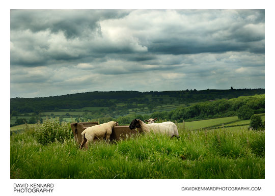
Sheep around water trough from http://www.davidkennardphotography.com
Sheep congregate around a water trough on top of a hill between the villages of Withcote, Knossington, and Braunston-in-Rutland, around the border between Rutland and Leicestershire, England.
From Wikipedia (http://en.wikipedia.org/wiki/Domestic_sheep):
Sheep are most likely descended from the wild mouflon of Europe and Asia. One of the earliest animals to be domesticated for agricultural purposes, sheep are raised for fleece, meat (lamb, hogget or mutton) and milk. A sheep's wool is the most widely used of any animal, and is usually harvested by shearing. Ovine meat is called lamb when from younger animals and mutton when from older ones. Sheep continue to be important for wool and meat today, and are also occasionally raised for pelts, as dairy animals, or as model organisms for science.
Sheep husbandry is practised throughout the majority of the inhabited world, and has been fundamental to many civilizations. In the modern era, Australia, New Zealand, the southern and central South American nations, and the British Isles are most closely associated with sheep production.
Sheep-raising has a large lexicon of unique terms which vary considerably by region and dialect. Use of the word sheep began in Middle English as a derivation of the Old English word sc?ap; it is both the singular and plural name for the animal. A group of sheep is called a flock, herd or mob. Adult female sheep are referred to as ewes, intact males as rams or occasionally tups, castrated males as wethers, and younger sheep as lambs. Many other specific terms for the various life stages of sheep exist, generally related to lambing, shearing, and age.
Being a key animal in the history of farming, sheep have a deeply entrenched place in human culture, and find representation in much modern language and symbology. As livestock, sheep are most-often associated with pastoral, Arcadian imagery. Sheep figure in many mythologies - such as the Golden Fleece—and major religions, especially the Abrahamic traditions. In both ancient and modern religious ritual, sheep are used as sacrificial animals.
Date taken: 2010-06-12 10:43:27
Más sobre Sheep around water trough
480: Sheep around water trough
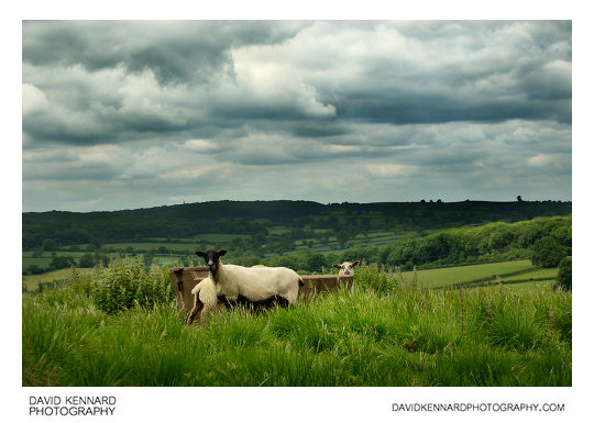
Sheep around water trough from http://www.davidkennardphotography.com
Sheep congregate around a water trough on top of a hill between the villages of Withcote, Knossington, and Braunston-in-Rutland, around the border between Rutland and Leicestershire, England.
From Wikipedia (http://en.wikipedia.org/wiki/Domestic_sheep):
Sheep are most likely descended from the wild mouflon of Europe and Asia. One of the earliest animals to be domesticated for agricultural purposes, sheep are raised for fleece, meat (lamb, hogget or mutton) and milk. A sheep's wool is the most widely used of any animal, and is usually harvested by shearing. Ovine meat is called lamb when from younger animals and mutton when from older ones. Sheep continue to be important for wool and meat today, and are also occasionally raised for pelts, as dairy animals, or as model organisms for science.
Sheep husbandry is practised throughout the majority of the inhabited world, and has been fundamental to many civilizations. In the modern era, Australia, New Zealand, the southern and central South American nations, and the British Isles are most closely associated with sheep production.
Sheep-raising has a large lexicon of unique terms which vary considerably by region and dialect. Use of the word sheep began in Middle English as a derivation of the Old English word sc?ap; it is both the singular and plural name for the animal. A group of sheep is called a flock, herd or mob. Adult female sheep are referred to as ewes, intact males as rams or occasionally tups, castrated males as wethers, and younger sheep as lambs. Many other specific terms for the various life stages of sheep exist, generally related to lambing, shearing, and age.
Being a key animal in the history of farming, sheep have a deeply entrenched place in human culture, and find representation in much modern language and symbology. As livestock, sheep are most-often associated with pastoral, Arcadian imagery. Sheep figure in many mythologies - such as the Golden Fleece—and major religions, especially the Abrahamic traditions. In both ancient and modern religious ritual, sheep are used as sacrificial animals.
Date taken: 2010-06-12 10:43:32
Más sobre Sheep around water trough
481: Sheep in field
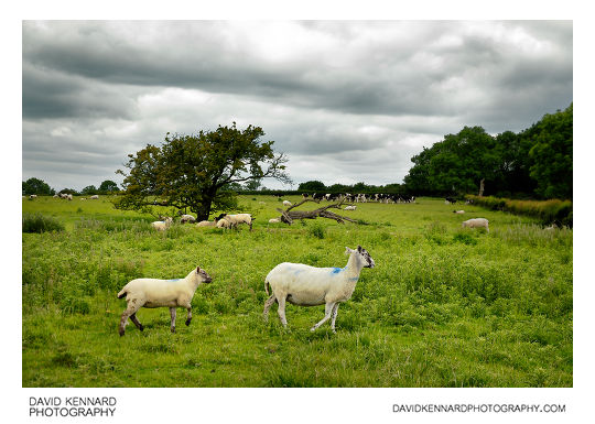
Sheep in field from http://www.davidkennardphotography.com
A ewe and lamb cross a field to the northwest of Braunston-in-Rutland, around the border between Rutland and Leicestershire, England.
From Wikipedia (http://en.wikipedia.org/wiki/Domestic_sheep):
Sheep are most likely descended from the wild mouflon of Europe and Asia. One of the earliest animals to be domesticated for agricultural purposes, sheep are raised for fleece, meat (lamb, hogget or mutton) and milk. A sheep's wool is the most widely used of any animal, and is usually harvested by shearing. Ovine meat is called lamb when from younger animals and mutton when from older ones. Sheep continue to be important for wool and meat today, and are also occasionally raised for pelts, as dairy animals, or as model organisms for science.
Sheep husbandry is practised throughout the majority of the inhabited world, and has been fundamental to many civilizations. In the modern era, Australia, New Zealand, the southern and central South American nations, and the British Isles are most closely associated with sheep production.
Sheep-raising has a large lexicon of unique terms which vary considerably by region and dialect. Use of the word sheep began in Middle English as a derivation of the Old English word sc?ap; it is both the singular and plural name for the animal. A group of sheep is called a flock, herd or mob. Adult female sheep are referred to as ewes, intact males as rams or occasionally tups, castrated males as wethers, and younger sheep as lambs. Many other specific terms for the various life stages of sheep exist, generally related to lambing, shearing, and age.
Being a key animal in the history of farming, sheep have a deeply entrenched place in human culture, and find representation in much modern language and symbology. As livestock, sheep are most-often associated with pastoral, Arcadian imagery. Sheep figure in many mythologies - such as the Golden Fleece—and major religions, especially the Abrahamic traditions. In both ancient and modern religious ritual, sheep are used as sacrificial animals.
Date taken: 2010-06-12 10:51:25
Más sobre Sheep in field
482: High House, High Street, Braunston-in-Rutland
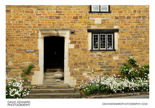
High House, High Street, Braunston-in-Rutland from http://www.davidkennardphotography.com
High House, one of the sandstone cottages located on the High Street in the village of Braunston-in-Rutland, Rutland, UK.
Date taken: 2010-06-12 11:05:29
Más sobre High House, High Street, Braunston-in-Rutland
483: Sandstone cottage, Braunston-in-Rutland
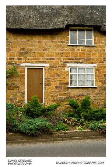
Sandstone cottage, Braunston-in-Rutland from http://www.davidkennardphotography.com
The door of a sandstone cottage leads straight into a plant bed by the edge of the road. The cottage is located on the High Street in the village of Braunston-in-Rutland, Rutland, UK.
Date taken: 2010-06-12 11:06:02
Más sobre Sandstone cottage, Braunston-in-Rutland
484: Southern end of High Street, Braunston-in-Rutland
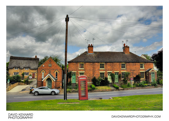
Southern end of High Street, Braunston-in-Rutland from http://www.davidkennardphotography.com
A red telephone box stands at the edge of the green where High Street, Cedar Street, and Knossington Road meet, in Braunston-in-Rutland, Rutland, UK. Behind the phone box can be seen some red brick cottages and an old small church on High Street, along with a thatched sandstone cottage.
Date taken: 2010-06-12 11:07:54
Más sobre Southern end of High Street, Braunston-in-Rutland
485: All Saints' Church, Braunston in Rutland - West doorway
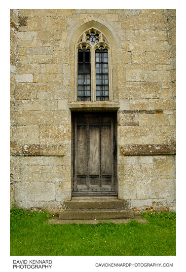
All Saints' Church, Braunston in Rutland - West doorway from http://www.davidkennardphotography.com
The doorway at the bottom of the tower at the western end of All Saints' Church, Braunston in Rutland. The oldest part of the Church dates from around 1150, but there have been various rebuildings and additions to the building since then.
The tower was rebuilt in 1728–9, but re-using the same materials from the old tower. For more information on All Saint's Church, Braunston-in-Rutland, see: http://www.british-history.ac.uk/report.aspx?compid=66196&strquery=braunston#s3
Date taken: 2010-06-12 11:11:18
Más sobre All Saints' Church, Braunston in Rutland - West doorway
486: Braunston Goddess stone carving

Braunston Goddess stone carving from http://www.davidkennardphotography.com
The Braunston "Goddess" stone carving, situated outside the western end of All Saints' Church in Braunston-in-Rutland, Rutland, UK.
From Wikipedia (http://en.wikipedia.org/wiki/Braunston-in-Rutland#The_Braunston_.22Goddess.22):
A curious sculpted stone stands in the churchyard, at the west end of the church, close to the tower. Known as the Braunston "Goddess", it was found in about 1920 when the church doorstep needed to be replaced. When the slab was lifted this carving was revealed on the underside. There has been considerable speculation as to its age and meaning, and its original position as part of the church building, or whether it may even predate the church. It is clearly not a gargoyle as it has no drainage channel. It may have had an apotropaic purpose. It has facial and stylistic similarities with some Irish Sheela na Gigs, but it has no genitalia.
Date taken: 2010-06-12 11:11:36
Más sobre Braunston Goddess stone carving
487: View northwest across field towards Braunston
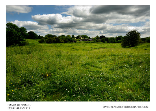
View northwest across field towards Braunston from http://www.davidkennardphotography.com
Looking northeast across a field of grass and thistles, a farm building and All Saints' Church can be seen, in Braunston-in-Rutland, Rutland, UK.
Date taken: 2010-06-12 11:17:01
Más sobre View northwest across field towards Braunston
488: Field of green wheat
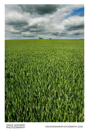
Field of green wheat from http://www.davidkennardphotography.com
A field of winter wheat grows to the southwest of Braunston-in-Rutland, in Rutland, UK.
From Wikipedia (http://en.wikipedia.org/wiki/Winter_wheat):
Winter wheat is a type of cereal that is planted from September to December in the Northern Hemisphere. Winter wheat sprouts before freezing occurs, then becomes dormant until the soil warms in the spring. Winter wheat needs a few weeks of cold before being able to flower, however persistent snow cover might be disadvantageous. It is ready to be harvested by early July.
Hard winter wheats have a higher gluten protein content than other wheats. They are used to make flour for yeast breads, or are blended with soft spring wheats to make the all-purpose flour used in a wide variety of baked products. Soft wheat is used for specialty or cake flour. Durum, the hardest wheat, is primarily used for making pasta. Almost all durum wheat grown in North America is spring-planted.
Winter wheat is grown throughout Europe, North America, and in northern Asia.
Date taken: 2010-06-12 11:23:01
Más sobre Field of green wheat
489: Field of green wheat
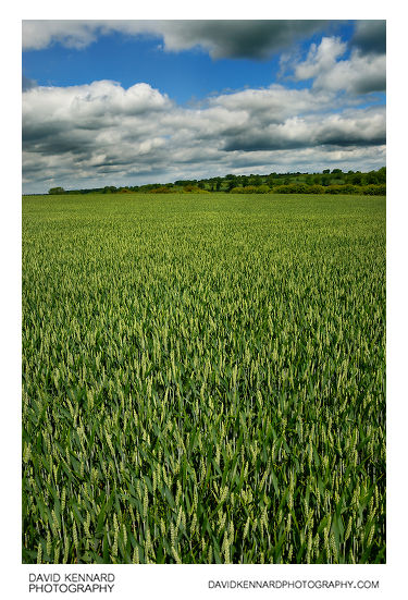
Field of green wheat from http://www.davidkennardphotography.com
A field of winter wheat grows to the southwest of Braunston-in-Rutland, in Rutland, UK.
From Wikipedia (http://en.wikipedia.org/wiki/Winter_wheat):
Winter wheat is a type of cereal that is planted from September to December in the Northern Hemisphere. Winter wheat sprouts before freezing occurs, then becomes dormant until the soil warms in the spring. Winter wheat needs a few weeks of cold before being able to flower, however persistent snow cover might be disadvantageous. It is ready to be harvested by early July.
Hard winter wheats have a higher gluten protein content than other wheats. They are used to make flour for yeast breads, or are blended with soft spring wheats to make the all-purpose flour used in a wide variety of baked products. Soft wheat is used for specialty or cake flour. Durum, the hardest wheat, is primarily used for making pasta. Almost all durum wheat grown in North America is spring-planted.
Winter wheat is grown throughout Europe, North America, and in northern Asia.
Date taken: 2010-06-12 11:23:10
Más sobre Field of green wheat
490: Field of green wheat
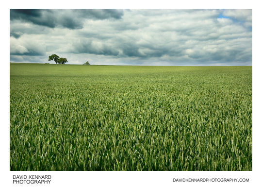
Field of green wheat from http://www.davidkennardphotography.com
A field of winter wheat grows to the southwest of Braunston-in-Rutland, in Rutland, UK.
From Wikipedia (http://en.wikipedia.org/wiki/Winter_wheat):
Winter wheat is a type of cereal that is planted from September to December in the Northern Hemisphere. Winter wheat sprouts before freezing occurs, then becomes dormant until the soil warms in the spring. Winter wheat needs a few weeks of cold before being able to flower, however persistent snow cover might be disadvantageous. It is ready to be harvested by early July.
Hard winter wheats have a higher gluten protein content than other wheats. They are used to make flour for yeast breads, or are blended with soft spring wheats to make the all-purpose flour used in a wide variety of baked products. Soft wheat is used for specialty or cake flour. Durum, the hardest wheat, is primarily used for making pasta. Almost all durum wheat grown in North America is spring-planted.
Winter wheat is grown throughout Europe, North America, and in northern Asia.
Date taken: 2010-06-12 11:23:44
Más sobre Field of green wheat
491: Field of green wheat
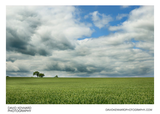
Field of green wheat from http://www.davidkennardphotography.com
A field of winter wheat grows to the southwest of Braunston-in-Rutland, in Rutland, UK.
From Wikipedia (http://en.wikipedia.org/wiki/Winter_wheat):
Winter wheat is a type of cereal that is planted from September to December in the Northern Hemisphere. Winter wheat sprouts before freezing occurs, then becomes dormant until the soil warms in the spring. Winter wheat needs a few weeks of cold before being able to flower, however persistent snow cover might be disadvantageous. It is ready to be harvested by early July.
Hard winter wheats have a higher gluten protein content than other wheats. They are used to make flour for yeast breads, or are blended with soft spring wheats to make the all-purpose flour used in a wide variety of baked products. Soft wheat is used for specialty or cake flour. Durum, the hardest wheat, is primarily used for making pasta. Almost all durum wheat grown in North America is spring-planted.
Winter wheat is grown throughout Europe, North America, and in northern Asia.
Date taken: 2010-06-12 11:23:56
Más sobre Field of green wheat
492: Field of green wheat
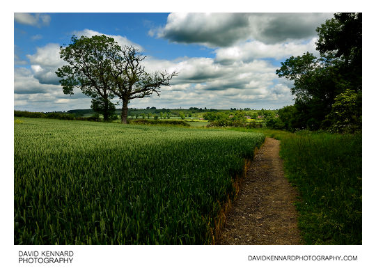
Field of green wheat from http://www.davidkennardphotography.com
A path leads alongside a green field of winter wheat, southwest of Braunston-in-Rutland, in Rutland, UK.
From Wikipedia (http://en.wikipedia.org/wiki/Winter_wheat):
Winter wheat is a type of cereal that is planted from September to December in the Northern Hemisphere. Winter wheat sprouts before freezing occurs, then becomes dormant until the soil warms in the spring. Winter wheat needs a few weeks of cold before being able to flower, however persistent snow cover might be disadvantageous. It is ready to be harvested by early July.
Hard winter wheats have a higher gluten protein content than other wheats. They are used to make flour for yeast breads, or are blended with soft spring wheats to make the all-purpose flour used in a wide variety of baked products. Soft wheat is used for specialty or cake flour. Durum, the hardest wheat, is primarily used for making pasta. Almost all durum wheat grown in North America is spring-planted.
Winter wheat is grown throughout Europe, North America, and in northern Asia.
Date taken: 2010-06-12 11:28:19
Más sobre Field of green wheat
493: Field of green wheat
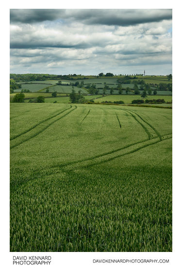
Field of green wheat from http://www.davidkennardphotography.com
The tracks left by a tractor can clearly be seen in a green field of winter wheat growing to the southwest of Braunston-in-Rutland, in Rutland, UK. A patchwork of green fields can be seen on the hill behind.
From Wikipedia (http://en.wikipedia.org/wiki/Winter_wheat):
Winter wheat is a type of cereal that is planted from September to December in the Northern Hemisphere. Winter wheat sprouts before freezing occurs, then becomes dormant until the soil warms in the spring. Winter wheat needs a few weeks of cold before being able to flower, however persistent snow cover might be disadvantageous. It is ready to be harvested by early July.
Hard winter wheats have a higher gluten protein content than other wheats. They are used to make flour for yeast breads, or are blended with soft spring wheats to make the all-purpose flour used in a wide variety of baked products. Soft wheat is used for specialty or cake flour. Durum, the hardest wheat, is primarily used for making pasta. Almost all durum wheat grown in North America is spring-planted.
Winter wheat is grown throughout Europe, North America, and in northern Asia.
Date taken: 2010-06-12 11:31:50
Más sobre Field of green wheat
494: Green fields
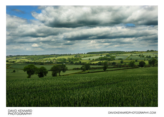
Green fields from http://www.davidkennardphotography.com
A patchwork of green fields, southwest of the village of Braunston-in-Rutland, around the border between Rutland and Leicestershire, UK.
Date taken: 2010-06-12 11:33:46
Más sobre Green fields
495: Farm track
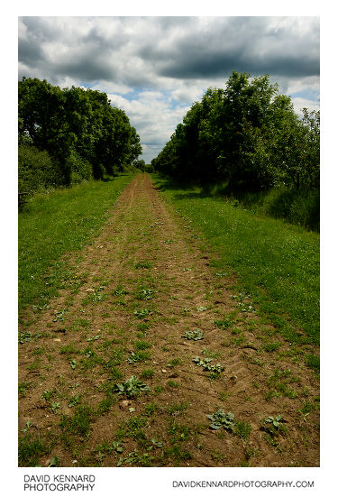
Farm track from http://www.davidkennardphotography.com
A track used for farm access to fields near Leighfield, around the border between Rutland and Leicetershire, UK.
Date taken: 2010-06-12 11:42:39
Más sobre Farm track
496: Grass and buttercup field
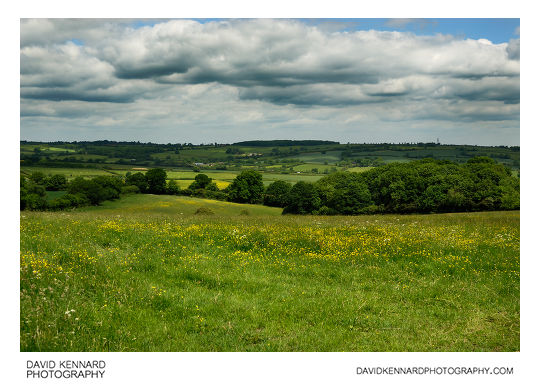
Grass and buttercup field from http://www.davidkennardphotography.com
Buttercups grow in a grass field as clouds hang overhead, between Braunston-in-Rutland and Launde, around the border between Rutland and Leicestershire, UK.
Date taken: 2010-06-12 11:43:15
Más sobre Grass and buttercup field
497: Grassy track
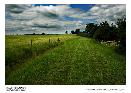
Grassy track from http://www.davidkennardphotography.com
A wide path runs alongside a field of recently mown grass, between Withcote and Braunston-in-Rutland, around the border between Rutland and Leicestershire, UK.
Date taken: 2010-06-12 11:49:25
Más sobre Grassy track
498: Sheep in field of mown grass
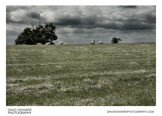
Sheep in field of mown grass from http://www.davidkennardphotography.com
Sheep browse at the top of a field of recently mown grass, between Withcote and Braunston-in-Rutland, around the border between Rutland and Leicestershire, UK.
Date taken: 2010-06-12 11:52:14
Más sobre Sheep in field of mown grass
499: Sheep in field of mown grass
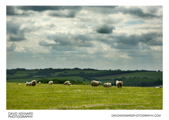
Sheep in field of mown grass from http://www.davidkennardphotography.com
Sheep browse at the top of a field of recently mown grass, between Withcote and Braunston-in-Rutland, around the border between Rutland and Leicestershire, UK.
From Wikipedia (http://en.wikipedia.org/wiki/Domestic_sheep):
Sheep are most likely descended from the wild mouflon of Europe and Asia. One of the earliest animals to be domesticated for agricultural purposes, sheep are raised for fleece, meat (lamb, hogget or mutton) and milk. A sheep's wool is the most widely used of any animal, and is usually harvested by shearing. Ovine meat is called lamb when from younger animals and mutton when from older ones. Sheep continue to be important for wool and meat today, and are also occasionally raised for pelts, as dairy animals, or as model organisms for science.
Sheep husbandry is practised throughout the majority of the inhabited world, and has been fundamental to many civilizations. In the modern era, Australia, New Zealand, the southern and central South American nations, and the British Isles are most closely associated with sheep production.
Sheep-raising has a large lexicon of unique terms which vary considerably by region and dialect. Use of the word sheep began in Middle English as a derivation of the Old English word sc?ap; it is both the singular and plural name for the animal. A group of sheep is called a flock, herd or mob. Adult female sheep are referred to as ewes, intact males as rams or occasionally tups, castrated males as wethers, and younger sheep as lambs. Many other specific terms for the various life stages of sheep exist, generally related to lambing, shearing, and age.
Being a key animal in the history of farming, sheep have a deeply entrenched place in human culture, and find representation in much modern language and symbology. As livestock, sheep are most-often associated with pastoral, Arcadian imagery. Sheep figure in many mythologies - such as the Golden Fleece—and major religions, especially the Abrahamic traditions. In both ancient and modern religious ritual, sheep are used as sacrificial animals.
Date taken: 2010-06-12 11:53:47
Más sobre Sheep in field of mown grass